[Index]
July 2005 to June 2006 Tropical Cyclones in the Australian Region
[Australian Region][South Indian Ocean][South Pacific Ocean][Southern Hemisphere][Summaries and Track Data]
| Tropical
Cyclones
[Index] |
July 2005 to June 2006 Tropical Cyclones in the Australian Region [Australian Region][South Indian Ocean][South Pacific Ocean][Southern Hemisphere][Summaries and Track Data] |

Individual Tropical Cyclone Information
Some part of the cyclone track must occur within 90 E and 180 E (and be in the southern hemisphere) to be included.
| Cyclone Name |
Basin |
Joint Typhoon Warning Centre data | Bureau of Meteorology data | Other Info | ||||||
|---|---|---|---|---|---|---|---|---|---|---|
| TC Num | Dates | Map | Warn | TC Num | Dates | Map | Warn | |||
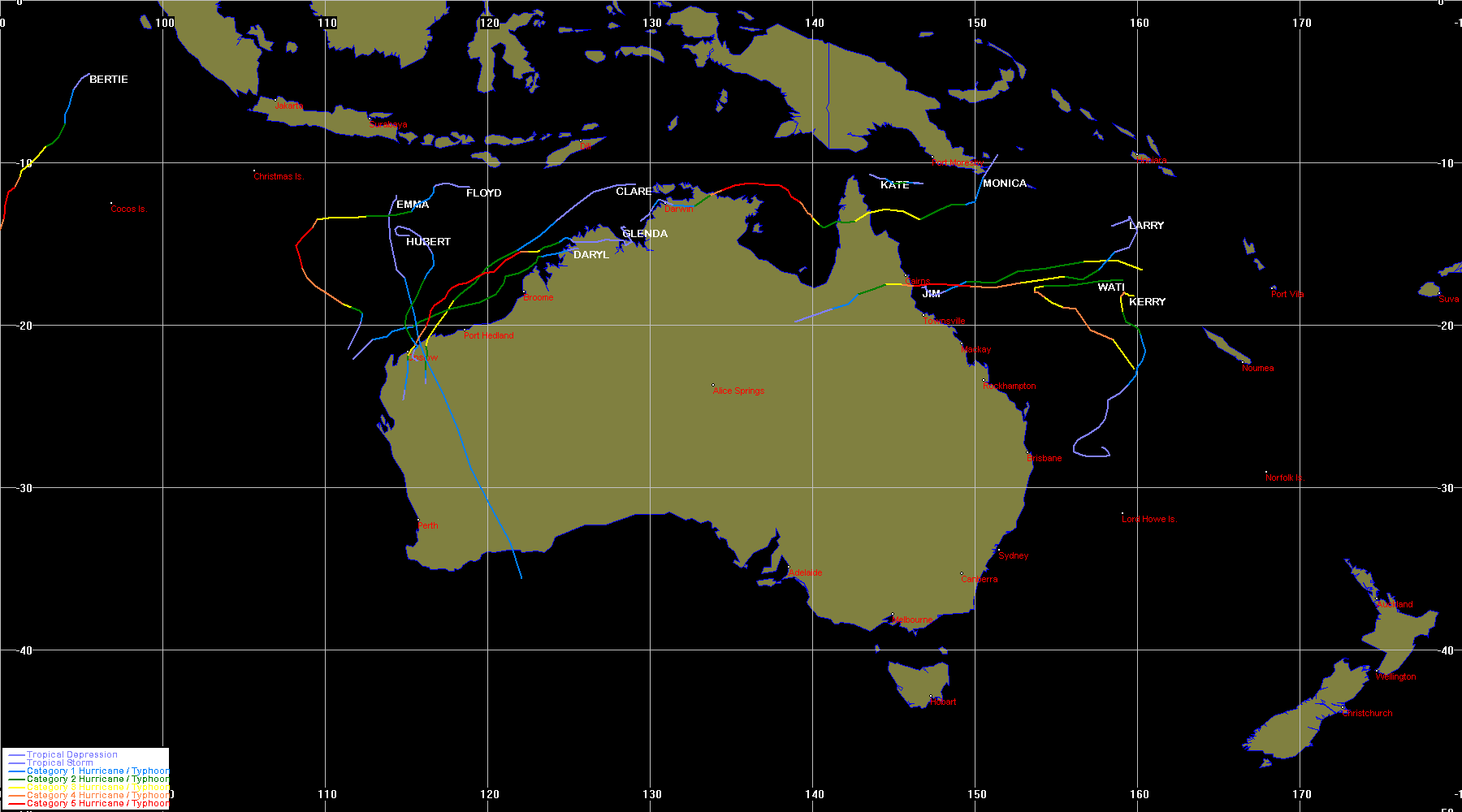
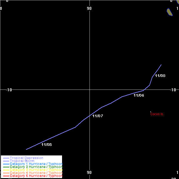
| Unnamed | SIO | 0602 | 05 - 08 Nov 2005 | Map | Warn | Event description | ||||
| Bertie- Alvin |
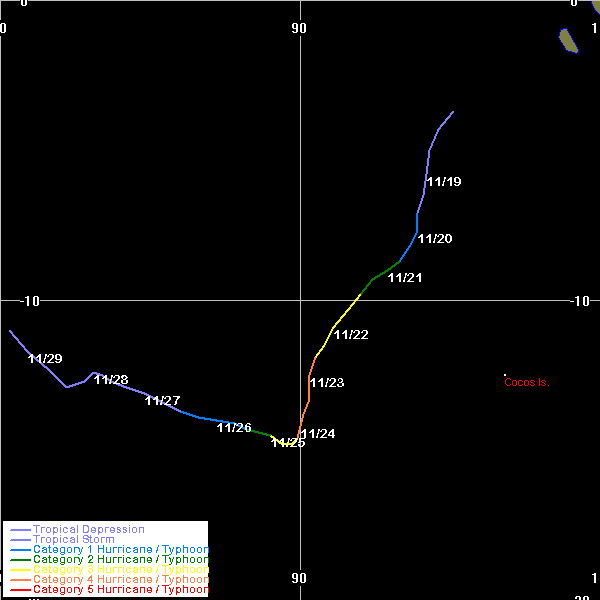
SIO | 0603 | 18 - 28 Nov 2005 | Map | Warn | 200504 | 18 - 24 Nov 2005 | Map | Warn | Event description |
| Clare | SIO | 0605 | 07 - 10 Jan 2006 | Map | Warn | 200505 | 06 - 10 Jan 2006 | Map | Warn | Event description | BoM Report |
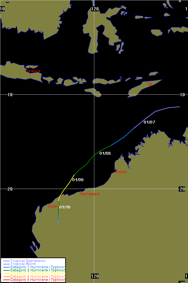
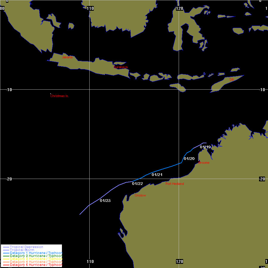
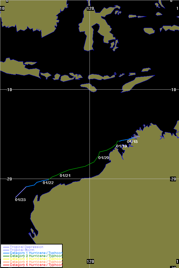
| Daryl | SIO | 0608 | 17 - 23 Jan 2006 | Map | Warn | 200506 | 17 - 23 Jan 2006 | Map | Warn | Event description |
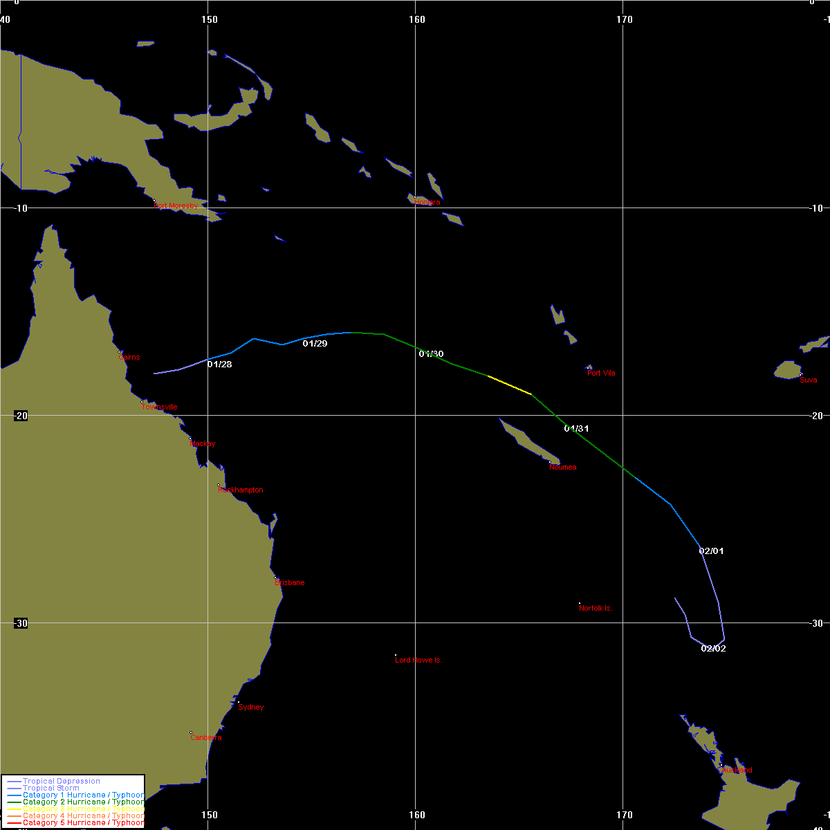
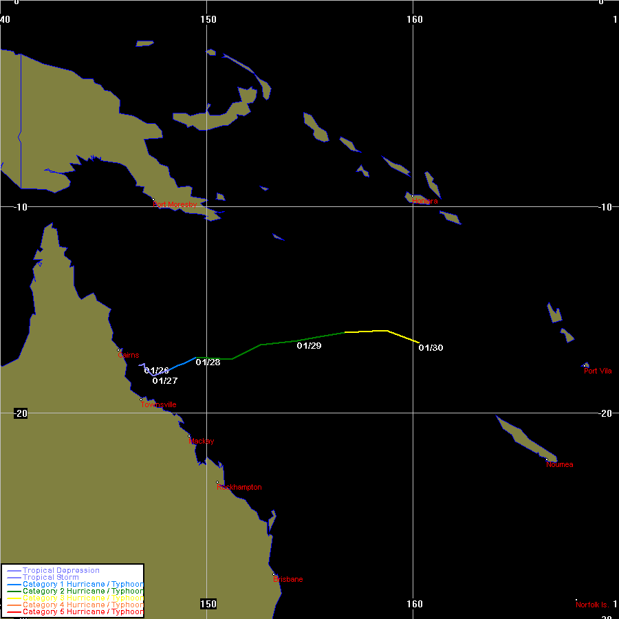
| Jim | SPAC | 0610 | 26 Jan - 02 Feb 2006 | Map | Warn | 200501 | 25 - 30 Jan 2006 | Map | Warn | Event description |
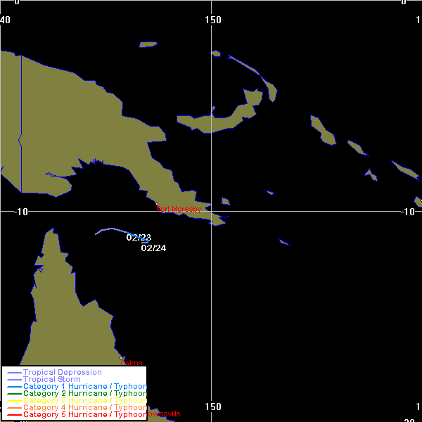
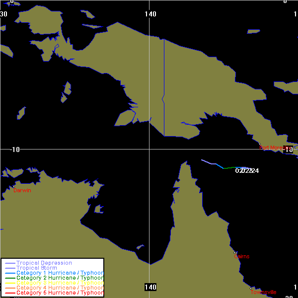
| Kate | SPAC | 0613 | 22 - 24 Feb 2006 | Map | Warn | 200502 | 22 - 24 Feb 2006 | Map | Warn | Event description |
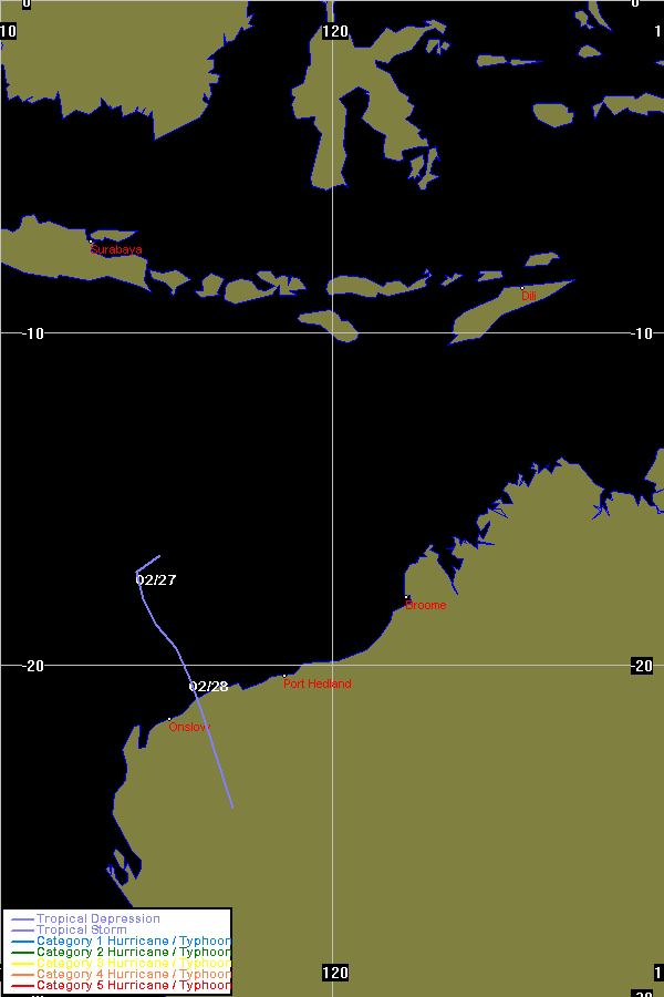
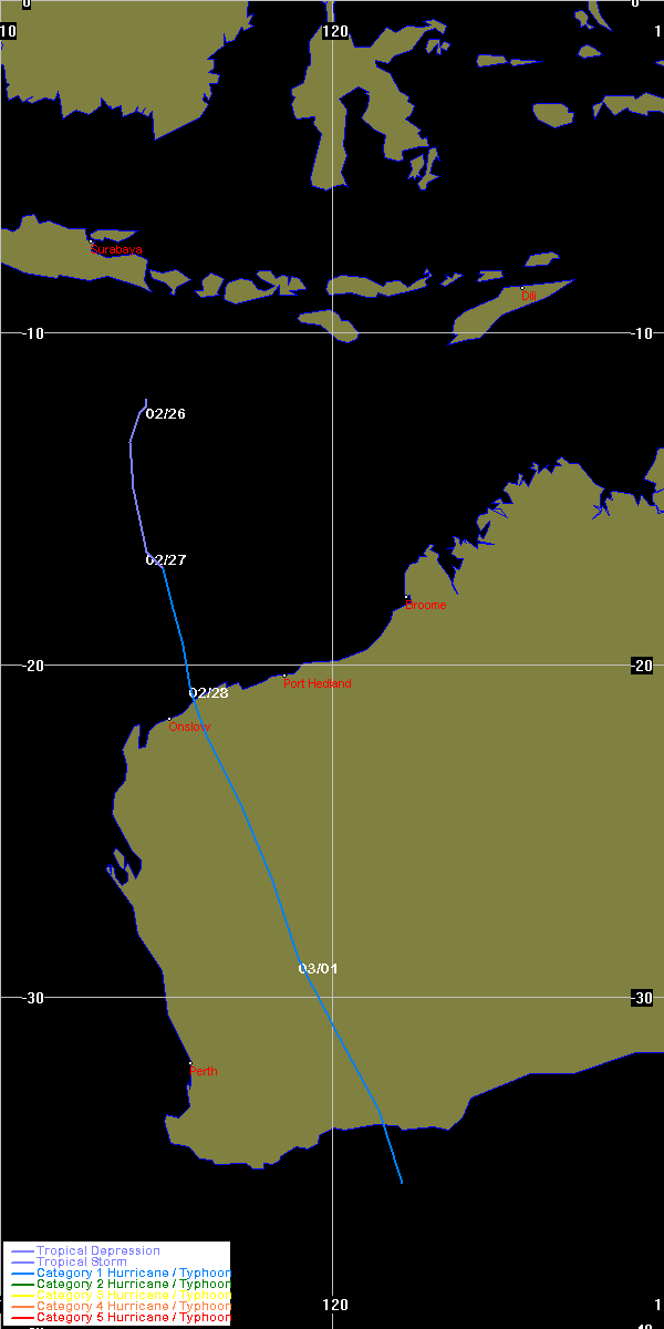
| Emma | SIO | 0615 | 26 - 28 Feb 2006 | Map | Warn | 200507 | 25 Feb - 01 Mar 2006 | Map | Warn | Event description |
| Unnamed | SPAC | 01 - 06 Mar 2006 | Operational Track | Event description | Hybrid low tracked by BoM | ||||||
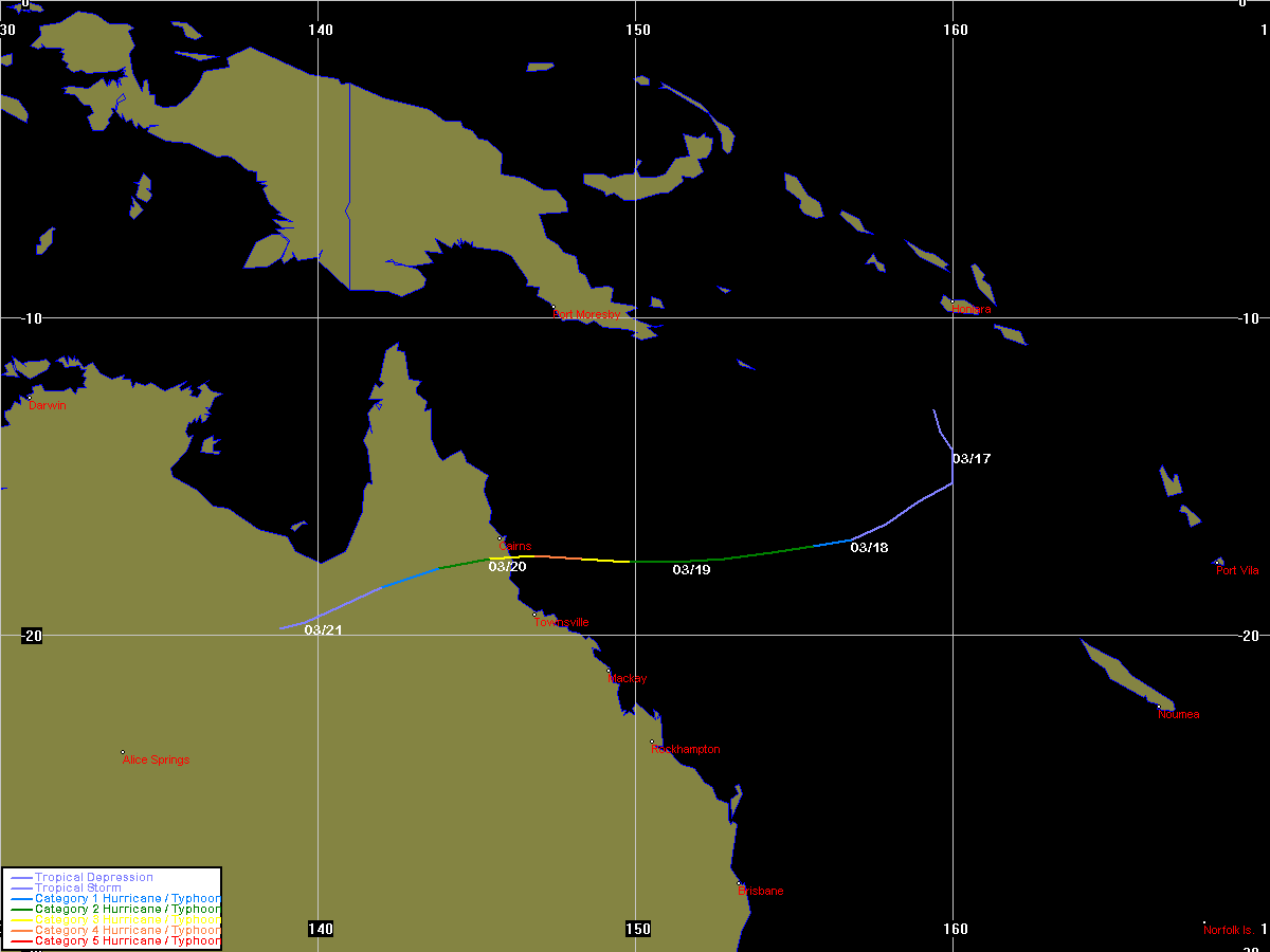
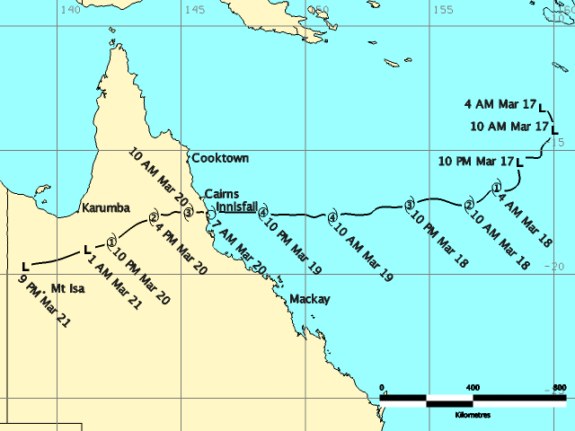
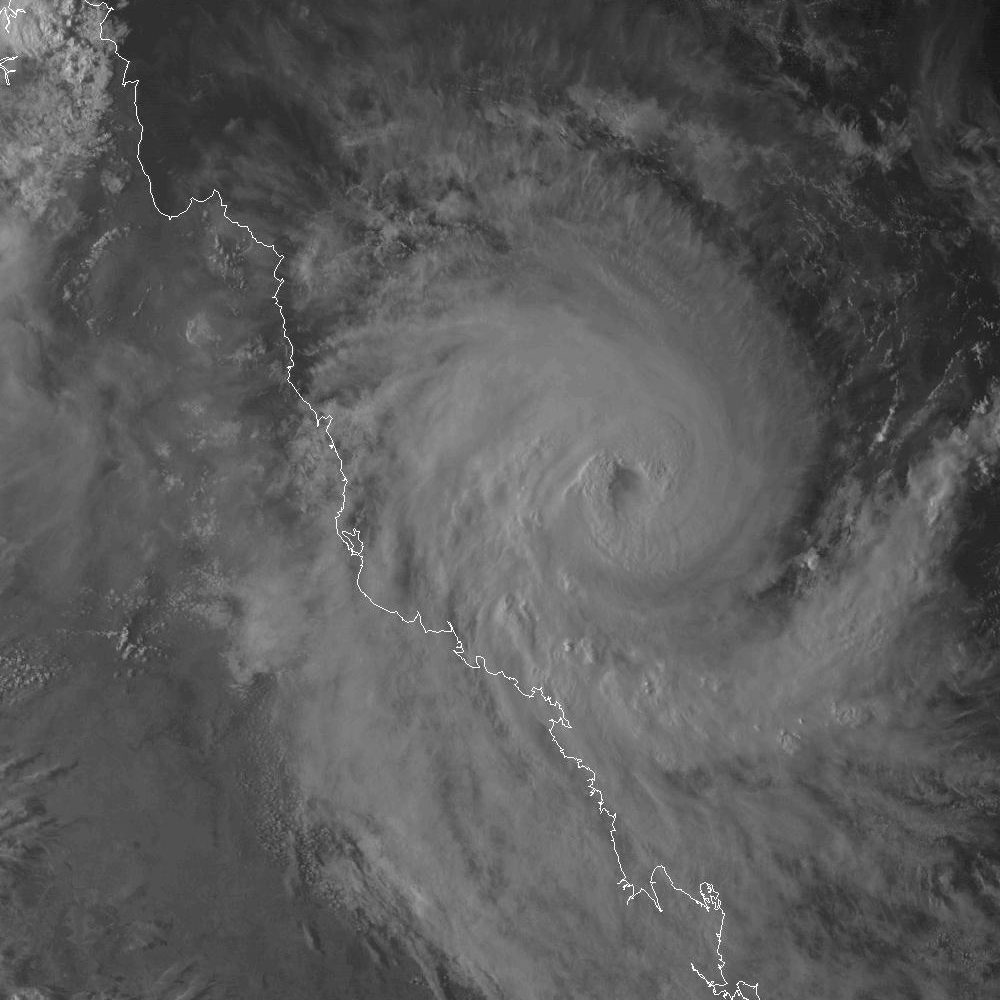
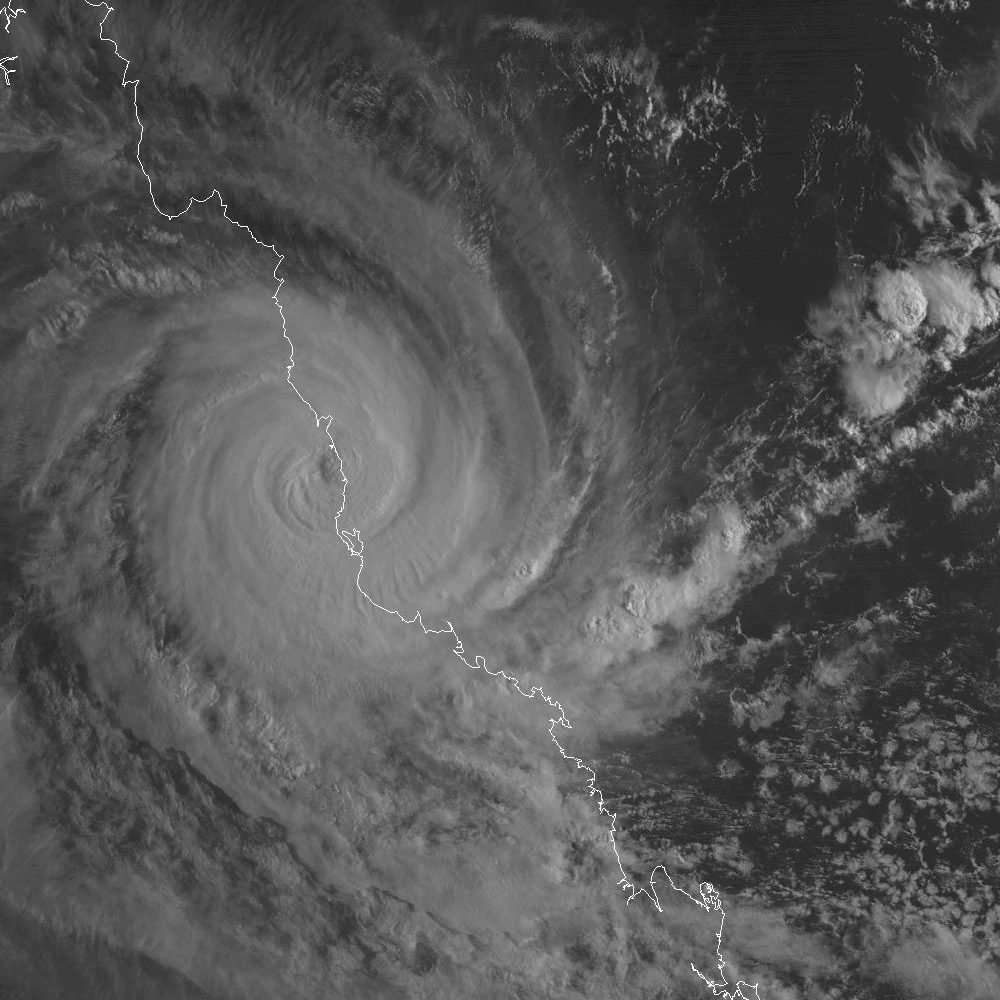
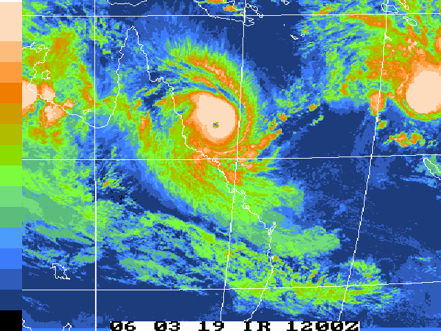
| Larry | SPAC | 0617 | 16 - 21 Mar 2006 | Map | Warn | 200510 | Map | Warn | Event description | BoM Report | Larry Forum Report (PDF) Radar Loop: 11am 19th to 10am 20th (local) Satpics (1km VIS): [4.30pm 19th][7.30am 20th] Satpic Loop (IR): 031600z to 032100z |
|
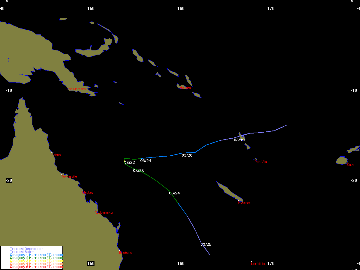
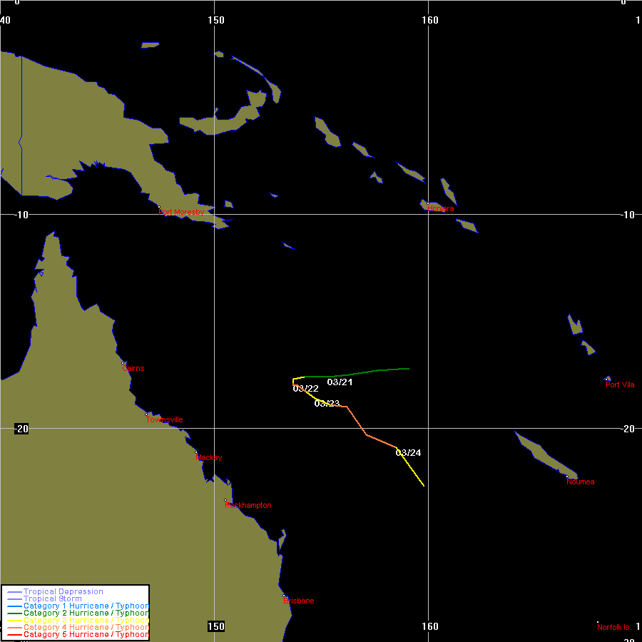
| Wati | SPAC | 0618 | 17 - 28 Mar 2006 | Map | Warn | 200503 | 20 - 24 Mar 2006 | Map | Warn | Event description Satpic Loop (IR): 031912z to 032506z |
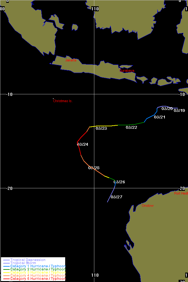
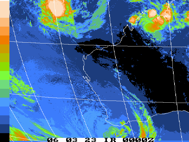
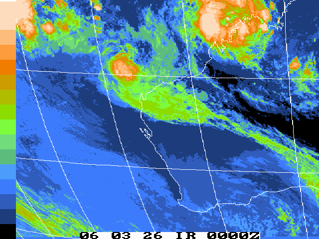
| Floyd | SIO | 0619 | 19 - 27 Mar 2006 | Map | Warn | 200508 | 18 - 27 Mar 2006 | Map | Warn | Event description Satpic Loop (IR): 032300z to 032612z |
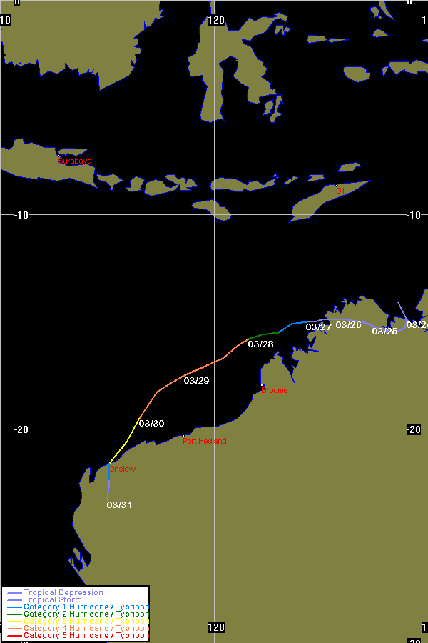
| Glenda | SIO | 0620 | 23 - 31 Mar 2006 | Map | Warn | 200509 | 22 - 31 Mar 2006 | Map | Warn | Event description Radar Loop: 4pm 29th to 11pm 30th (local) Satpic Loop (IR): 032600z to 033100z BoM Report |
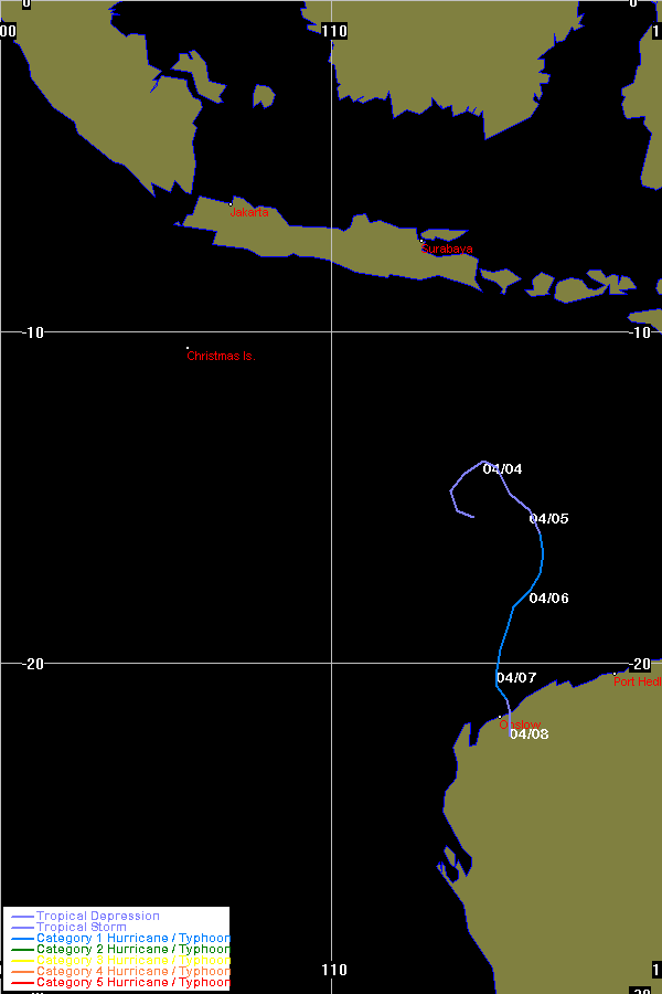
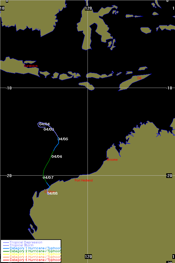
| Hubert | SIO | 0621 | 04 - 07 Apr 2006 | Map | Warn | 200511 | 02 - 08 Apr 2006 | Map | Warn | Event description |
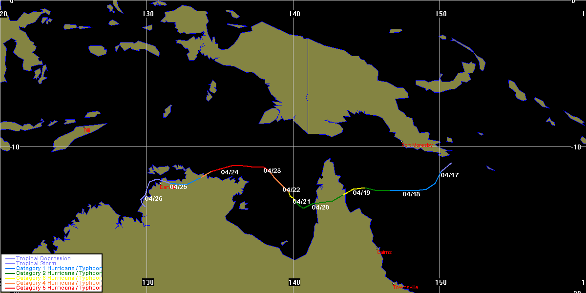
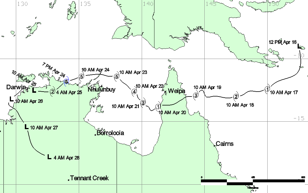
| Monica | both | 0623 | 16 - 26 Apr 2006 | Map | Warn | 200512 | Map | Warn | Event description | BoM Report | |
| Cyclone Name |
Basin |
Joint Typhoon Warning Centre data | Bureau of Meteorology data | Other Info | ||||||
| TC Num | Dates | Map | Warn | TC Num | Dates | Map | Warn | |||
BoM data obtained from the Bureau of Meteorology, Melbourne
JTWC data obtained from the Naval Pacific Meteorology and Oceanography / Joint Typhoon Warning Centre, Hawaii
Historical Season Maps for all seasons that data is available.
Plotting Information about the track maps on this website. Also includes southern hemisphere TC regions and BoM TC intensity classification scale.
Wikipedia 2005-06 Southern Hemisphere tropical cyclone season
All maps produced by Michael Bath
|
Document: tropical_cyclones_2006_australian_region.html
Updated: 6th March 2008 |
[Australian Severe Weather index] [Copyright Notice] [Email Contacts] [Search This Site] |