Author Topic: Hailstorm : NSW Storms (incl Sydney hailstorm): 7 to 9th December 2007  (Read 153212 times)

0 Members and 1 Guest are viewing this topic.

Offline Mike

  • Australian Severe Weather Moderators
  • Wedge tornado F5
  • *
  • Posts: 1,348
  • Gender: Male
  • Dry season here...boring!
    • http://StormscapesDarwin.com
RE: Hailstorm : NSW Storms (incl Sydney hailstorm): 7 to 9th December 2007
« Reply #90 on: 30 December 2007, 08:35:41 AM »
Yes, i was thinking that but thought that would have been a response from just about anyone witnessing the hail and it was the Western Sydney bit that threw me. :)  The guy with the chair as protection would have to rate my favorite - def a keeper!
Darwin, Northern Territory.
StormscapesDarwin.com
Lightning Research 2010/14

Offline Michael Bath

  • storm chaser
  • Administrator
  • Wedge tornado F5
  • *
  • Posts: 1,602
  • Gender: Male
    • Australian Severe Weather
Re: Hailstorm : NSW Storms (incl Sydney hailstorm): 7 to 9th December 2007
« Reply #91 on: 13 February 2008, 05:27:00 AM »
Chase report NSW Central West: Saturday 8th December 2007

(re-posted due to accidental deletion of the original)

Rodney Wallbridge and I also decided to head inland for a weekend chase adventure - lured by the GFS forecasts which had been in place for several days.

The 12z run checked pre-dawn Saturday showed potential targets from around Nyngan extending NNE towards Collarenebri. Even at this late stage 500 temps were forecast to be quite encouraging with -10 extending up to 30 S at 06z A reanalysis of 06z GFS later that evening showed that it ended up being closer to -8 or -7, quite a difference to the forecast.

It was a long but awesome drive from Lismore to the Coonamble area via Glen Innes, Narrabri and Pilliga. The area was amazingly green.

The first cell spotted at 1.15pm was over the Warrumbungles and it was quite healthy looking.
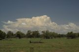


Decent cumulus and congestus teased at our location and even this cell just to our north managed a CG at 2.20pm. The flies were a menace though - geeez !
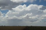


At some point after this the wind tended a bit westerly though the cumulus remained encouraging. We saw later that the dew point dropped to 10 at Coonamble by 4pm - a reflection of the air mass profile on the Cobar sounding.

Storms were occurring a fair way to the north, before some ok cells formed to the south. We moved to near Gulargambone and had a view of the cell Michael Thompson copped his microburst.
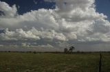
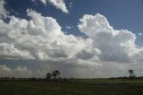

But that was it for a while - it really looked dried out at this point. Later in the afternoon other low topped activity developed over the Warrumbungles :
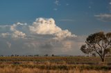
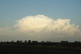

The wind had shifted to a fresh NE about an hour before sunset and allowed some congestus to build pretty much over Coonamble. I was taking some shots of the cloud just because of the sunset colours before being amazed at a CG occurring! Soon after that a small microburst occurred.
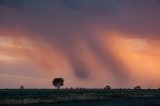
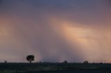
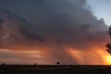
This wannabe storm managed to put out several CGs before it dissipated 30 minutes later.
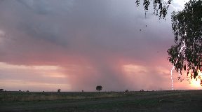
video still

---> All photos for 8th December

MB
Location: Mcleans Ridges, NSW Northern Rivers
Australian Severe Weather:   http://australiasevereweather.com/
Lightning Photography:   http://www.lightningphotography.com/
Early Warning Network: http://www.ewn.com.au
Contact: Michael Bath

Offline Jimmy Deguara

  • Australian and Tornado Alley storm chaser
  • Administrator
  • Wedge tornado F5
  • *
  • Posts: 2,218
  • Gender: Male
  • Storm Chaser since 1993, Tornado Alley 2001
    • Australia Severe Weather
My Auntie and Uncle who live on the edge of Blacktown were on the edge of the supercell and copped hail to about 6cm in diameter.

Photographs courtesy Joe and Rita Vella
-------------------------------------
Australian Severe Weather
www.australiasevereweather.com

Australian Thunderbolt Tours
www.thunderbolttours.com

Phone  0408 020468  (International :  61  2  408 020468)

Offline Harley Pearman

  • Barrel tornado F4
  • *
  • Posts: 584
Hello

I recently found the Bureau of Meteorology report on their website on the thunderstorm of 9 December 2007 worth mentioning here under the heading:-

Summary of significant Severe Thunderstorm events in NSW 2007/2008

Only three thunderstorms make this list and one of those is the North west Sydney event as below.

9 December 2007 - Severe storm with giant hail hits NW Sydney

It is stated that "a severe thunderstorm crossed Sydney's western and northern suburbs at around 4 pm producing many reports of golf ball to tennis ball hail in suburbs stretching from Blacktown to Wahroonga. The largest confirmed hail was 7 cm at Blacktown and 6 cm at Wahroonga although there was an unconfirmed report of 11 cm hail at Cherrybrook".

The damage bill has run into millions of dollars. The storm and associated cells also affected the NSW Central Coast and Newcastle producing very heavy rain, hail and squally winds. More than 1,300 calls for assistance were received by the SES.

It is a short report and there are no radar images of it available. However further to this, I am aware that there were around 59,000 insurance claims (Various) and a preliminary estimated damage bill of around $377 million. The final figure is likely to vary once it is known and fully costed.

As I live in the affected area, there are still homes in the Blacktown area with tarpaulins over their roofs three months after the event.

It is interesting to note that a report of 11 cm hail was reported but not verified.


Harley Pearman

Offline Harley Pearman

  • Barrel tornado F4
  • *
  • Posts: 584
Hello

Cost of the 9 December 2007 event - A perspective:

Jimmy, further to my recent post and your suggestion, I have looked at some insurance costs of this event. It appears the final insured cost will come to approximately $400 million. That is for insured loses only but I cannot find a figure for "Uninsured loses".

That would make it Sydney's costliest storm event since the April 14 1999 event which cost $1.72 Billion (Insured loses) with uninsured loses taking that figure to $2.3 Billion. (That equates to US - $1.5 Billion being a conversion ratio figure that I can find).

The Blacktown event appears to be Sydney's third most expensive thunderstorm event after the April 14 1999 event (1) and the 1991 event (2). It is acknowledged that a figure of $215 Million is stated for the 1991 event but there is evidence to suggest the costs were as high as $645 million but the final figure is not known.

Since 2000 if one looks at the 2000 event (November), 2002 event (February) and now the 2007 event (December) the 3 big supercells across western Sydney have caused approximately $930 million damage (Insured figures that I have found in the past) on western Sydney.

I am aware of the October 26 2003 event at Riverstone and environs but that pales and damage was limited to approximately $17 million because much of the impact was not on an urban area. However it may have been different had the urban area taken the full force of it.

The Blacktown event is by far the largest of the three recent hits since 2000, most likely because the storm reached peak intensity over a built up area and so it was the urban area that took the full force of the hail.   

 Harley Pearman

Offline pingtang

  • Multi-vortex F1
  • *
  • Posts: 70
  • Gender: Male
    • Southcoastweather
Okay I have a short video here of the Sydney supercell from a blue mountains perspective. Video quality is quite ordinary,almost mobile phone standard but it will do for now. It still gives you a good idea on what the structure was like.   
This storm had a strong overshoot for a good 10-15minutes atleast!


Offline vrondes

  • Multi-vortex F1
  • *
  • Posts: 77
Re: Hailstorm : NSW Storms (incl Sydney hailstorm): 7 to 9th December 2007
« Reply #96 on: 10 December 2008, 01:44:39 PM »
It's a year since the December 9 Sydney hailstorm . I thought it was a good time to post these photos I found on a card that I had misplaced.These shots were taken just after it passed through blacktown, we were in Westpoint for a party at the time it struck. I took these around 4pm facing the NE and they show the flanking line feeding nicely into the powering updraft, with the shear giving the updraft a wonderful classic supercell forward tilt. There is even a funnel vortex on the SW side of the updraft. The hailstones are what I salvaged from the carpark and our well dented car. Hope these add another perspective to an incredible event. Cheers, Con.