Author Topic: Severe Storms NSW March 28 2010  (Read 6383 times)

0 Members and 1 Guest are viewing this topic.

Offline Jimmy Deguara

  • Australian and Tornado Alley storm chaser
  • Administrator
  • Wedge tornado F5
  • *
  • Posts: 2,218
  • Gender: Male
  • Storm Chaser since 1993, Tornado Alley 2001
    • Australia Severe Weather
Severe Storms NSW March 28 2010
« on: 29 March 2010, 05:25:33 PM »
Although I forecasted the storms for today, I didn't bother paying too much attention to the chasing. Npot even the developing convection took my fancy over the mountains. It was not until I monitored the storms on radar that I saw the storm near Bowral develop, weaken and then redevelop and track along a boundary.

Finally, I took the road south knowing that the development would have weakened which it did. The boundary did ignite some more development though with lack of heating from storm anvils to the west of Mittagong, the storm struggled. It briefly took in some inflow though weakened rapdily after that point. I hope someone else got the earlier show - I was too lazy today.


Regards,

Jimmy Deguara
-------------------------------------
Australian Severe Weather
www.australiasevereweather.com

Australian Thunderbolt Tours
www.thunderbolttours.com

Phone  0408 020468  (International :  61  2  408 020468)

Offline Michael Thompson

  • Multi-vortex F1
  • *
  • Posts: 57
Re: Severe Storms NSW March 28 2010
« Reply #1 on: 29 March 2010, 06:10:07 PM »
Surprise little chase today to the Moss Vale area. The storm was much better than I anticipated, I anticipated weak pulse junk, and while the storm was a pulse type it was borderline severe. I encountered hail on three separate occasions to 2cm, with perhaps the odd larger stone as some roof clunks sounded quite solid. I also witnessed a CG hit a tree just 20m from me while I was driving through the hail. Sorry no footage of that one, you will just have to take my word.


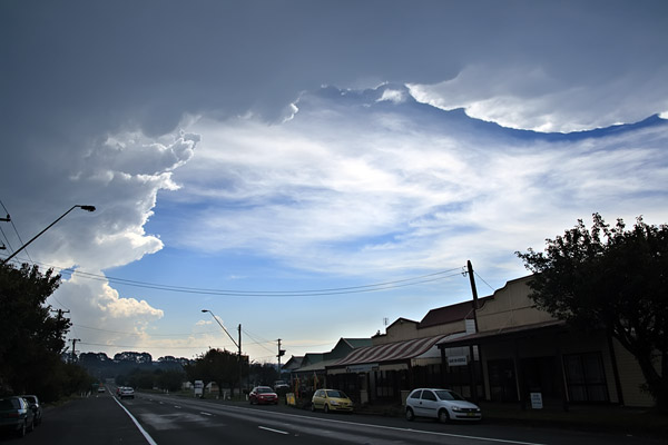
This is the main street of Robertson in between pulses. An earlier pulse that originated near Bundanoon (off screen to right direction) is responsible for the hard anvil edge.


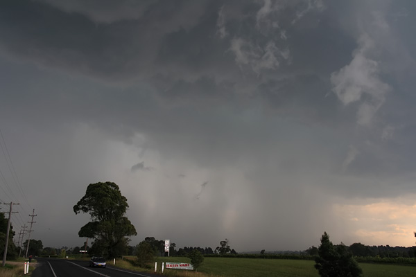
It briefly looked like the show was over, but as often is the case the outflow butted up against the moist NE to form a near cell just of Moss Vale which gave my first hail for the day.


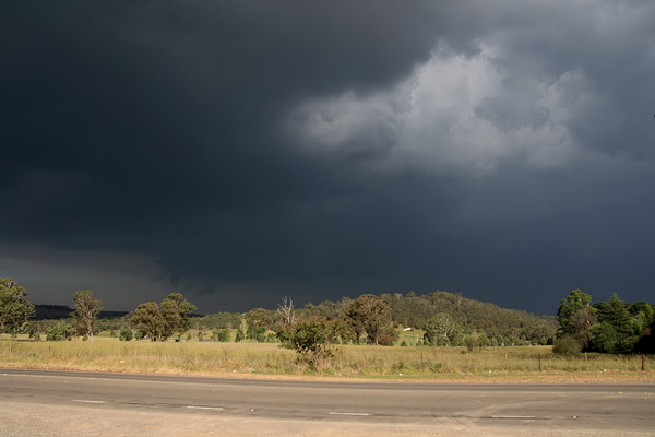
Again the show looked over, but this dark base started up again just east of Mittagong, giving more hail.


This time however it was good night show over
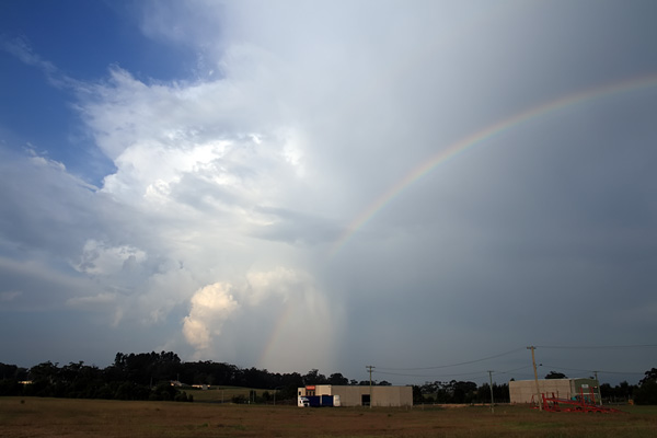


Storm with small hail - 28th March2010 - Southern Highlands, NSW, Australia

Offline Jimmy Deguara

  • Australian and Tornado Alley storm chaser
  • Administrator
  • Wedge tornado F5
  • *
  • Posts: 2,218
  • Gender: Male
  • Storm Chaser since 1993, Tornado Alley 2001
    • Australia Severe Weather
Re: Severe Storms NSW March 28 2010
« Reply #2 on: 30 March 2010, 02:22:56 AM »
Hi Michael,

Nice chase there with the early action. It seems when I left Sydney you were heading up through Robertson. Definitely a severe storm and hail to 3cm. The last picture probably matches the part in mine of the second stop near the Picton turn off with the pretend inflow.

Regards,

Jimmy Deguara
-------------------------------------
Australian Severe Weather
www.australiasevereweather.com

Australian Thunderbolt Tours
www.thunderbolttours.com

Phone  0408 020468  (International :  61  2  408 020468)

Offline Richary

  • Barrel tornado F4
  • *
  • Posts: 680
  • Gender: Male
Re: Severe Storms NSW March 28 2010
« Reply #3 on: 30 March 2010, 11:56:16 AM »
I had been out towards Hornsby, and noted this particular cell as I was driving back south. Hard to make out through the general haze enveloping Sydney yesterday, but it was apparent the top off the anvil was blowing quite a long way and well over the top of Sydney.
« Last Edit: 30 March 2010, 12:47:29 PM by Jimmy Deguara »