Author Topic: Elsmore and Ben Lomond Tornadoes: Monday 6th November 1989  (Read 11893 times)

0 Members and 1 Guest are viewing this topic.

Offline Michael Bath

  • storm chaser
  • Administrator
  • Wedge tornado F5
  • *
  • Posts: 1,602
  • Gender: Male
    • Australian Severe Weather
Elsmore and Ben Lomond Tornadoes: Monday 6th November 1989
« on: 13 November 2007, 09:00:17 AM »
Abstract from the Bureau of Meteorology report (released in February 1992) on this event:

"A severe thunderstorm outbreak occurred over north-eastern NSW on 6 November 1989. A visit was made to the most seriously affected area. Three tornado paths were identified and the most intense tornado was assigned a Fujita rating of F3, placing it among the most intense tornadoes on record in Australia.  The meteorological setting for the episode is described. Dry mid-tropospheric air and very strong wind shear through the lower half of the troposphere were both present at the time of the storms. Evidence suggesting that the tornadic thunderstorm was a supercell storm is described. An argument which suggests that the Fujita scheme may have underestimated the intensity of the strongest tornado is also presented."

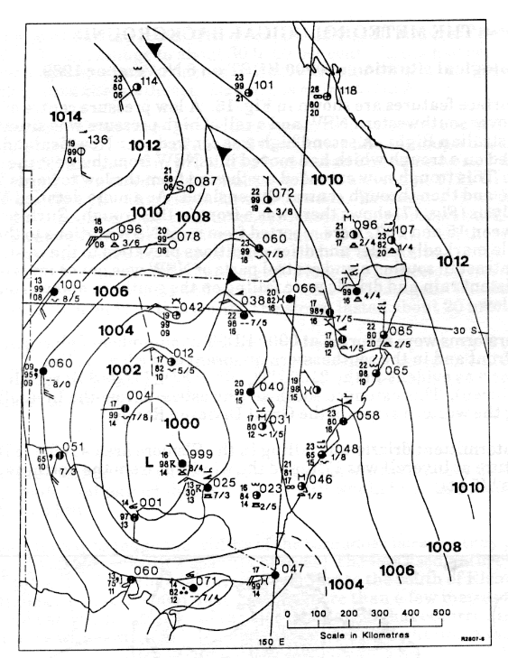
Some figures scanned from the report

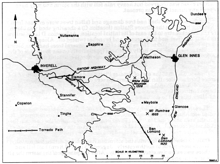
1. Location of the three tornadoes


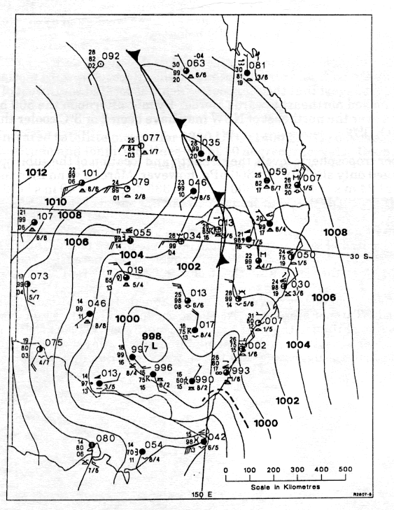
2. Tracks of the two tornadoes in the Elsmore area
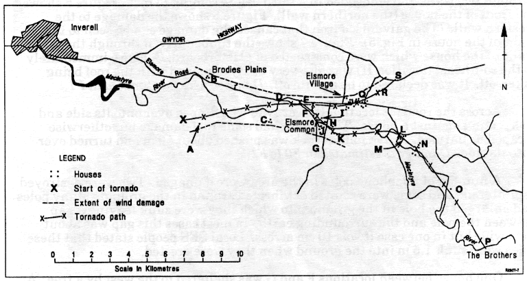


3. Track of the tornado in the Ben Lomond area
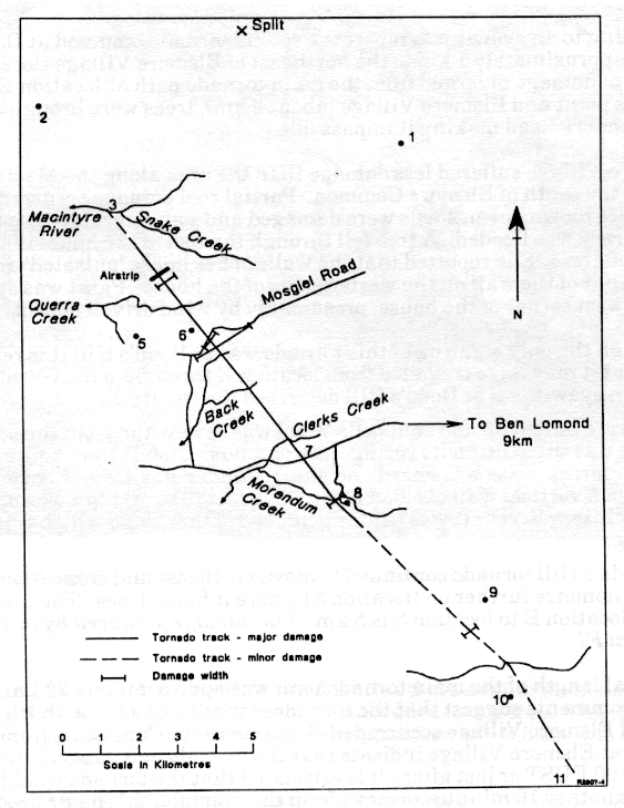


4. MSL analysis at 9am EDT and 3pm EDT


Some additional data I've gathered from the internet.

GFS run 06/11/1989 06z

Instability: Lifted Index

Relative Humidity: 0300 / 0500 / 0600 / 0700 / 0850 / 1000

Temperature: 0300 / 0500 / 07000850 / 1000

Winds (knots): 0300 / 0500 / 0600 / 0700 / 0850 / 0925 / 1000

IR Satpics from 05th Nov 18z to 06th Nov 15z in 3 hour increments.
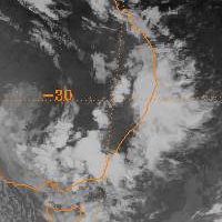
18z (5am EDT)
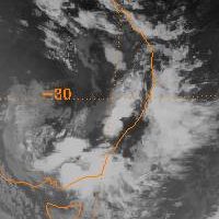
21z (8am EDT)
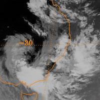
00z (11am EDT)
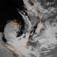
03z (2pm EDT)
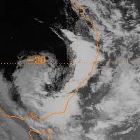
06z (5pm EDT)
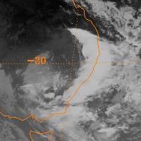
09z (8pm EDT)
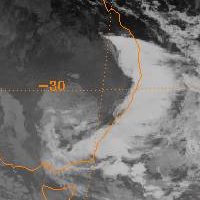
12z (11pm EDT)
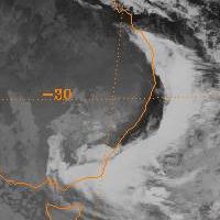
15z (2am EDT)


Regards, Michael

Location: Mcleans Ridges, NSW Northern Rivers
Australian Severe Weather:   http://australiasevereweather.com/
Lightning Photography:   http://www.lightningphotography.com/
Early Warning Network: http://www.ewn.com.au
Contact: Michael Bath

Offline Jimmy Deguara

  • Australian and Tornado Alley storm chaser
  • Administrator
  • Wedge tornado F5
  • *
  • Posts: 2,218
  • Gender: Male
  • Storm Chaser since 1993, Tornado Alley 2001
    • Australia Severe Weather
Re: Elsmore and Ben Lomond Tornadoes: Monday 6th November 1989
« Reply #1 on: 13 November 2007, 09:52:32 AM »
Michael,

I have read that report a few times - well selected sections of the report:) One thing I noted was the extent that the author goes to prove that it was most likely a supercell!Such rare creatures they are.

Another component was the mention of dry air aloft increasing the likelihood of the storm producing hailstones - something I have maintained ever since.

As to the tornado - obviously there were two, at least one tornado was relatively long tracked by Australian standards from memory (long tracked if my memory serves me was 14km or longer). It was also intense - probably in the F3 range having caused severe damage to houses.

This ranks up there with the few recorded violent tornadoes in recent times.

Regards,

Jimmy Deguara
-------------------------------------
Australian Severe Weather
www.australiasevereweather.com

Australian Thunderbolt Tours
www.thunderbolttours.com

Phone  0408 020468  (International :  61  2  408 020468)

Offline nmoir

  • Elephant Trunk F2
  • *
  • Posts: 200
  • Gender: Male
  • "busting chases since 1999"
    • Oculi.com.au
Re: Elsmore and Ben Lomond Tornadoes: Monday 6th November 1989
« Reply #2 on: 10 October 2008, 01:12:40 AM »
Geez , check the difference between those sat pix 11am and 5pm , what an explosion !
Nick Moir
Photographer
The Sydney Morning Herald
and www.oculi.com.au

Offline Shaun Galman

  • Stove pipe F3
  • *
  • Posts: 441
  • Gender: Male
    • ridgelightning.com
Re: Elsmore and Ben Lomond Tornadoes: Monday 6th November 1989
« Reply #3 on: 10 October 2008, 06:02:59 AM »
Hi guys,

It would've been great to see shots of this particular storm outbreak! 3 tornado's and no doubt a few others that went unnoticed that day? WOW!

I was just thinking to myself that it seems funny how the initial tornado (A on the target graphs) followed the path of the Macintyre River quite closely?

And those sat maps are spectacular as nmoir pointed out! I guess we would have received the earlier onset around 10-11am here or thereabouts. That's how you'd want a strong front and trough to combine for severe weather every time! (or maybe a little more to the west so I could get in on the action lol!)

Very interesting.
Cheers,
Shauno
Chasing Region: Lightning Ridge. N.S.W.
Website: www.ridgelightning.com