and Chasing
[Index][Archives]
North Coast Severe Storms: Saturday 16th December 1995
by Michael Bath
| Storm News and Chasing [Index][Archives] |
North Coast Severe Storms: Saturday 16th December 1995 by Michael Bath |
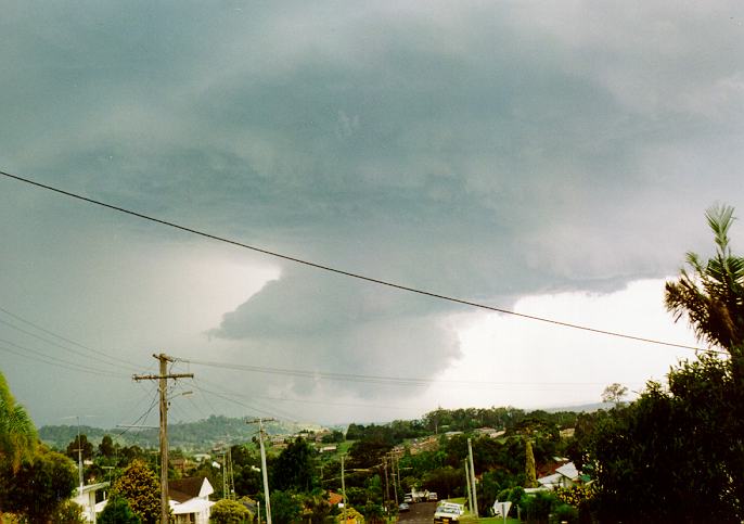
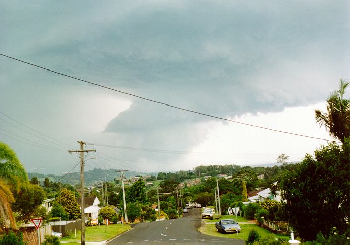
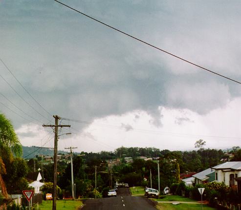
The Lismore area of NSW was hit by two severe storms during the afternoon and evening. At 5.30 pm, hail up to 5cm diameter fell, damaging cars and gardens. At 10.30 pm a second band of storms produced severe wind gusts in Lismore and Ballina. Wind speeds were at least 50 knots and resulted in some minor roof damage as well as trees being brought down in many areas. Rainfall recorded during the storms was Lismore 20mm, Ballina 10mm, Casino 13mm, Nimbin 30mm, Mullumbimby 24mm, Murwillumbah 22mm, Tweed Heads 22mm.
14:15 16/12/95 TAREE MNC 65kt gust. Snapped trees and blew roofs off homes
15:25 16/12/95 MULBRING HUN 4.0cm hail, 54kt gust, 26mm in 20 mins. Flash flooding. Trees uprooted. Hail smashed windows, killed animals and totally desroyed crops.
17:00 16/12/95 SOUTH NEWCASTLE HUN 4.2cm hail
17:30 16/12/95 GOONELLABAH NR 5.0cm hail. Damage to cars.
18:30 16/12/95 KEMPSEY MNC 81kt gust. Trees down and roofs damaged.
20:00 16/12/95 WOOLI MNC Wind pulled out trees and damaged roofs.
21:58 16/12/95 GOONELLABAH NR 50kt gust. 3 roofs off in Lismore and large trees blown down.
22:30 16/12/95 KYOGLE NR 50kt gust. Trees uprooted and roofs taken off homes.
Additional Observations of the two severe storms which hit the Lismore area on 16th December 1995
by Stuart Macdonald, Alstonville
We received about 25mm out of both the storms that day. The first storm didn't drop much. To me it was worse than it looked. The sky did have a slight green tinge in places, it also had a large shelf cloud as well. One thing I noticed about the storm was that it seemed to come in from the south which is a bit unusual. Usually they tend to drift in a more easterly direction. After the first storm which moved away to the north fairly quickly, we had some cirrus cloud and by sunset only cumulus and the remains of the storm was seen to the north. On dusk to the south I saw a dark storm cell which was well developed. I saw the anvil top but the flanking line wasn't visible. By dark there were flashes to the south quite distant. There seemed to be several cells operating at the same time. One such cell approached headlong. About 15 minutes before the main rain curtain struck there seemed to be a lot of lower clouds and you could see the lightning glowing under them where the rain was. Wind be this time was freshening to the southeast. The wind struck at around 50 knots and we had a terrific lightning show that night. Both storms on December 16 dissipated quickly leaving everything very quiet and peaceful.
|
Document: 9512-07.htm
Updated: 5th April, 2004 |
[Australian Severe Weather index] [Copyright Notice] [Email Contacts] [Search This Site] |