and Chasing
[Index][Archives]
Mt Dandenong Storm: Saturday 24th January 1998
by Jane ONeill
| Storm News and Chasing [Index][Archives] |
Mt Dandenong Storm: Saturday 24th January 1998 by Jane ONeill |
Wandered outside at about 9.30pm, took one look skyward, and was out the front door armed with video and camera in less than 60 seconds. There was a towering cumulonimbus just west of Mt Dandenong. Drove hell for leather up the mountain (20 minutes) to the lookout.
The storm was heading across the eastern suburbs straight towards us. The cloud base was below us so the cloud-cloud lightning appeared to be the product of someone sitting on top of the cloud shining a torch down onto the earth. I only sighted on cg stroke during the 2 hours I followed this storm.
As the cloud closed in on the mountain, thunder and lightning became almost continuous and it started hailing, lasting the best part of half an hour - hailstones about 1-1.5 cm in diameter. A fall of about 3" made 'sliding' down from the lookout extremely hazardous.
This storm continued out to the east of the state and remained very active for another hour before fading away.
These images obtained from James Cook University
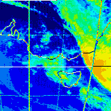
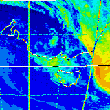
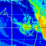
Infrared Satellite Image at 8pm & 11pm 24/1 and 2am 25/1 Local Time showing thunderstorms developing to the north and northeast of Melbourne, and spreading eastwards during the evening.


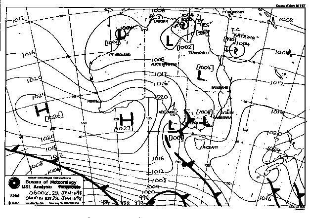
This image obtained from the Bureau of Meteorology
MSL Analysis 5pm Local Time

|
Document: 9801-02.htm
Updated: 14th January, 2003 |
[Australian Severe Weather index] [Copyright Notice] [Email Contacts] [Search This Site] |