and Chasing
[Index][Archives]
Severe Storm Outbreak: 9th - 10th July
by Jimmy Deguara
| Storm News and Chasing [Index][Archives] |
Severe Storm Outbreak: 9th - 10th July by Jimmy Deguara |
This event is the most impressive severe storm outbreak for many years during winter. Such outbreaks are very rare in these parts of Australia during the winter period. The event spanned from the afternoon of the 9th July to the evening of the 10th July, in the northeast and northern parts of New South Wales, and mainly on the 10th for south east Queensland. A severe storm advice was issued by the Bureau of Meteorology during the early morning period of the 10th July and then the afternoon of the 10th July.
This event was being closely watched from at least 3 days prior to the event as the models began to indicate an explosive environment on these days. Each run of the Aviation Model consistently marked out the region and the times this event would eventually unfold particularly from a couple of days before. Plotting my favourite (available) severe weather index known as the Surface Lifted Index (LI) should normally be approached with caution during the winter period. However, this event was indicating a summer like pattern which is why I felt that the indices could be used as a guide. The forecast for the LI was around 0 to -2 in the main source area. Other areas were still in a region of around 0 LI in some areas. This meant that significant or severe storms were possible on the 9th. However, the models were predicting the LI values to drop during the night to a low of -4 to -6 by late afternoon of the 10th. The system would then clear to the north east and off the coast.
The following factors influenced my decision to chase on the 10th:
Because
of the distance involved, the decision to leave early was a good one so that I
could be in the target area by 10am when I thought storms will develop. We left
home at 4:30am and then headed through the Putty Road as the sun began to rise.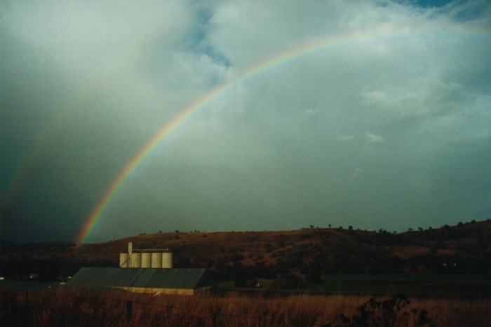 Light showers developed from here until around Scone. More breaks began to show
with castellanus in the clearer areas.
Light showers developed from here until around Scone. More breaks began to show
with castellanus in the clearer areas.
After some deliberation, I made a decision to head towards Gunnedah via Quirindi. This allowed for options to move further north and towards Narrabri or generally east towards Tamworth - wherever the best action would occur. We arrived at Gunnedah at approximately 10am. We went to Macdonalds for lunch only to find that breakfast was still being served. So we had brunch!
After lunch, we
had headed to the north of town in search of a vantage point. The best view was
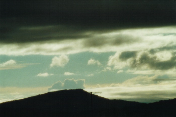
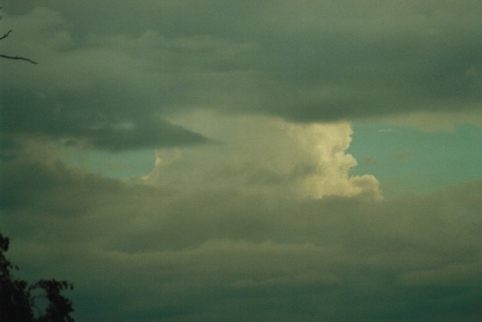
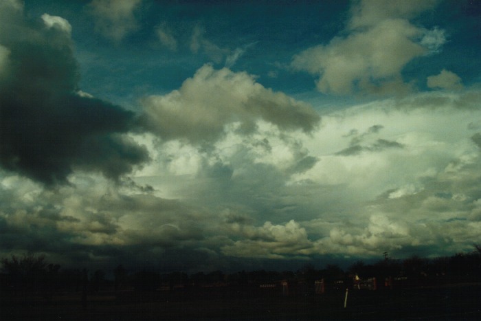
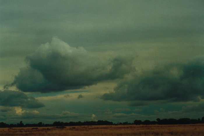
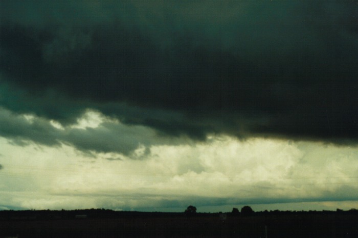
the quadrant west to north. There was widespread castellanus with larger cumulus
around developing from some of these. There were also thunderstorms developing
but not that spectacular due to the cloud mass persisting to the north.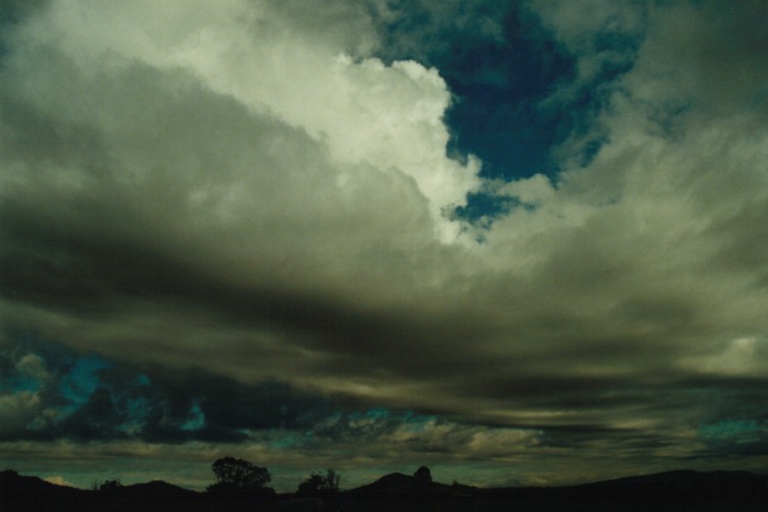
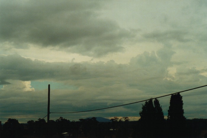
We were there from 11:00am and it seemed not much was happening. The mood had changed from excitement to one of frustration. I am one who has a lot of patience but this was now wearing me out. I was thinking to myself: "Why am I here? You travel all this way for this? ...Hang on! What's that in the distance?" I could see a tower rising though a gap in the cloud which had started off weak a few minutes earlier but now the cell was looking stronger. And then the phone call! Michael Bath tells me there is red on radar - hail!!! 1pm and it was starting to fire. He suggested that the radar had changed from almost nothing to red in a few 10 minute scans.
After
a few photographs and brief video, I made the decision to move towards the Narrabri
region and then come back with the system. 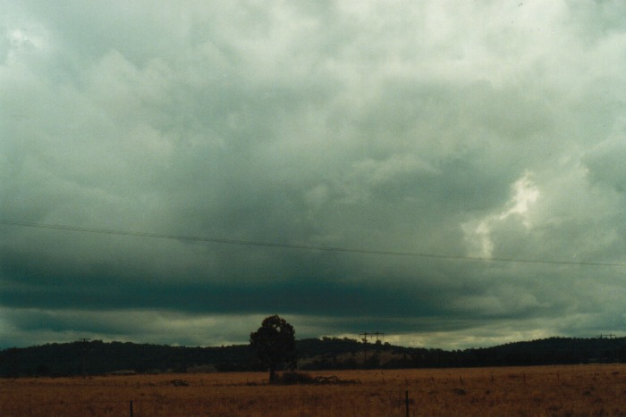 We
made a brief stop at Boggabri for a few more photographs and video. The sky had
started to really fire with storms all around. In fact, each time I looked around
when there was sufficient views, I would see another cell developing and other
cells strengthening. I seriously could not contain my excitement. I then began
to focus on the storm which was situated to the north which by now had passed
over the Narrabri area and was heading southeast. This was showing the most impressive
structure. By the time, we got to Narrabri, it became a blur. I had phone calls
of updates including warning messages for the region including and surrounding
the Narrabri area. I tried to get pictures and some video amongst the phone calls.
We
made a brief stop at Boggabri for a few more photographs and video. The sky had
started to really fire with storms all around. In fact, each time I looked around
when there was sufficient views, I would see another cell developing and other
cells strengthening. I seriously could not contain my excitement. I then began
to focus on the storm which was situated to the north which by now had passed
over the Narrabri area and was heading southeast. This was showing the most impressive
structure. By the time, we got to Narrabri, it became a blur. I had phone calls
of updates including warning messages for the region including and surrounding
the Narrabri area. I tried to get pictures and some video amongst the phone calls.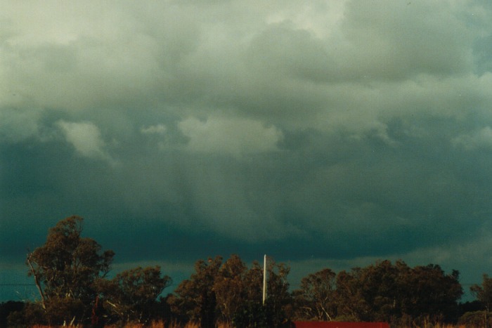
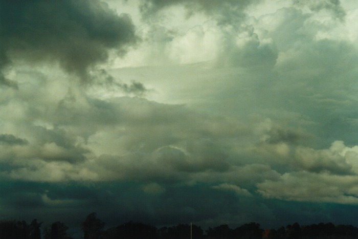
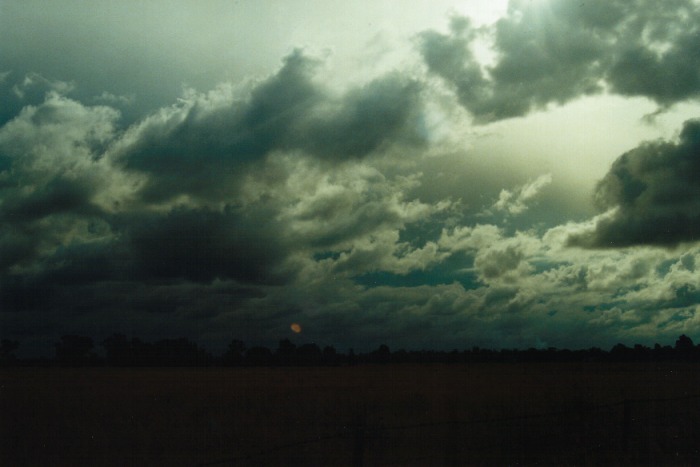
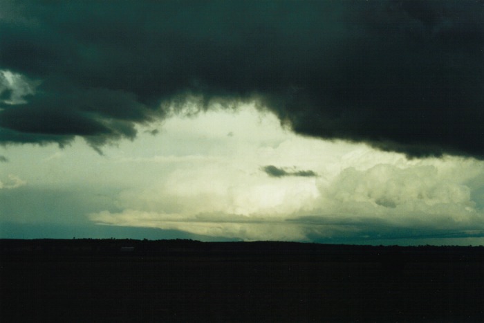
 The
storm to the southeast of Narrabri had developed a nice flanking line and developed
some interesting base features. There was evidence of good shear occurring with
this storm. By about 3pm, I could see that there were storms observed in all directions.
Most were developing into very large systems with dense anvils shearing 100km
or so ahead of the main cell and consistently in a southeasterly direction. And
it was evident that the anvils were thick although unfortunately hidden from view
by other anvils.
The
storm to the southeast of Narrabri had developed a nice flanking line and developed
some interesting base features. There was evidence of good shear occurring with
this storm. By about 3pm, I could see that there were storms observed in all directions.
Most were developing into very large systems with dense anvils shearing 100km
or so ahead of the main cell and consistently in a southeasterly direction. And
it was evident that the anvils were thick although unfortunately hidden from view
by other anvils.
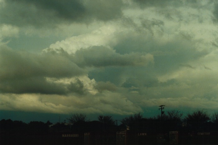
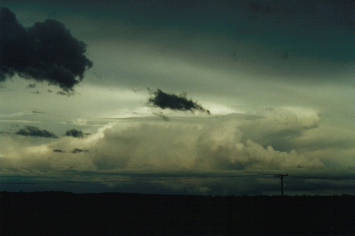
Now
I thought it would be best to remain where I was as a line of storms were moving
from the north west. These had crossed the border from Queensland and were moving
rapidly towards my general direction. Since they were some 100km away, I thought
I could get a better view by getting into a clearer or elevated area. The bridge
to the north of town was the best viewing point although I had to be careful due
to the traffic. 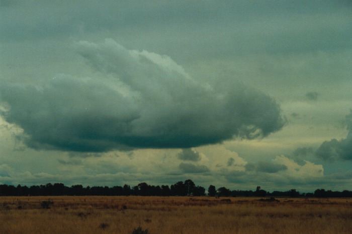 From
this bridge I got a better view of the structure of most of the storms including
the one to the southeast of Narrabri. The flanking line had persisted and also
was appearing more spectacular with the reflection of the hidden but slowly setting
sun. Whilst on this bridge, I also took notice of the storm nearer to Coonabarabran.
This looked particularly severe and was quite large considering its distance.
With updates coming through, it became evident that this was an unusual winter
outbreak - normally a summertime feature. It was likely at least some of the storms
may have been supercells although this would need verification and further analysis.
From
this bridge I got a better view of the structure of most of the storms including
the one to the southeast of Narrabri. The flanking line had persisted and also
was appearing more spectacular with the reflection of the hidden but slowly setting
sun. Whilst on this bridge, I also took notice of the storm nearer to Coonabarabran.
This looked particularly severe and was quite large considering its distance.
With updates coming through, it became evident that this was an unusual winter
outbreak - normally a summertime feature. It was likely at least some of the storms
may have been supercells although this would need verification and further analysis.
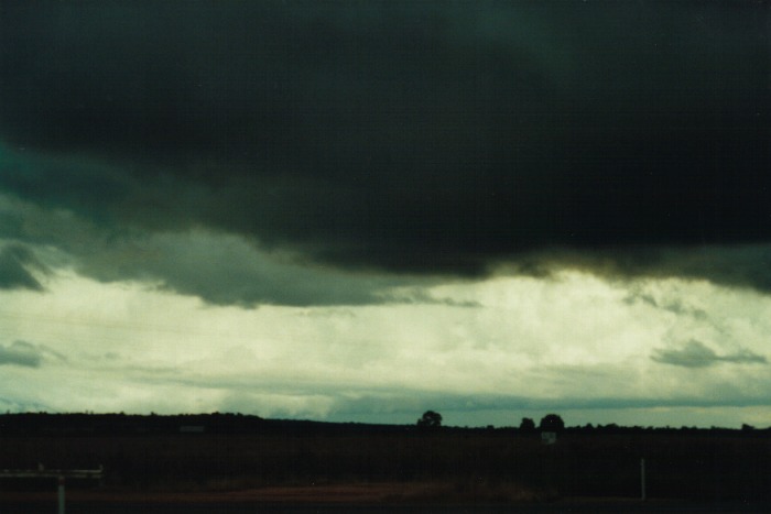
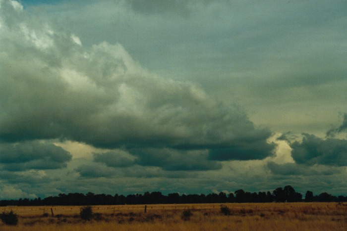
After a travelling 40km north towards Moree, we noticed that the storm there had already crossed the highway but also it seemed that storms were beginning to weaken. I was hoping for a lightning show but it was not going to happen. The storms were developing into a major cloud band. The only area it seemed that was missing out on the major action was Narrabri with only some localised heavy rain passing to the north and south of town. After some distant lightning and light rain observed later, it was all over.
I can say that this outbreak will go down as one of the most classic events and definitely the most exciting for a winter outbreak. It illustrates that anything is really possible and that you have to be a alert to the conditions. One negative point I felt that needed improvement is my knowledge or notes of the minor roads. It was possible that I could have chased the storm to the SE of Narrabri from one of the minor roads.
There were reports that came in that most storms had hail and some dumped in drifts. This was especially from the Coonabarabran event and also more reports from the one to the east of Narrabri which eventually hit Manilla with abundance of hail there. Lightning static on the radio was persistent and frequent as well. All in all, an excellent opportunity to chase in the middle of winter.
|
Document: 0007-02.html
Updated: 2nd November, 2001 |
[Australian Severe Weather index] [Copyright Notice] [Email Contacts] [Search This Site] |