and Chasing
[Index][Archives]
Spectacular LP Supercell near Camden western Sydney: Wednesday 12th February 2003
by Jimmy Deguara with photographs also from Geoffrey Thurtell and Jeff Brislane
| Storm News and Chasing [Index][Archives] |
Spectacular LP Supercell near Camden western Sydney: Wednesday 12th February 2003 by Jimmy Deguara with photographs also from Geoffrey Thurtell and Jeff Brislane |
Video time lapse of LP supercell clearly showing rotation and motion. Truly awesome - well worth downloading. [2.39mb WMV] The models had pointed out a reasonable wind shear profile but good turning of winds from lower levels upwards. There was to be deep moisture profile and dry air aloft making conditions favourable for severe storms particularly conducive to hail. Dew points on the day were higher than normal but nothing out of the ordinary for February (the most humid month).
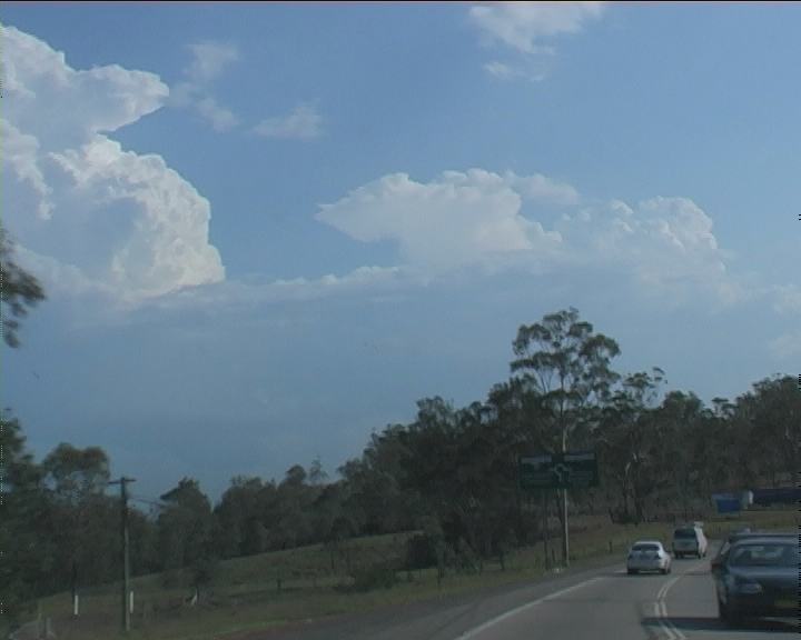
It was after work 2:30pm finish, though I was prepared for the chase. No updates required, I headed to the M4 Motorway and west to Penrith. The storms looked unimpressive but I chose one particular cell on the northern side of a merged region of storms since it was the cell that would most likely break the cap. There was heavy precipitation to the west of that from another mature cell. Of course, you could see the cells in the vicinity of the Putty district had begun to strengthen.
There was really no time to stop. By the time I got to Penrith the weak looking disorganised storms were taking shape so I positioned to the north heading towards Agnes Banks. A few bolts and large drops with some localised rain was the beginning of the intensification process. Ohhh and I saw the anvil through a gap whilst passing the Olympic lakes site near Penrith confirming this intensification process. Certainly not powerful but encouraging.
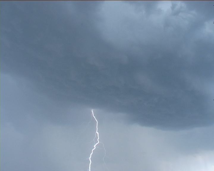
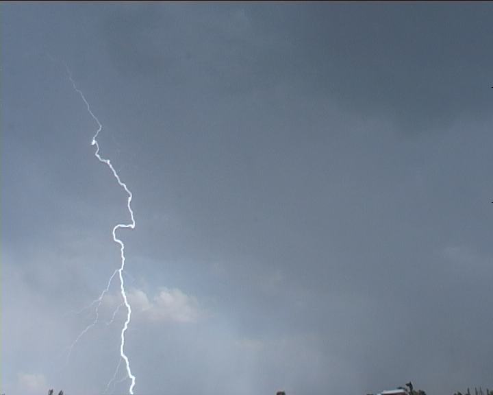
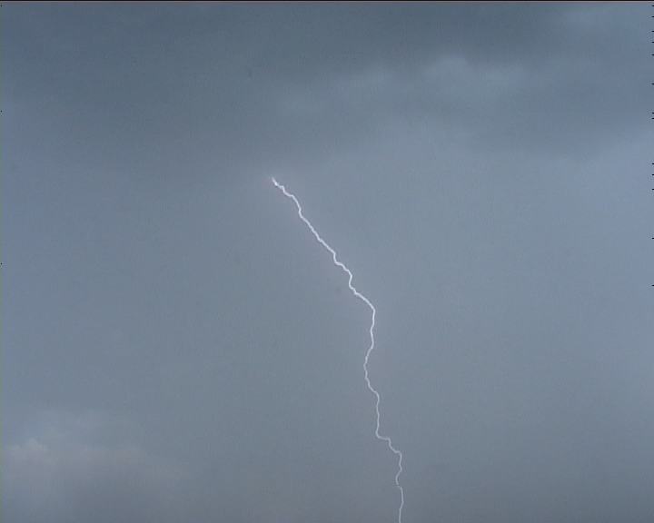
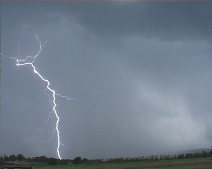
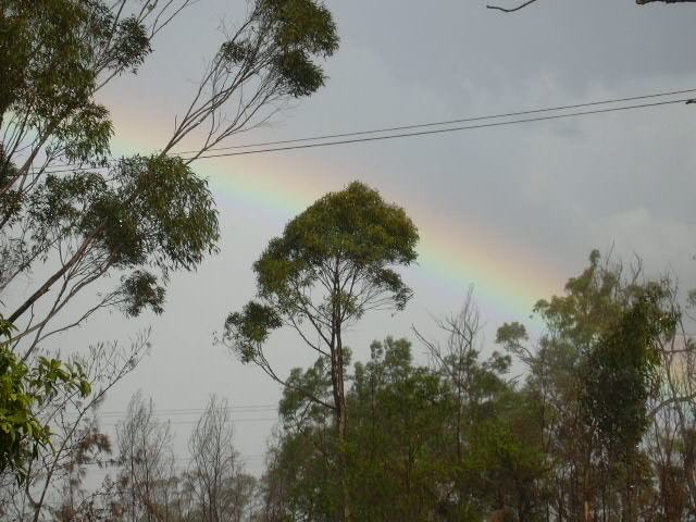
At Agnes Banks, it was about 3:20pm when I set up the tripod for base and lightning footage. The storm had certainly organised rapidly with lightning activity more frequent and the rain free base rather impressive.
Further to the north of Windsor, and it was time to let the cell go. To my disgust though, the sun lit up an impressive structured indentation of the storm and a lowering that I only caught glimpses of whilst heading back home. Finally at home, I took footage and photographed it but the storm had begun to weaken.
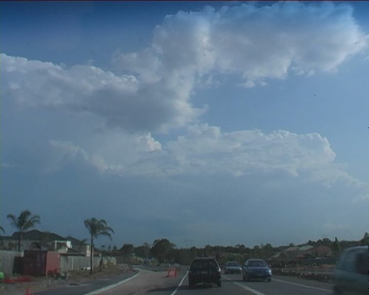
My thoughts began to turn onto the towers observed to the south. Having observed these on the way home, I did not feel like facing the peak hour traffic. One look though - Geoff and I were convinced it was worth chasing. I mean you can stay home to watch the news on television or head out on a chase.
Admittedly, the storm had briefly lost it's features when we left. Would it be a waste of time. What the heck - my instinct told me to keep going. Not before long - the storm revealed more updraughts. These updraughts displayed both relatively explosive bursts and rapid transitions. In Quakers Hill, I was itchy - impatient. Time seemed so fast as the towers were changing so rapidly. They were hard, crisp tops. They were near vertical. I wished I was already there under it!
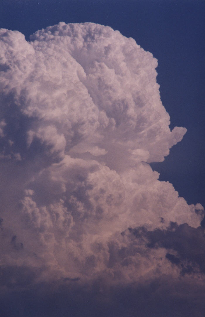
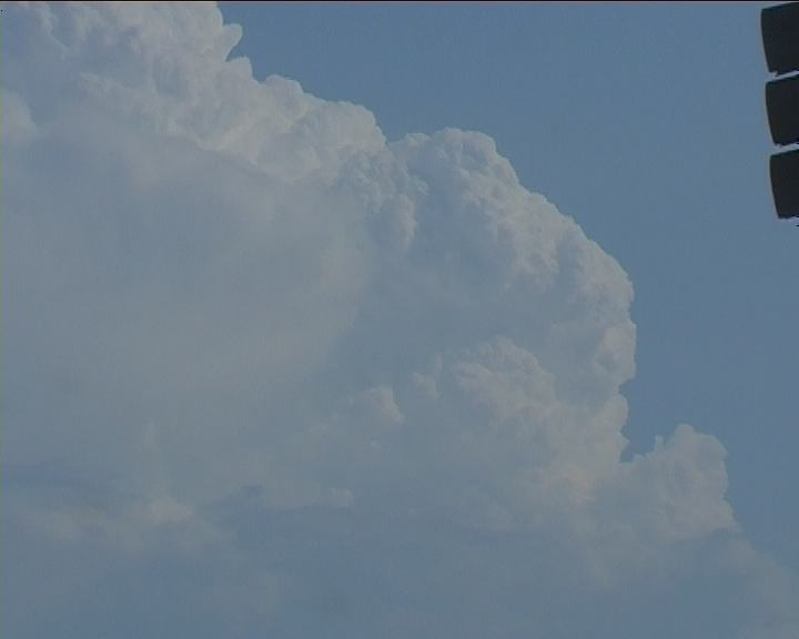
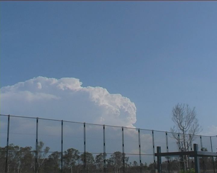
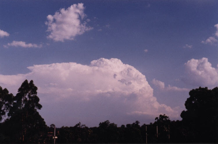
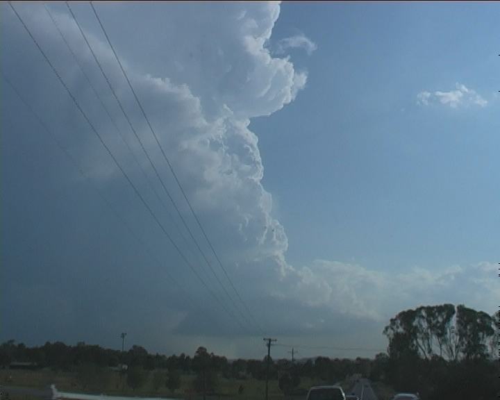
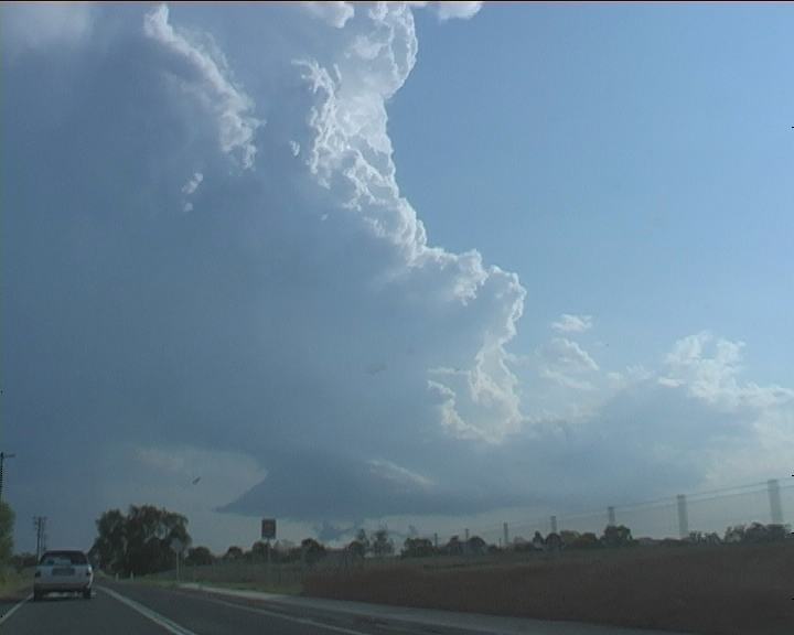
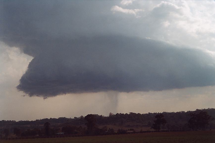
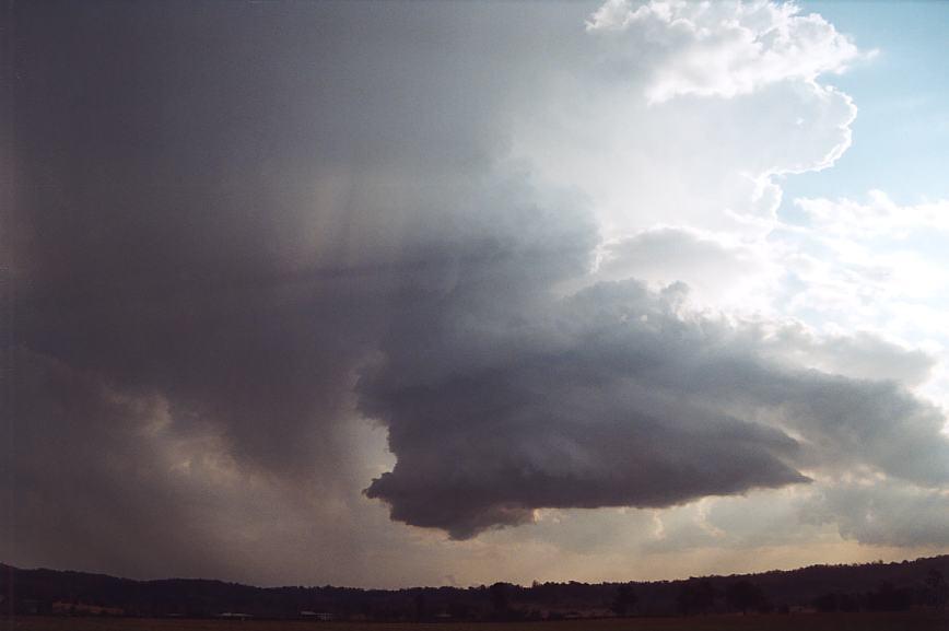
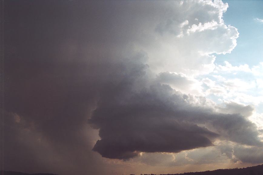
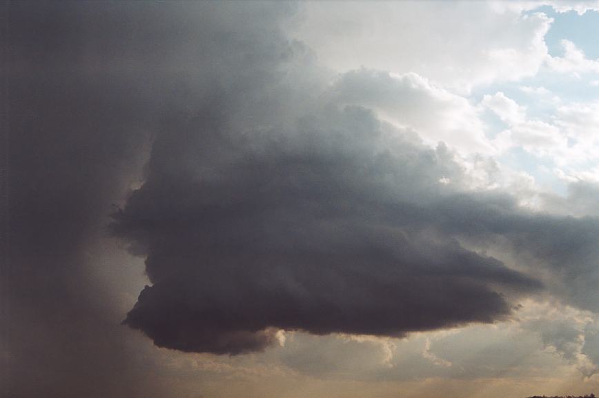
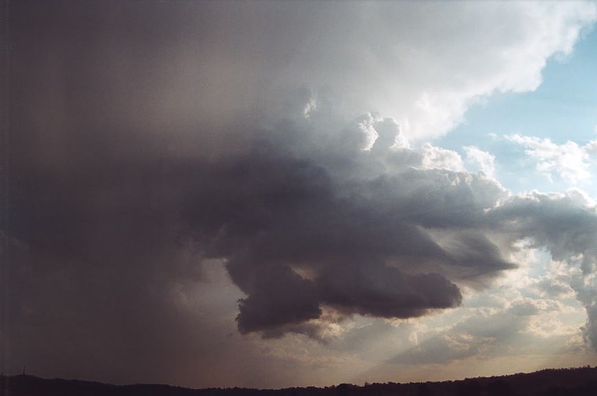
Was it over? Not a chance. I had been observing the cell to the southwest (generally west of this cell). It had begun to develop rather rapidly - simultaneously whilst this cell had begun its collapse stage. The adrenalin was out of control. Anything from the "cow catcher" to the powerful updraughts; this was a scene one would expect on the Plains. There was no doubt in my mind it was an LP supercell!!! Geoff did a great job of filming as much footage as he could amongst the house or tree obstacles. Finally freed from Camden, the LP supercell complete with "cow catcher" in its entirety revealed itself.
Suddenly scud began rising into the base. It was obvious from this sort of activity that this storm was serious. Now within close proximity, it was time to find a viewing spot. And with Razorback Mountain in view, a clearing emerged - ideal place to stop. No time wasted getting out the tripod. The camera was soon recording hoping for good time lapse. This allowed for myself to take it all in and of course take photographs. This was an awesome display of nature with true rotation and dynamical change in the lifecycle of an LP supercell.
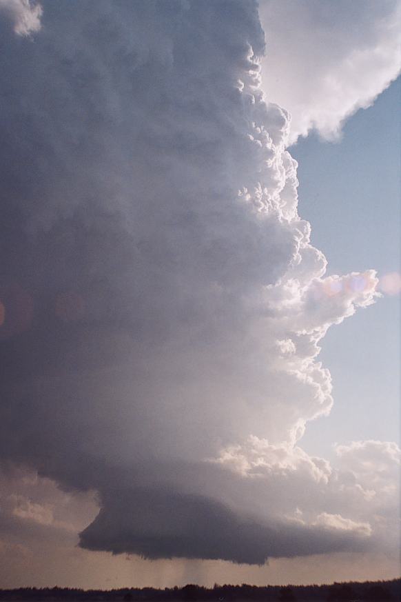
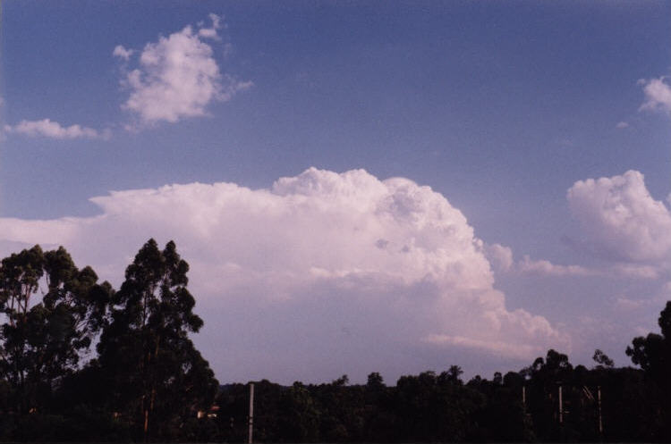
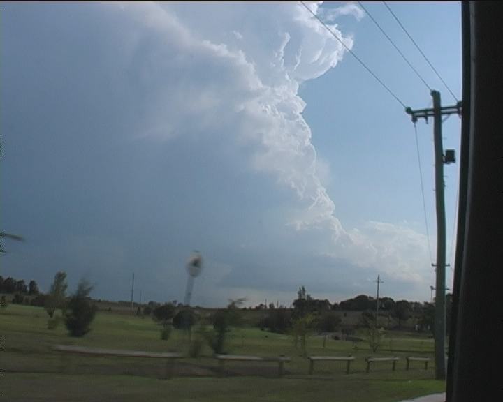
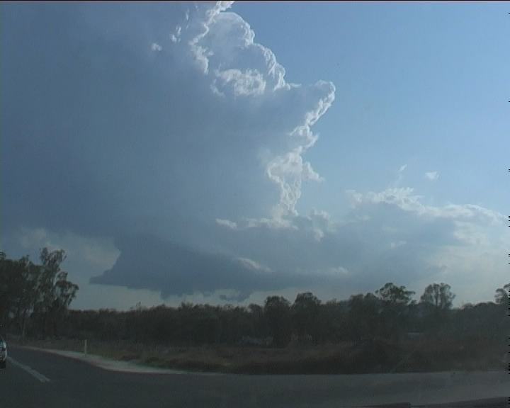
We watched this cell for about 15 minutes as it underwent general structural changes. The hailshafts began to retreat revealing more of the updraught and vault region. A clear slot began to develop - but soon after, the updraught began to weaken and become more tilted. The storm was dying. But during this whole process, the updraught was slowly rotating. Even when the narrowing stage occurred, there was rotation. The timelapse of the footage reveals this incredible process. Until finally, only a small remnant protrusion of what was left of the updraught and anvil drifted away with the windflow.
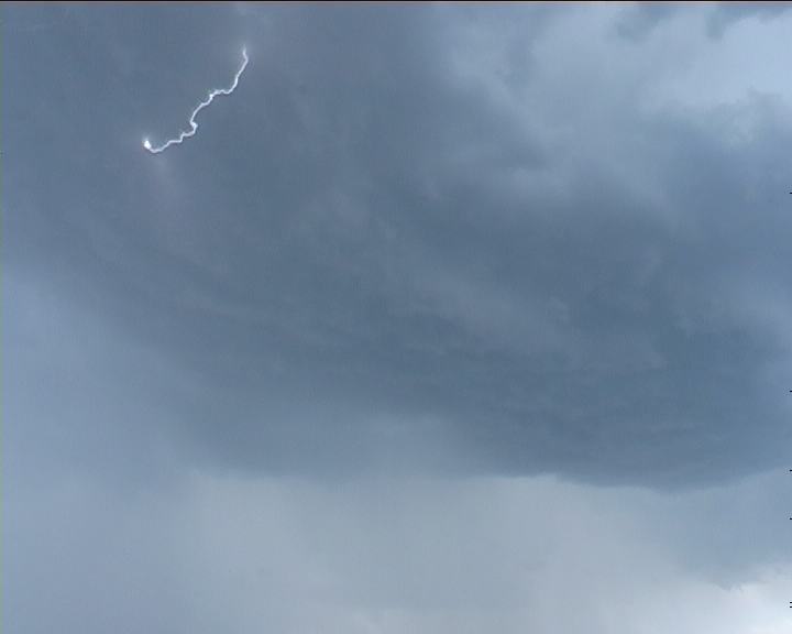
Geoff and I were still in awe and discussed the whole event in detail before heading home. It was an afternoon not to be forgotten - certainly a storm that will be reflected upon and analysed further as the footage is studied in more detail. It was a textbook LP supercell. One feature it did not exhibit much of from our perspective was lightning. There must have been - perhaps cloud to cloud lighting or perhaps it was somehow hidden; well there was some thunder heard.
If you (or someone you know) have any photographs or video of this event or any other type of severe storm such as damage, the storm structure itself or hail, please feel free to contact Jimmy Deguara. Your contributions are very welcome. Please any photographs or video footage are important so don't discount anything.
From Bureau
of Meteorology.
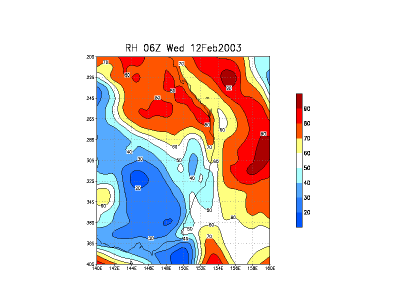
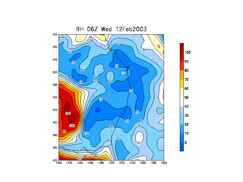
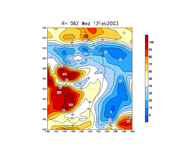
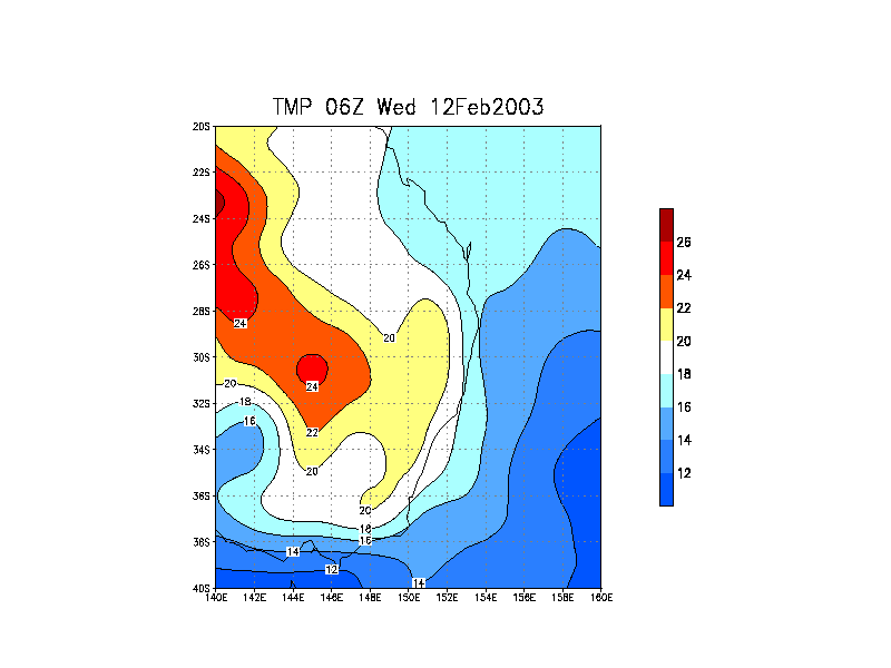
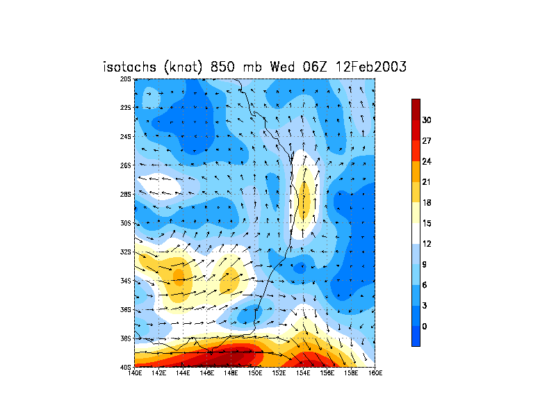
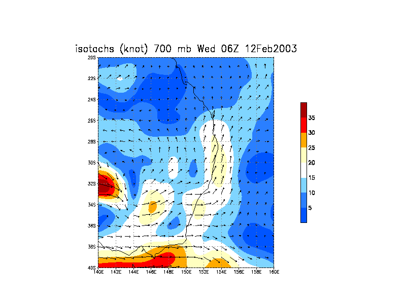
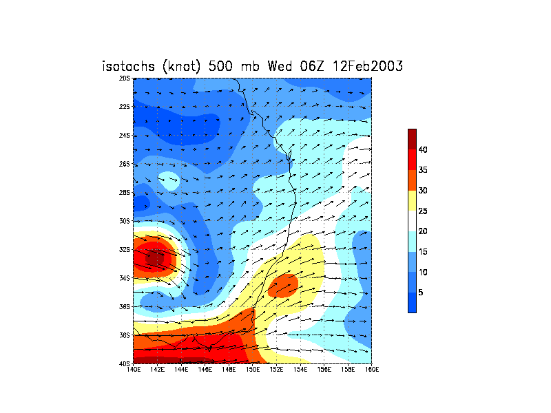
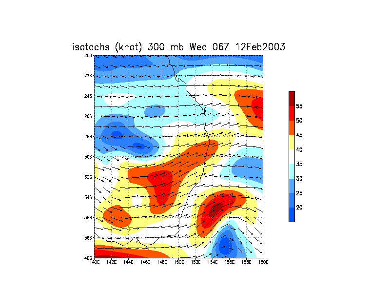
From NOAA 12/02/2003 06z analysis run
 This storm chase goes down as one of the most spectacular chases in the Sydney metropolitan area. I have not from memory chased such an extensive distance in the Sydney region. Three storms in an afternoon: one of them definite LP (low precipitation) supercell and another probable LP supercell was a certainly phenomenal effort. The first cell was also interesting and perhaps it would have been ideal had I remained ahead of this storm.
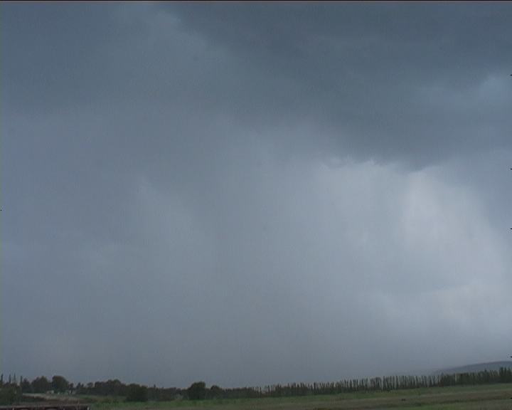
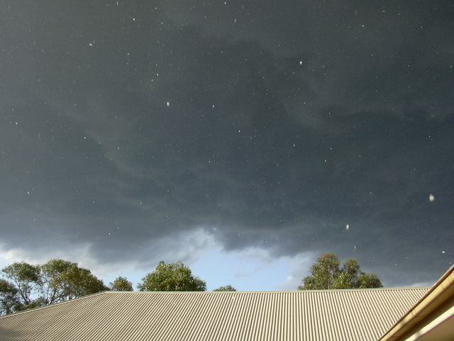
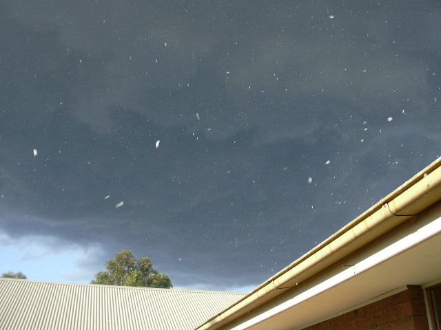
 Wind shear was certainly ideal in some ways but perhaps not sufficient at that point in time for supercell development unless the storm would intensify further. The storm though was inflow dominant for most of the time I was there until becoming slowly outflow dominant with microbursts developing and some rain starting to break through parts of the rain free base.


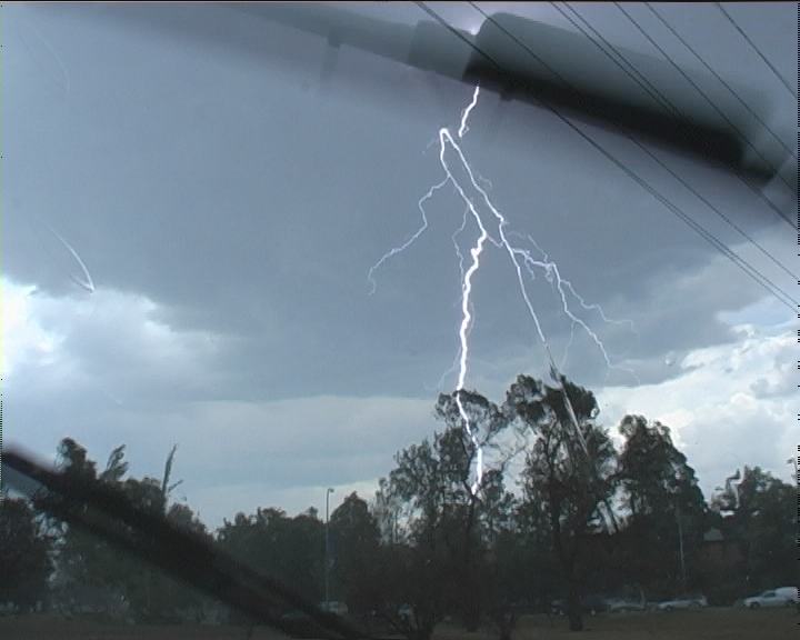
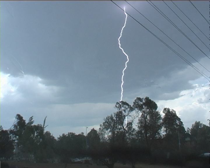
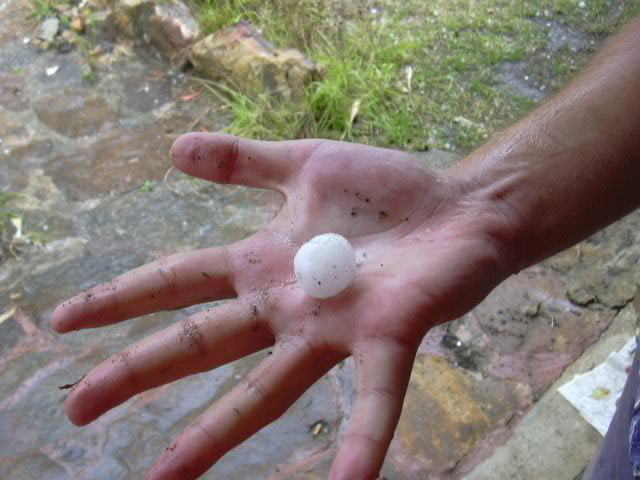
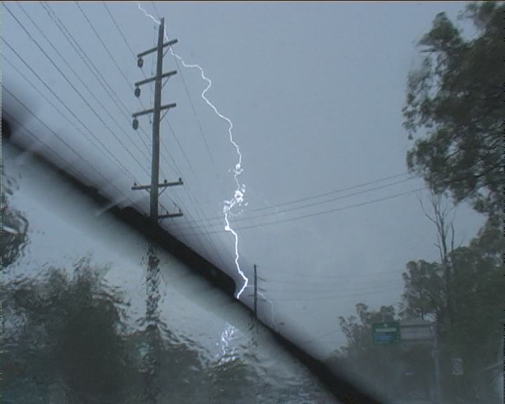 After obtaining some footage, it was time to head into the main core to investigate the core. Through the confusing road network, I finally made it on the Driftway which was more familiar and led me to Richmond Road. The storm was moving reasonably quickly but I made an attempt to keep up. The suburb of Windsor though produced annoying traffic and traffic lights. Sporadic hail teased as well as some lightning bolts and the sound of loud thunder. Enjoyed it!!! After all it was just an afternoon chase no real effort required.


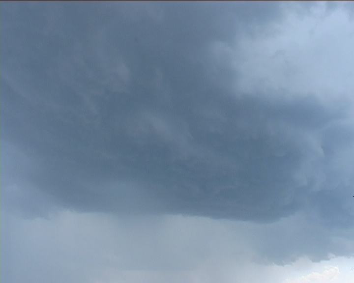
 Heading through Doonside revealed glimpses of it's base. Not really a surprise that this storm was revealing supercellular characteristics. It was the 'left rear structure' that resembled structure I had observed in the US Plains (Tornado Alley) perhaps the edge of the wall cloud 'cow catcher'?? Not sure. What was under it though!! It took us to Wallgrove Road nearer Horsley Park before a lowering finally was observed. I banged my hand on the roof - "LP supercell I shouted". There seemed no doubt!! There was a nice striated base and a wall cloud under that.
 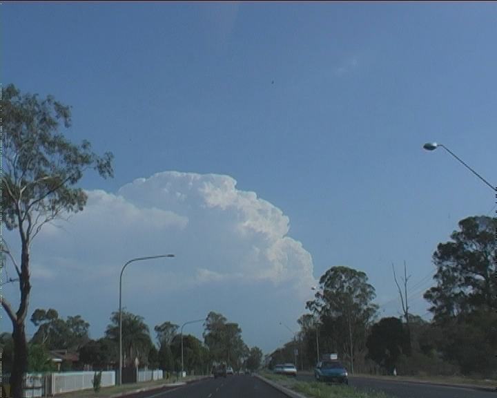 Mid-level inflow fed into the everchanging boiling updraughts. Further on, glimpses of the wall cloud indicated it losing structure and it seemed to be shrinking. It was now a race against time to observe what we could from as close as we could. But it was a lost cause - as predicted Cowpasture Road was full of cars with drivers uninterested with the storm in the foreground. The towers had lost hardness and we knew the storm was rapidly dissipating - the angled tilting in the updraught became less steep. I think even without traffic, our road network and timing would not have allowed us to get there in time.

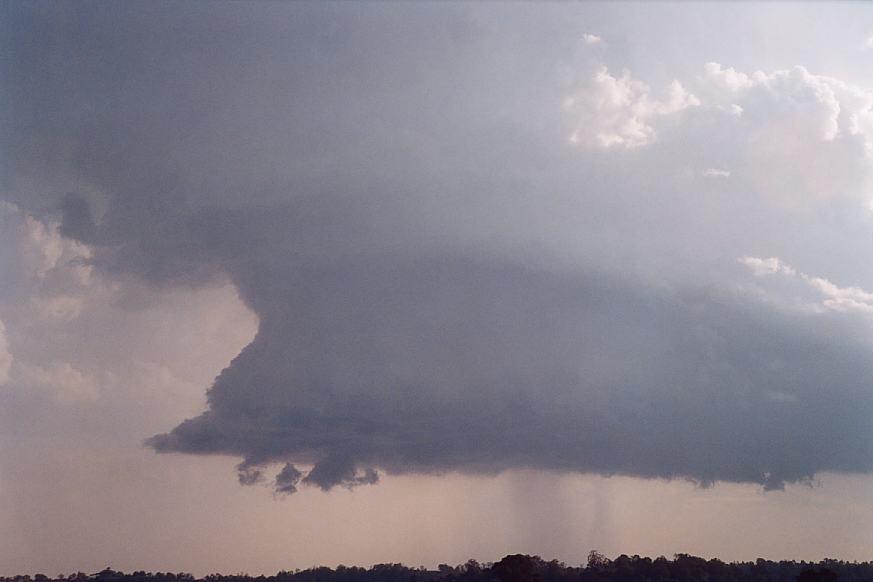
 Some photographs by Jeff Brislane of this storm
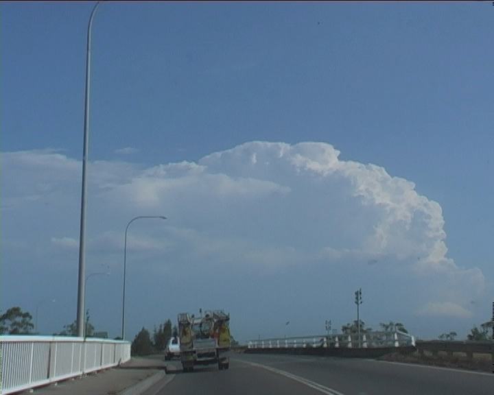
 I never thought Camden Valley Way was that long and so treed in. Well I always hope there are clear areas. Nevertheless, what Geoff and I were observing along this stretch towards Camden (southwestern outskirts of Sydney) was again explosive, sometimes smoothed updraught bulges. Truly awesome! Where was the base? What was under it? On approach to Camden, a "cow catcher" formation finally came into view.
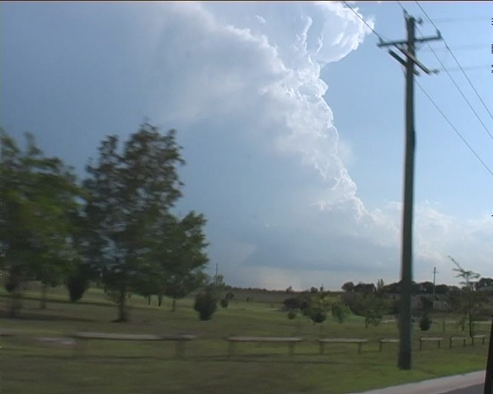


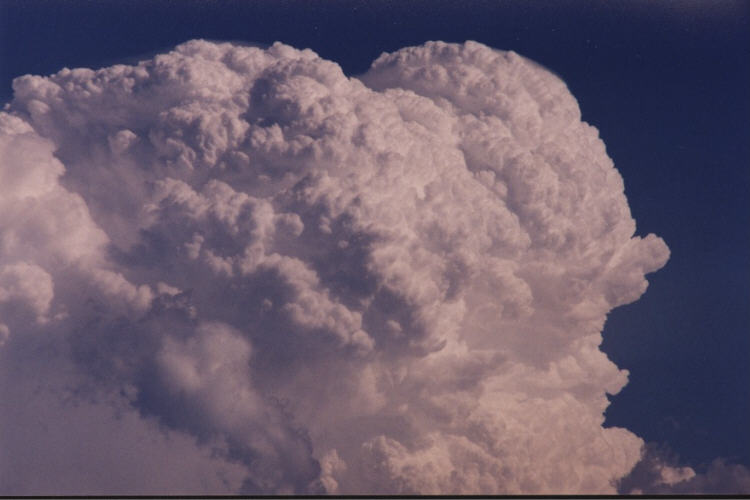
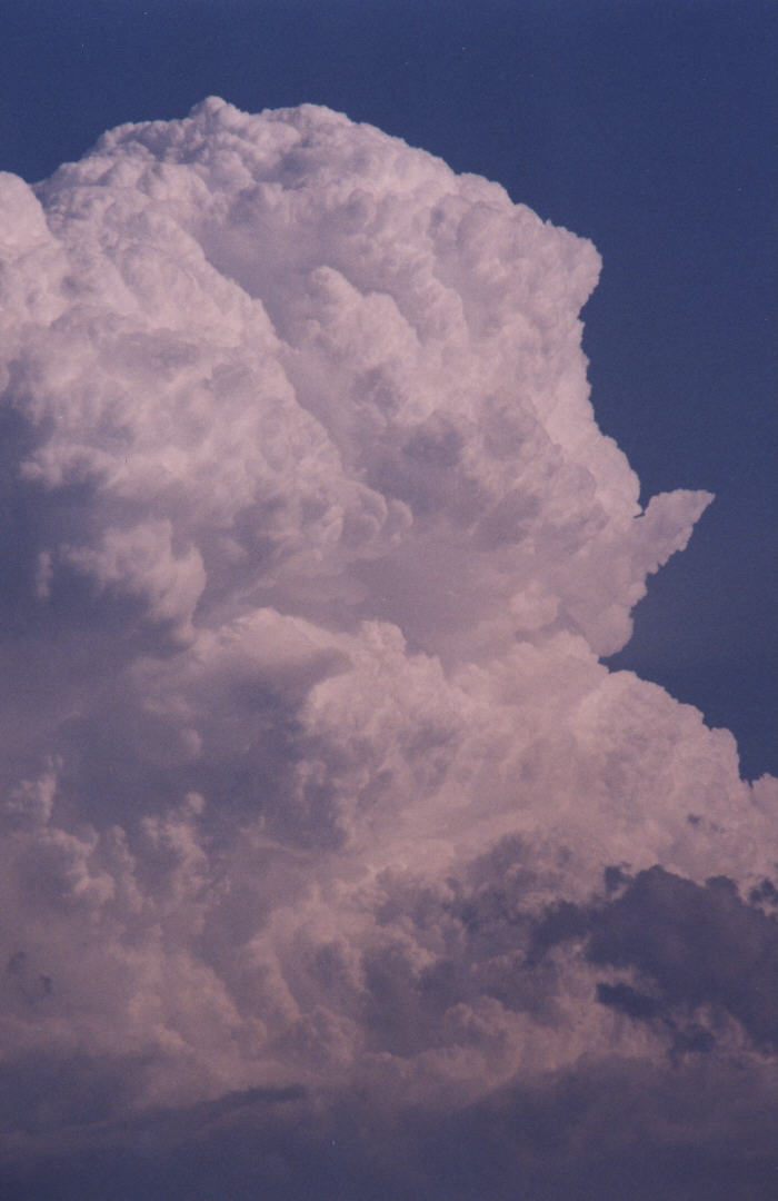
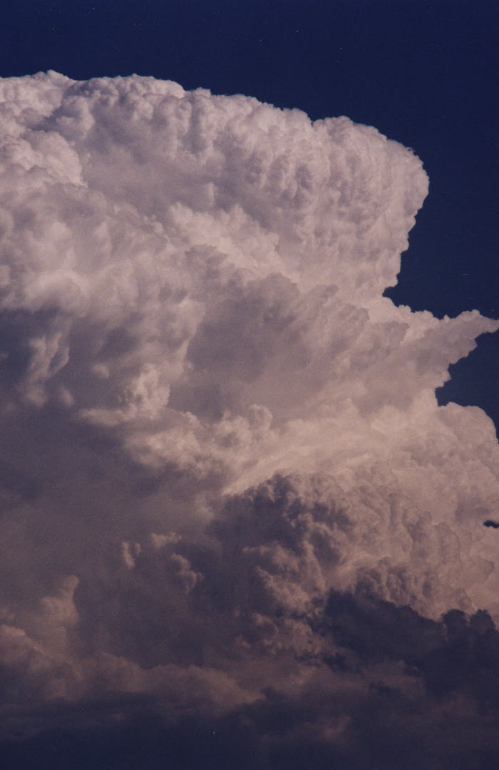
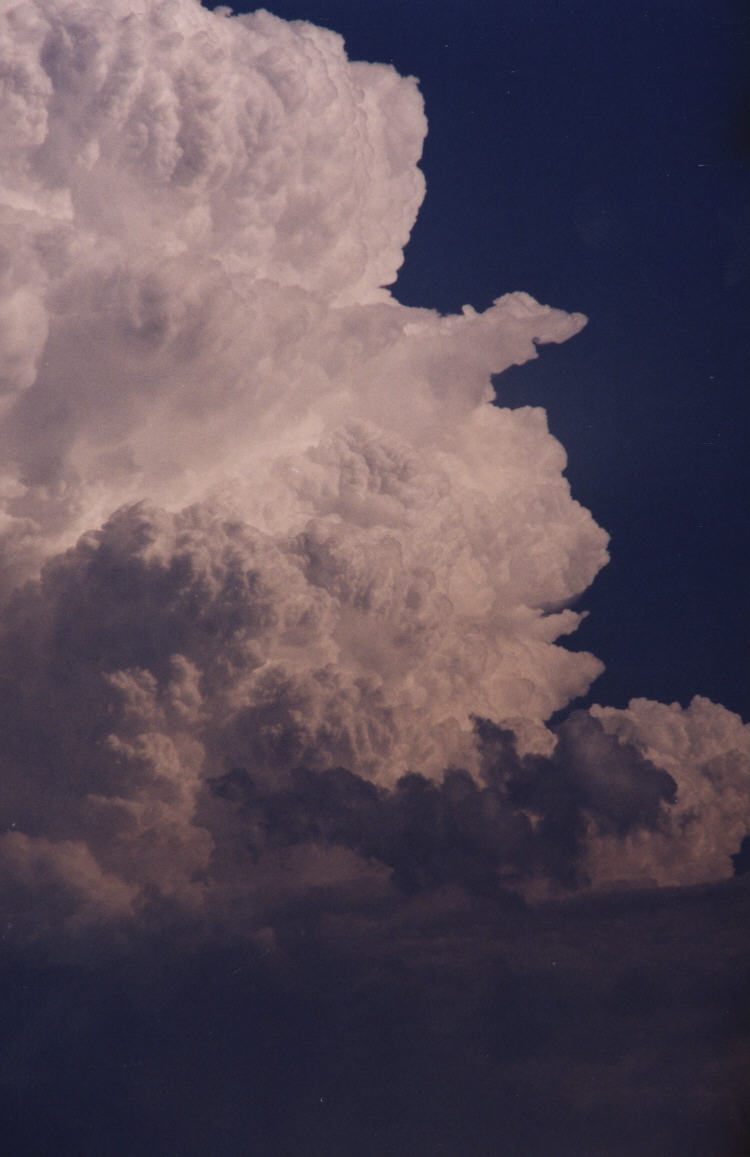
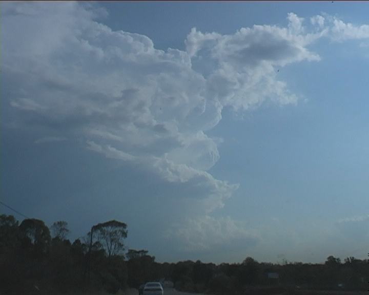
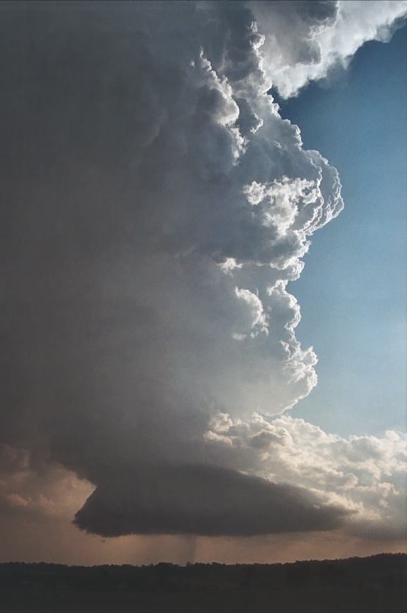
First few photographs by Geoffrey Thurtell and the others of myself. Note the change in structure from mature stage.

 First few photographs by Peter Belobrajic and the others of myself. Note the change in structure from mature stage.
Radar
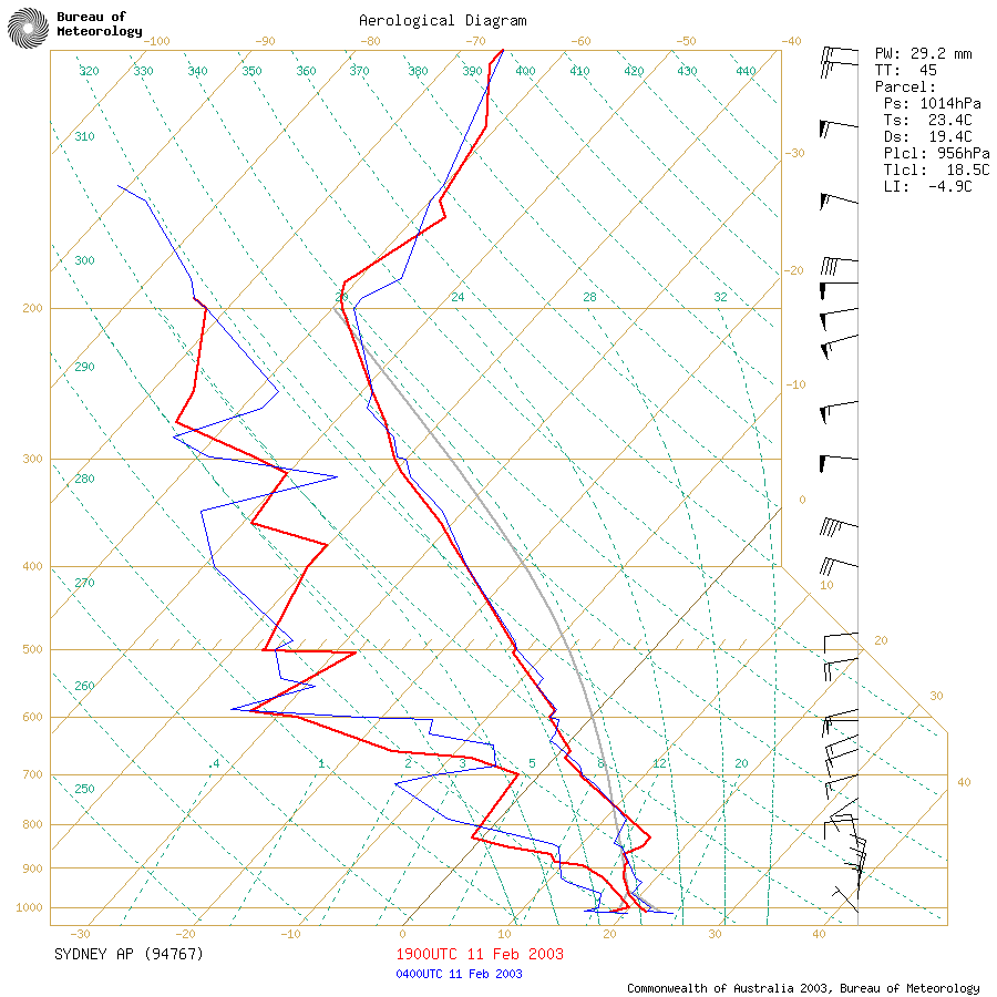
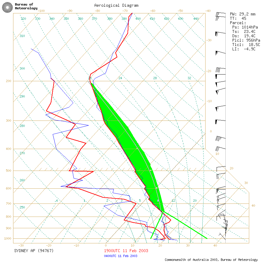
Sounding
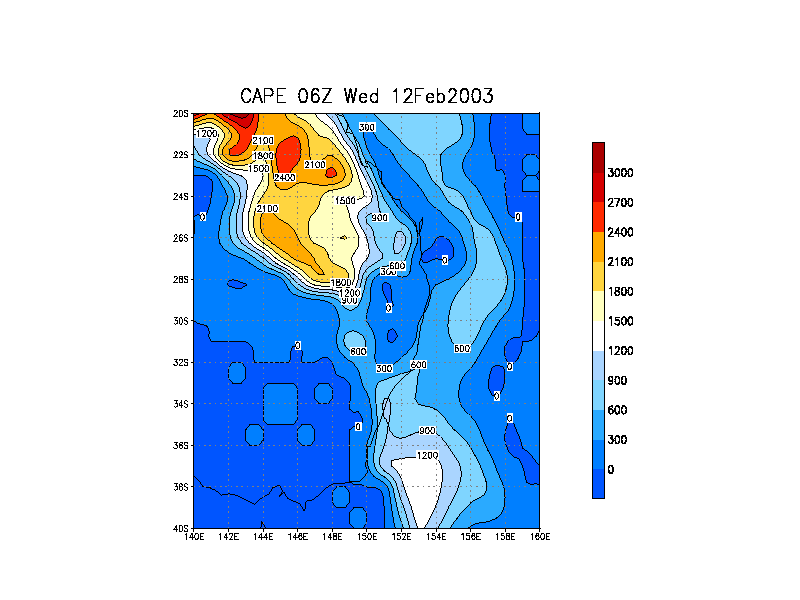
AVN Model Analysis
Document: 200302-01.htm
Updated: 24th February, 2003
[Australian Severe Weather index]
[Copyright Notice]
[Email Contacts]
[Search This Site]