and Chasing
[Index][Archives]
Explosive Severe Thunderstorm moves off the coast of Sydney: 30 January 2004
by Jimmy Deguara
| Storm News and Chasing [Index][Archives] |
Explosive Severe Thunderstorm moves off the coast of Sydney: 30 January 2004 by Jimmy Deguara |
 The impression I got leaving for work on the morning of the 30 th January was the moisture had returned sufficiently the previous day and the atmosphere looked unstable. Too late though. No equipment - so I hoped the storms would develop later in the day. Initially it seemed that the upper trough would have little influence this far north due to drying out. Wind shear was impressive though with 40-50 knots at the 500hPa level. Temperatures were also cooling aloft allowing for destablisation of the atmosphere.
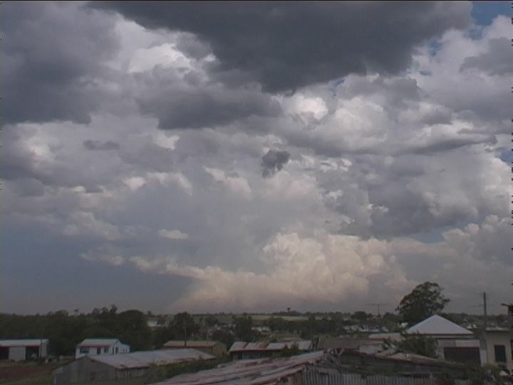
During the day large widespread congesting cumulus developed - some larger towers with pileus. . One tower began to dominate producing some precipitation. This would have been the storm that eventually frightened the living daylight out of David. Despite the earlier development, would the upper trough lag over the region until mid afternoon? Persist it did!
With the working day over, I was astonished that a massive tower had exploded to the southsouthwest. It was a race against time. I head to head home - fast! And did you think the traffic cared?
 Once home, I raced in, grabbed the camera, took some quick video, and raced off. Those crisp towers could make one salivate. Next destination - the coast near Sydney .
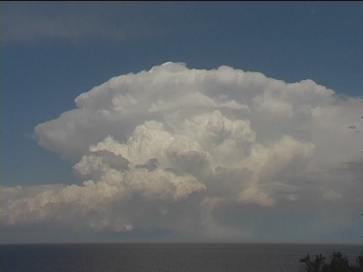
With traffic building up by this time, the M2 was the best alternative. Filming from different perspectives along the journey made for an ideal summary of the change in storm structure. This massive storm sent up powerful updraughts, an overshoot, an overhang, and also revealed some of its inflow features. After some confusion, I made it to North Head.
Standing on top of a log in the car-park to catch a view above the low growth, I photographed and filmed some of the impressive updraughts. And those overshoots! Wow! Each updraught would buldge upwards and shoot through the anvil despite the high winds aloft.
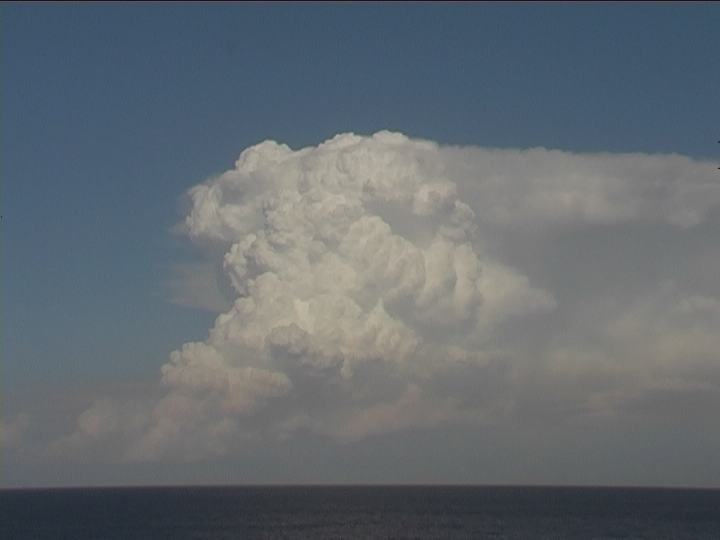 A weak cumulus produced a shower threatening to block my view though gradually dissipated. Besides, I moved to the Manly headland. From here I captured some impressive timelapse of a few major pulses. The setting sun reflection added to the spectacle. I just stood back and �took it all in� as Rune always says. The storm gradually showed signs of weakening so I ended my chase � meeting up with Mario who had observed the event from the south side of the city.
Click here for all stills listed online of this event.
If you (or someone you know) have any photographs or video of this event or any other type of severe storm such as damage, the storm structure itself or hail, please feel free to contact Jimmy Deguara. Your contributions are very welcome. Please any photographs or video footage are important so don't discount anything.
|
Document: 200401-10.htm
Updated: 12th November, 2004 |
[Australian Severe Weather index] [Copyright Notice] [Email Contacts] [Search This Site] |