and Chasing
[Index][Archives]
Severe Thunderstorm Images of the Month Archives - 2006
Other years: [1997][1998][1999][2000][2001][2002][2003][2004][2005][2006][2007][2008][2009][2010]
| Storm News and Chasing [Index][Archives] |
Severe Thunderstorm Images of the Month Archives - 2006 Other years: [1997][1998][1999][2000][2001][2002][2003][2004][2005][2006][2007][2008][2009][2010] |
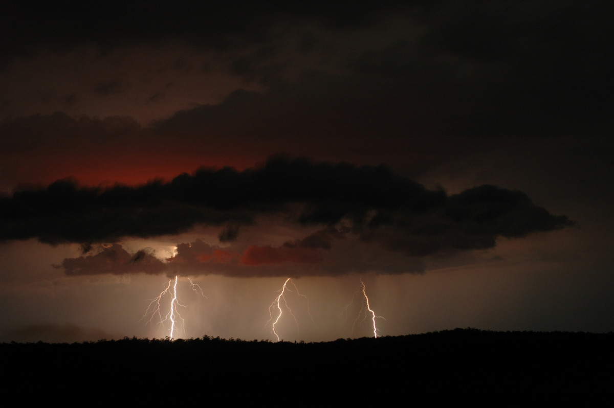
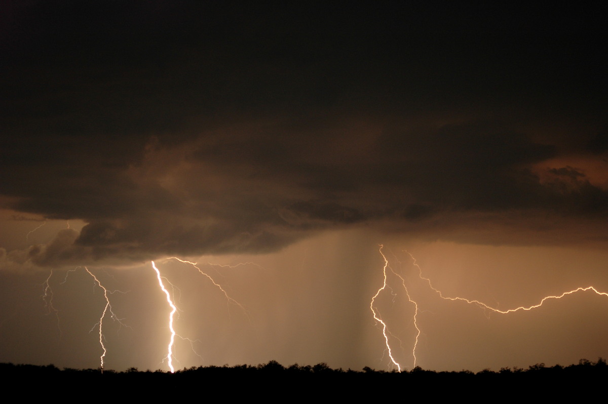
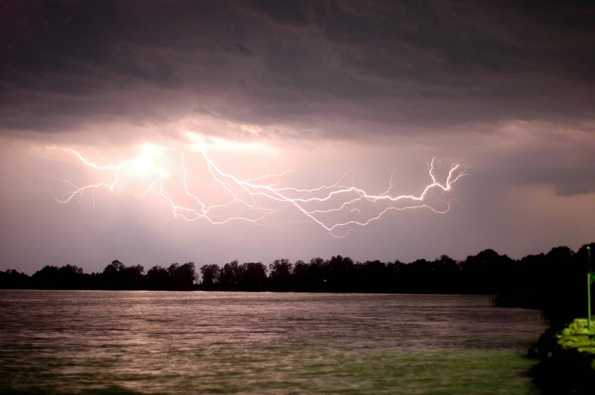
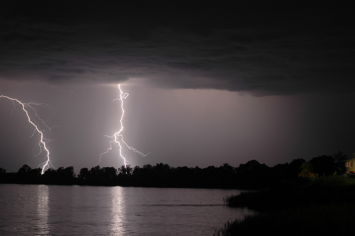
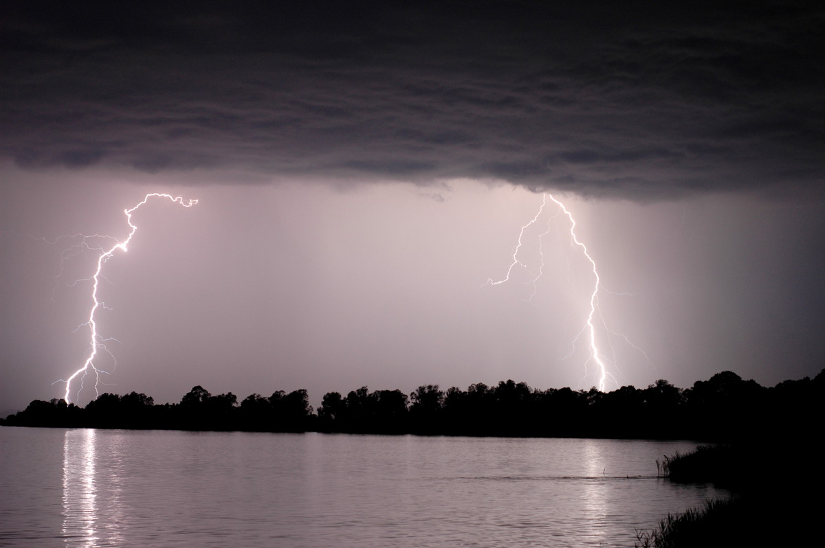
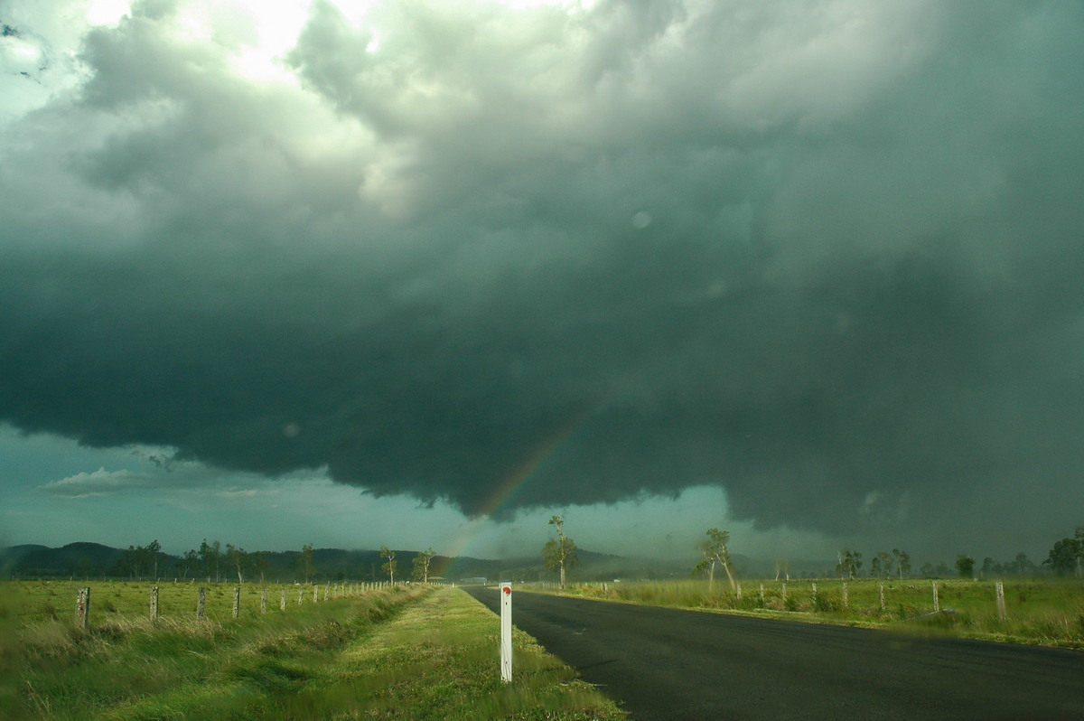
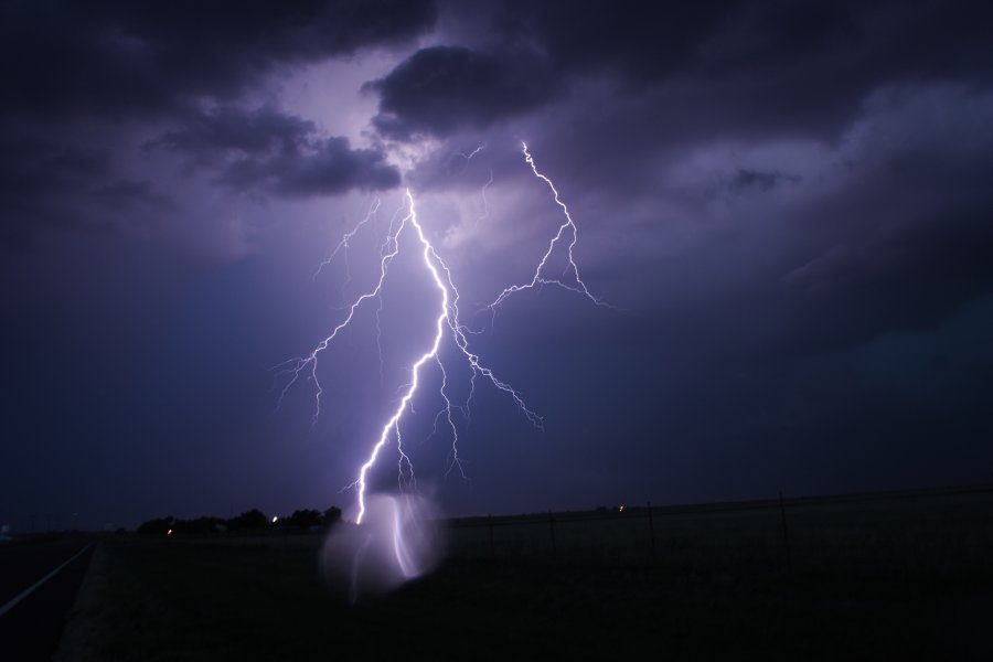
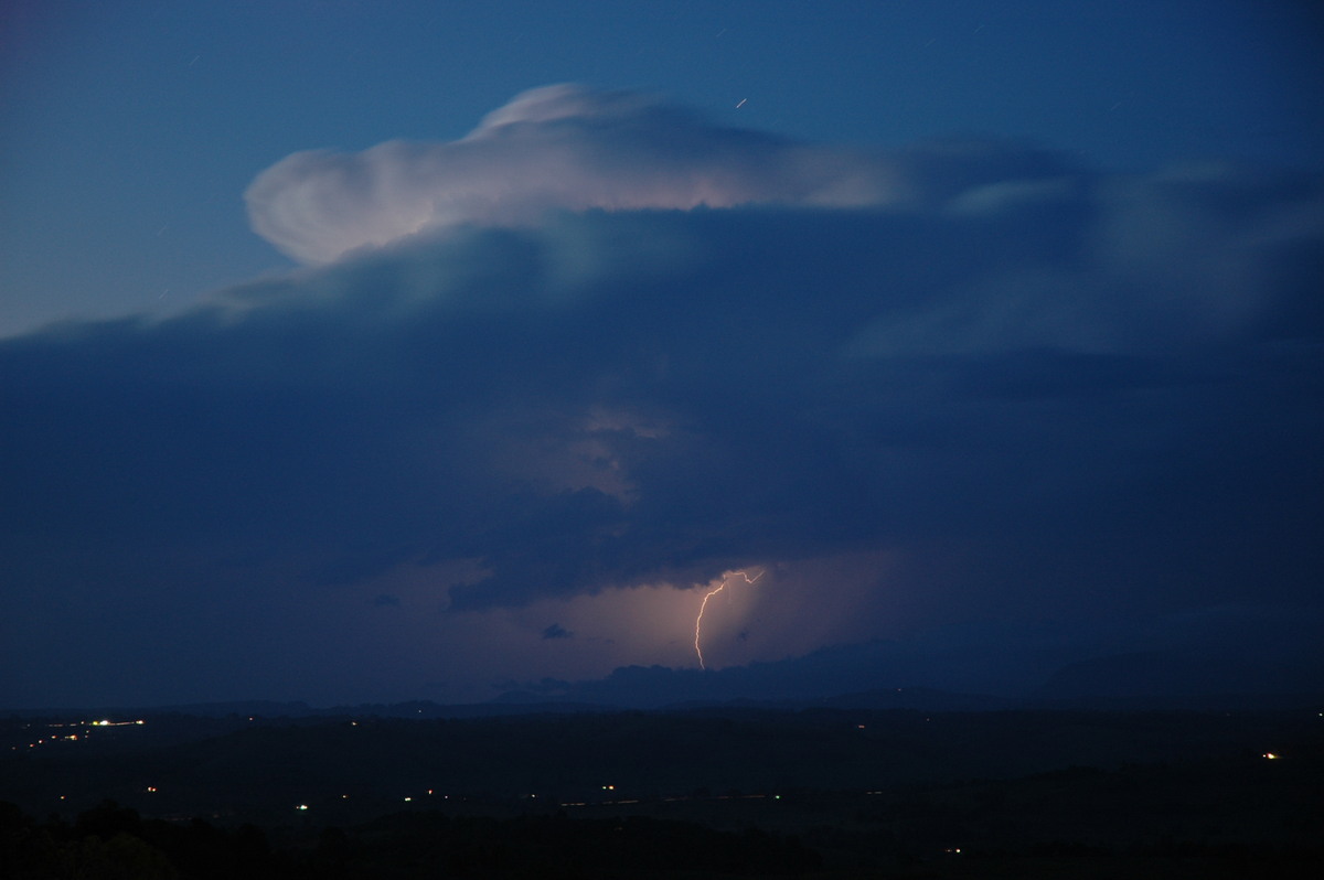
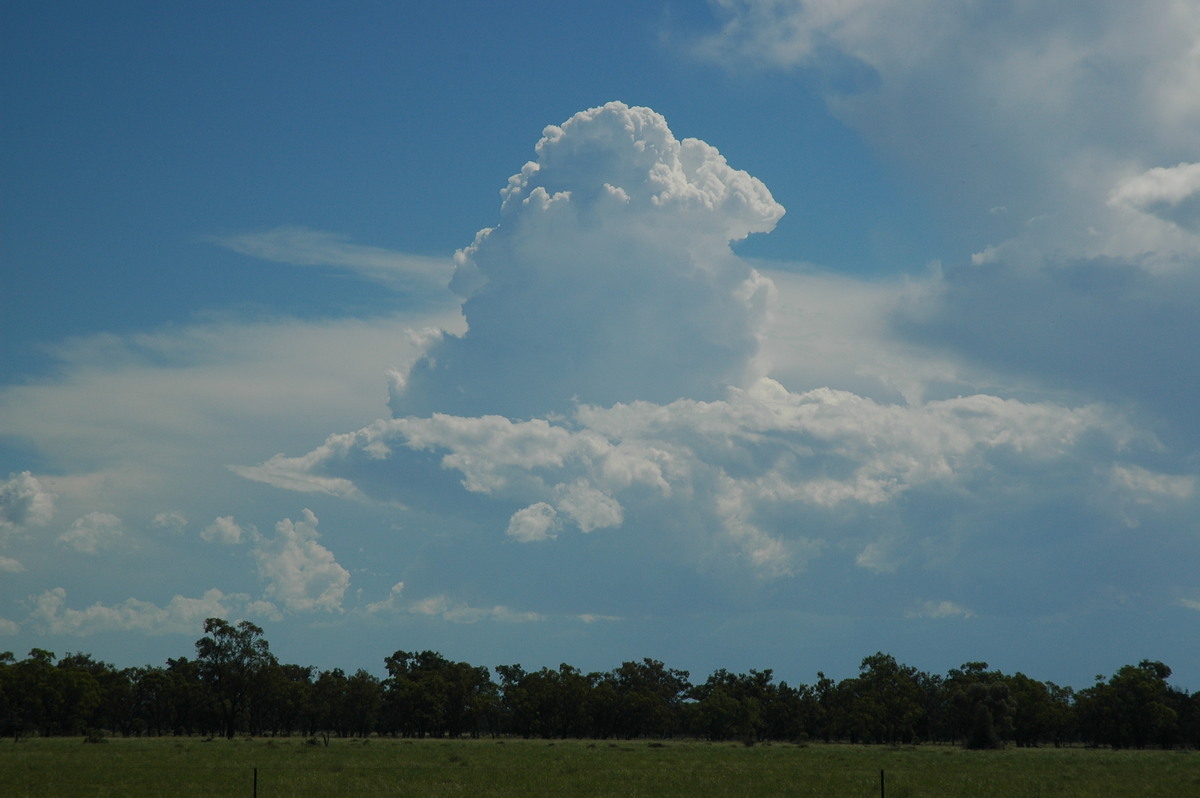
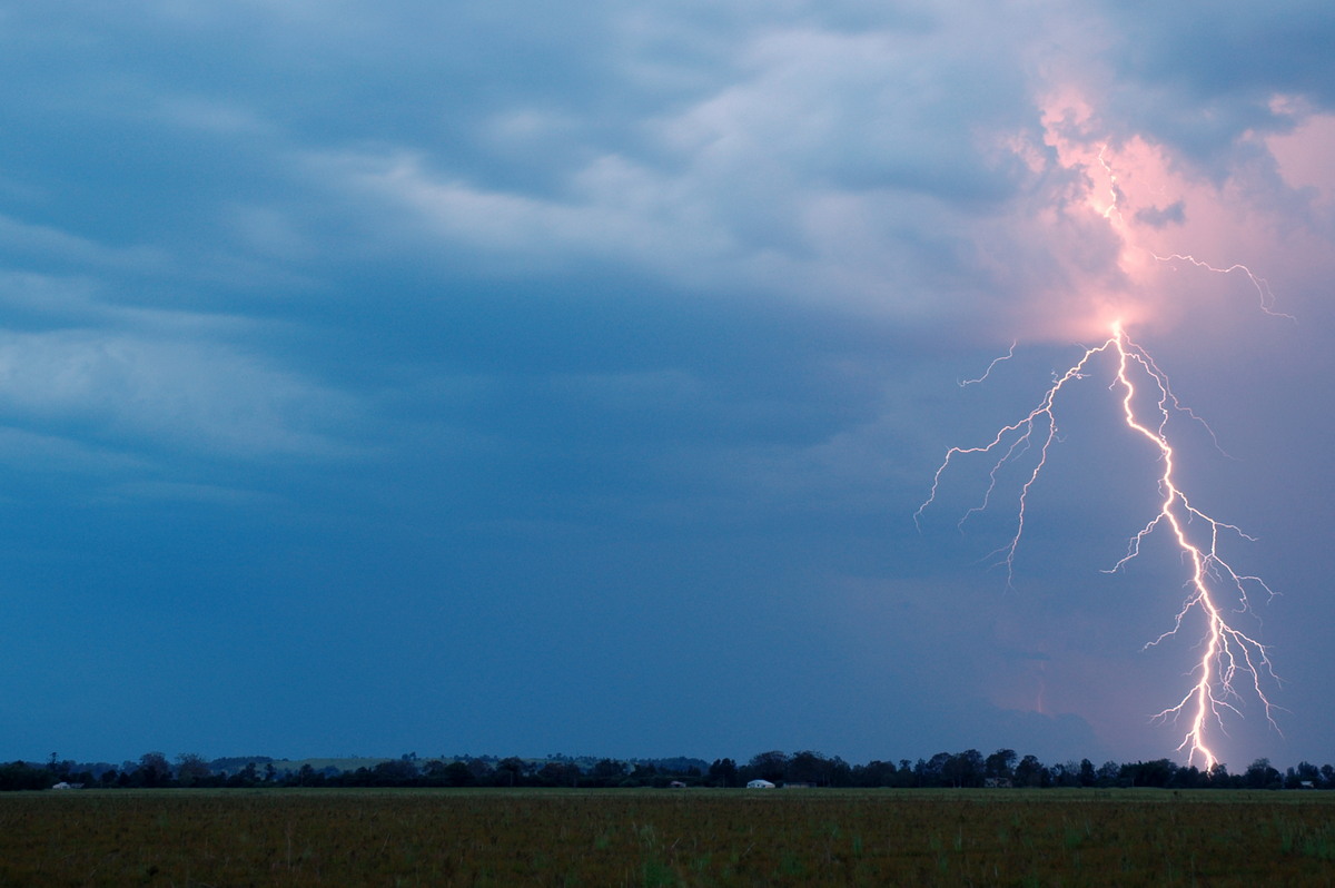
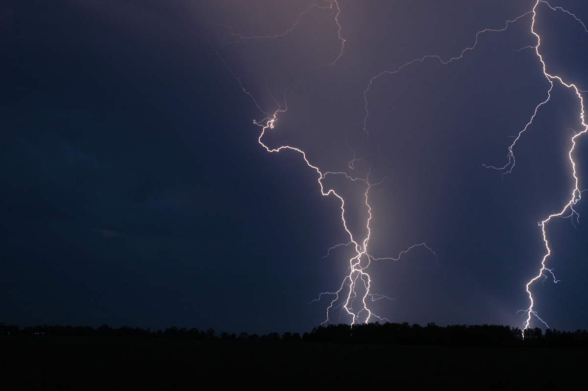
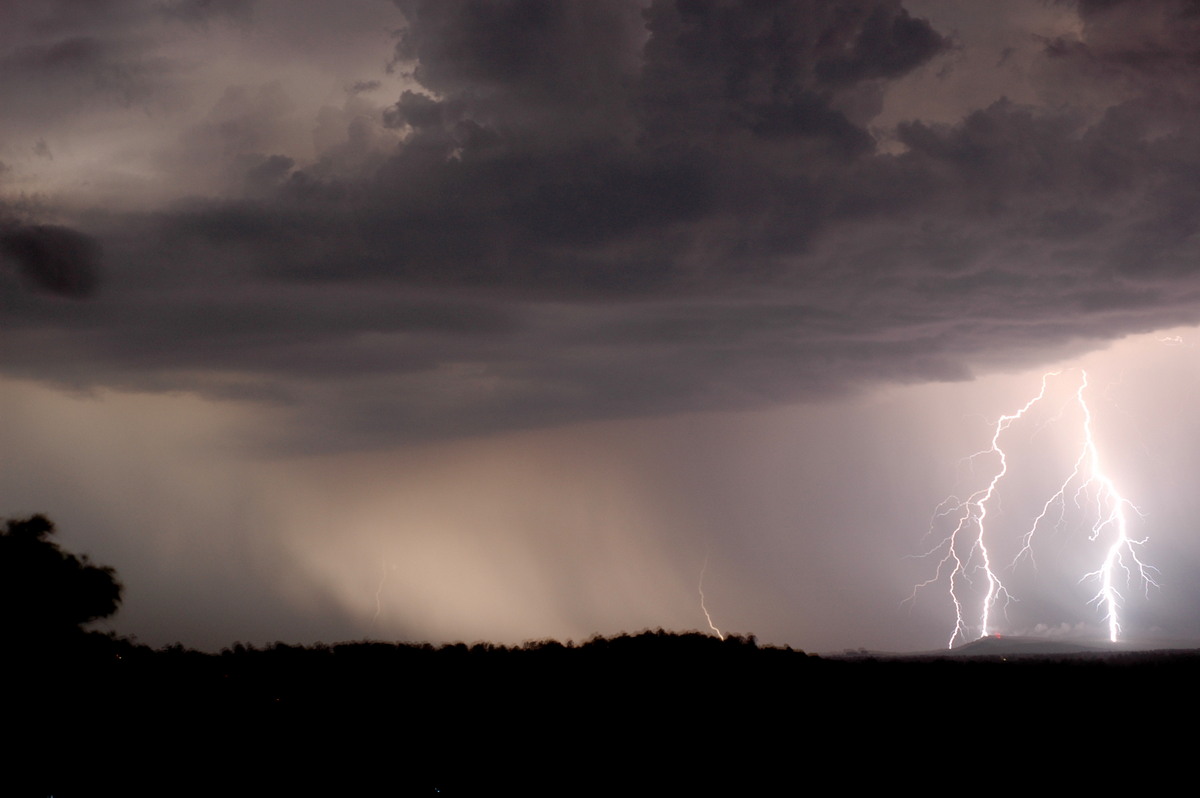
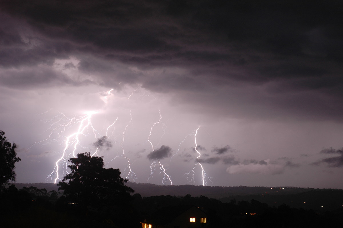
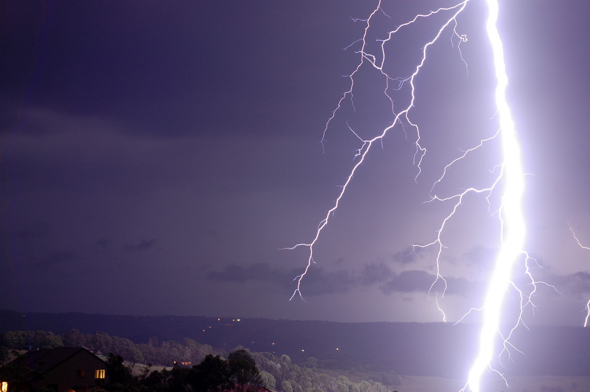
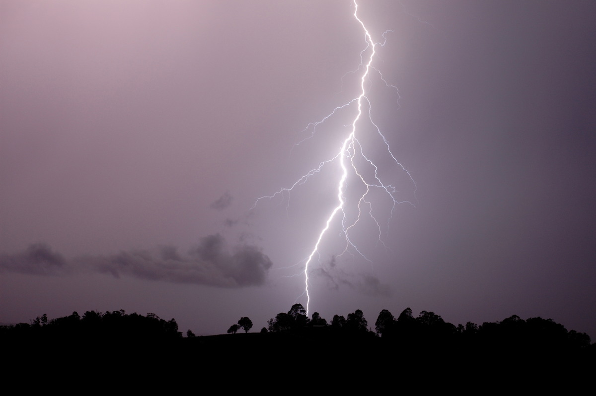
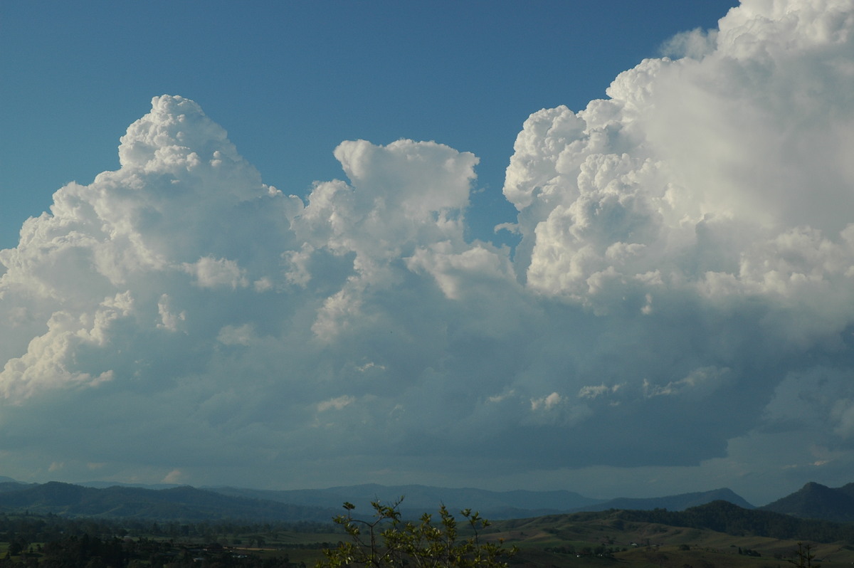
| Severe Thunder- storm images of the month: December 2006 Photographs by Michael Bath |
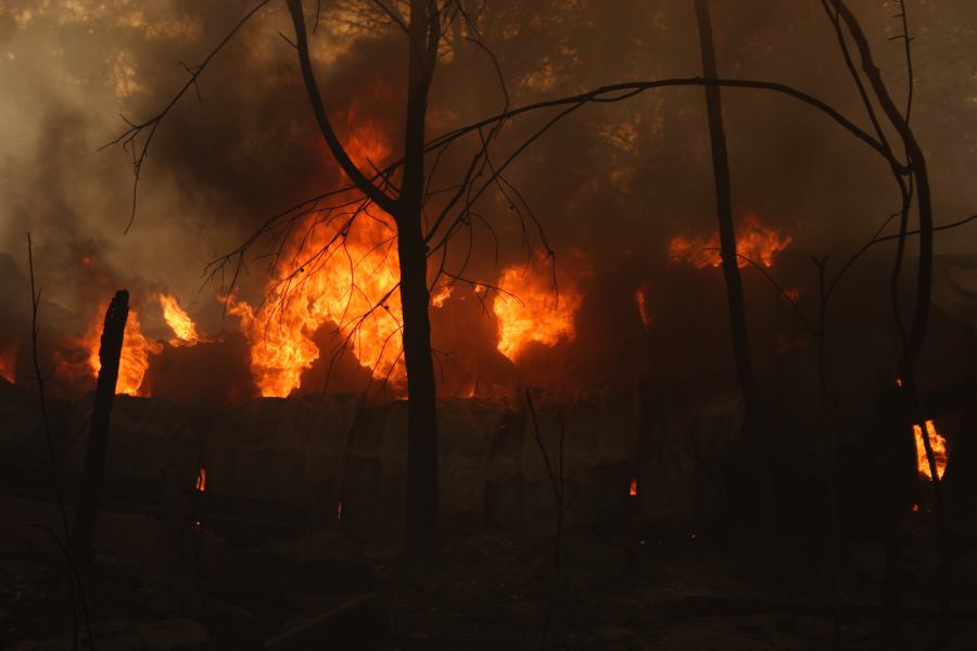
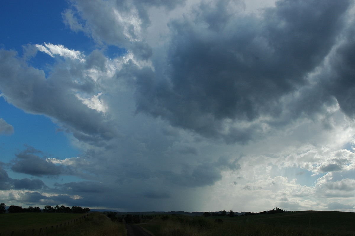
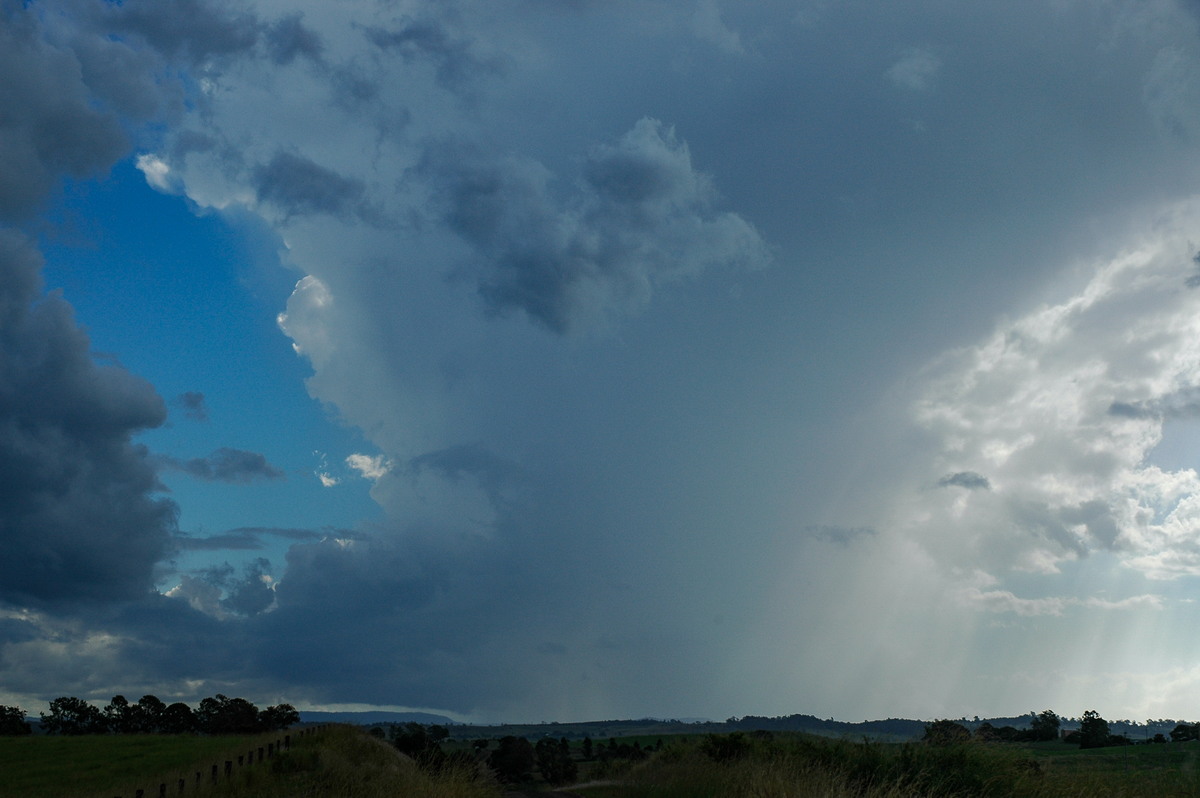
Tuesday 28th November 2006 will have to go down as one of the most spectacular dates for storm chasers who love lightning - at least since 8th January 2003. Fortunately many chasers on TDU were in the Northern Rivers region during this hot afternoon and evening. Chasers Michael Bath and Rodney Wallbridge headed south along the Summerland Way to Whiporie arriving just as storms started to move off the tablelands into the Clarence Valley.
The show was amazing, initially from a lookout just south of Whiporie, before the real show took off at Lawrence. This idyllic spot provided a Clarence River foreground to the three hour show.
There were several high based, low precipitation thunderstorms cells moving towards the northeast. Microbursts occurred from a number of these with some quite dramatic pulses of outflow winds hitting.
|
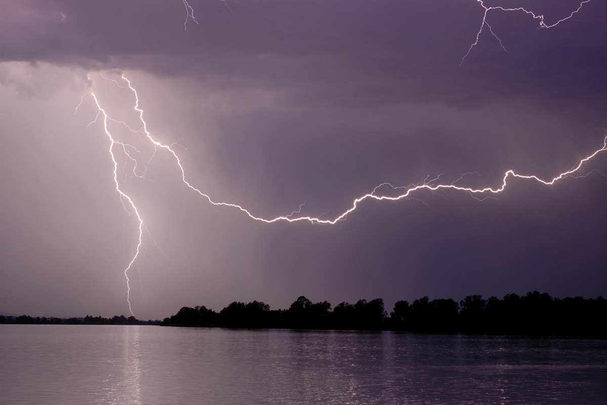
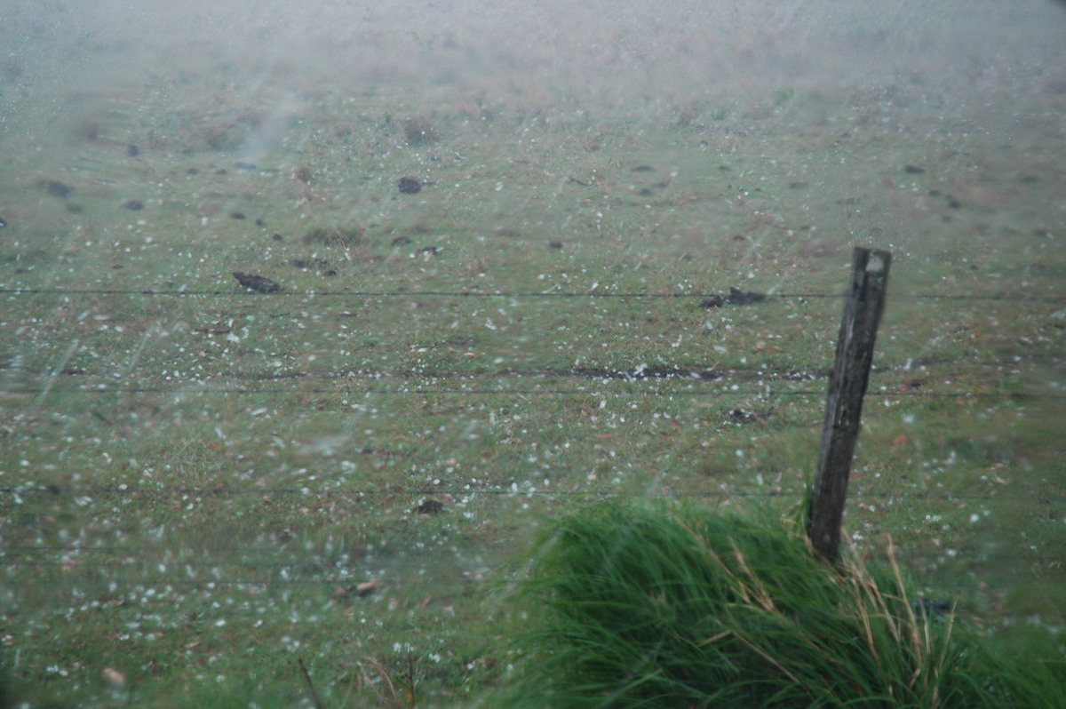
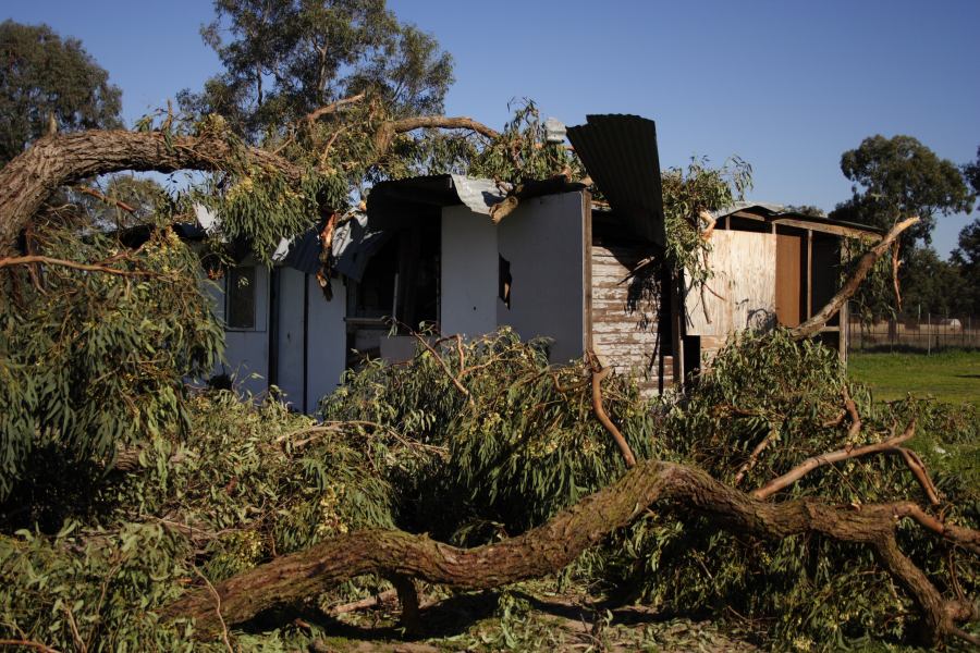
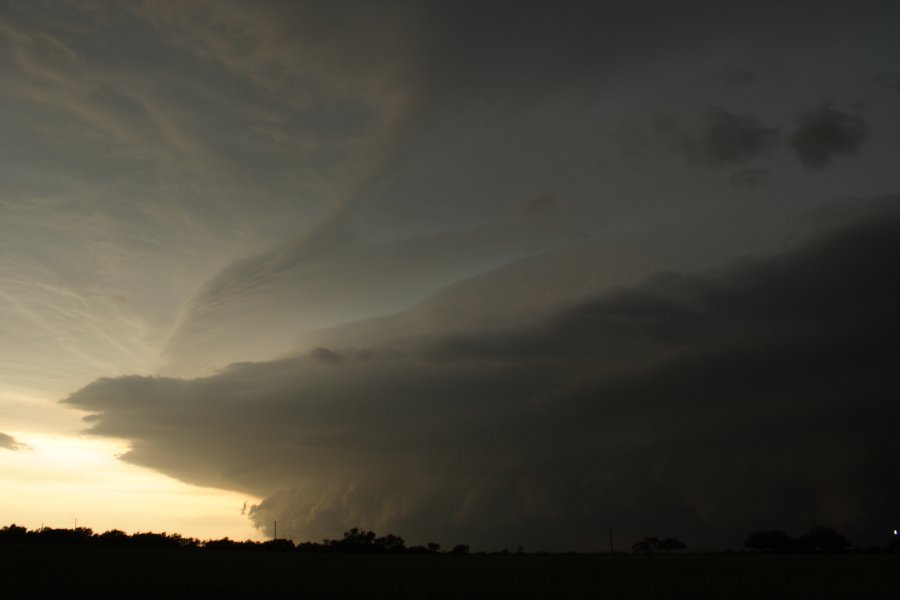
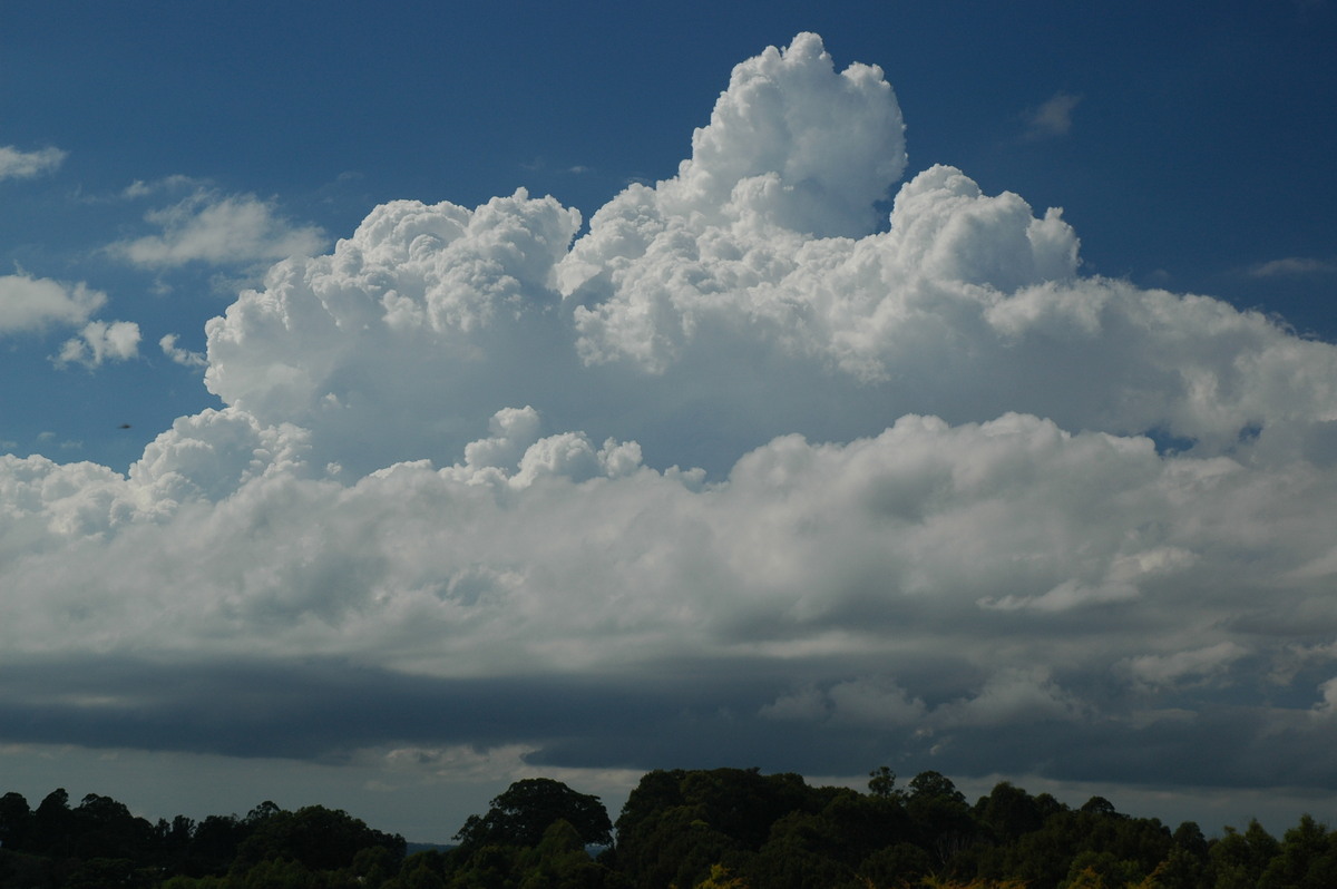
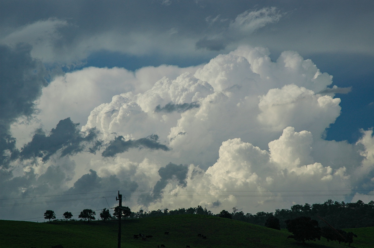
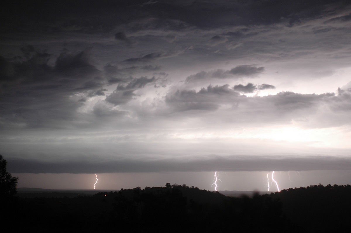
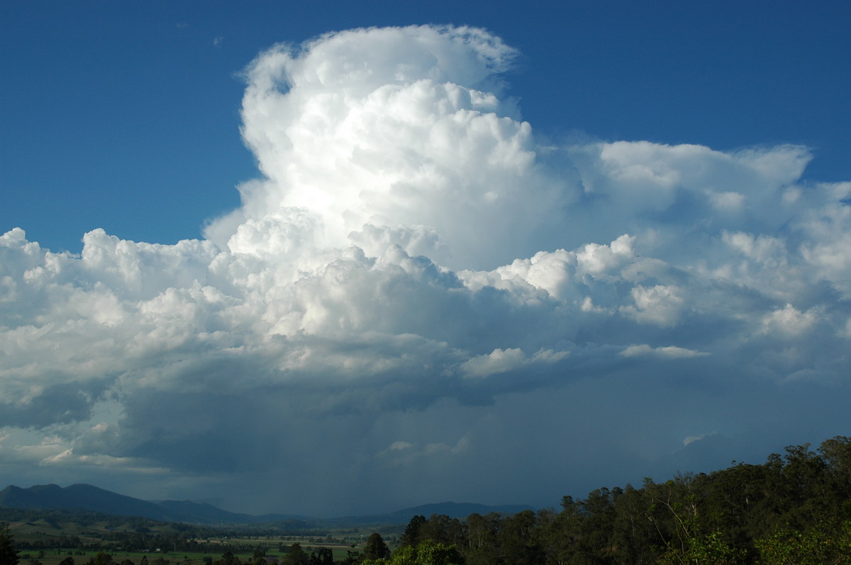
| Severe Thunder- storm images of the month: November 2006 Photographs by Michael Bath |
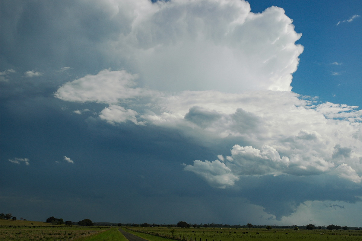
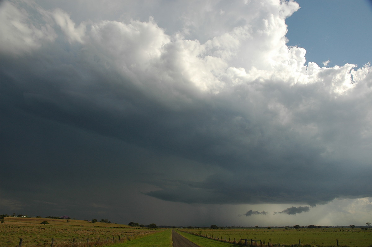
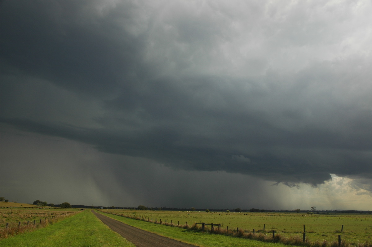
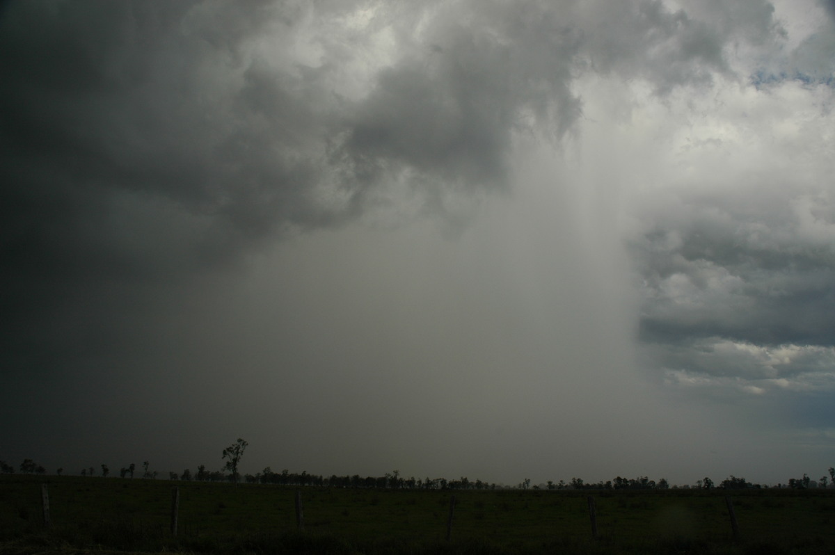
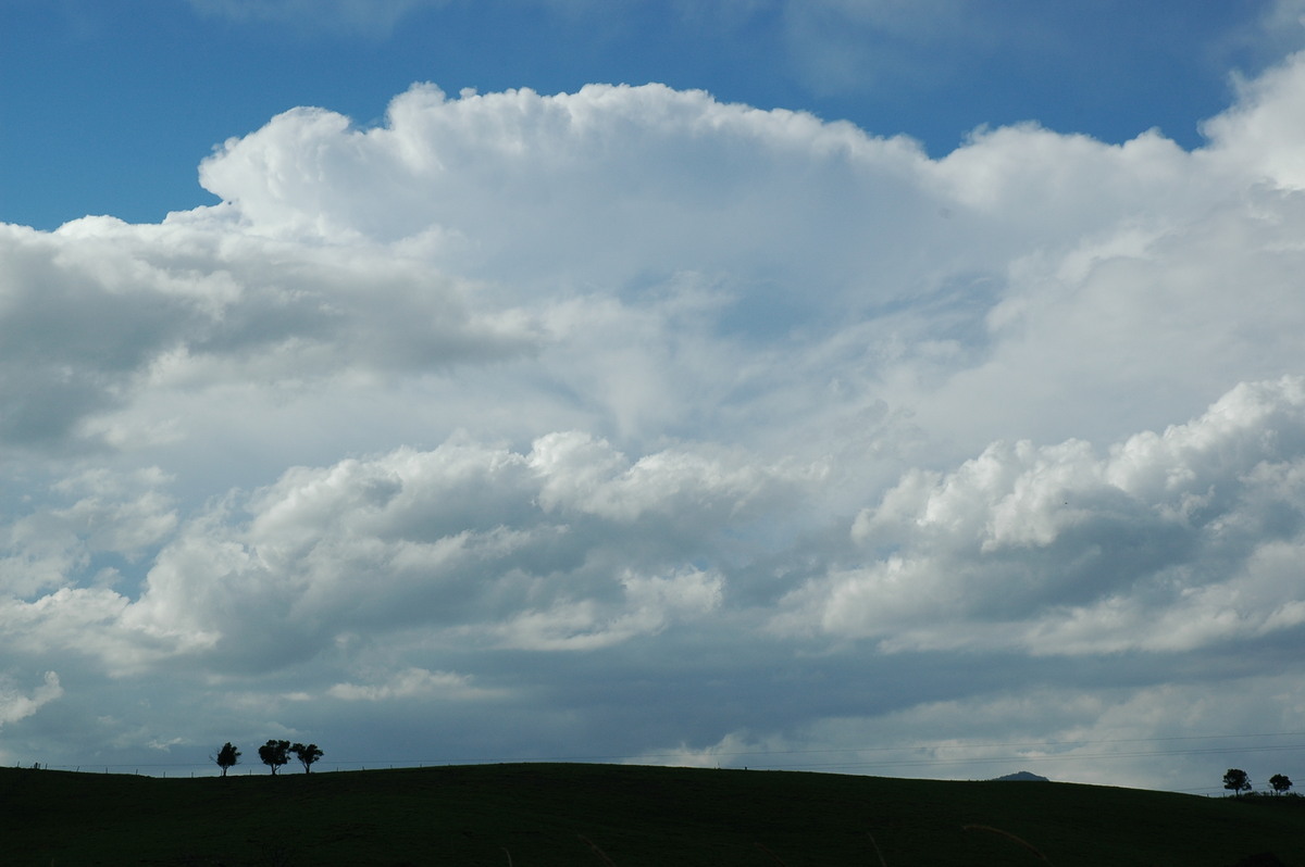
A thunderstorm lasted for about 8 hours after forming on the Dorrigo Plateau about 10am 1st November 2006 and headed consistently NNE. It did have supercell characteristics near Grafton then struggled in lower moisture for a while before picking up about 4pm south of Casino. It again became highly organised.
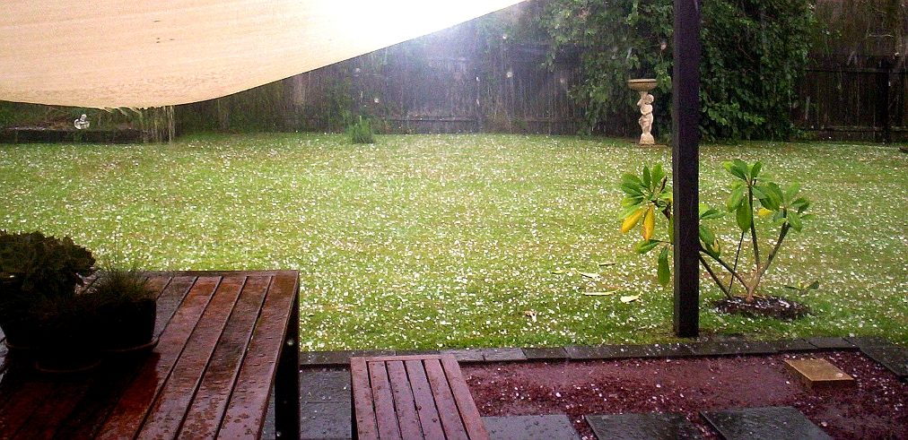
From the NW side of the side, violent outflow winds hit. Driving into the storm was at first moderate rain, then intense rain with small hail, following by a barrage of 2-3cm stones and also some hitting were 4cm.
|
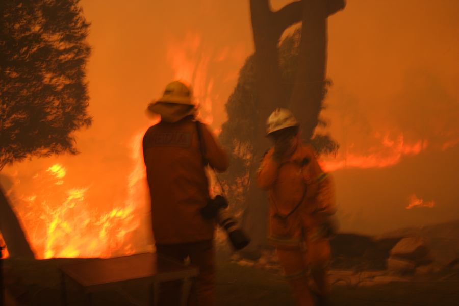
| Severe Thunder- storm images of the month: October 2006 Photographs by Jimmy Deguara |
September 2006 in Sydney was a month of extremes: flash flood event on the
6th followed by bushfire weather and damaging gale force winds on the 24th that
created extensive blackouts.
|
| Severe Thunder- storm images of the month: September 2006 Photographs by Jimmy Deguara |
USA Tornado Alley Chasing 2006
|
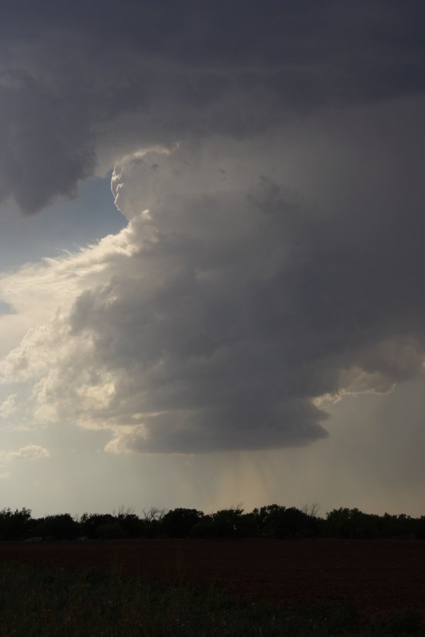
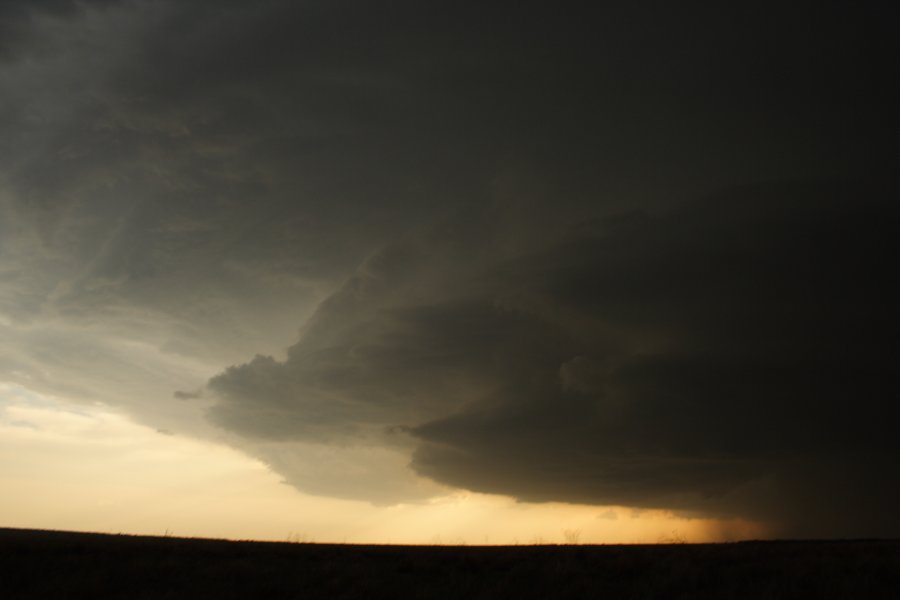
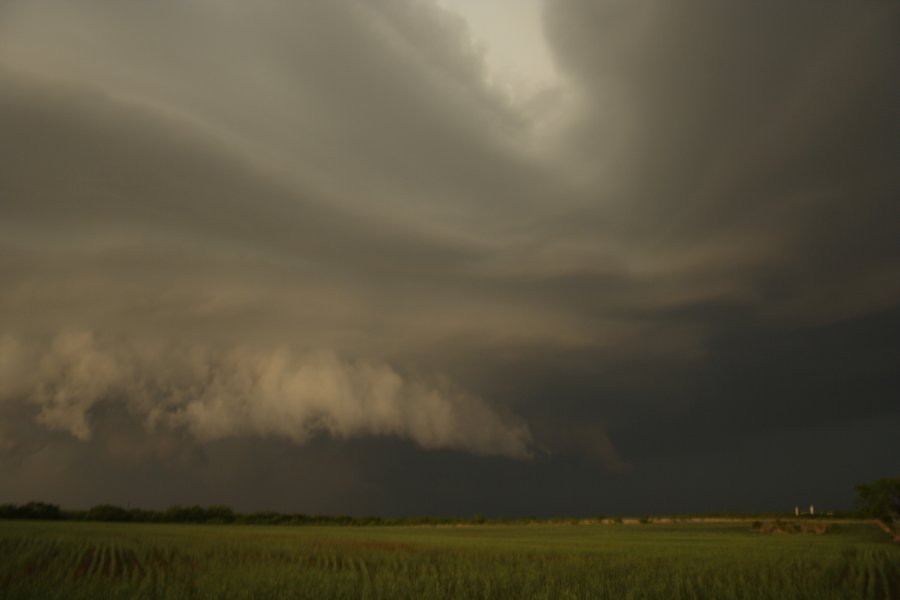
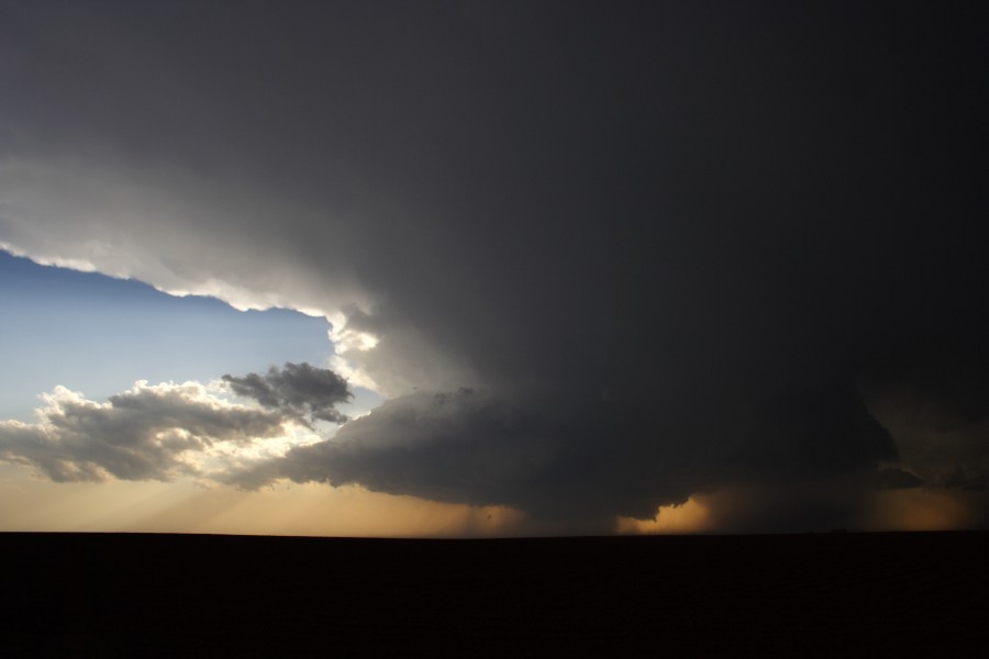
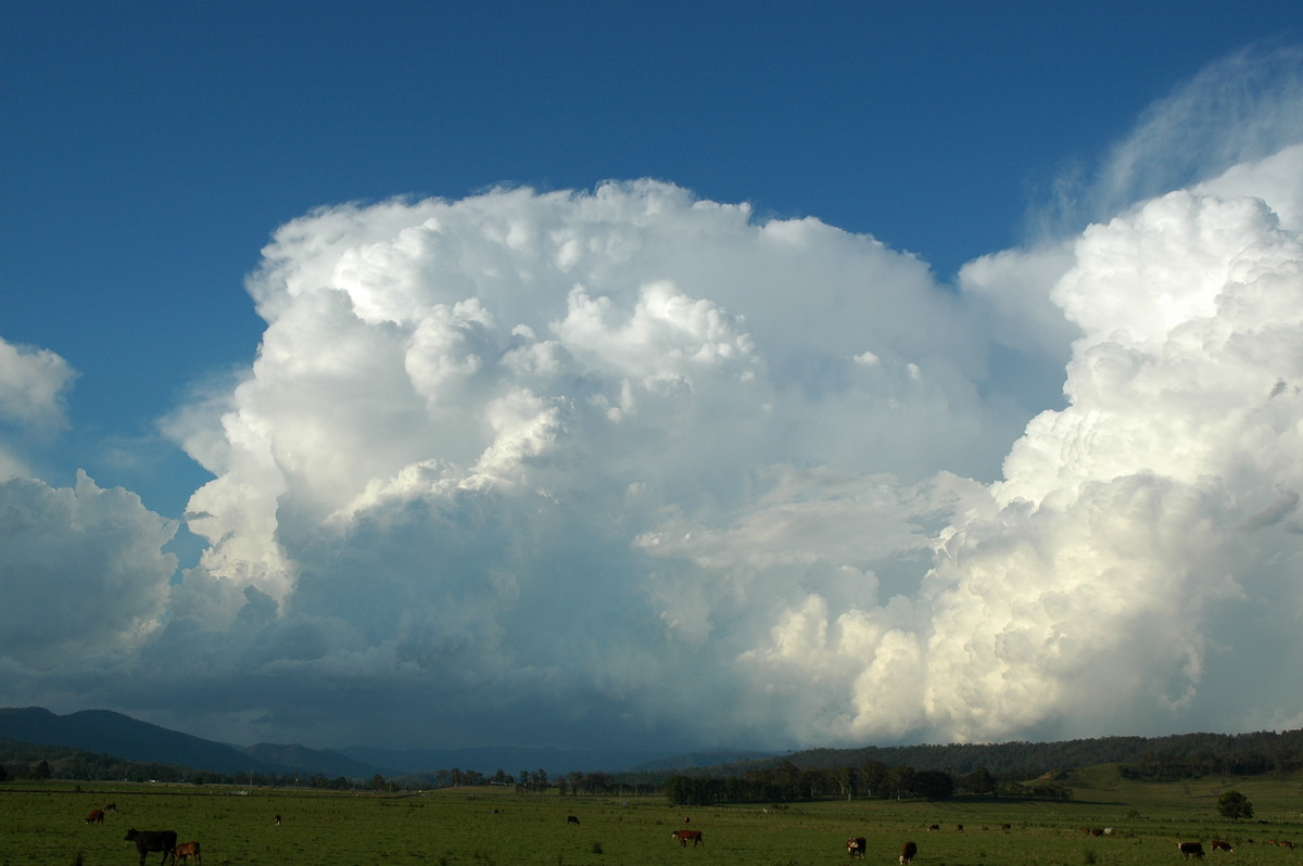
| Severe Thunder- storm images of the month: August 2006 Photographs by Jimmy Deguara |
USA Tornado Alley Chasing 2006
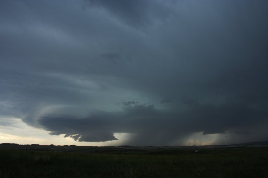
This storm dominated spinning like a top trough sunset before outflow got the better of it. This menacing High Precipitation (HP) supercell exhibited incredible
inflow band and striated structure followed by a spectacular high energy lightning show!
|
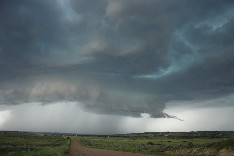
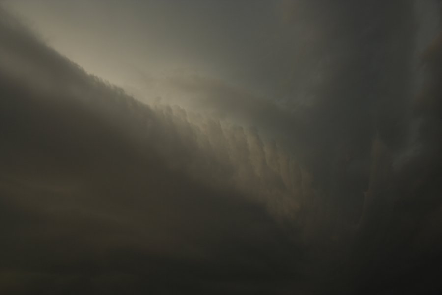
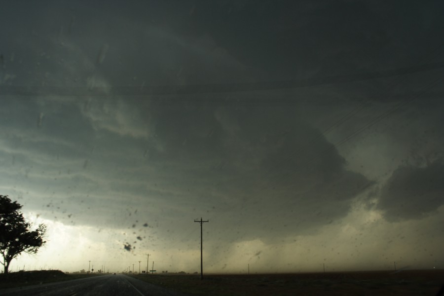
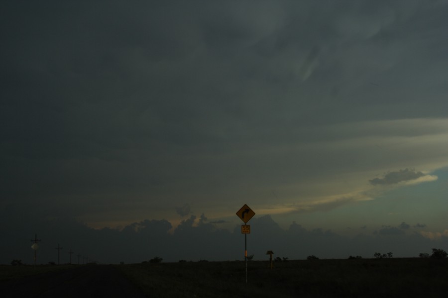
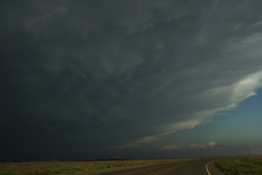
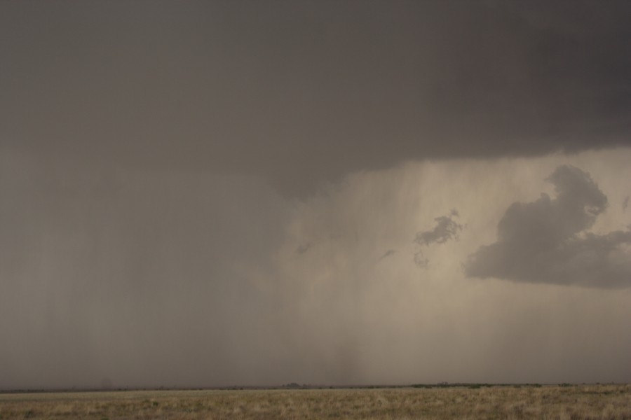
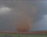
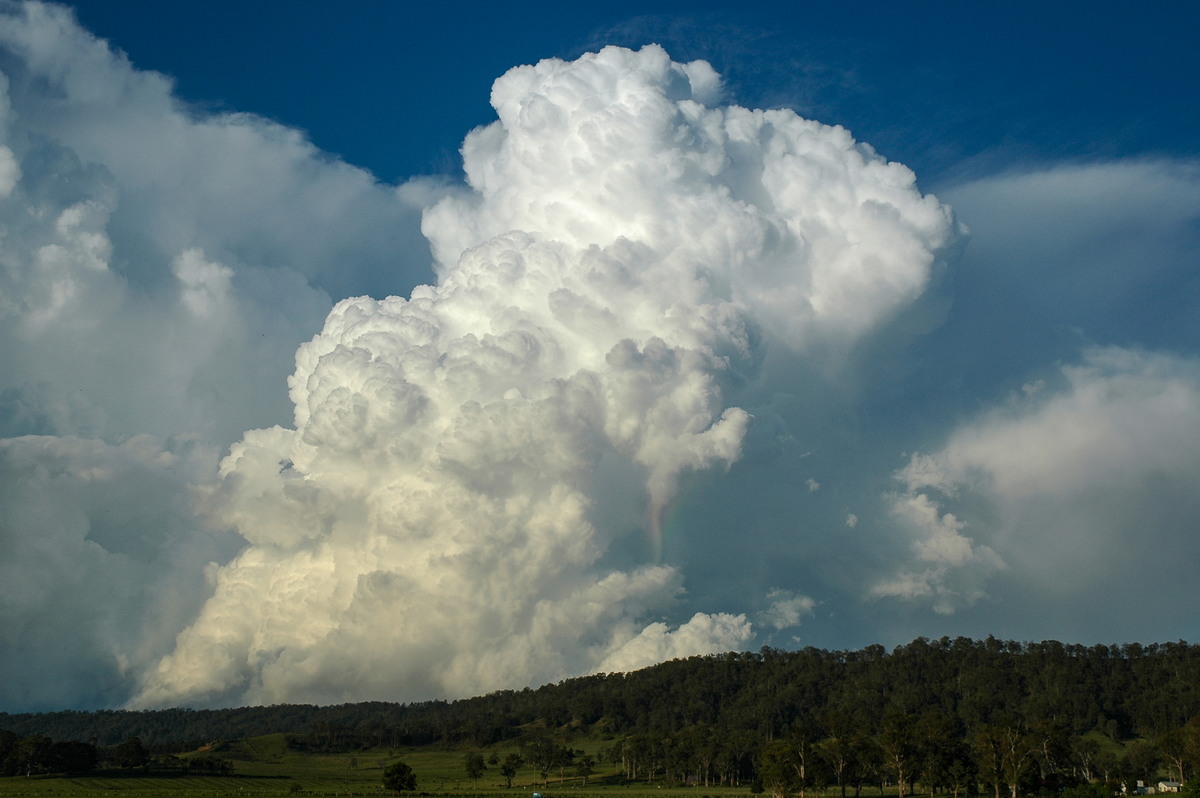
| Severe Thunder- storm images of the month: July 2006 Photographs by Jimmy Deguara |
USA Tornado Alley Chasing 2006
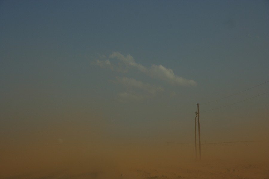
However, the storm simply split, exploded and became suck zone central just west of Patricia
- dust sucked in from the southwest and another plume from the southeast. An incredible structure developed with wall cloud during this stage - hail streaks a gentle reminder of imminent danger to windshields.
As the RFD cut through, rotation tightened and increased and a funnel developed. Rain wrapped around the developing tornado hiding it from view. On our southward approach to retreat from the imminent cold RFD and hailstones, a dust whirl spun up rapidly in front on the left side of the road 10 metres from our vehicle. This swirl tightened with inflow jets feeding an F0 rated multivortex tornado. The
video of this
dusty tornado is awesome.
|
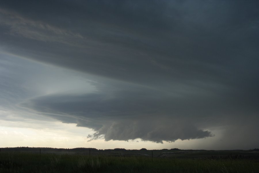
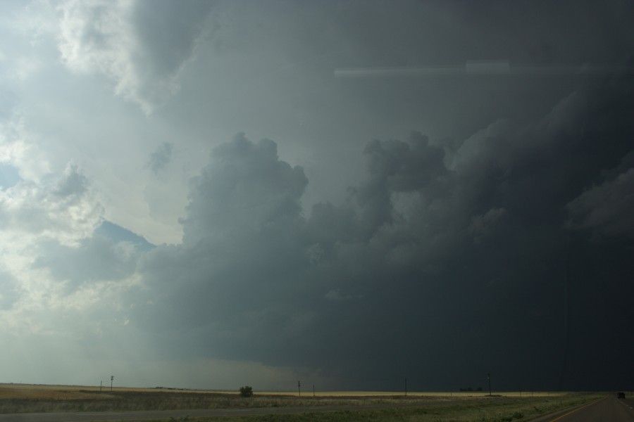
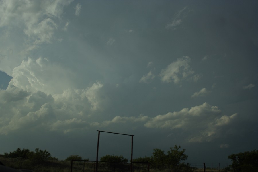
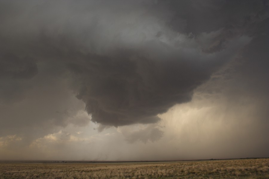
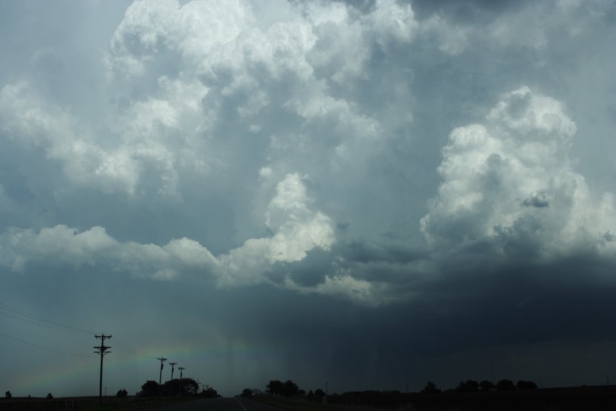
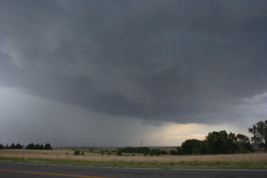
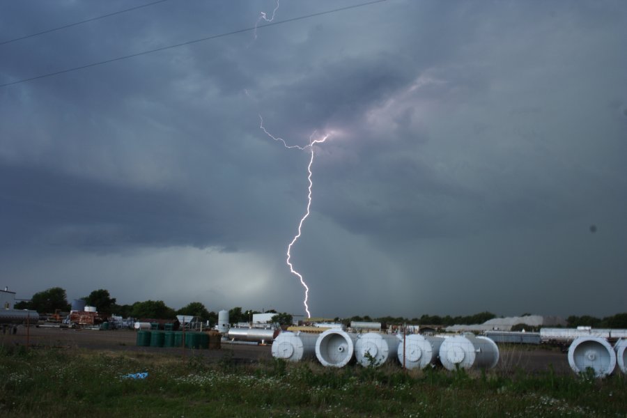
| Severe Thunder- storm images of the month: June 2006 Photographs by Jimmy Deguara |
USA Tornado Alley Chasing 2006
We finally made it through east of Wheeler and south with and ahead of the Roberts County cell. We decided in the end to play this cell and what a barrage of lightning it let go south of Sayre. This coincided with a reorganisation of the meso or a new meso. I don't believe the outflow was always interfering with the updraft given the alignment of the cell and its motion. The late evening lightning was near Mangum and was incredible!
|
| Severe Thunder- storm images of the month: May 2006
Photographs by Michael Bath and Kye |
A weak stalling trough in the far NE of NSW on 21st April 2006 provided a late season chance for a storm chase. Surface winds shifted to southerly late morning which normally indicates the end of any chances locally, however given it not an early morning change, it provided a trigger for some storms close to the Queensland border.
The Tweed Coast and Kyogle areas fired up initially.
A brief chase commenced with observations of some cells along the Border Ranges and locally west of Kyogle. Structure was quite nice but struggling south of the border.
Storms progressed towards the Gold Coast with severe weather in parts. Kye from Mudgeeraba witnessed a barrage of hail 2 to 3cm diameter as the storm passed over.
All storms cleared out to sea by about 4.30pm.
|
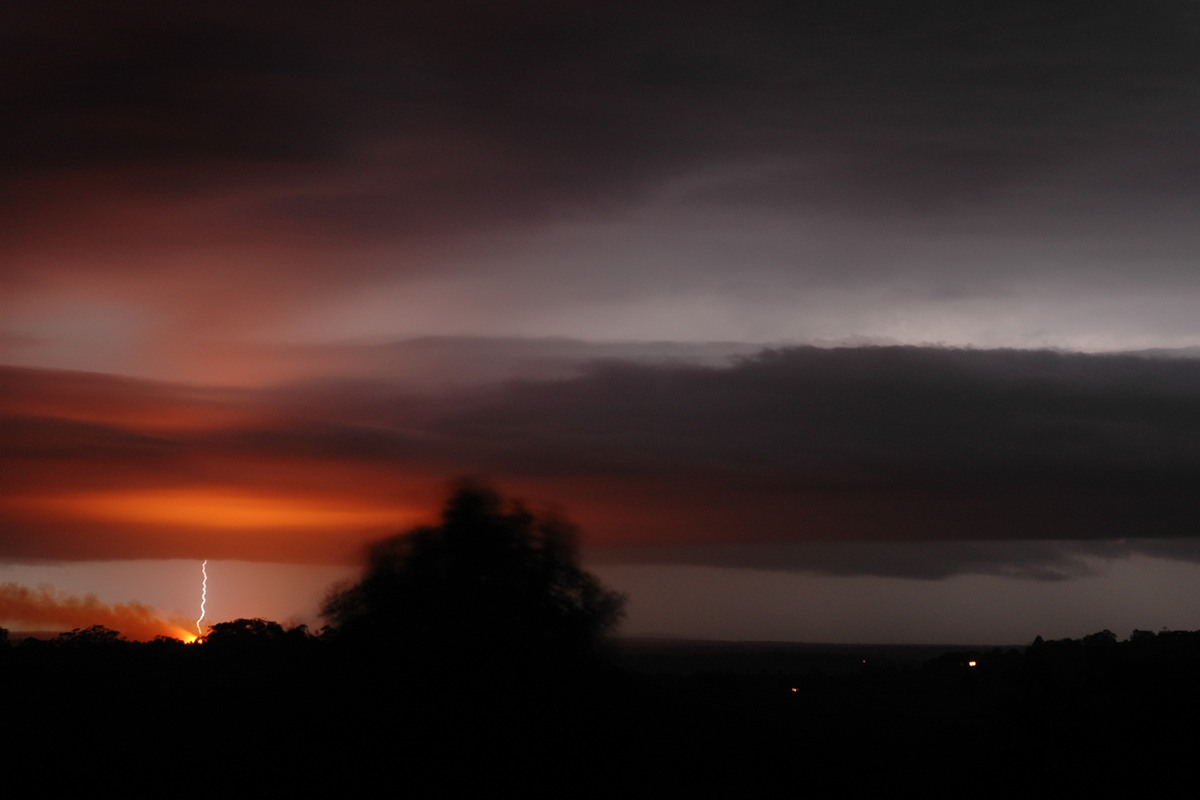
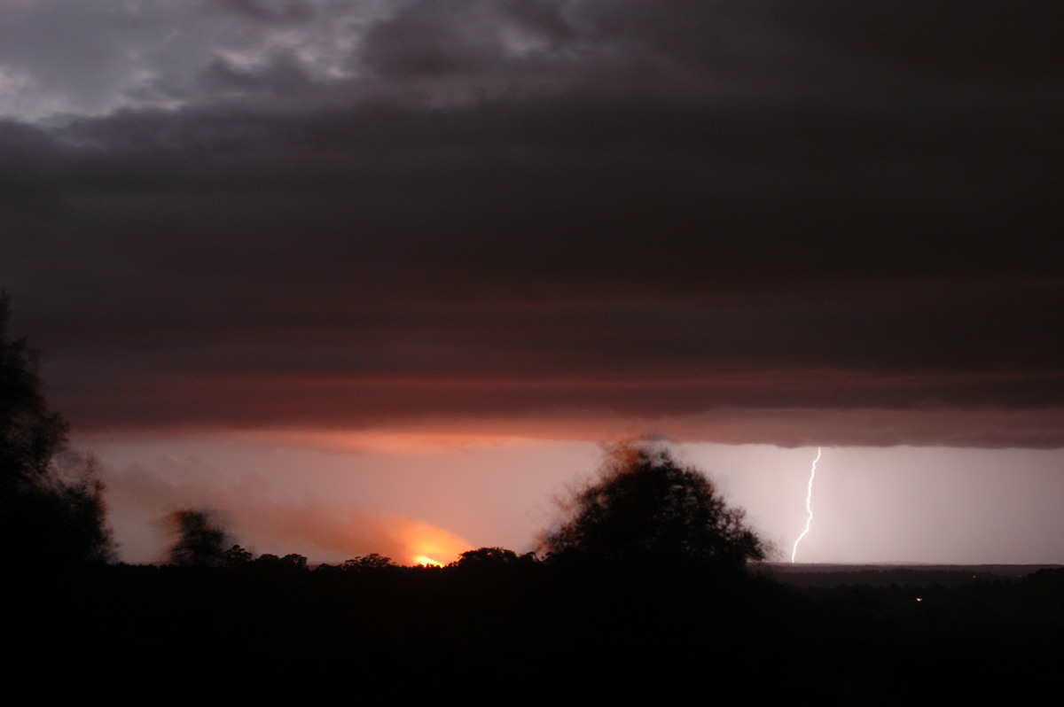
| Severe Thunder- storm images of the month: April 2006
Photographs by Michael Bath |
The last third of October 2005 was a very active period for thunderstorms in the Northern Rivers region with storm chasing underway most days. One of the more spectacular days was 25th October.
This northern activity collapsed upon evening, however an extensive SE-NW line of storms developed in the Northern Rivers during the evening. A two hour lightning show was enjoyed from Tregeagle.
The orange colour was from a cane burn near Coraki.
|
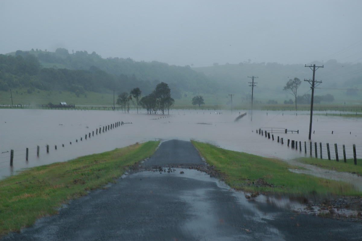
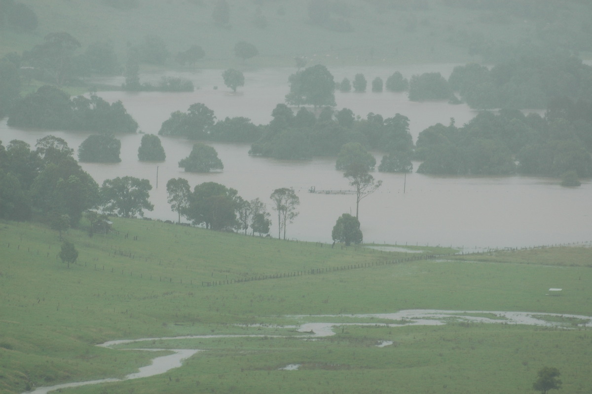
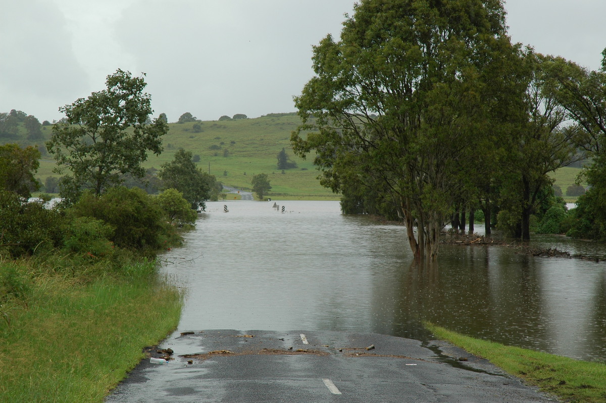
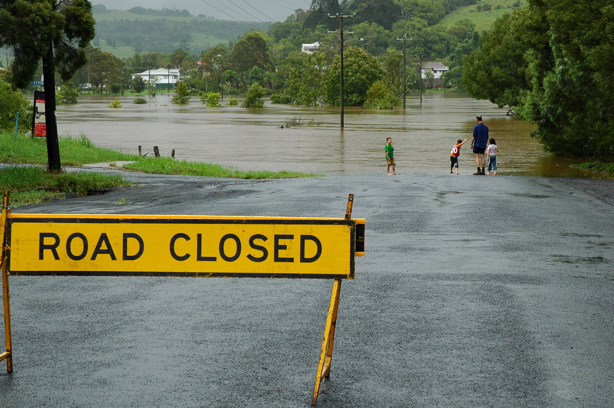
| Severe Thunder- storm images of the month: March 2006 Photographs by Michael Bath |
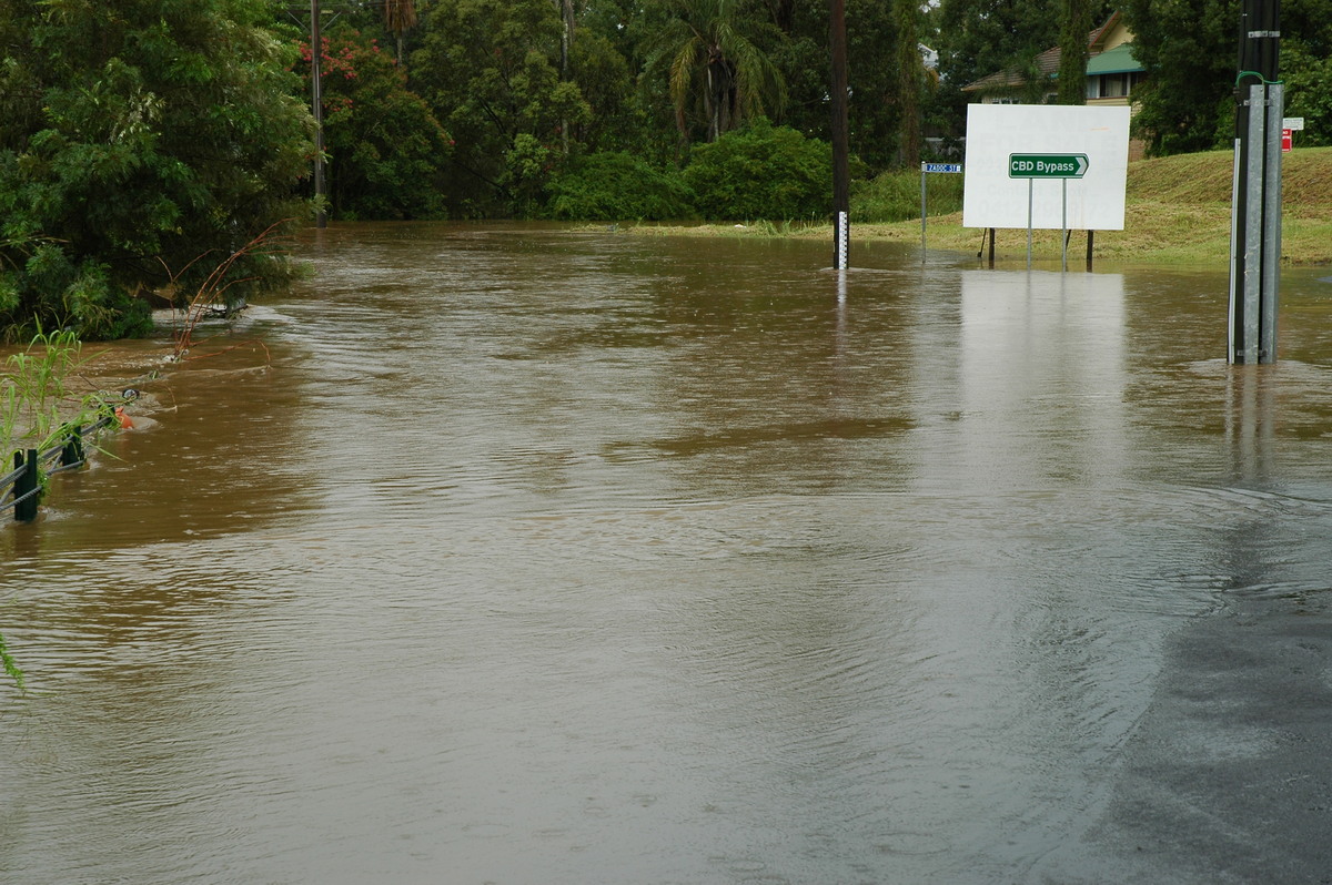
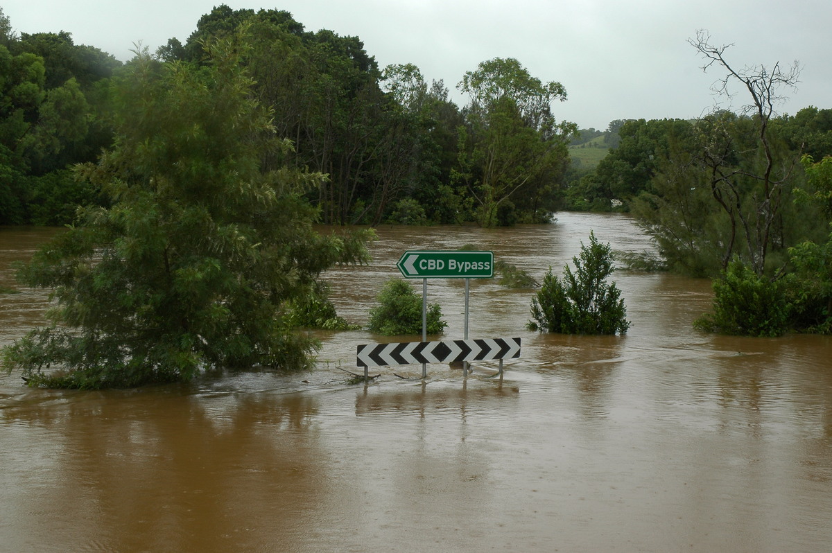
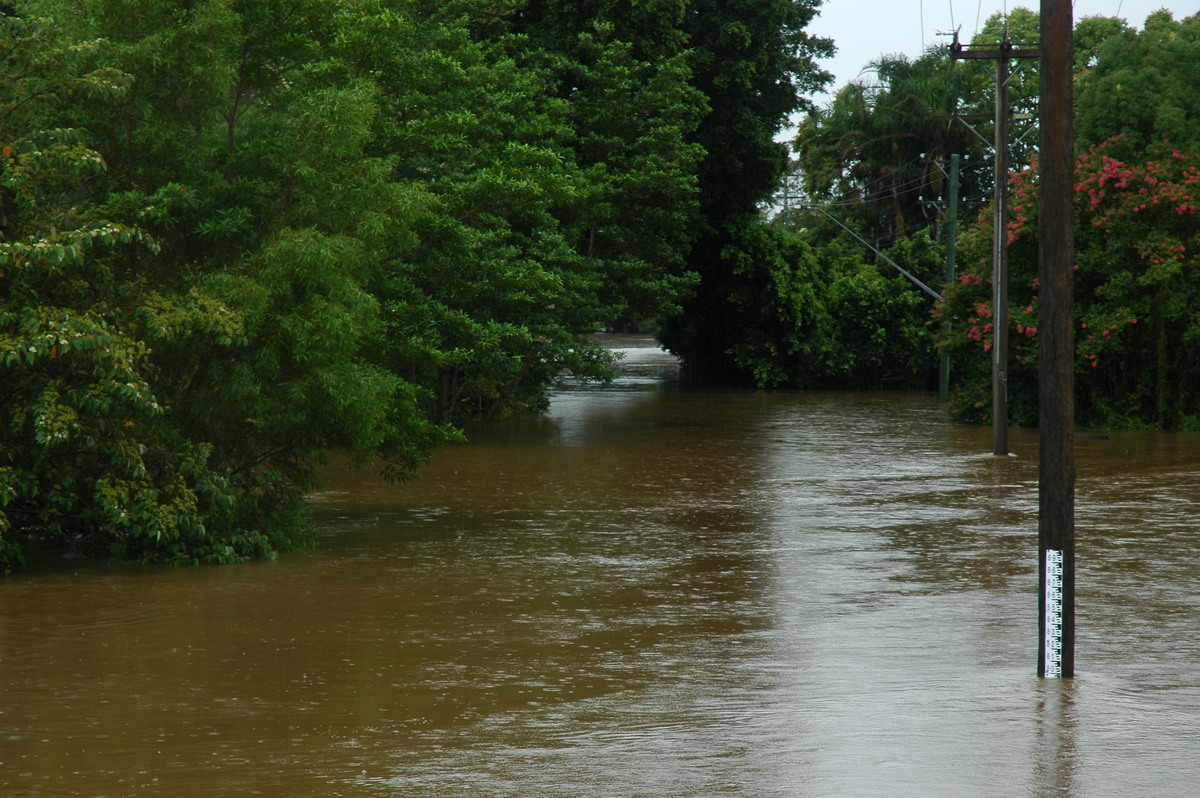
Fairly localised very heavy falls of rain commenced on parts of the Northern Rivers of NSW during the late afternoon of Wednesday 18th January 2006. Rainfall totals of 300 millimetres or more accumulated during the following 24 hours with the Brunswick River and Wilsons River catchments experiencing major flooding. Thunderstorms embedded in the rain led to some locations recording around 500mm of rain in just 24-36 hours.
The Wilsons River flows into Lismore but given the western half of the catchment (Leycester Creek) received far less rain, the impact was only moderate flooding in the Lismore central business district. The river peaked at 7.85 metres at 12.30pm on Friday 20th.
|
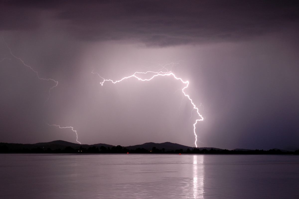
| Severe Thunder- storm images of the month: February 2006
Photographs by Michael Bath and Rodney Wallbridge |
The highlight of the chase day was a line of high-based storm activity that developed west of Collarenebri towards 6pm. Although one cell eventually dominated and tracked east for nearly two hours, there were no real indications of supercellular structure. However, it did not matter - the breathtaking scenes on the plains that developed with sunset, and the phenomenal amount of pulsing CG lightning was just incredible.

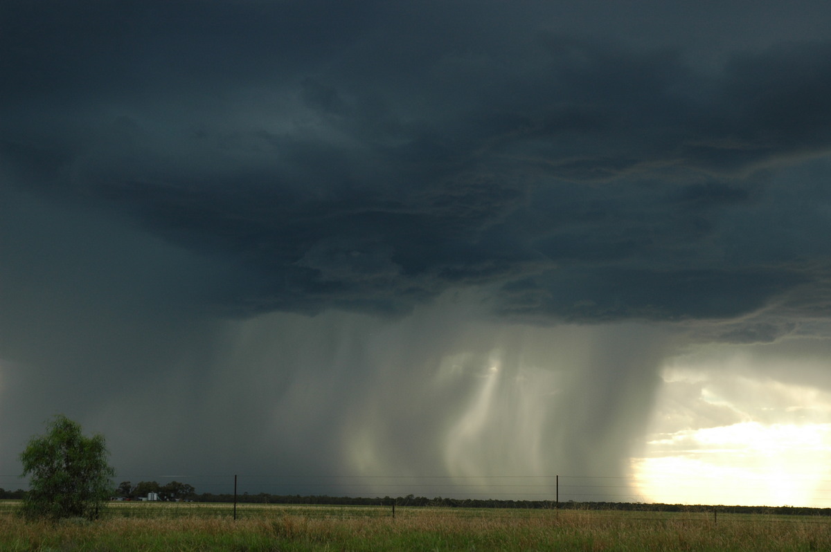
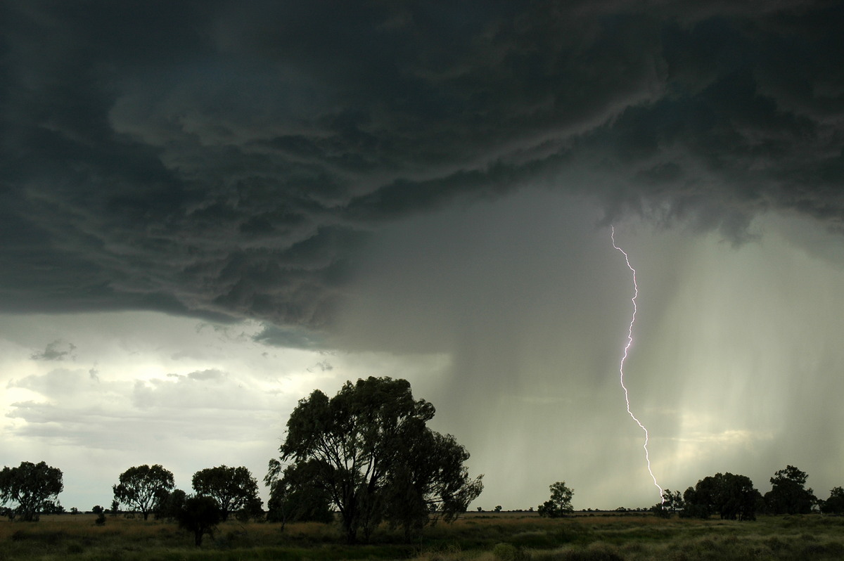
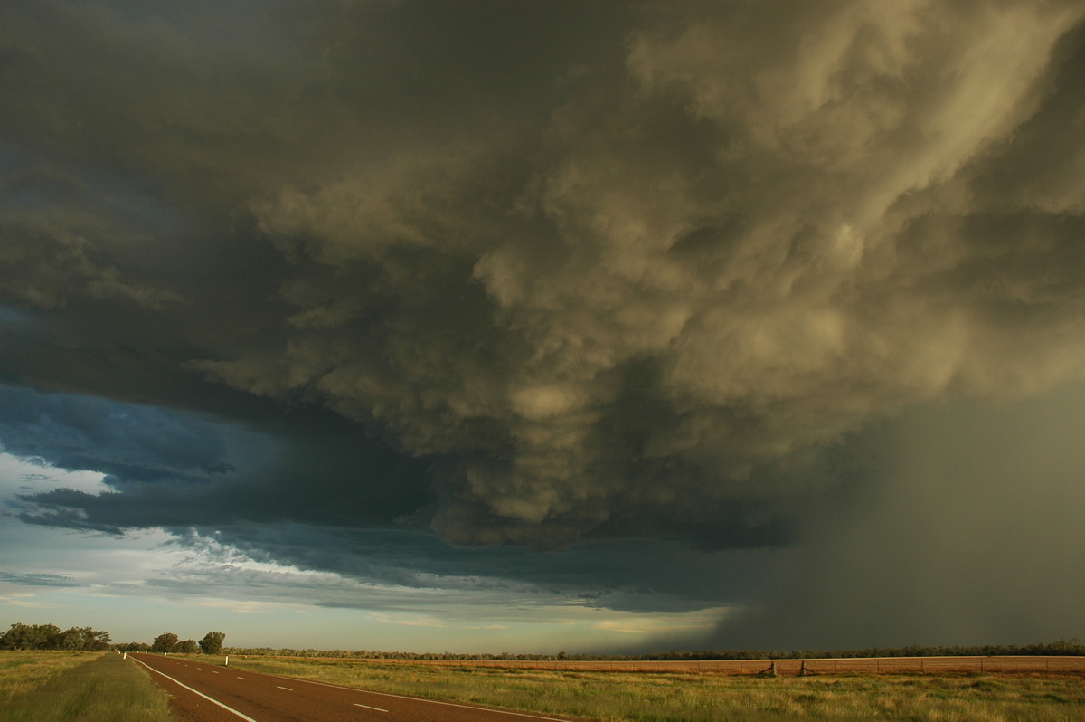
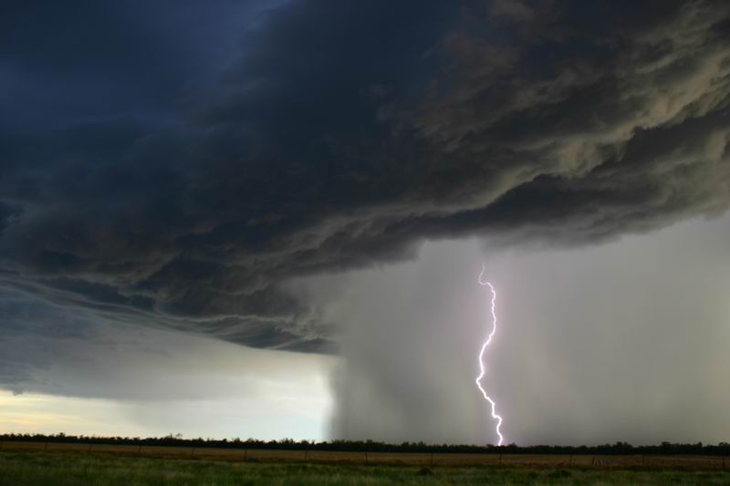
See the reports for this storm outbreak by Dave Ellem and Dave Sercombe, and Michael Bath and Rodney Wallbridge.
|
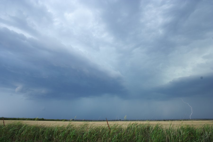
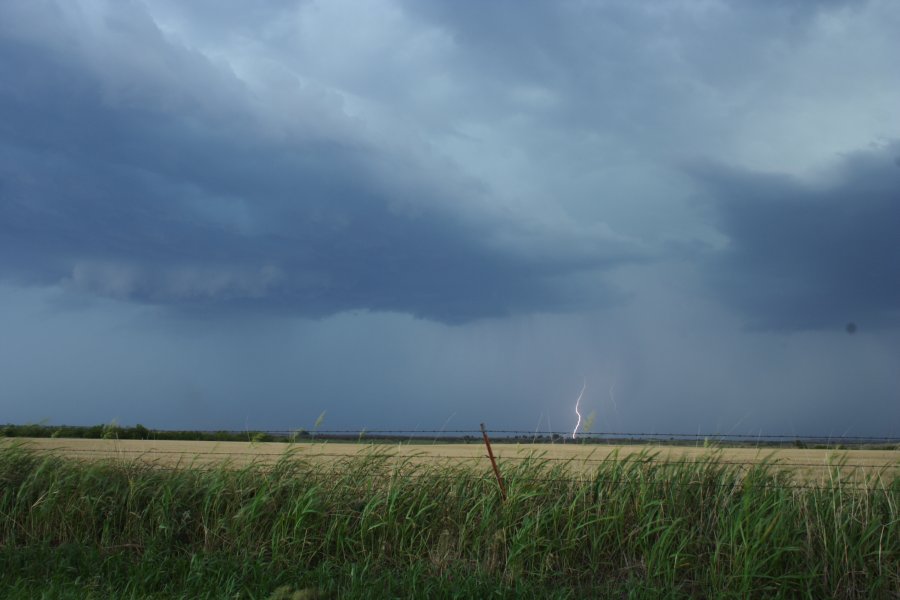
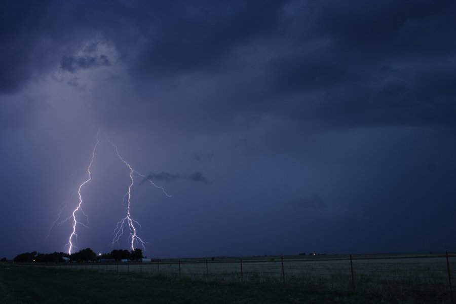
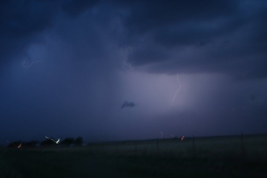
| Severe Thunder- storm images of the month: January 2006
Photographs by Michael Bath |
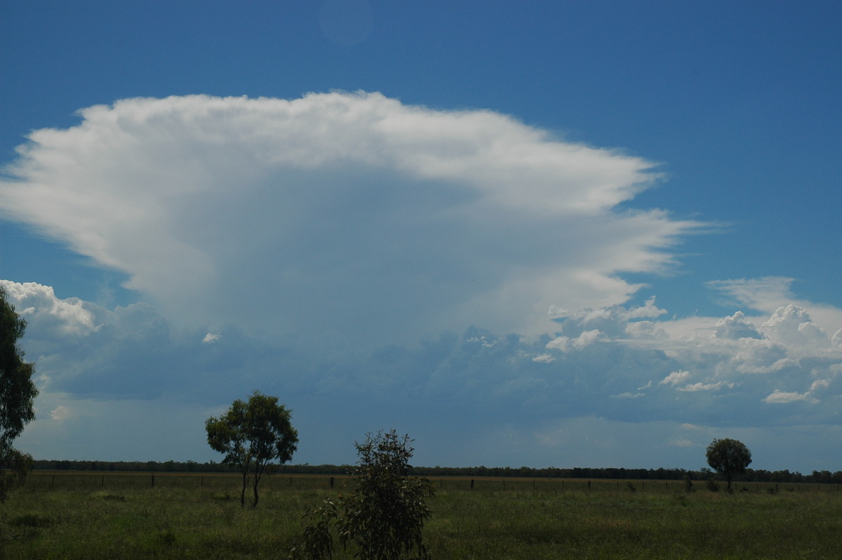
Extreme heat and humidity in the Northern Rivers provided the fuel for a spectacular evening lightning show on 3rd January 2006. Strong capping held off most thunderstorm activity until late in the day.
Destabilisation and fairly light wind shear created an environment for high based lightning active storms persisting for several hours.
|
|
Document: arc2006.htm
Updated: 2nd August 2007 |
[Australian Severe Weather index] [Copyright Notice] [Email Contacts] [Search This Site] |