and Chasing
[Index][Archives]
Sydney Storm Chase: Saturday 18th November 1995
by Jimmy Deguara
| Storm News and Chasing [Index][Archives] |
Sydney Storm Chase: Saturday 18th November 1995 by Jimmy Deguara |
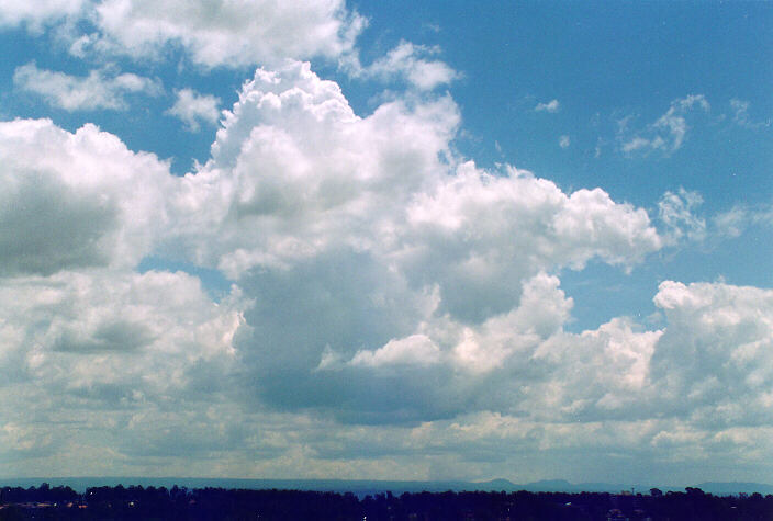
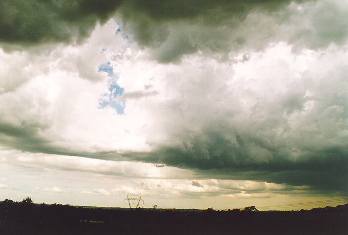
We headed to Rooty Hill to evaluate the situation. Often it is a good idea to stop at a good vantage point so that a plan can be devised. Large cumulus developed into a thundery shower to the NW and another storm to the SW. We could have easily decided to chase the storm near Richmond. The problems were the lack of a road network and that the best position would be to pass onto the other side giving the more spectacular northern view. This storm was also weakening so we both decided to head SW towards the Camden region.
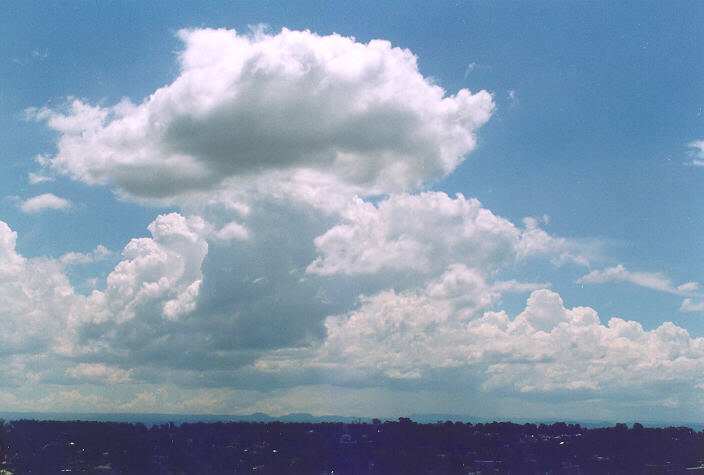
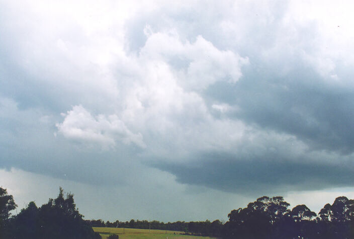
We drove west down the F4 freeway, and then south along Erskine Park Road and Mamre Road towards Kemps Creek. After a short stop at Rossmore around 2:40 we headed for Camden but stopped at Oran Park instead. We were close to a growing multicell, which we had observed earlier. The multicell produced moderate to heavy falls of rain for about 10-15 minutes. With the rain clearing, we headed for more open country outside Cobbity Pony Club.
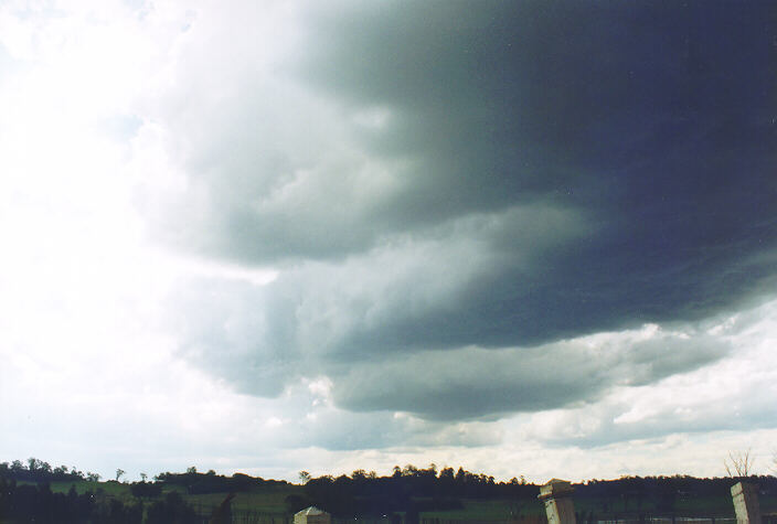
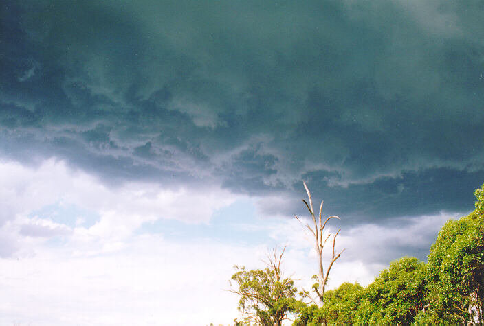
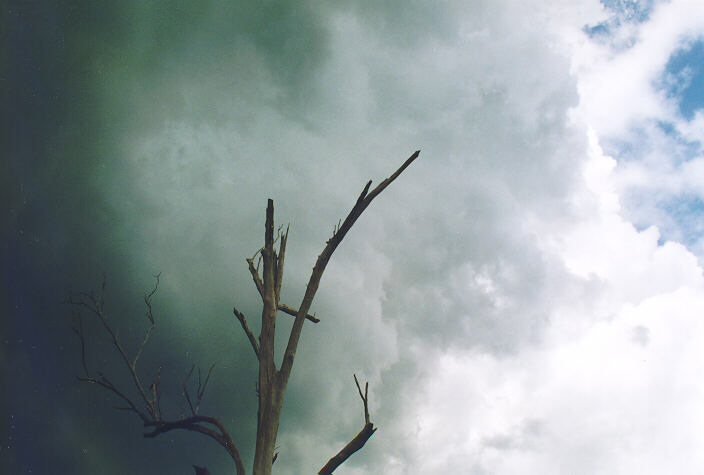

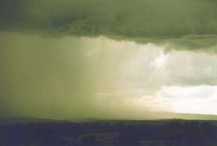
It was the rear and adjacent developing cells that provided an unusually spectacular show. The bases of the band of developing cells were dark and 'boiling'. We were on the southern side of this band as it slowly moved east. But rear development continued almost overhead. Then I was alerted to what seemed to be the sound of rain. It was an eerie feeling: I could hear the rain but not see it falling anywhere around us. Finally it occurred to me that the sound was the rain as it thundered on the road only about 10 -15 metres away and remaining stationary. Because of our photographic equipment we hurried into the car. The rain gradually spread with huge droplets hammering the roof of the car.
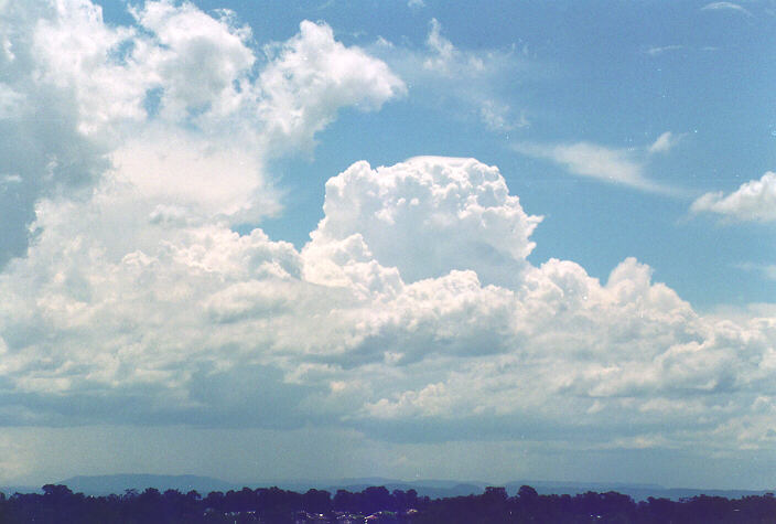
Once the rain stopped, we decided to head into this storm to observe if any hail had fallen. We drove through some heavy falls of rain moving north and then east back towards Rossmore but observed no hail. There seemed to be activity all over. Storm cells shooting up everywhere. Michael had noticed a relatively large cell to our west and north west which he thought was worth investigating. This storm had developed to our northwest but had been hidden by this local activity. And what a decision it was!
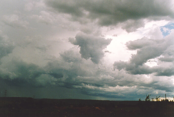
Heading back west out of Rossmore revealed a massive severe multicell, which was heading our way: east. Our objective was to move closer and into clearer territory to pinpoint where the main action was situated. The best attack therefore was to head north along the Northern Road towards Penrith.
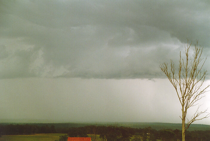
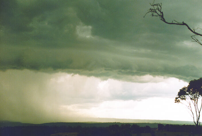
Several kilometres north along the Northern Road created a sudden adrenalins rush. What a sight: a wet microburst with an intense precipitation. The outflow directed north. We pulled over at a spot with a magnificent uninterrupted view. Michael continued to video the spectacular 'toe' and also a developing shelf cloud. I took several photographs. As it approached, it became possible to observe the precipitation being pushed sideways. My second eye kept watch to allow us sufficient time to escape toward the north.
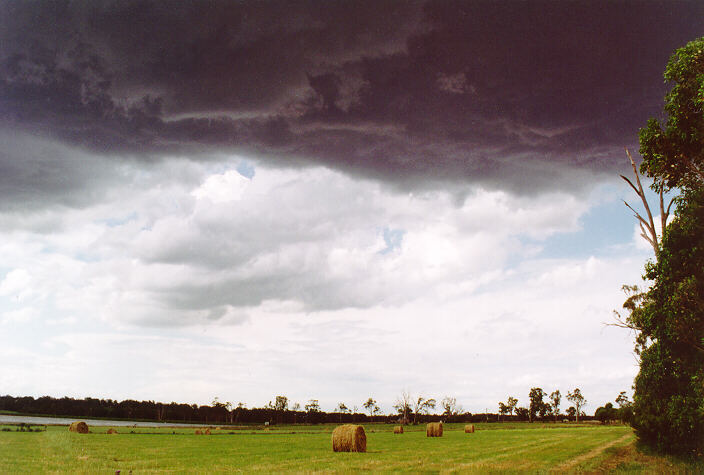
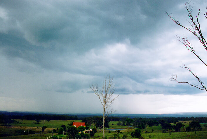
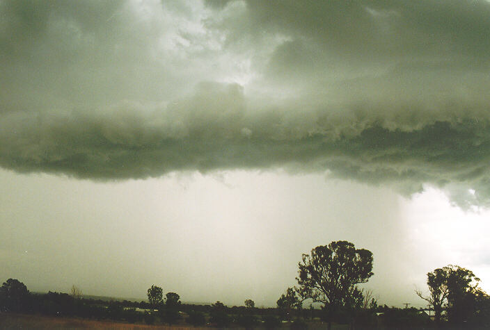
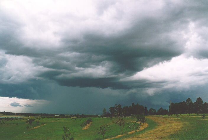
At around 4:25pm we headed north out of path of the storm and took more shots. We could not have been more perfectly situated and the timing was almost perfect. We again headed north towards Orchard Hills arriving there at 4:45pm for more photographic shots. The storms were moving further east with increasing precipitation cascades. There were several reports of hail, very heavy rain and strong winds from this storm.
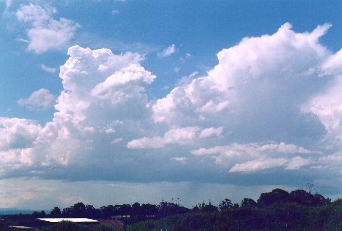
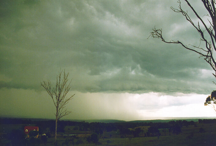
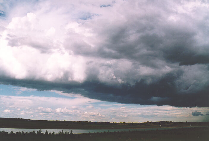
However, the action was not over. More storms were developing to our west indicated by a distinct side anvil and increasing cumulus. We headed further north, through Penrith to Castlereagh by 5:15 pm. We took further shots from a few positions of the retreating severe thunderstorm whilst keeping watch to our west.
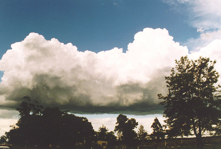
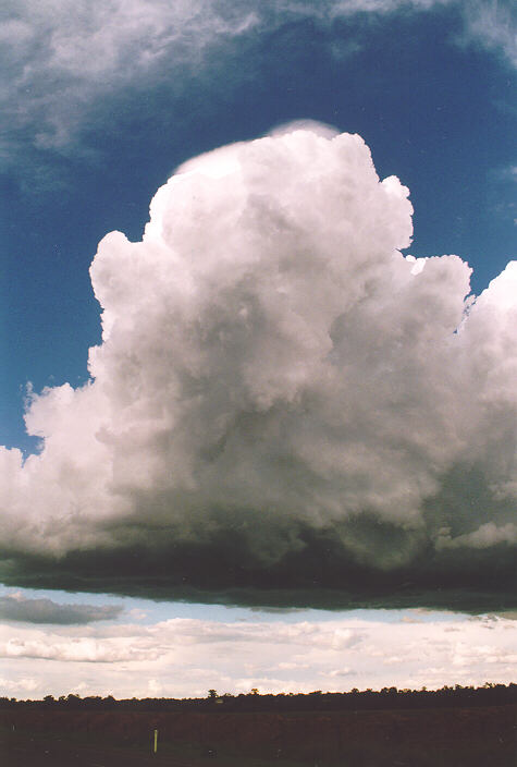
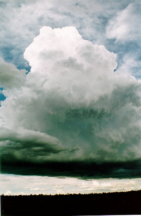
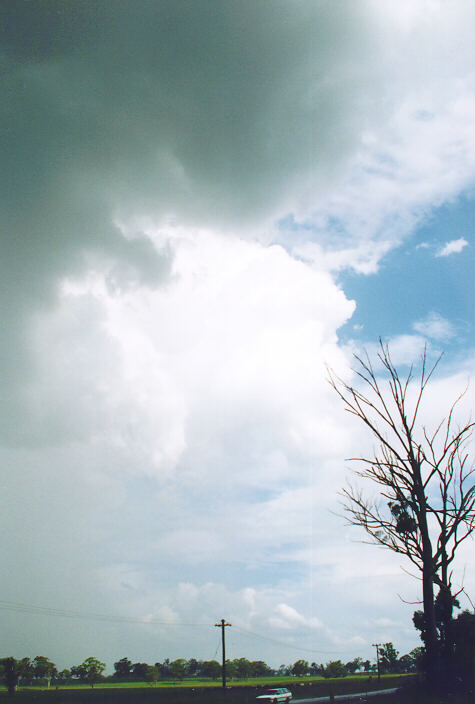
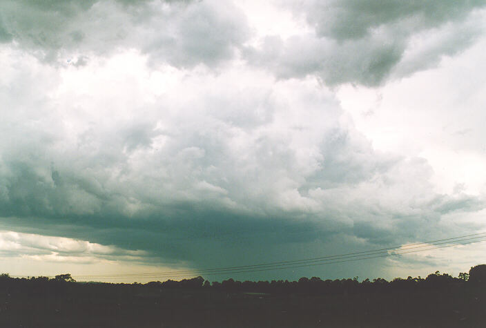
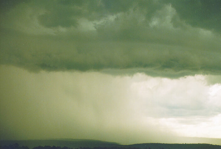
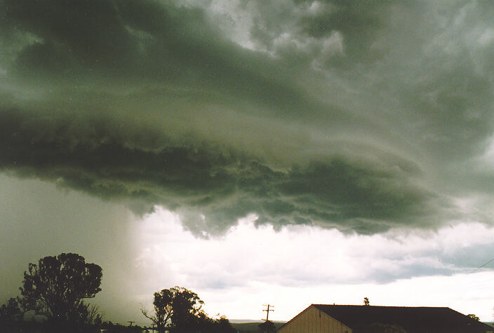
Michael and I noticed a medium isolated cumulus tower to our north that seemed to be attached to the left rear of the flanking line of the severe thunderstorm. We seemed to ignore this at first but perhaps as a result of the outflow of the main storm, it began to grow rapidly. In a matter of about ten minutes, it grew so high that we could not keep it in frame both on video or camera. With the sun setting to our west, we took the opportunity to take some unique shots of a bright, back lit cumulus from such close proximity. Its base was also boiling with a spectacular light green tinge appearance within its structure. Some severe bolts of lightning were observed at this stage. A light precipitation developed gradually giving way to a dense precipitation cascade. It seemed as if the precipitation provided the fuel to accelerate east away from our reach.
After taking some more shots at the University of Western Sydney campus Richmond (5:30pm), we headed back to Oakhurst. This was an unusual but spectacular end to a very successful, action-packed afternoon of storm chasing.
|
Document: 9511-04.htm
Updated: 6th April, 2004 |
[Australian Severe Weather index] [Copyright Notice] [Email Contacts] [Search This Site] |