and Chasing
[Index][Archives]
Severe Hail Storms - Springwood Event: Wednesday 11th December 1996
by Cliff Newman
| Storm News and Chasing [Index][Archives] |
Severe Hail Storms - Springwood Event: Wednesday 11th December 1996 by Cliff Newman |
The morning of Wednesday 11th December 1996 in Springwood seemed rather innocuous meteorologically - mild, humid but not oppressive, with a little low cloud drifting in from the north-east underneath patchy middle level stratiform cloud. As fair weather had been forecast and the projected surface weather chart was unexciting, my observations were rather casual; nonetheless I did not knowingly observe any altocumulus of any significance, nor any castellatus.
Ready to go out into the garden, I heard the 12.35 p.m. radio "Country Hour" meteorologist advise that a severe thunderstorm advice had been issued for the Northern Tablelands and that it might later extend to the Central Tablelands. Outside observations revealed a darkening cloud base to the south and south-west of our home 3 km east of Springwood. Observations of any cloud tops were prevented by the presence of extensive middle level cloud. Thunder and lightning soon followed, and then a moderate shower suggesting I forget about the garden.
By 1.40 p.m. this rather extensive storm seemed to be passing to the east-south-east and the sun came out, with the northern cloud anvil confirming its movement from the west-north-west. Cloud to the north and north-west was not threatening. Promptly changing clothes for the third time, I headed for the garden while my wife, Caroline, who is absolutely terrified (from past experience) of the prospect of being caught in a hail storm sought my reassurance that it was safe to go shopping - indeed, I said that she should be right for a couple of hours (as clouds were slow moving and it seemed fairly clear to the west-north-west, the source of the sunshine). A little low cloud was drifting in from the north-north-east. Increasing thunder from blackening cloud due west did not concern me as it would "obviously" bypass us to the south as normally happens in such situations. It was now 1.50 p.m. Ten minutes and a bucket of weeds later, Caroline raced down our driveway; "panicking again" I thought.
However, she told me of observing a green tinge in the approaching storm clouds as she topped Golf Course Hill 2 km away (Caroline is a particularly good weather observer and uncanny sensor of likely weather changes). I then took notice ! The next ten transforming minutes were fascinating. The wisps of low cloud suddenly started drifting in from the south-west with a freshening light breeze indicative of air out flow from the adjacent storm. Then the storm seemed to explosively expand north-east with a distant low roar, like a rushing wind, but ominously reminiscent of a louder roar observed in the approach of a more intense (not severe) hail storm we experienced here some ten years or so ago, coming through the wide tract of bush to the south of our house. Hail !
Thirty seconds later I reached the house under a completely darkened sky just as the first hail stones bounced down.
Had the storm expanded with the rapid formation of north-east cells as part of a large multicell cluster? Or, had it changed direction from an east-south-east to a north-east movement? Or was it being pushed north-eastwards by the upper level trough line?
A multicell configuration seems unlikely due to the absence of strong winds.
Steady hail of mainly 1 to 2 cm marbles continued for about half an hour, but with heavier rough elliptical hailstones (about 5% of fall) of up to 3 cm diameter appearing from time to time - really unspectacular, as normally severe hailstorms crash down with the help of much stronger downdrafts. Only 19 mm of rain (excluding hail) was recorded. Severe thunder and lightning did not occur until near the end of the storm, whilst downdrafts were weak throughout, with the breeze not even becoming moderate. Cloud also prevented my observing the cloud tops after the storm had passed over.
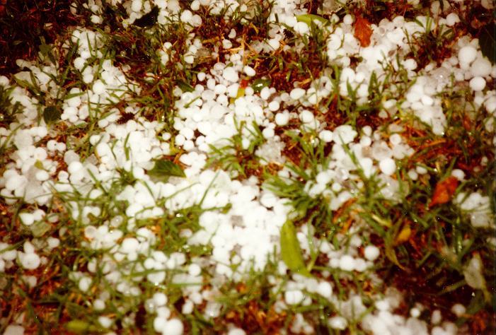
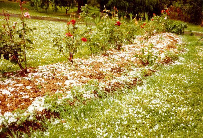

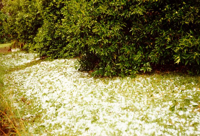
The ground was only one third covered but the hail pruned my tomato bushes very effectively and left moderate foliage damage in its wake, but no structural damage.
The worst of the storm was felt at the next town up the Mountains, Faulconbridge, where golf ball sized hail fell and did extensive damage to cars and some houses and injured a small group of high school children. From local enquiries, it seems that the hail extended from Glenbrook to Lawson, encompassing several towns.
A good start to a rather barren thunderstorm season!
|
Document: 9612-02.htm
Updated: 6th April, 2004 |
[Australian Severe Weather index] [Copyright Notice] [Email Contacts] [Search This Site] |