and Chasing
[Index][Archives]
Weather Data for Sunday 5th November 2000
compiled by Michael Bath
| Storm News and Chasing [Index][Archives] |
Weather Data for Sunday 5th November 2000 compiled by Michael Bath |
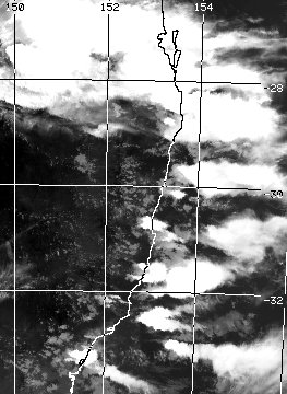
At around 4.40pm the storm hit Nimbin, and around 5.20pm Mount Warning Road.
| Time | Grafton radar | Brisbane radar |
|---|---|---|
| 4.10pm local |  |
|
| 4.20pm local |  |
|
| 4.30pm local |  |
 |
| 4.40pm local |  |
 |
| 4.50pm local |  |
 |
| 5.00pm local |  |
 |
| 5.10pm local |  |
 |
| 5.20pm local |  |
not available |
| 5.30pm local |  |
 |
| 5.40pm local |  |
These images from US AF Weather Agency at 2pm, 4pm, 5pm and 6pm local


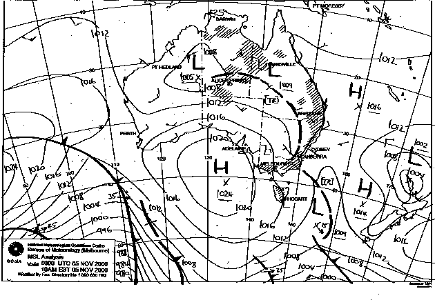
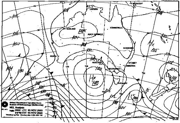
These images from Bureau of Meteorology
These images from Bureau of Meteorology at 11am and 5pm local.
These images from NOAA
Lifted Index 5pm
local

CAPE 5pm local

|
Document: 0011-07.html
Updated: 3rd November, 2001 |
[Australian Severe Weather index] [Copyright Notice] [Email Contacts] [Search This Site] |