and Chasing
[Index][Archives]
Chase in Tornado Alley 2001 - Special Report: Episode 3 - Now includes video
report compiled by Jimmy Deguara
| Storm News and Chasing [Index][Archives] |
Chase in Tornado Alley 2001 - Special Report: Episode 3 - Now includes video report compiled by Jimmy Deguara |
We left Plano heading for northeastern Oklahoma. I had hopes of possible activity there. Storms did break the cap yet these were quickly disappearing further east. We stayed the night at Coffeyville, Kansas (famous for its largest recorded hailstone).
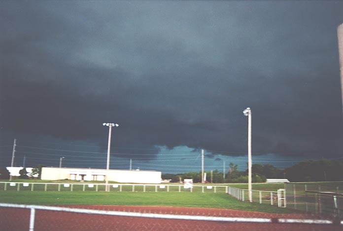 During
the night and early morning, storms did develop in the area. In fact there was
a severe storm warning with heavy rain and large hailstones. I quickly got some
pictures of a developing gust front. General thunderstorm activity dominated afterwards.
During
the night and early morning, storms did develop in the area. In fact there was
a severe storm warning with heavy rain and large hailstones. I quickly got some
pictures of a developing gust front. General thunderstorm activity dominated afterwards.
We decided to head west and gradually came across some clearing. Checking the models at Winfield (another Sunday!!), it was decided that the target area would be further west. Wind shear was not a problem but the cap was strong (in fact the cap was weaker to the east). We found ourselves on top of the hills near Medicine Lodge and stopped for a view.
There were towers
developing to the south, which was the reason we had stopped. It seemed to look
less interesting to the west. So we headed towards these towers. Perhaps at the
time it seemed a good move. After all, a tornado watch was issued in the area.
But looking back, we should have stayed and watched somewhat longer. It was in
this area that storms developed later. 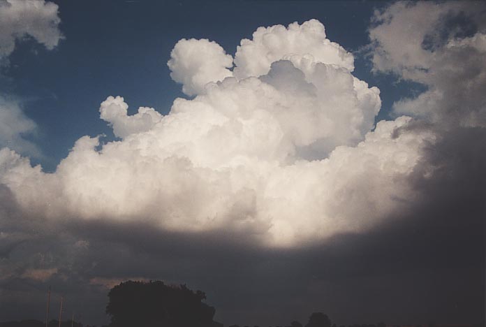
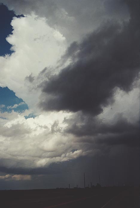
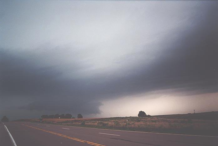
Anyway, heading towards these towers, the cap was not able to break despite some convergence. The southeasterly winds seemed to be dragging the moisture further inland - towards Medicine Lodge!! Nevertheless, after heading further east, passing several chase vehicles, we stopped on a side road.
David was somewhat furious as this day was so ideal but the cap had stuffed the whole day up (David was not interested in a night chase). I did believe that based on the increasing towering cumulus and organisation of the stratocumulus, something would develop. A Kansas TV crew pulled along side wondering if we had observed anything. We chatted for a little while only for them to discover we were Australians, we had observed a major tornado and now they wanted to do an interview. It was like a mock interview - messy hair and unprepared, we answered the questions. David stole the limelight and thank God for that - I was lost for words. Oh, and by the way, it was no mock interview. They had said it would be shown on Kansas Channel 12 that night. We found out from a librarian who recognised us the next day, we were on!!
Anyway, a storm did develop that night - probably tornadic but confirmed by a spotter. Sorry but thanks David for putting up with my winging that night wanting to chase the storm. We stayed the night at Wellington.
We thought Wellington would be a good place to stay for access to a library. Unfortunately, there were problems that week so we had to go further east to Winfield to find check the models at the library there. Our target region was southern to central western Kansas. In fact, I favoured a good chance for tornadic development in a region to the north of Medicine Lodge!! There was some good rotational convergence there and if storms developed, I saw the potential for excellent rotation.
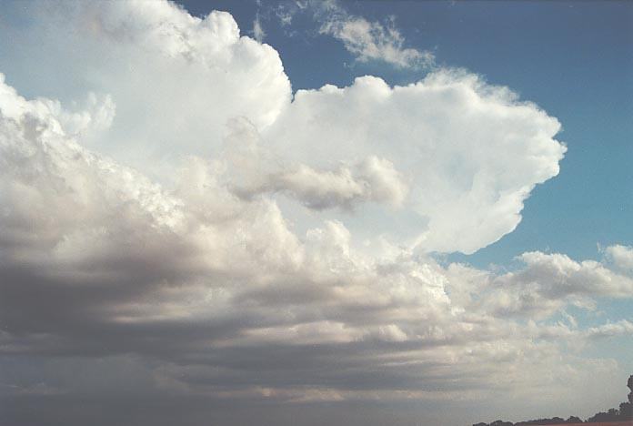
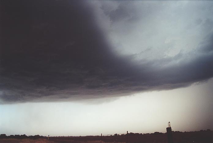
So we headed west towards the rise near Medicine Lodge. As we did, we found that the cloud had cleared and the temperature had dropped significantly!! So we stopped on top of the hill and noticed that there was a line of cumulus congestus stretching from across the border in northern Oklahoma into Kansas and then slightly curved north westwards to the north.
 We
decided to head near this line near Harper but this time stay with it monitoring
its movement. Isolated congestus began to grow through various breaking-the-cap
phases. Eventually, the storms just to the south of us showed signs of backshearing.
I was concerned with the lower level winds as the south easterly winds were pushing
slowly through. But it seems the whole line system remained almost stationary
though cumulonimbus were showing signs of drifting up wind to the northeast.
We
decided to head near this line near Harper but this time stay with it monitoring
its movement. Isolated congestus began to grow through various breaking-the-cap
phases. Eventually, the storms just to the south of us showed signs of backshearing.
I was concerned with the lower level winds as the south easterly winds were pushing
slowly through. But it seems the whole line system remained almost stationary
though cumulonimbus were showing signs of drifting up wind to the northeast.
We headed for the
library at Harper to find a tornado watch had just been issued for our region!!
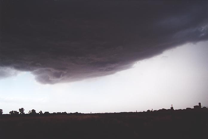
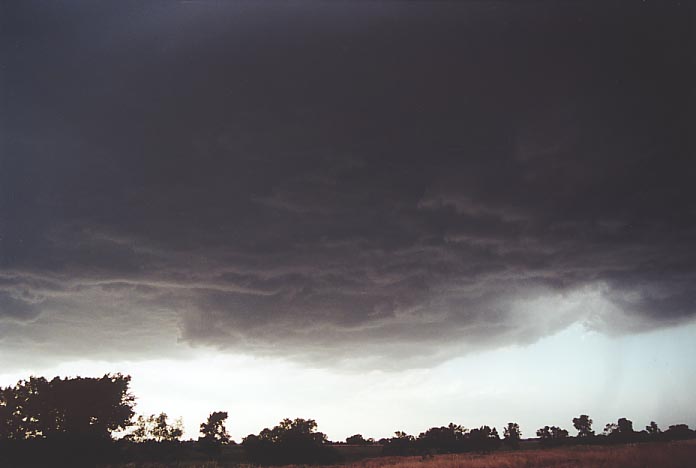
We finally check the radar and hell - the storm had taken off. 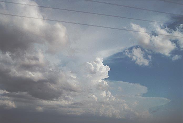 We
were out in a flash and found the storm had exploded with a large back-sheared
anvil and a towering flanking line developing. In fact as we left Harper to gain
a better position on the southeastern side, we found storms further south had
also exploded. We stuck with this storm. We zigzagged our way to a spot west of
Bluff City. We had to pass under dark menacing clouds. There was risk of serious
hail from this storm system as a severe storm warning had already been issued
but mostly for the storm we had just missed. Storm spotters were out in force
as usual.
We
were out in a flash and found the storm had exploded with a large back-sheared
anvil and a towering flanking line developing. In fact as we left Harper to gain
a better position on the southeastern side, we found storms further south had
also exploded. We stuck with this storm. We zigzagged our way to a spot west of
Bluff City. We had to pass under dark menacing clouds. There was risk of serious
hail from this storm system as a severe storm warning had already been issued
but mostly for the storm we had just missed. Storm spotters were out in force
as usual.
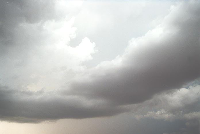
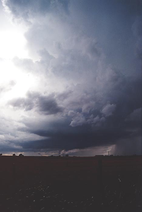
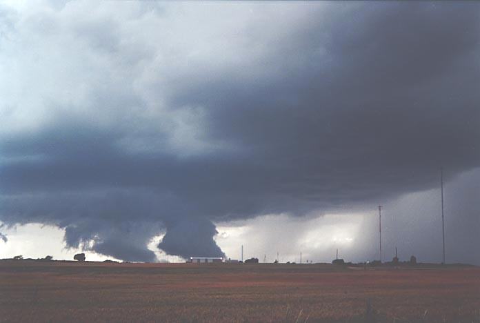
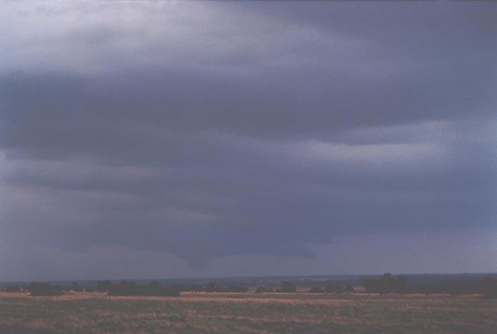
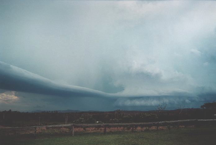
We remained in the region where again rain free bases persisted and the parent storm with hail moved upwind. We looked for signs of rotation. We saw a few areas where the base was trying to organise into some rotation but gradually one area began to dominate. And to reinforce this, inflow increased and then an inflow band developed. In fact, this was a curved inflow band. Rotation was clear but we felt that we were in an unsafe position if a tornado dropped so we headed east. The rotation persisted and then to our disgust, the wall cloud and rotation fell apart.
 We
had turned on a road north and parked on a side road next to a couple of chasers.
As I recorded on video my disappointment, I hear "Well. Well. Well." I thought,
who in the world could this person be that knows me in the middle of nowhere?
Then I recognised it was Tim Marshall!! I thought what a coincidence to meet near
this storm. It was great to be able to chat with Tim again firstly about the storm
and then about our trip. Then Tim departed.
We
had turned on a road north and parked on a side road next to a couple of chasers.
As I recorded on video my disappointment, I hear "Well. Well. Well." I thought,
who in the world could this person be that knows me in the middle of nowhere?
Then I recognised it was Tim Marshall!! I thought what a coincidence to meet near
this storm. It was great to be able to chat with Tim again firstly about the storm
and then about our trip. Then Tim departed.
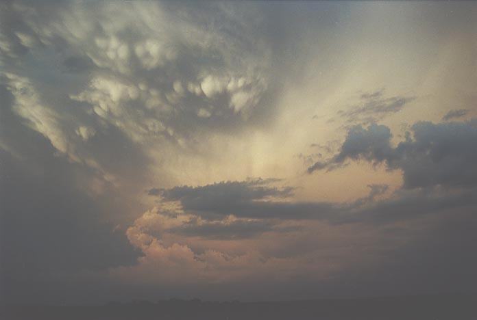
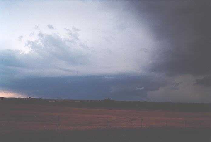
We stayed a little
longer, filmed and photographed the sunset lit supercell to the east, and then
headed off through Bluff City, and on to northern Oklahoma. We stayed the night
at Enid. Of course, more thunderstorms came through later that night with a tornado
reported and of course severe warnings. Some close cg's earlier that morning!
Click the following video to view
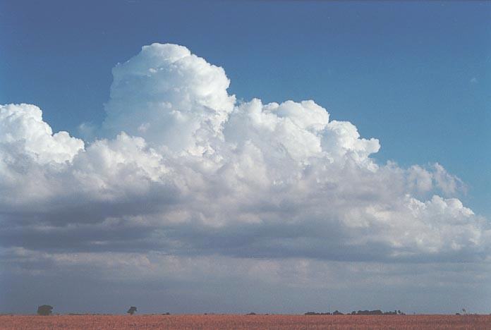
We awoke to an overcast stratocumulus sky with breaks and clearing altocumulus castellanus from the previous night's activity. We checked the models at Enid (a small city) and determined the target to be western Oklahoma. In fact, we targeted Woodward as the next stop. Conditions on this day were going to be conditional in terms of brief tornadoes rather than long lived ones. In my view, the models indicated interaction between outflow and inflow of neighbouring storms would need to be monitored before any storms could show persistent rotation.
We had a brief lunch stop at the rise of the caprock hills and then headed further west. Cumulus patches had developed hiding from view some of the developing larger cumulus. We re-checked the situation in the library at Woodward and then decided to head out of town to see what storms we could find.
 We
knew this was going to be the most difficult situation to be able to choose storms
once they developed. However, we maintained position. We did not have to wait
long before an anvil started to develop. We headed south and then gradually west
finally getting close and in between two storms. The storm to our southwest was
becoming severe but merging with the one to its northeast (located to our north).
The one to the north quickly became severe soon after and we finally heard a warning
issued in our county for severe hail and very heavy rainfall.
We
knew this was going to be the most difficult situation to be able to choose storms
once they developed. However, we maintained position. We did not have to wait
long before an anvil started to develop. We headed south and then gradually west
finally getting close and in between two storms. The storm to our southwest was
becoming severe but merging with the one to its northeast (located to our north).
The one to the north quickly became severe soon after and we finally heard a warning
issued in our county for severe hail and very heavy rainfall.
 We
decided to weather the heat and head into the path of the southern storm only
to find it had redeveloped within the merging process and had now crossed the
road northwards. So we headed north generally back to Woodward. The storm was
quite spectacular but as we neared Woodward, we caught a glimpse of another storm
to the north. It had a more favourable flanking line and so we passed through
traffic and water on roads to head north.
We
decided to weather the heat and head into the path of the southern storm only
to find it had redeveloped within the merging process and had now crossed the
road northwards. So we headed north generally back to Woodward. The storm was
quite spectacular but as we neared Woodward, we caught a glimpse of another storm
to the north. It had a more favourable flanking line and so we passed through
traffic and water on roads to head north. 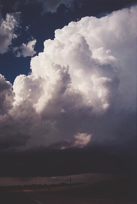
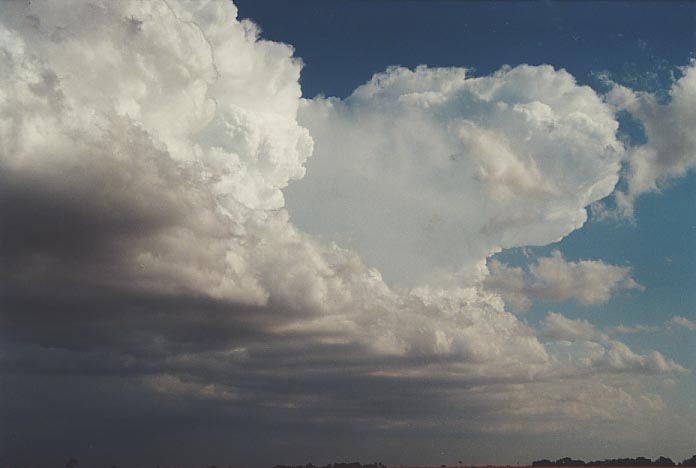
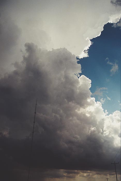
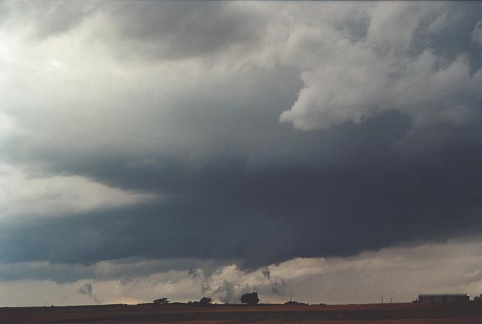
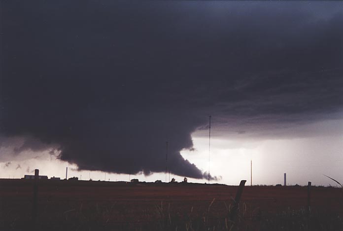
The storm to the north was developing quite nicely with a flanking line and well directed rear flank downdraught. However, it was the roads this time - lack of roads to get us in position. As we neared it, we noticed rotation, and decided to watch from the main road. If the storm turned right, then it would move east and we would head down another road to catch it. But the inflow domination was too strong so that new development was occurring before any real activity could dominate. The storm then rained on itself. We had our eyes on another storm to the south which had initially looked weak but had started to develop a favourable flanking line structure. So we left the other storm and watched this one. We also noticed now that a storm to the west was also organising itself.
 So
we positioned ourselves to the south of town. Finally, we were able to observe
a high contrast and nice rain-free base from the correct side. We also noted that
the storm to the west of Woodward had just been issued a warning for severe hail.
The rear flank downdraught was well placed but the conditions were not ideal for
enhanced rotation. But then the outflow of the storm to its east freshened in
conjunction with its own strong updraught pulse. An inflow band also developed
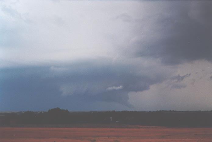
as this inflow freshened. Suddenly, the base began to pick up scud and the base
began to slowly rotate. The scud slowly built into a spectacular wall cloud lowering
with rotation evident. A tornado warning was issued soon thereafter.
So
we positioned ourselves to the south of town. Finally, we were able to observe
a high contrast and nice rain-free base from the correct side. We also noted that
the storm to the west of Woodward had just been issued a warning for severe hail.
The rear flank downdraught was well placed but the conditions were not ideal for
enhanced rotation. But then the outflow of the storm to its east freshened in
conjunction with its own strong updraught pulse. An inflow band also developed
as this inflow freshened. Suddenly, the base began to pick up scud and the base
began to slowly rotate. The scud slowly built into a spectacular wall cloud lowering
with rotation evident. A tornado warning was issued soon thereafter.
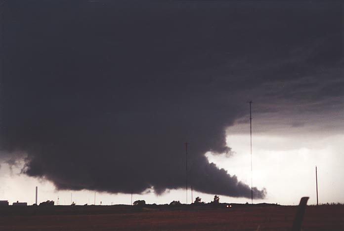
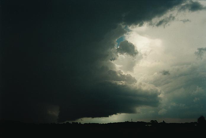
What an awesome sight!! This was a wall cloud almost touching the ground on this elevated plain with scud forming and rising like a fire into the wall cloud's tail cloud region. We were within a few kilometres from the wall cloud lowering. Cloud to ground lightning pulse from within or near the wall cloud - most captured on video. Soon it was time to move as the storm was making a right move so we headed along the road southeast. From here, we noted that the eastern storm had made a move northeast with its own wall cloud. Two simultaneous wall clouds. And then a third cell became severe revealing its features. Our wall cloud dissipated and the outflow of this storm was enhancing the wall cloud potential of this third storm to its west. This developed into a spectacular rotational structure but seemed to be more high precipitation oriented. We initially thought it was going to be another massive HP system. But this storm seemed to show signs of development to western or south western side.
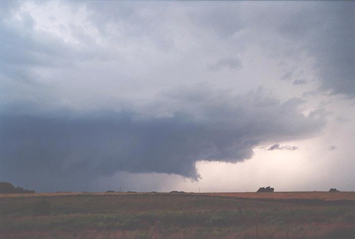
Unfortunately for us, there just was not sufficient windshear on this day even with the interaction of outflow to form sufficient rotation for tornadic development. David seemed to be watching the activity closely and thought there may have been a chance of tornadic activity. Nothing seemed to be confirmed though but it was at least might close.
This chase was one with a difference - different environment, different dynamics particularly wind shear. Until one travels to the United States, it is difficult to comprehend the dynamics that tend to come together in Tornado Alley. There is no doubt that Australia cannot match the dynamics on such a REGULAR basis. But I would like to raise a few points:
Classical supercell in the United States 29th May 2001
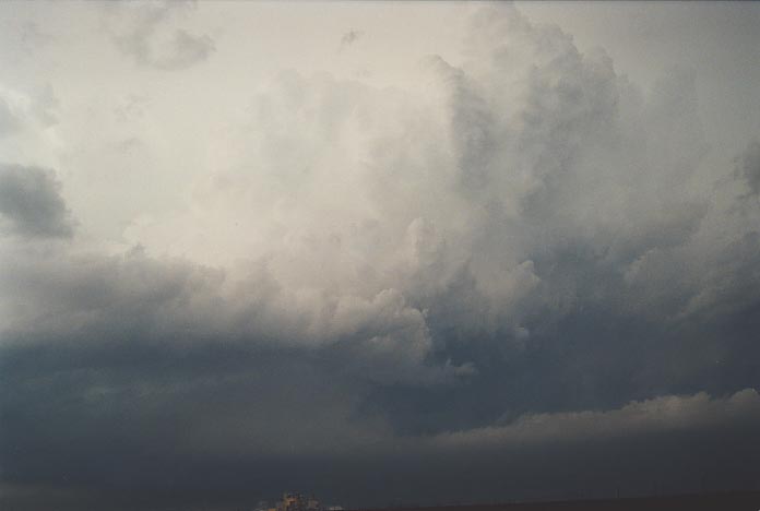
Classical supercell near Coffs Harbour, NSW, Australia 5th November 2000
and
Wall cloud in the United States 5th June 2001
Wall cloud near Oberon, NSW, Australia 7th January 2001
Now these are not exactly mirror images but they do reflect some similarities in terms of features and structure. I feel that this at least provides some important evidence that significant events are occurring even near populated areas - Coffs Harbour and Oberon respectively in the above cases.
Finally, I would like to thank David Croan for sharing the experience and being a great team member. To say it is difficult to chase for a long period of time is an understatement, but despite some minor differences of opinion, I think David and I worked well as a team, combining and sharing our chasing experience, discussing thoughts about forecasts, and chasing. Anyone that has chased long distances with me know how demanding it can be so David did well. Hi navigation skills were also commendable. We will hopefully go back next year and years to come.
Chase in Tornado Alley 2001 - Special Report: Episode 1
Chase in Tornado Alley 2001 - Special Report: Episode 2
|
Document: 200105-05.html
Updated: 17th May, 2002 |
[Australian Severe Weather index] [Copyright Notice] [Email Contacts] [Search This Site] |