and Chasing
[Index][Archives]
Severe Thunderstorm pounds Bathurst:
Saturday 8th February 2003
by Jeff Brislane and Matthew Piper
| Storm News and Chasing [Index][Archives] |
Severe Thunderstorm pounds Bathurst: Saturday 8th February 2003 by Jeff Brislane and Matthew Piper |

Jeff Brislane's Report
Friday afternoon and I was on the verge of contacting Matthew Piper to see if he
wanted to chase on Saturday when he beat me to it. AVN was showing a nice area
of high CAPE and L/I over the Central Tablelands from Mudgee south to Oberon. We
both had severe withdrawals (SDS) and need a thundery fix.
Next morning after picking up Matt at 10:30, we were on our way. After stopping
for food at Lithgow we headed west. We decided to head up Mudgee road first. I
was thinking that the best area would probably be on the Northern side of the
predicted target area towards Mudgee.
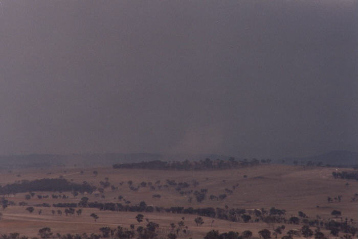
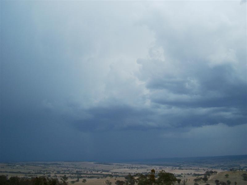
At Capertee we stopped and watched the first towers start to go up on the trough
line that was positioned around Orange in a NNW to SSE line. After 15 minutes we
decided to head north to Ilford were we had the opportunity to change directions
if need be. It was really difficult to make out a lot of the distant development
that morning due to thick smoke from a fire in the Wollomi National Park that
was being drawn into the trough by an easterly wind. It was because of this lack
of visibility that Matt decided to phone TWC for a radar update of the
developing trough line. He got hold of Matthew Pearce at TWC who advised him
that the better-looking development was back around Bathurst.
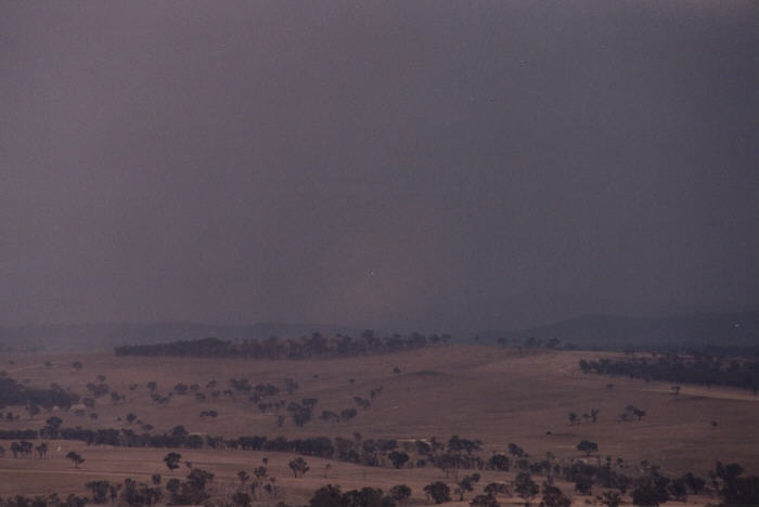
After Matt got off the phone and explained to situation to me we decided that we
would head up the Sofala road to a higher vantage point to make our final
decision on which direction to take. There were only three ways from here
Bathurst, Mudgee or Lithgow and because of the non-existent road network there
would be no going back on our decision. Bathurst was Matthews's choice and I
agreed (fingers crossed)!!!
The closer we got to Bathurst the more we realised that we had made the right
decision. Towers were everywhere, which is not so good if you want supercells,
but at least our SDS was in for a fix!
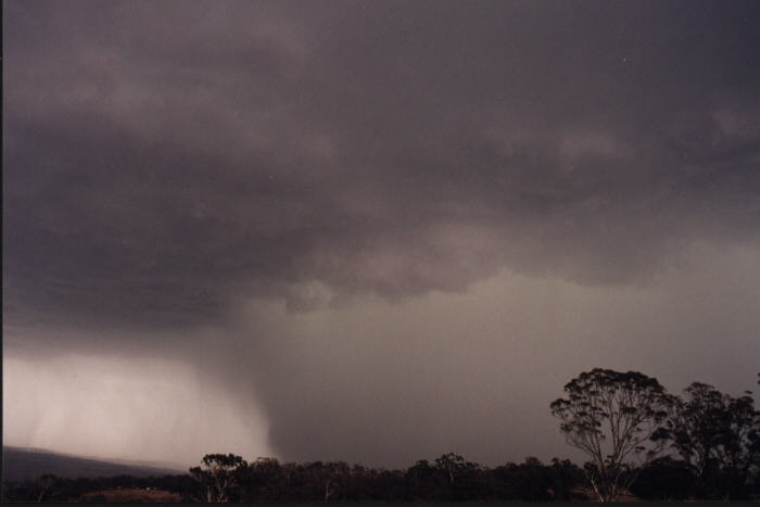
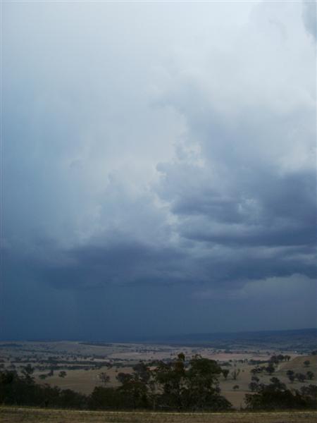
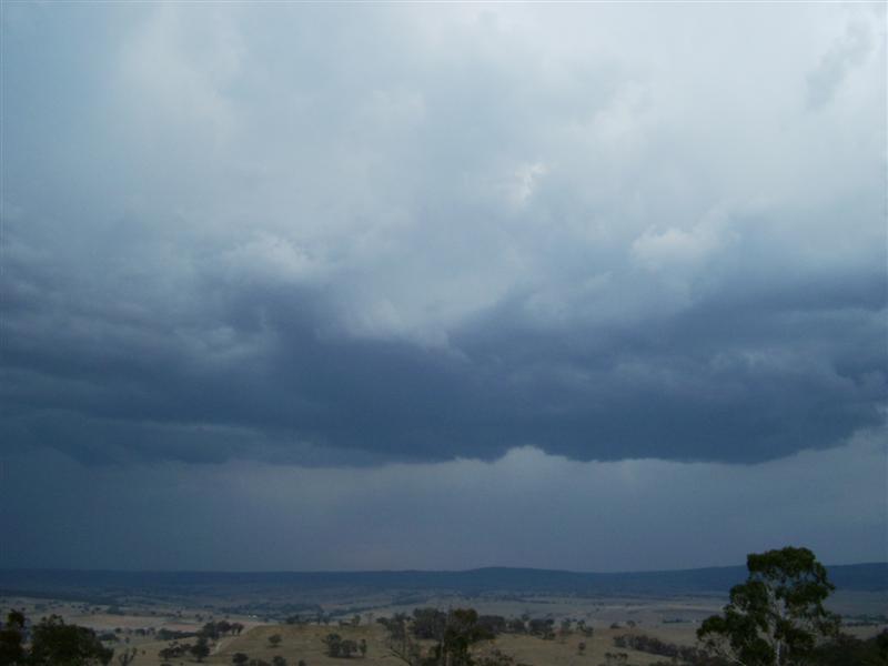
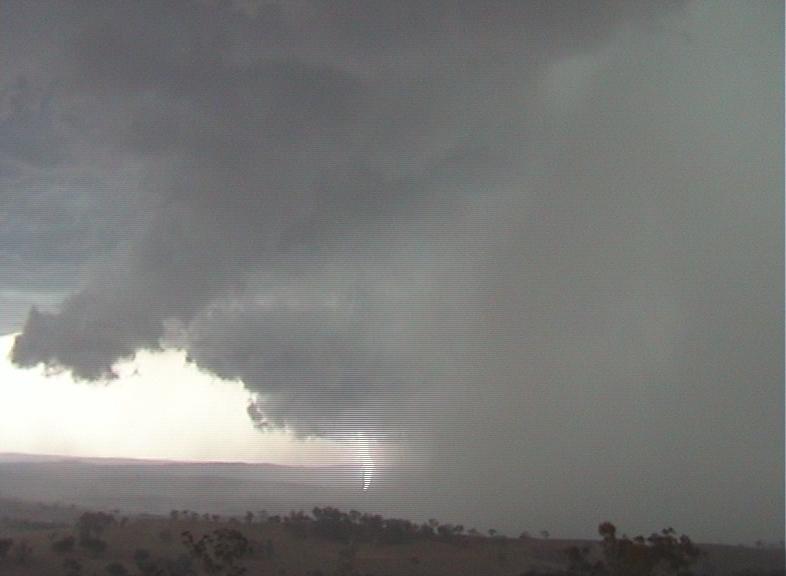
It was at this point that we saw a nice rain free base with a semi circular
lowering on the South side of the city. We headed straight to Mt Panorama to get
a better view. By the time we got there it had dissipated but there were now
plenty of storms to watch to our south and south-west.
I set up my tripod and started taking pictures hoping to get some lightning shots. Matthew pointed out an area of dust blowing up from a possible microburst to the southwest. I put a telephoto lens on and got a couple of pics that just show the dust through the haze.
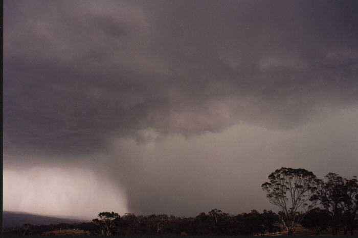
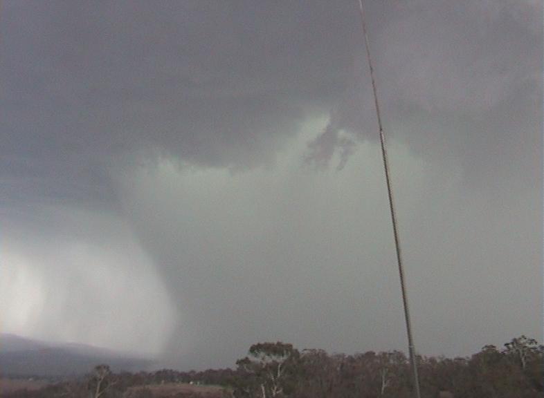
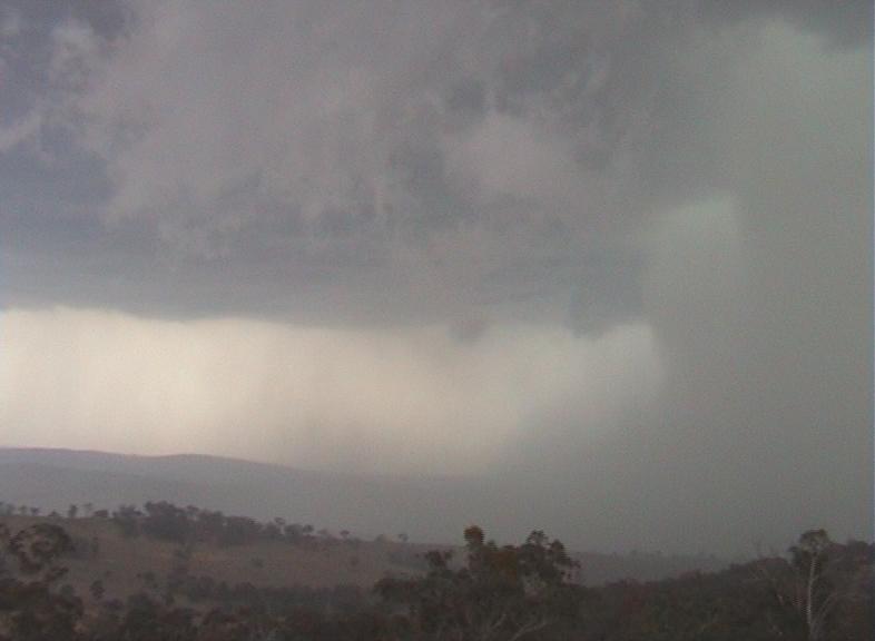
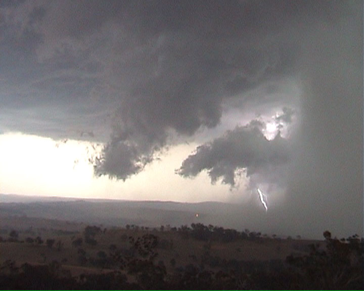
To our west now a rain free base had formed and was tracking in a northerly direction along the ranges west of Bathurst. Matthew had only just mentioned to me that it could do something interesting when it started to drop cg's.
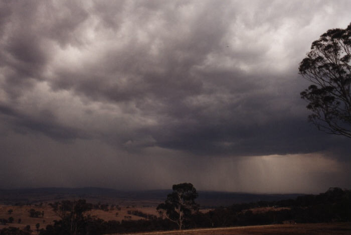
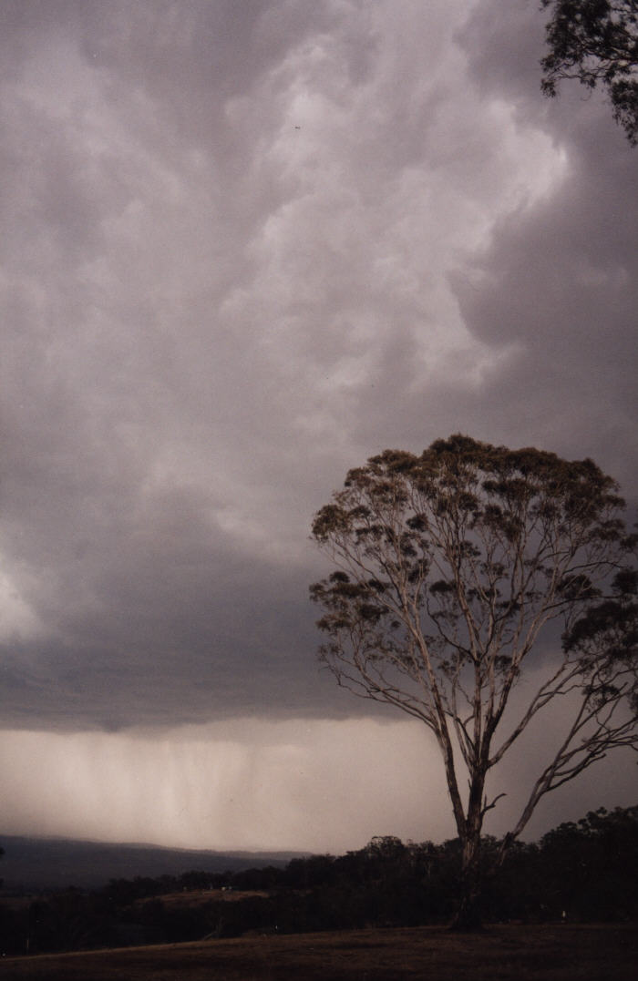
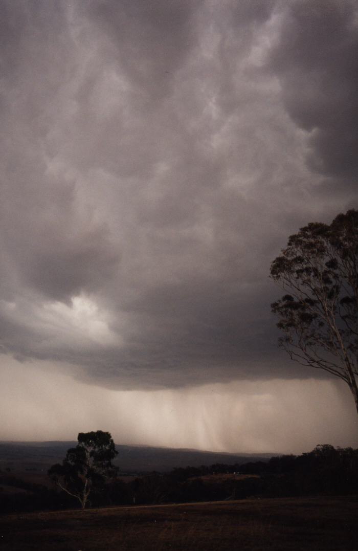
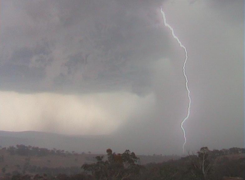
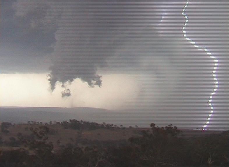
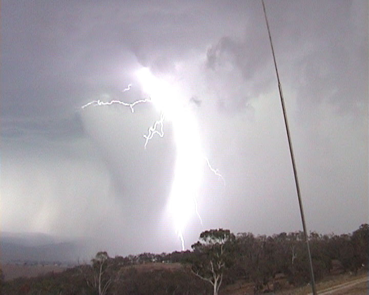
The RFB had moved a little further north when precipitation started coming out of the northern side. At first it was only a couple of thin black rainshafts, but they soon merged and started to grow. It was at this point that we got the fright that we probably deserved for standing on an exposed mountain next to a thunderstorm. A lightning bolt struck a metal antenna about 30 meters behind us and sent us both diving for the car!!! Talk about a flang!!! I actually heard the lightning arcing on the metal tower before the whip cracking thunder. From then on this storm became an in car storm!!!
Video of very loud thunder on top of Mount Panorama [0.38mb WMV]
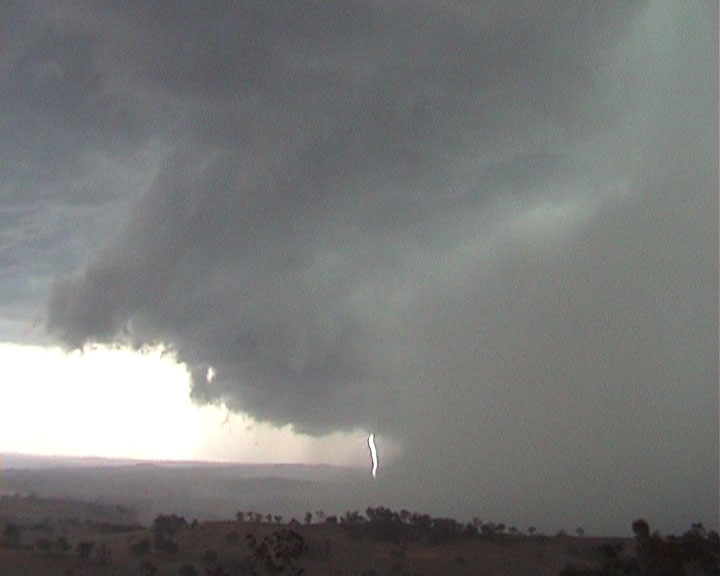
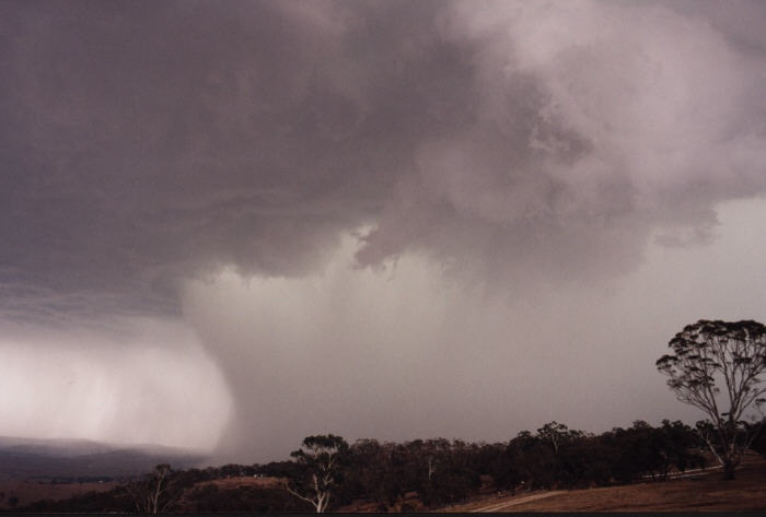
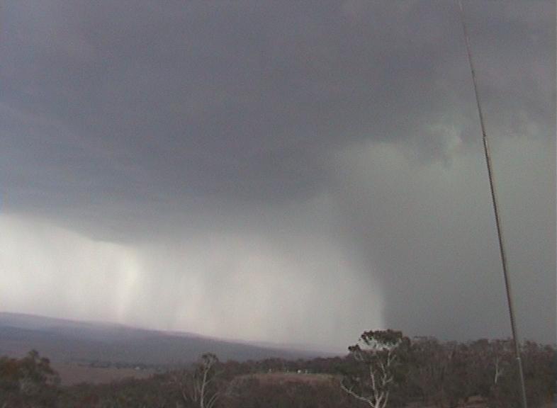
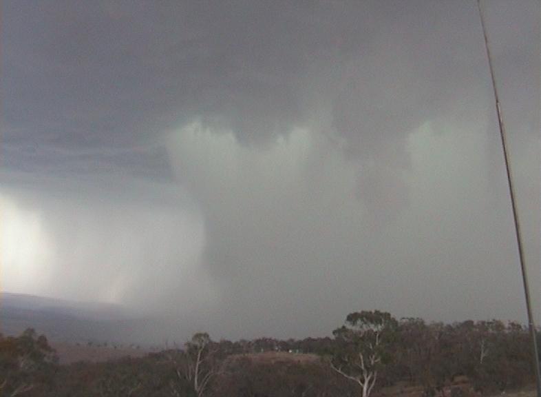
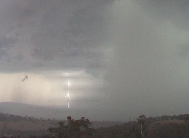
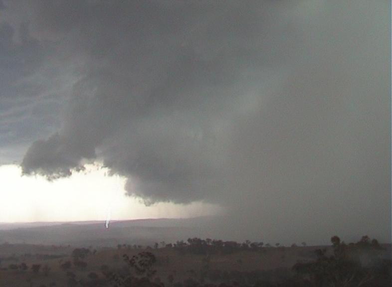
What happened now can only be described as absolutely amazing. The rainshaft
from the developing cell in front of us was now becoming huge! It was intensely
black on the western side and it was starting to turn green in the middle and
pink on the eastern side, and it was starting to come back towards us.
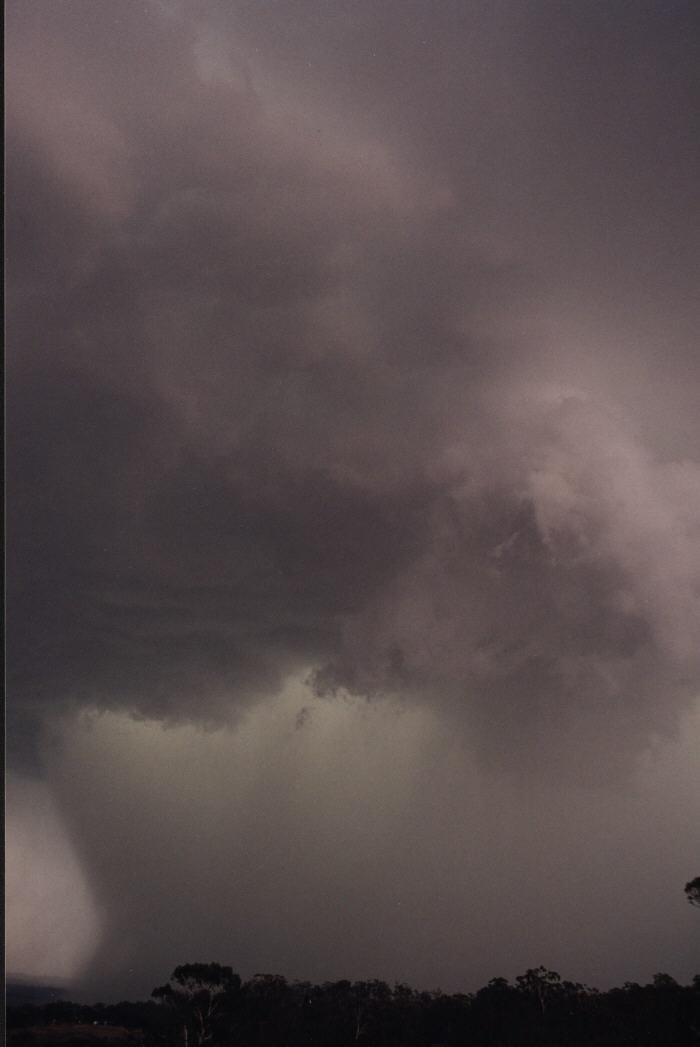
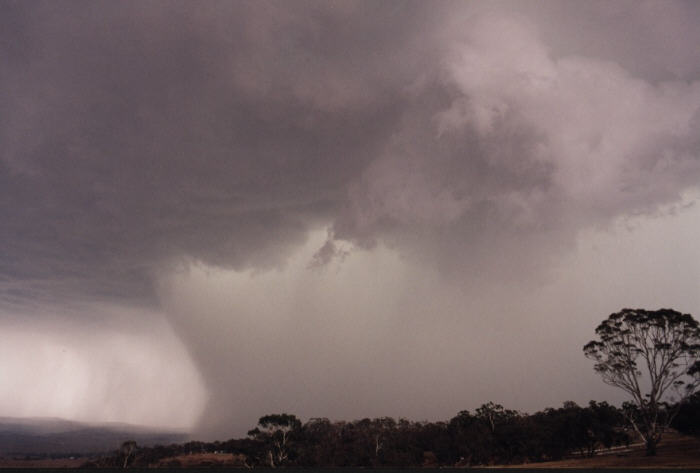
Twenty minutes ago the RFB was heading north and
now it had just exploded into a monstrous outflow region the size and colour of
which I have never before witnessed. The cell that was building above for long
just let go in this amazing display of outflow dominance.
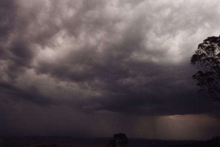
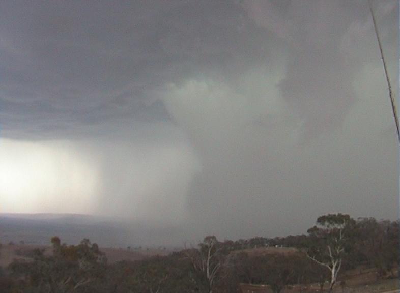
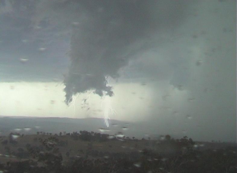
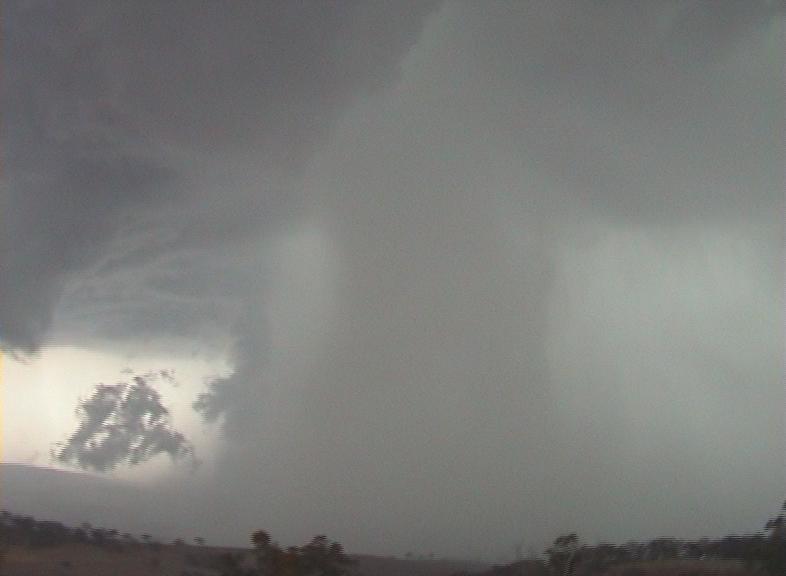
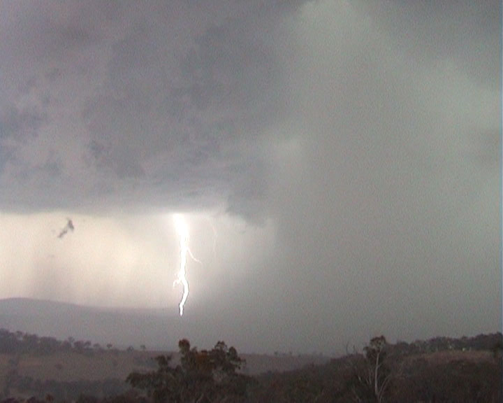
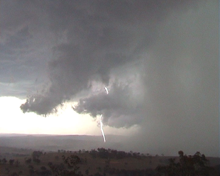
One of the features of this massive outflow dominant storm was some huge wet
microbursts which we witnessed coming out of the South Western side. In my
photos there are two microburts captured. The first one shows a large lump
descending down the rear side on the rain shaft.
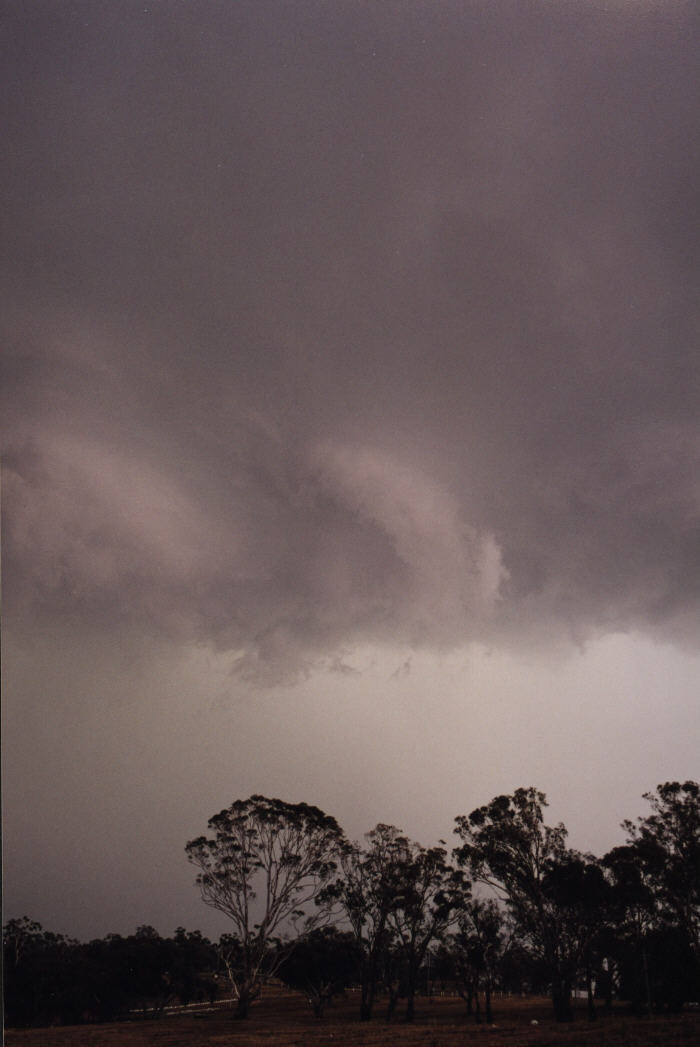
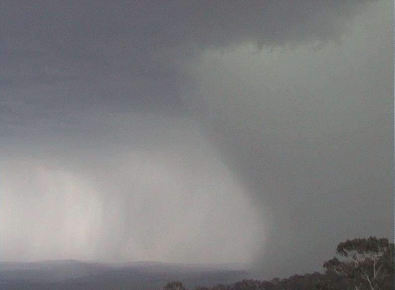
This initial microburst caused a small rainfoot and probably set up the dynamics in the side of the rain shaft that caused its unusual shape.
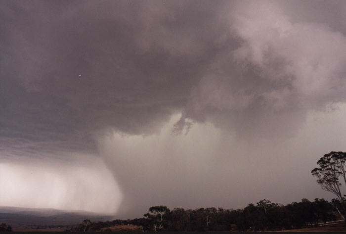
The second Microburst was a lot larger and it came from inside the rainshaft so it wasn't visible at first but it's affect on the rain shaft was, when it blew out the side of the rain shaft completely and created a massive rainfoot.
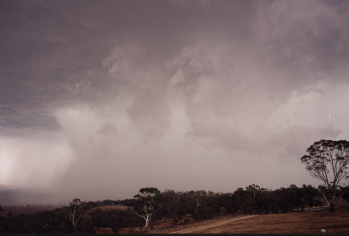
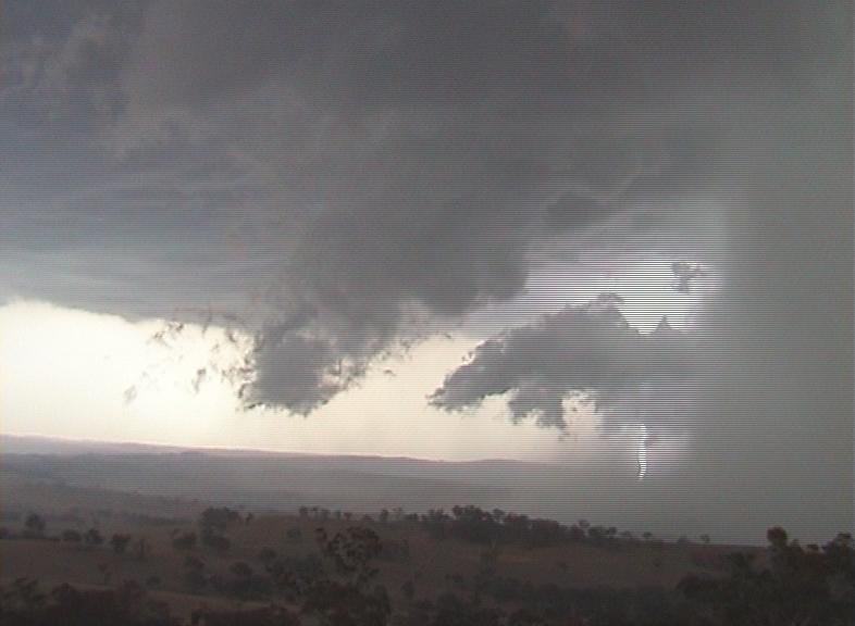
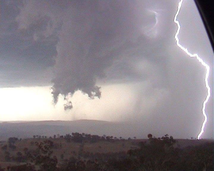
Eventually this second rainfoot started to lift
and condense into cloud, which was drawn back into the storm. This cloud then
formed an amazing tail type cloud that hung from the cloud base and almost
touched the ground at one point!
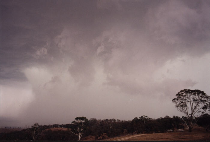
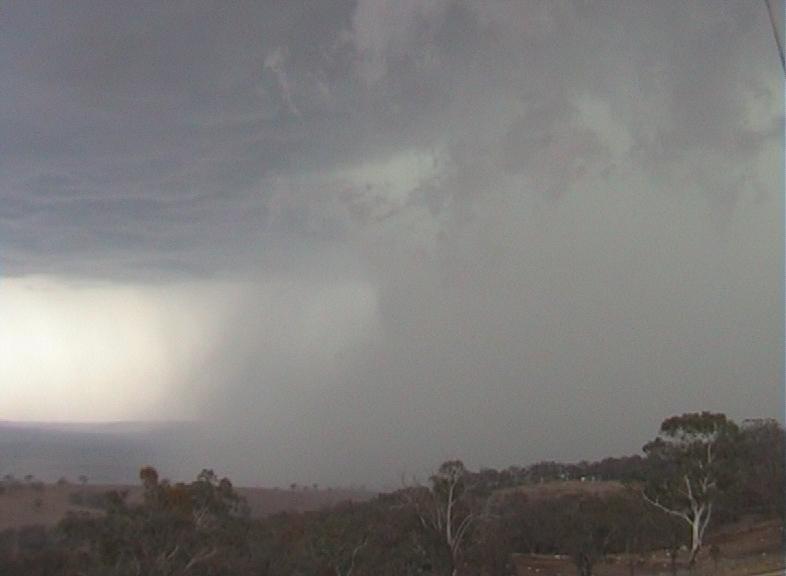
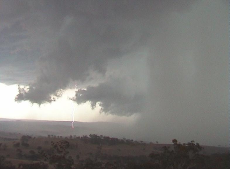
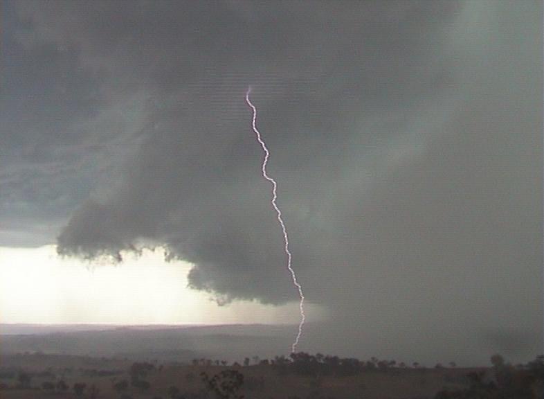
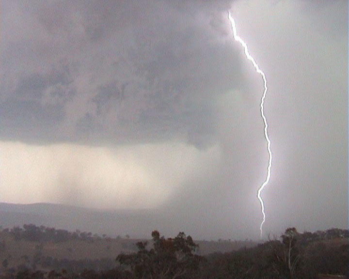
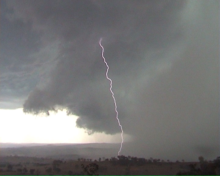
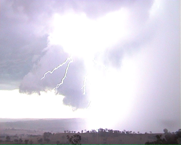
At this point the lightning was incredible with cg's dropping out of the cloud
base beside the rain shaft. It was a definite severe storm with reported wind
gust from Bathurst airport AWS at over 60 knot's during this intense phase.
There was also localised flash flooding and wind damage from the microbursts.
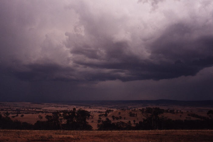
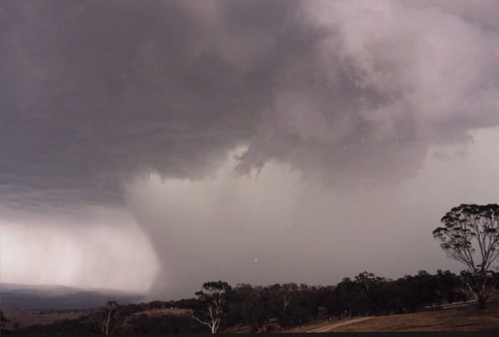
After a further 20 minutes the storm slowly started to look weaker and less
impressive, so we decided to try and intercept the core out on the Mid Western
Highway before it got to weak in the hope of seeing some falling hail.
Unfortunately there was no hail but we saw some minor flash flooding around West
Bathurst and we also found some willow trees that had been smashed to pieces by
the microbursts, which confirmed what we had seen earlier.
We drove further south to Blayney and then east to Newbridge were we found
evidence of some extreme flash flooding just out of town. After that we drove
back to Bathurst and back into the storm system.
Unfortunately this system basically turned into a thundery rain band after this,
which pretty much put an end to our days chasing. We found a service station and
filled up. Matthew rang Jimmy for an update and after about 10 minutes
discussing the situation we headed south to try and intercept a possible severe
storm near Yass, but that's another story..
One of the most amazing things about this storm for me was the view we got from
our position on top of Mt.Panorama. It was like sitting in the top row of a
stadium and watching the whole thing unfold below like some sort of show. We had
a rain free front row seat on an incredible storm that almost blew Bathurst
away!!!
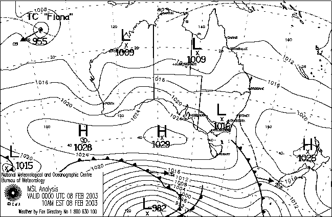
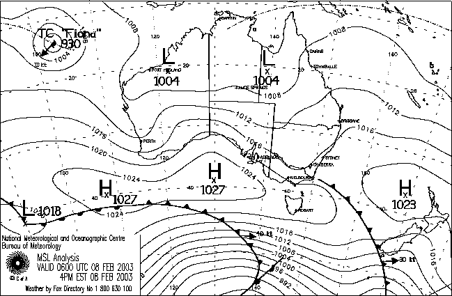
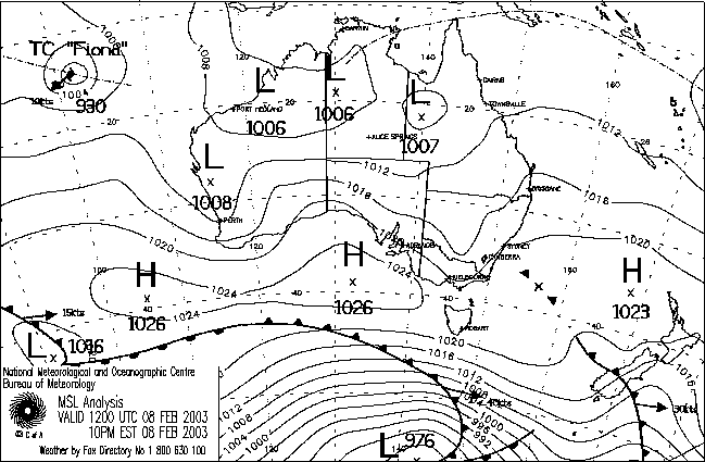
MSL Analysis
From
Bureau
of Meteorology.
Matthew Piper's
Report Saturday the 8th February was predicted to provide the best
environment for thunderstorms on the Central Tablelands since late 2002. Jeff
Brislane and myself were eager to chase this day so we headed out at around 11am
to our target area of Mudgee. On the way to Mudgee we noticed a rapid build up
in TCu to the south towards Bathurst. After getting an update on the situation
from TWC we decided to head for Bathurst via the Sofala road. Once to the south
of Sofala we encountered the first rain for the day from a weakening anvil. As
we approached the northern outskirts of Bathurst we could see what appeared to
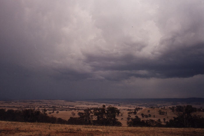
be a gust-front on a storm to our south. We decided then to head up to the top
of Mount Panorama and watch the slowly approaching storms from there. A series
of relatively weak storms formed to our south for about the next half hour and
it soon became apparent that new storms were progressively developing closer to
us.
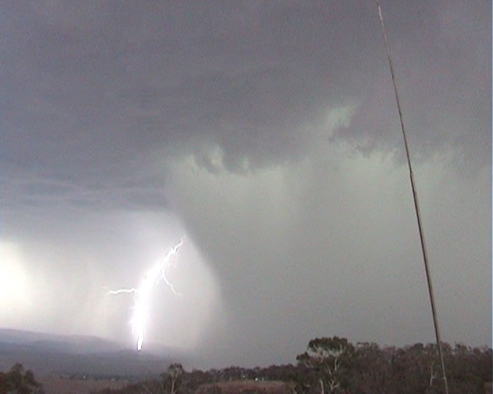
After getting a fright from a CG which dropped nearby we
decided to shelter in the car. It was only a short time after this that we observed the
rapid development of an intense rain shaft. The lightning activity was also
picking up considerably and outflow from the storm was creating a spectacular
pink tinged gust-front. The storm then before our eyes proceeded to let loose a
massive wet microburst. The rain quickly spread out a large distance from the
storm and eventually we ended up receiving a fine spray of water on our
windscreen. Winds gusting to 65 kts were apparently reported from
Bathurst and when we core-punched the remains of the storm later on we observed
a number of willow trees which had been severely damaged. The lightning display from this storm was second to none
with Jeff and I being left in sheer awe by natures awesome power. The contrast
in colours from this storm were fantastic ranging from an olive green in the
main rain shaft to a pink tinge in the cloud along the outflow. This storm also
created widespread flash-flooding in the Bathurst area with 57 mm being recorded
at the airport. Steering winds on this day were only around 10 kts hence
the storms that developed moved along at a snails pace and were ideal for
producing flash-flooding. The storms were so slow moving in fact that we were
able to come back an hour or so later and the storm was almost in the exact same
position we had left it in. Moisture was abundant throughout all levels of the
atmosphere hence the development of hail was hindered. Brief small hail however
was observed from the storm in Bathurst and I cannot discount the probability of
larger hail falling during the period when the storm was at its most intense.
The category of storm that I observed at Bathurst would most closely fit that of
a severe multi-cell.


Document: 200302-02.htm
Updated: 22nd April, 2003
[Australian Severe Weather index]
[Copyright Notice]
[Email Contacts]
[Search This Site]