and Chasing
[Index][Archives]
Supercell with Giant Hail - Northern Rivers Storm Chase: Saturday 25th of October 2003
by Michael Bath and Dave Ellem
| Storm News and Chasing [Index][Archives] |
Supercell with Giant Hail - Northern Rivers Storm Chase: Saturday 25th of October 2003 by Michael Bath and Dave Ellem |
Today's setup was similar to yesterday with shear only light to moderate in strength, but exhibiting some reasonable turning in the lower levels: 925hPa - N 15kts, 850 NW18, 700 W25, then mainly W or WSW at 30 or 40 kts up to 300. Storms were generally expected to head slowly eastward with stronger cells ENE. The main difference today was the cap, yesterday it had been virtually non-existent with storms and cloud developing too quickly, but overnight some mid-level level warming had occurred. I expected storms to form later in the day but was pretty certain they would given the instability indices: CAPE around 2500 and LI around -7 for the western parts of the Northern Rivers region.
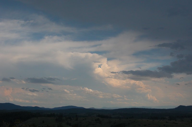
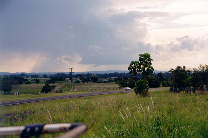
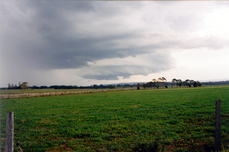
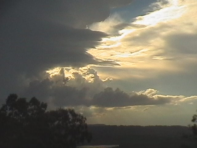
During the entire morning period only some small cumulus developed, there was not even the hint of any congestus. Despite this, I headed off on chase just after 1pm, picking up Dave Ellem from Wollongbar then we met Rodney Wallbridge at Goonellabah. The sky still lacked anything much of interest apart from some storms about 200km to the south near Coffs Harbour and Dorrigo, and some congesting cumulus to the far SW - somewhere between Grafton and Glen Innes.
Heading west towards Casino some reasonable looking
cumulus were observed along the eastern part of the ranges. A couple of these
grew a little taller with one in particular taking on a thick turkey tower
appearance. It persisted and was in a direction consistent with the initial
target area of the Mallanganee lookout on the Richmond Range 40km W of Casino.
As we headed further west everything started to look junky and weak. I was
feeling apprehensive about heading west as some much stronger looking cells
were somewhere west of Grafton and also south of there. We headed back to
Casino to stop and get a feel for what was going on and likely to develop.
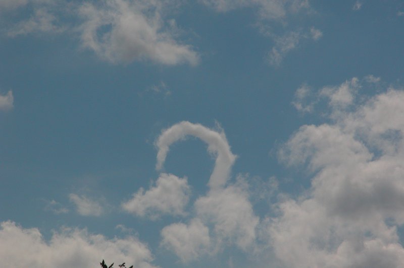
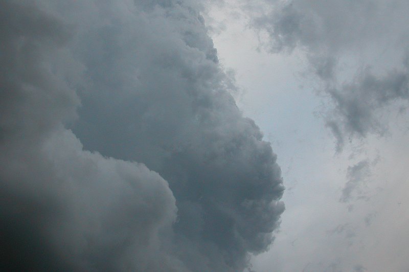
Whilst waiting we observed quite a rare cloud formation - a horseshoe vortex.
Maybe a sign our luck for the afternoon was about to change!
After a short while it was agreed to head west to the original target area
once more. It was just too far to head south to the cells there, and some
promising new convection had formed in a similar location to the earlier turkey
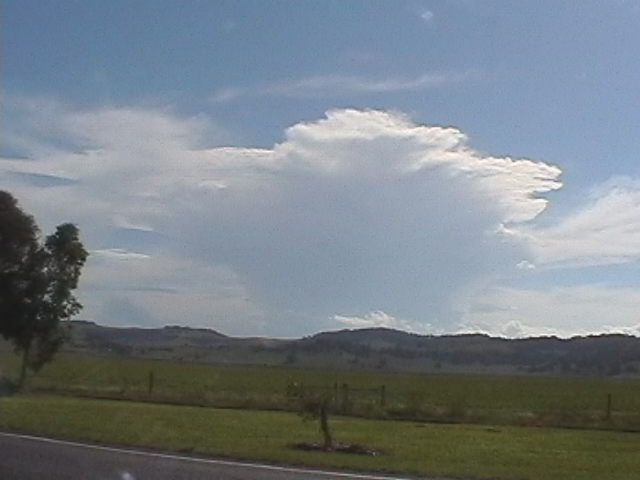
tower. It was a good decision as it was soon obvious this cell was really
starting to get going. We could not see much of the base during the drive
west, but the storm was pushing up crisp solid towers on its NW flank. It
soon begun to anvil towards the ESE while thick well contrasted features occurred
on the north and northwest of the cell.
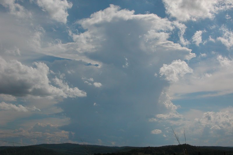

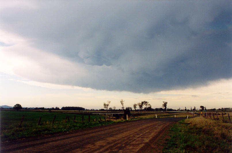
It was very exciting to watch this storm evolve from nothing into a strong
looking storm, especially knowing that it was likely to be very close to the
Bruxner Highway allowing for great intercept possibilities. By 3.15pm we were
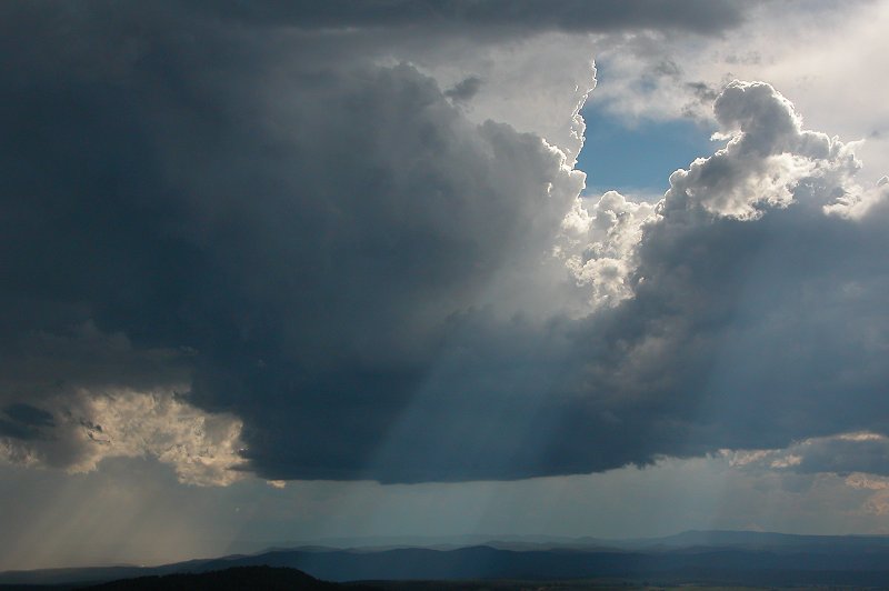
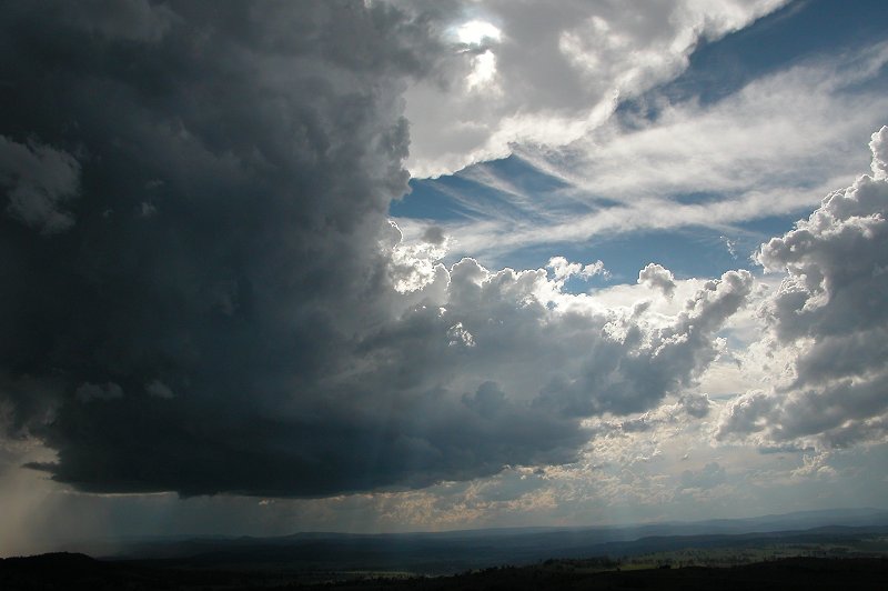
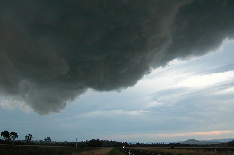
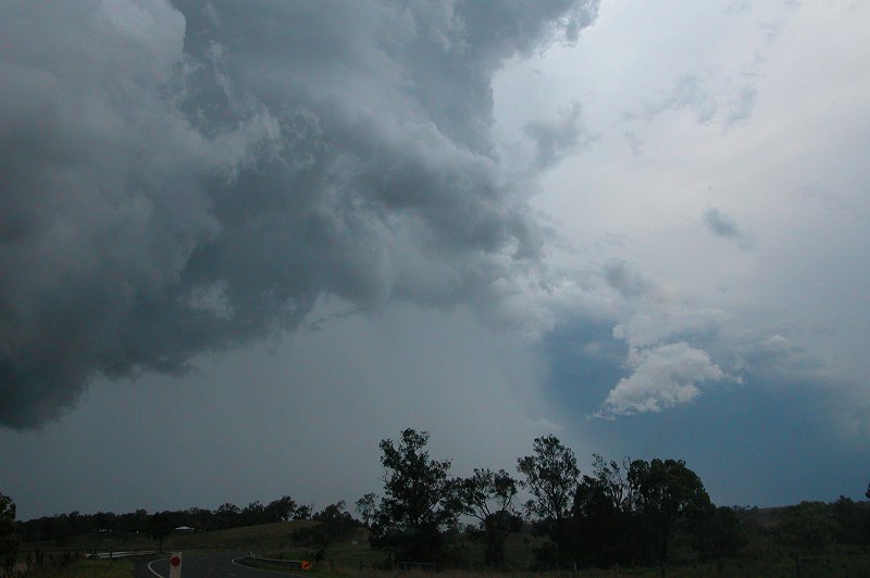
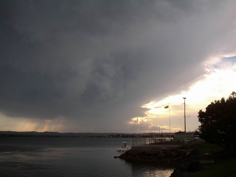
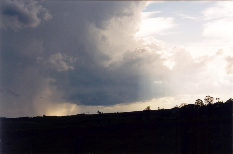
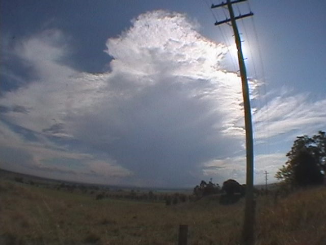
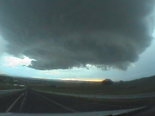
parked at the top of the Richmond Range overlooking the valleys to the west,
and in awe at the beautiful storm cell about 15km to the WSW. As soon as we
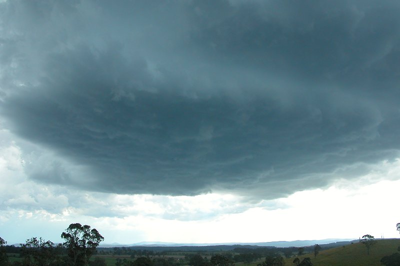
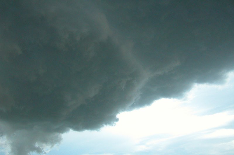
saw the base it was clear the storm was becoming highly organised with a very
good separation of inflow from outflow. The rain free base on the northern
side of the storm was large, rippled, and growing fast with subsequent updrafts
visible shooting up the NW flank. There was a nice gap then a little precipitation
falling S and SE of the inflow area. The thick anvil was slowly spreading
towards the ESE.

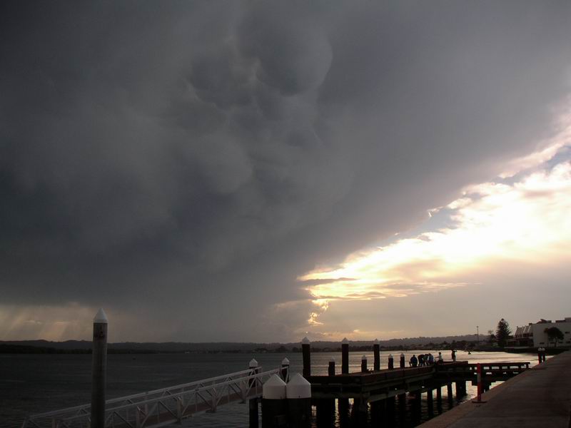
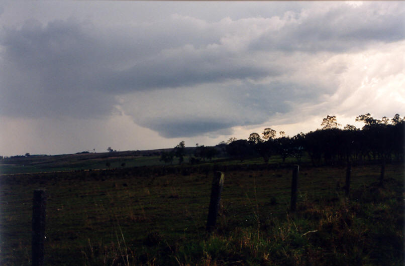
Northeast winds were feeding quite strongly into the updraft, picking up in
strength occasionally, presumably as each new tower formed. The rain free
area grew in size horizontally over the time we observed it, but the storm
was barely moving. There was regular thunder coming from in cloud and anvil
lightning, but not a lot of CGs. It was not clear if any rotation was occurring
at this stage, but it was definitely looking more and more like the features
expected from a developing supercell.


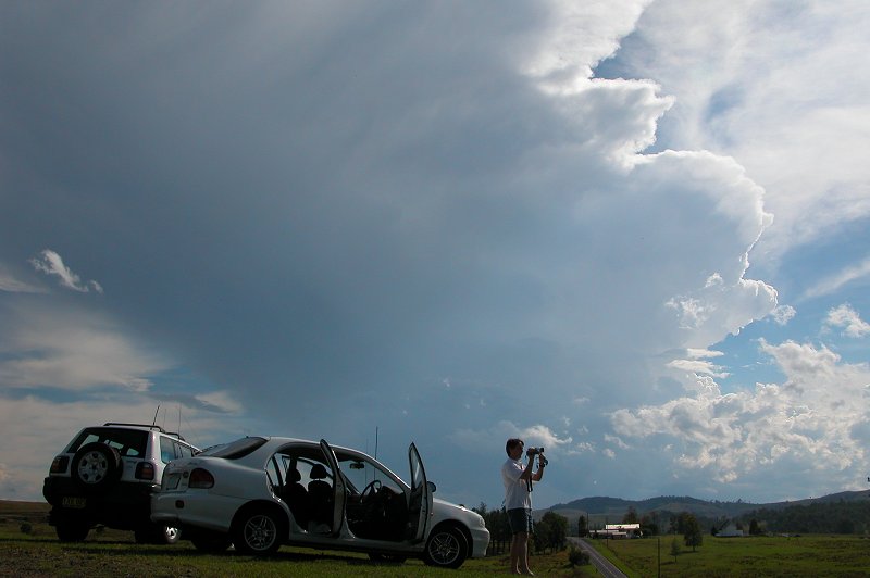
We watched the storm for about 30 minutes from the Mallanganee lookout before
deciding it was getting a little too close. The lookout has several communication
towers on it and some CGs were occurring fairly close by. Rodney did not want
to get any hail on his new car, but Dave and I decided we wanted to see what
was going on closer to the RFB. Rodney headed north along the Richmond Range
into the national park hoping to then head east to Kyogle later on. Dave and
I drove westward down into the valley, then up a side road off the Bruxner
Highway about 5km west of where we had been previously.

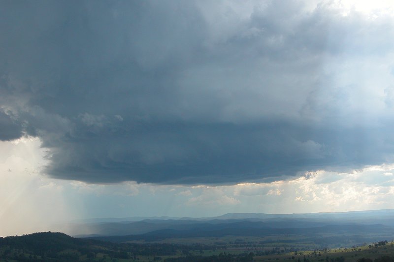
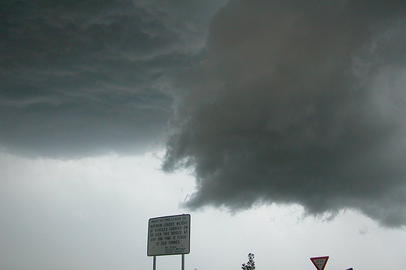
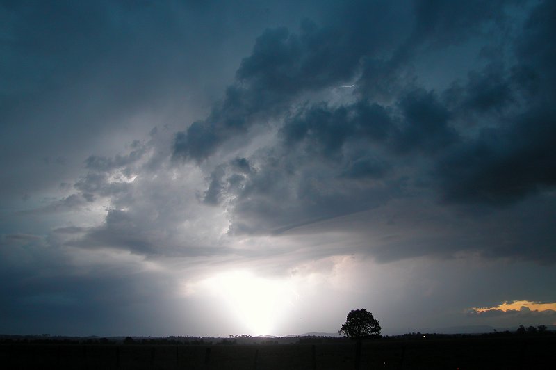
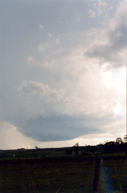
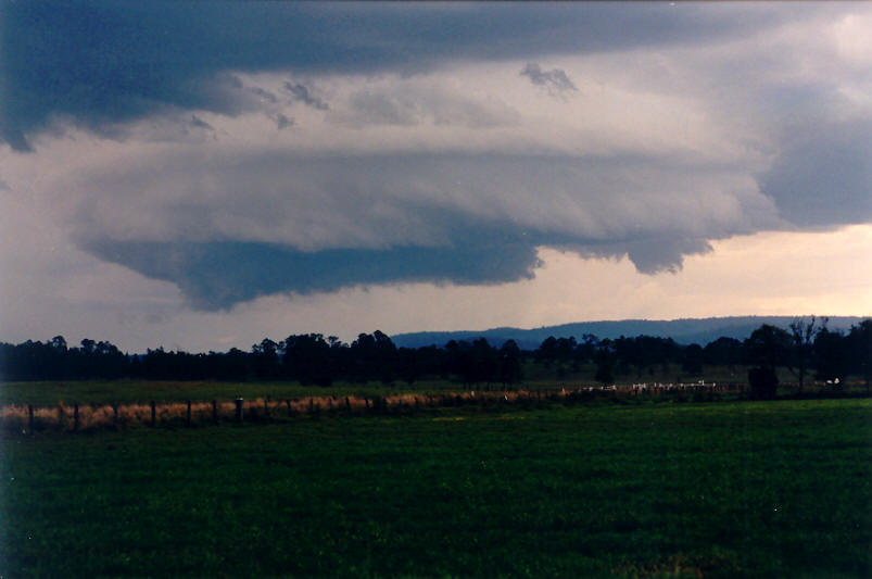
We were right under the eastward edge of the RFB, which was looking more and
more like a meso. The storm was moving slowly towards the NE. It looked like
the precipitation was a few km to our SW, however things changed quite dramatically
just before 4pm: smash ! - a large hail stone shattered onto the road way
in front of us, then another, then several more, and they were big ! It was
a weird feeling, no rain at all, hardly any wind, and chunks of ice smashing
and bouncing all around us. They were well spaced though as it took a while
before one hit the car. This eased off for a few minutes before it returned
with larger stones and more of it. The sound on the car was amazing, along
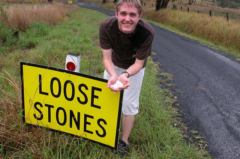
with the excitement of us in it ! Some hail was getting quite large with stones
around the 5 or even 6cm diameter falling, though most was 2 to 3cm. We called
the State Emergency Service and Bureau of Meteorology to report the large
hail, then enjoyed the show as the hail continued. There was very little rain
for about 10 mins, then rain and hail fell for a further 10 minutes after
that. We collected a few hailstones to measure them, the largest found was
4cm.


We decided to head back east and try to get ahead
of the storm and meet it along the Casino to Kyogle road. Normally this would
be impossible, but this storm was moving so slowly we had a good chance. After
crossing the Richmond Range and heading back down the eastern side of the
hills, we drove into the precipitation area once more. Hail soon started and
got bigger and full on for a while. The fields were becoming white from the
quantity of hail falling, some of which was again golf ball sized. Hail event
number two, we almost couldn't believe it. The hail eased off by about Mummulgum,
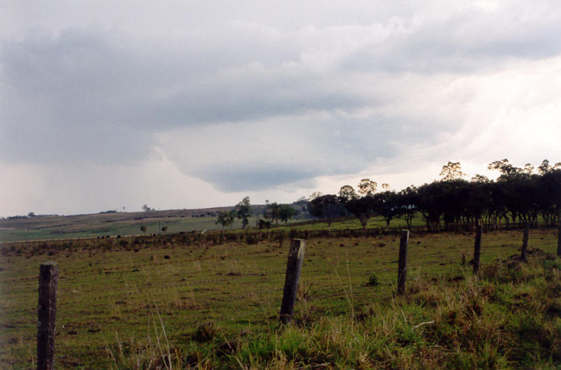
but the outflow rain persisted on the drive back to Casino. During the drive
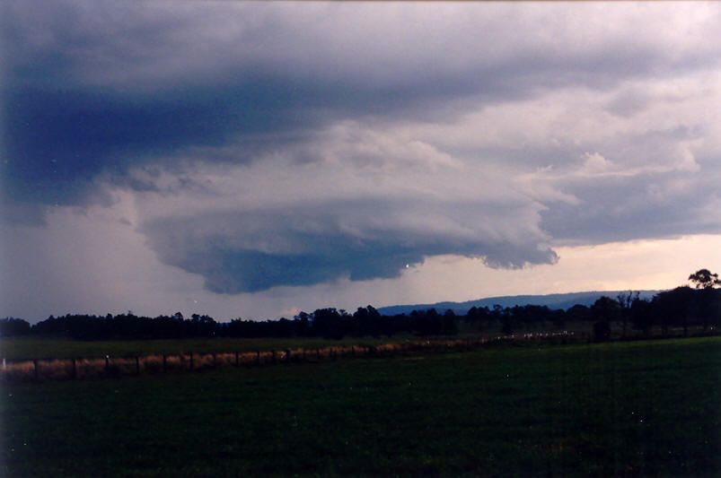
we could just make out the rain free area on the northern side of the storm.
It still looked very strong.
We drove through Casino then headed north on the Kyogle
road. The stupid train level crossing lights were on so we had to stop and
wait, and wait ... but no train. Dave got out to check the tracks and could
see no train so we drove through. Soon afterwards we again encountered heavy
precipitation, then hail again ! It was small at first but as we continued
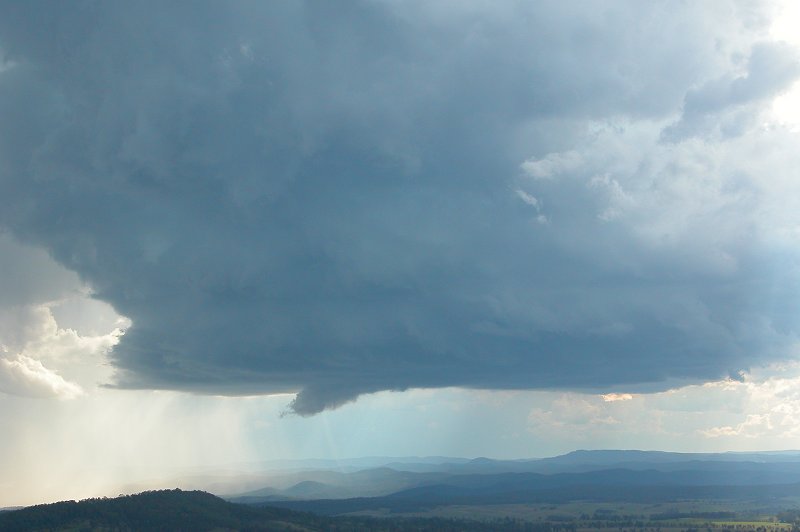
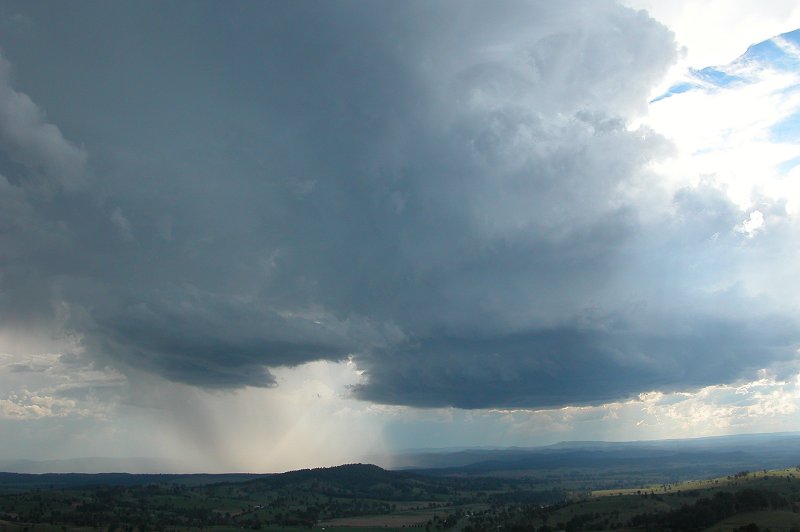
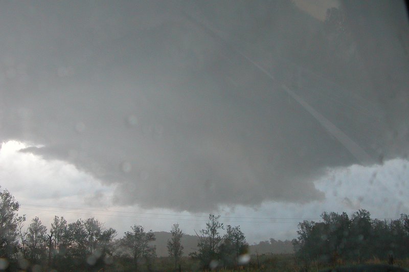
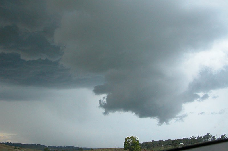
northwards it got large. We pulled over where we could see the very large
meso structure.
The hail was the most spectacular of the day here, very large stones bouncing
all over the place, smashing into the car, it was just amazing... We shot
north again to try to get on the other side of the storm and watch the advancing
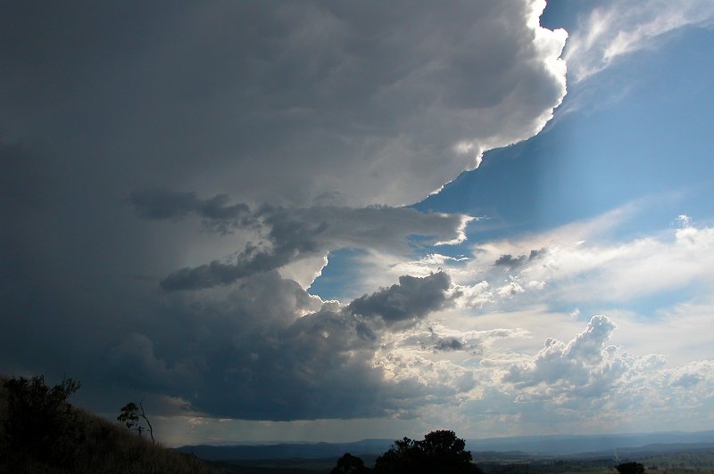
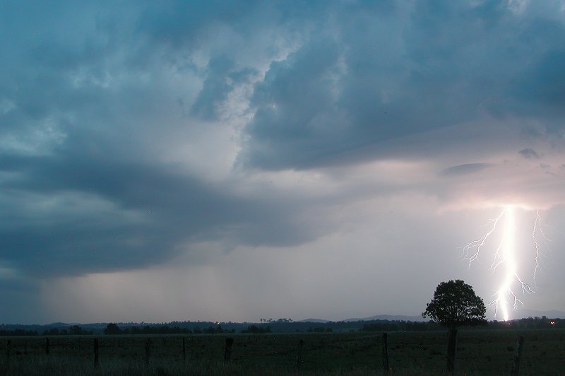
system. It wasn't long before we were in a good position now facing south
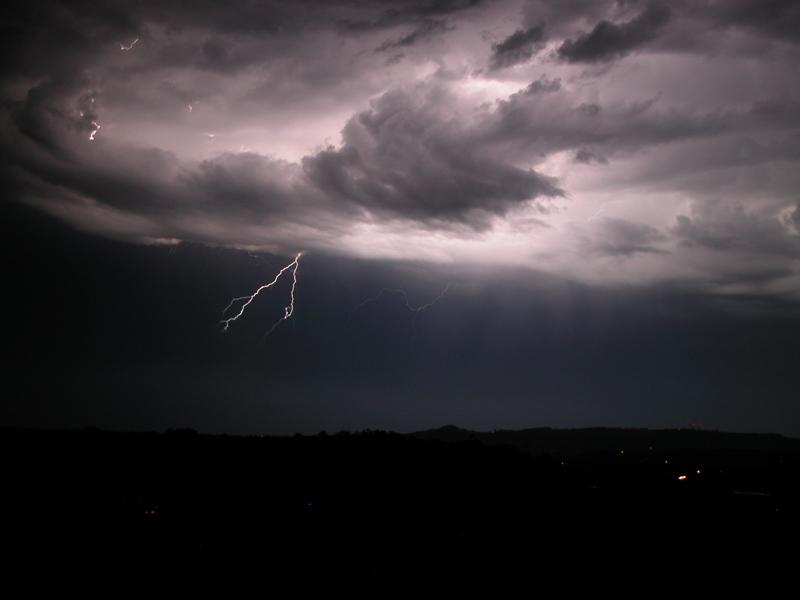
as the storm advanced NE. Base rotation was quite evident here, and a very
obvious hail shaft was just behind it. To the southwest was a new storm with
what looked like a wall cloud, but it was a little too distant to be sure.
Another storm was north of that one, and to our west.
We watched the meso a little longer before deciding
to head back south and see what the next storm would produce. It was now about
5.45pm and we had been under or near this supercell for over 2 hours, and
encountered large hail 3 times from it, but it was now starting to weaken.
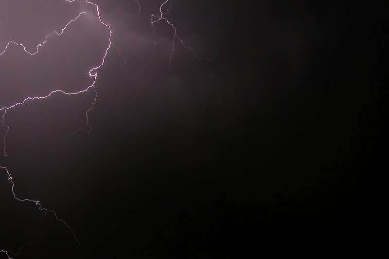
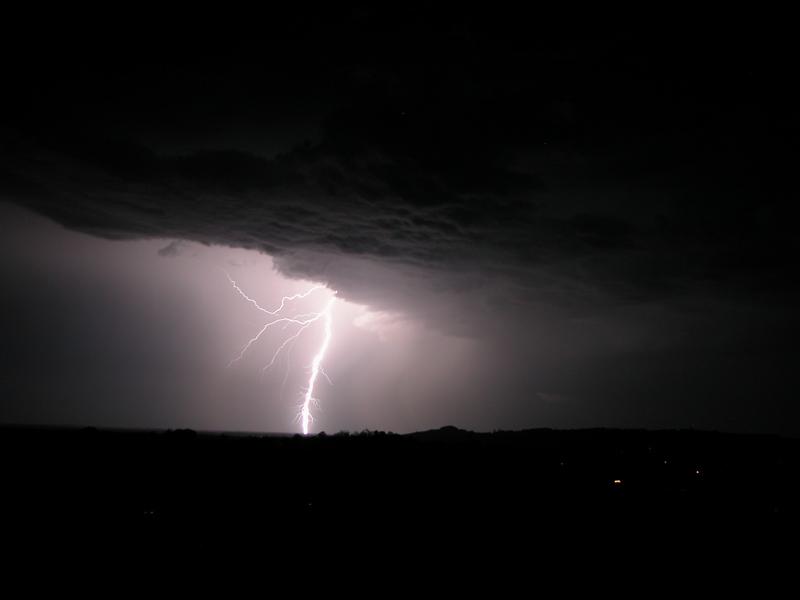
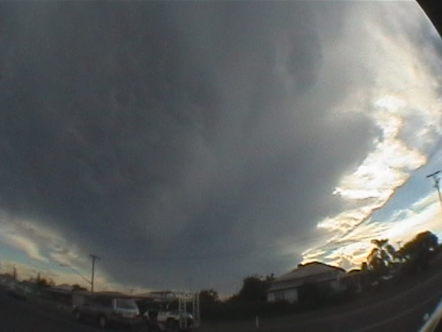
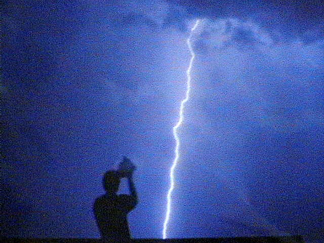
By 6pm we were on a side road NW of Casino watching the next storms move in. Lightning was going berserk to the WSW and WNW from two cells, unlike the previous storm chased which did not have much visible lightning. Rodney called in to say he had captured awesome structure shots of the supercell from the northern side.
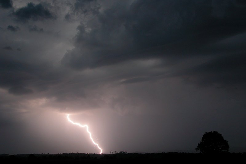
Tripods were set up and it was a matter of waiting for
the CGs to occur. It was an awesome display, with some lightning occurring
very close by. Lightning seemed to be going off in all directions when some
light rain started to fall from the outflow of the cell to the WNW.

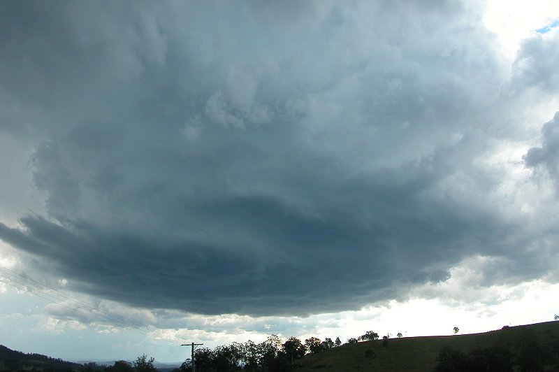
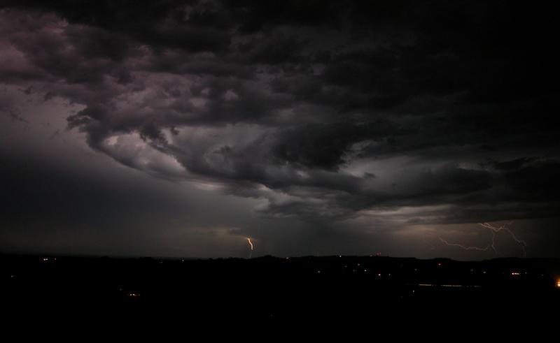
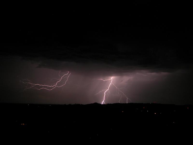
We drove into Casino to get some food, then went back north to about halfway
between Casino and Kyogle to see what this storm would produce. It was fairly
slow moving as well, and this time a shelf cloud feature had developed. It
edged over, the lightning was strobing all around, the sky was going off every
fraction of a second ! The rain started, with some heavier falls in bursts
with the odd bang of hail on the car roof. Then a real torrent fell and hail
got to around 1 to 2cm diameter, but this did not last long.
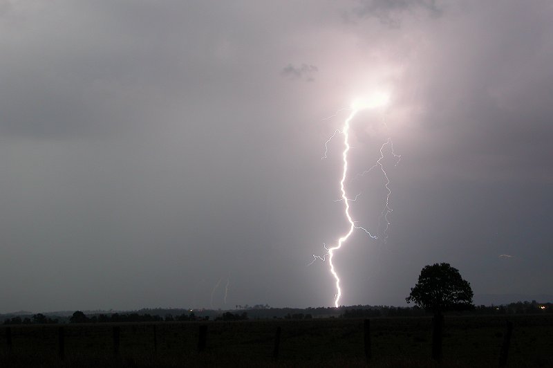
The sky was still electric during the entire drive home
to McLeans Ridges. Storms were firing along the Queensland border so we all
enjoyed the lightning show for a while before calling it quits about 10pm.

Photographs taken from Goonellabah by Ray Mullens:

Photographs taken from Ballina by John Bath:
Photographs taken from near Casino by Scott Hills:


Michael Lloyd from Brisbane also chased in the Casino area and captured these images.


Michael started his chase in Lismore before deciding to head to Casino to watch the developing cell, but then back tracked to Lismore to watch from a lookout. After discovering it had a red core on radar at 3.30pm he headed to Kyogle to meet the storm, eventually moving into the hail shaft before quickly retreating to the NW flank of the supercell to watch the mesocyclone area. The hail shaft moved over again and gave larger hail this time, so he raced to Kyogle before heading back to Brisbane, enjoying the lightning display on the way!
Video footage taken from the Richmond Range by Rodney Wallbridge:
 Timelapse sequence of meso ending at 4.26pm (high quality) [3.21mb]
Timelapse sequence of meso ending at 4.26pm (lower quality) [661kb]
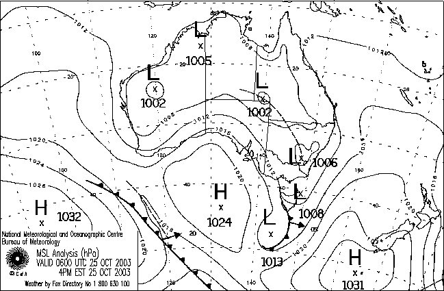
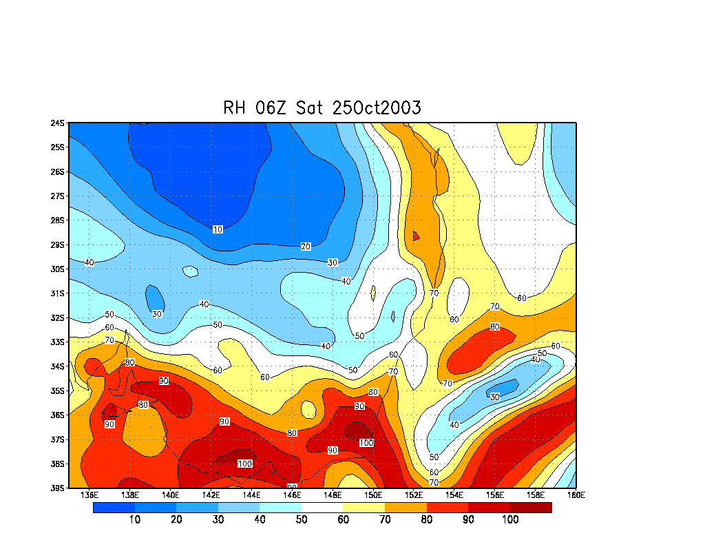
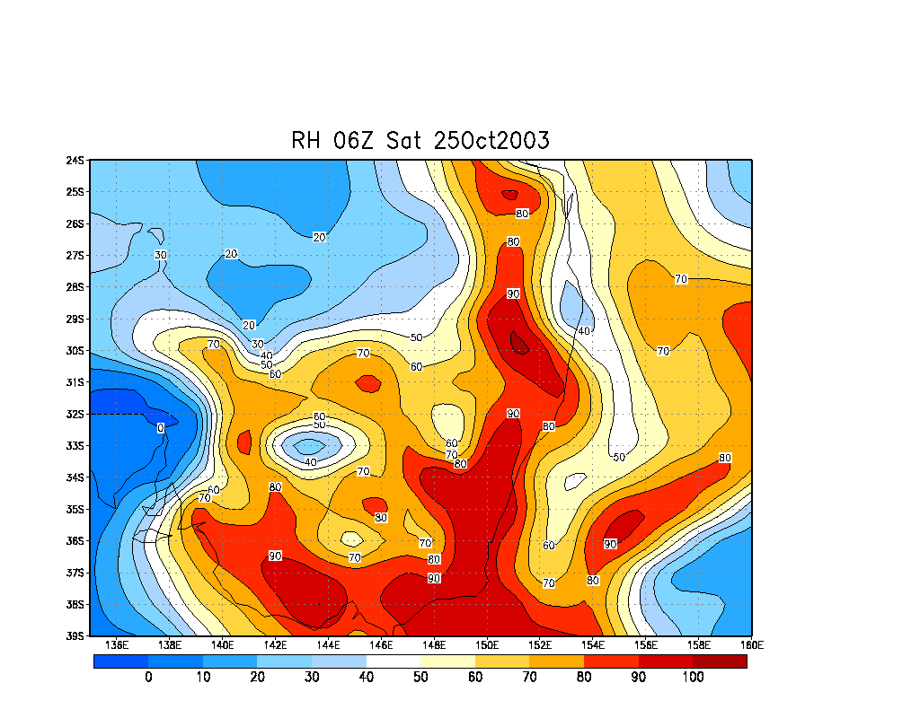
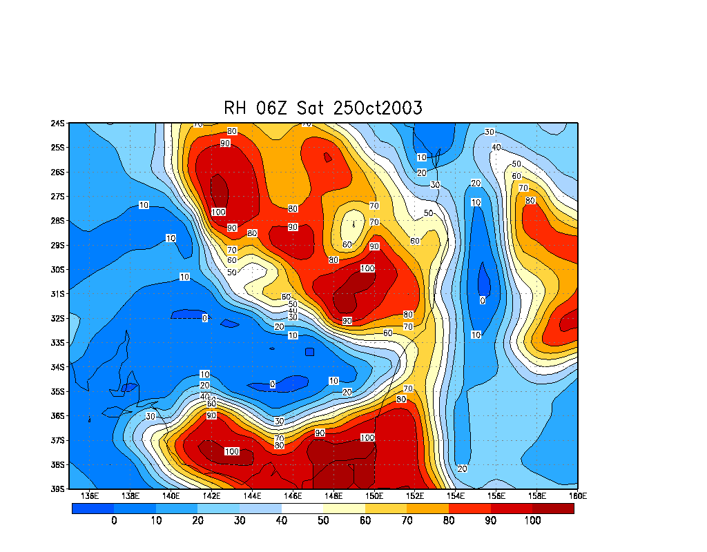
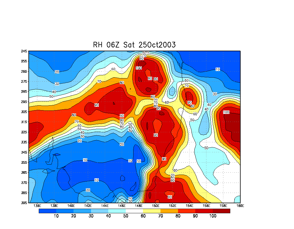
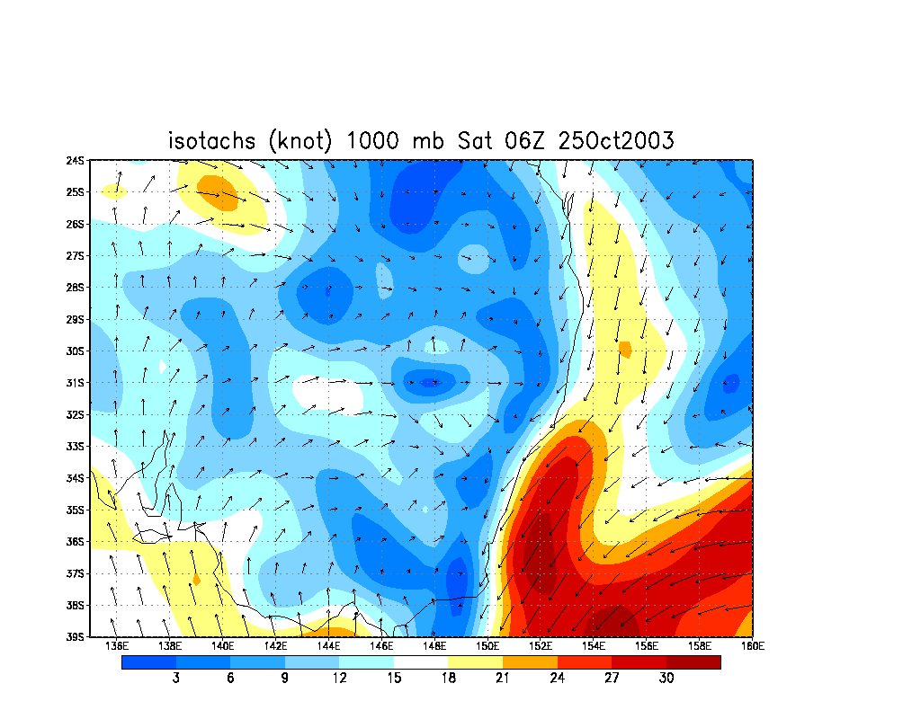
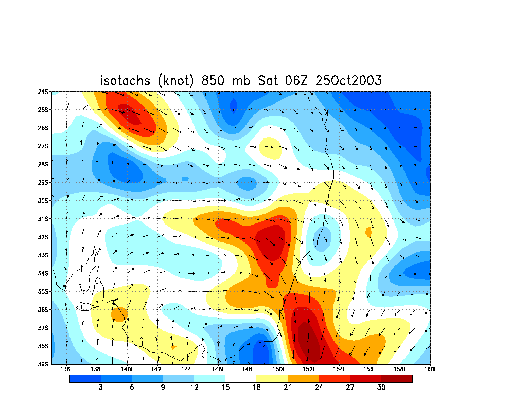
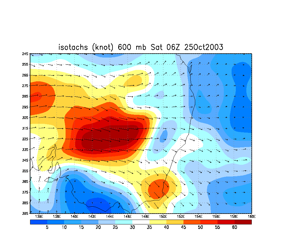
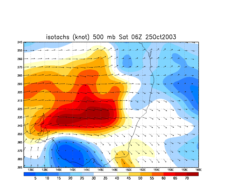
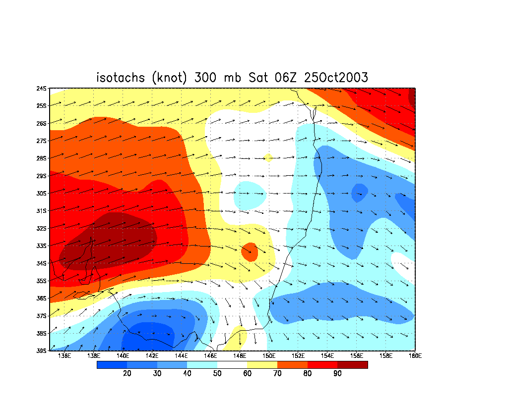
From Bureau of Meteorology.
From Bureau of Meteorology.
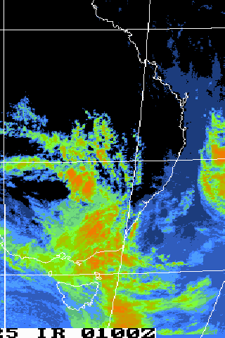
Images are at 06 to 10z (4pm to 8pm local)
01z to 12z animation
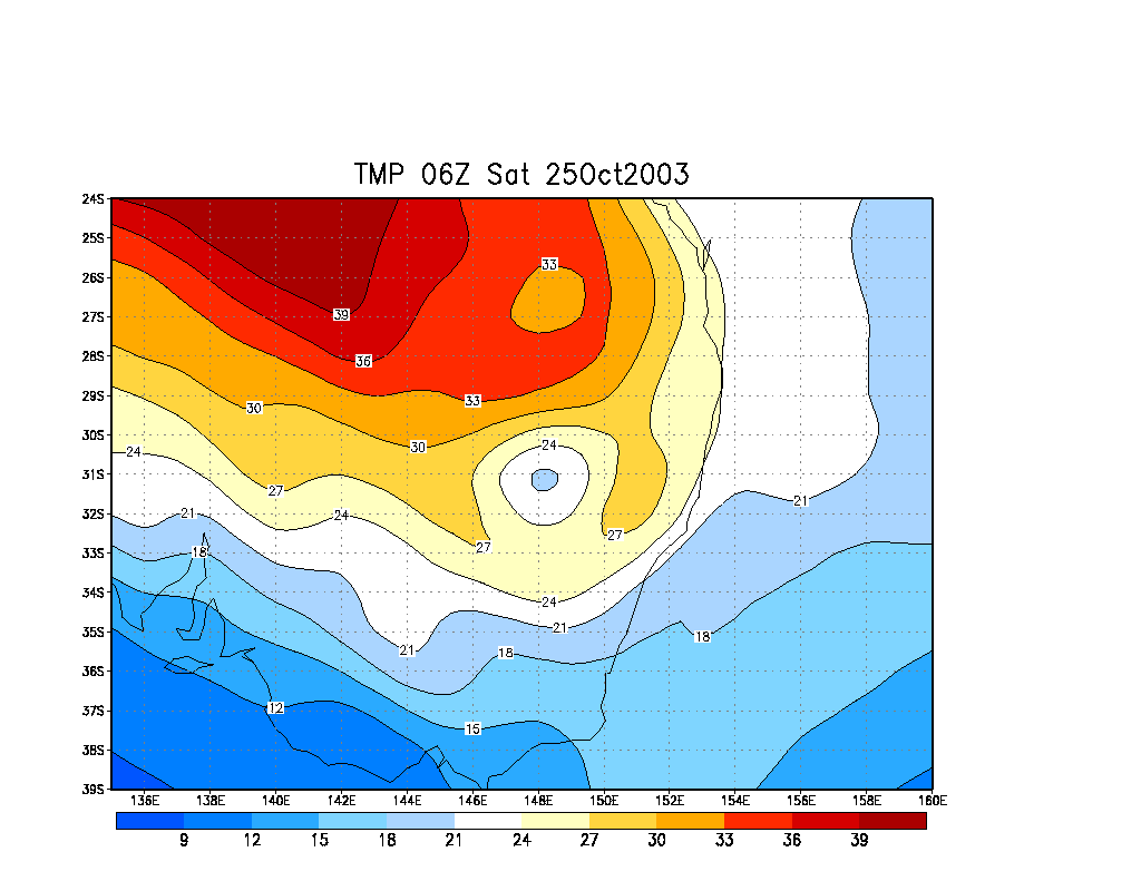
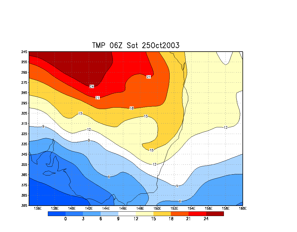
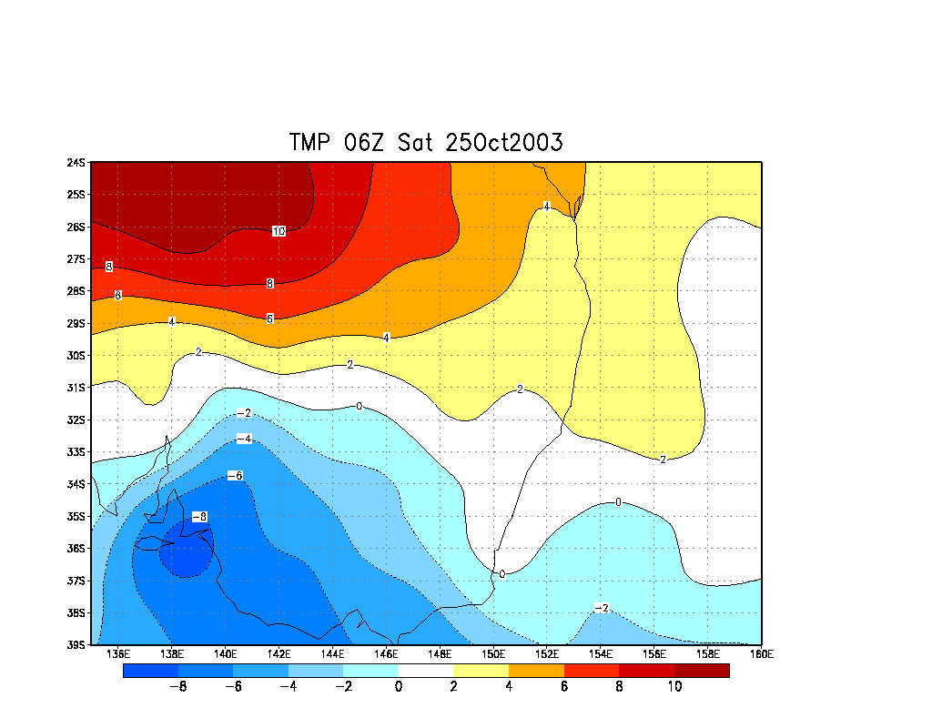
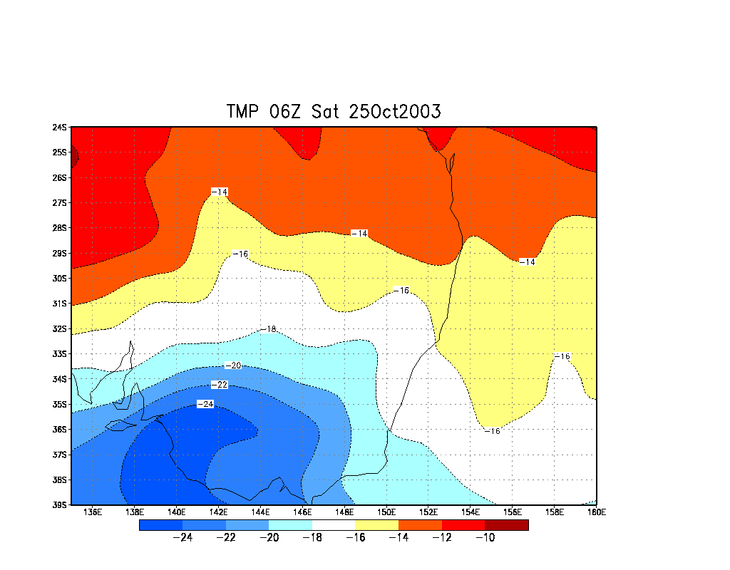
From Bureau of Meteorology.
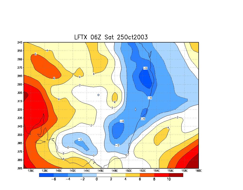
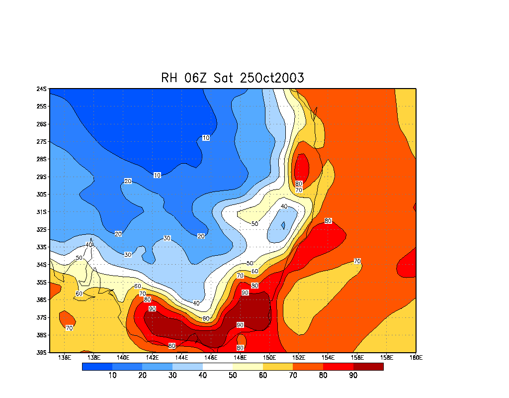
From NOAA 25/10/2003 06z analysis run
|
Document: 200310-06.htm
Updated: 5th January 2006 |
[Australian Severe Weather index] [Copyright Notice] [Email Contacts] [Search This Site] |