and Chasing
[Index][Archives]
Mallanganee Supercell Storm Chase: Friday 6th January 2006
Report compiled by Michael Bath and Rodney Wallbridge
| Storm News and Chasing [Index][Archives] |
Mallanganee Supercell Storm Chase: Friday 6th January 2006 Report compiled by Michael Bath and Rodney Wallbridge |
The sky on this day was cluttered with variable winds in the Northern Rivers of NSW. Temperatures got into the low 30s and humidity was very high and followed heavy falls of rain from a series of thunderstorms the previous night. Interestingly, the winds turned fresh NNE mid afternoon.
I was occasionally checking radar noting storms on the eastern Northern Tablelands heading NE. After 4pm cells became better organised and started to move NNE. I headed off on chase and picked up Rodney from Lismore. A storm was likely to get to about the Mallanganee area in about an hour, which is about the same time it takes to drive there.
We could see some back end structure of an earlier supercell over Bonalbo, and west of Casino caught a few glimpses of the main updrafts of the storm that had originally formed near Glen Innes, tracked NE, then turned NNE west of Jackadgery about 4pm. The updrafts were pushing very high - perhaps 15km - and were strong and vertical in appearance. That was the last we saw of it!
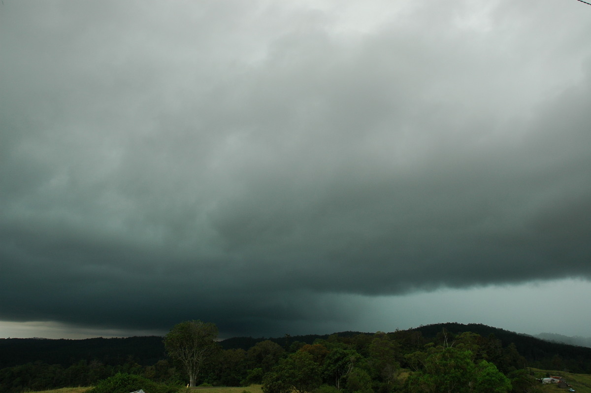
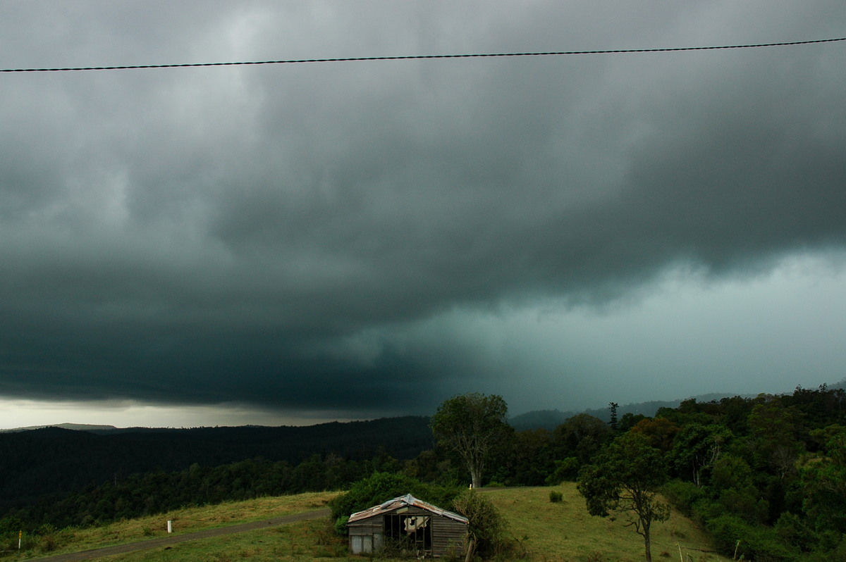
We kept heading west and arrived at the Mallanganee lookout just before 6pm. A lot of low cloud seemed to develop all around us just before we got there. Parts of the supercell base were observed to the SE and S. Lightning was occurring in the rain area but no bolts were visible to us at this stage. There was also a constant background rumble from updraft thunder. Despite not being able to see much of the structure, it was very ominous in appearance. Base rotation became evident on the western flank.
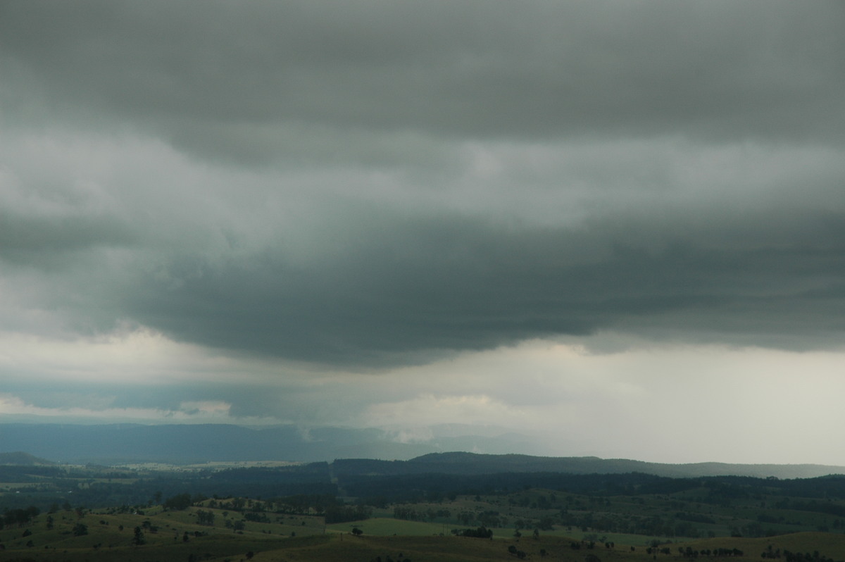
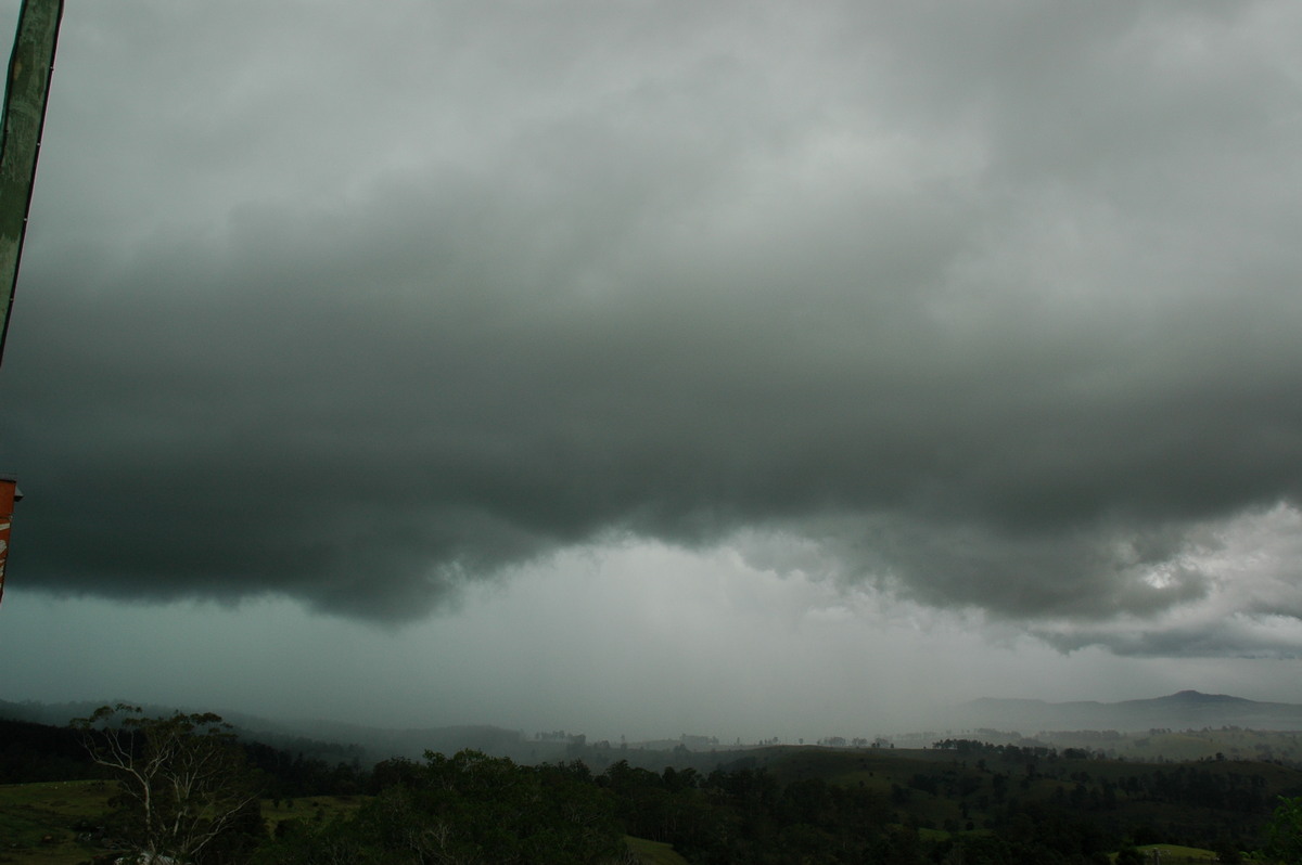
The storm was about to hit our location and lightning was getting too close for comfort. We headed back NE towards Mummulgum, expecting some hail, though at this stage were not aware of the intensity of this storm.
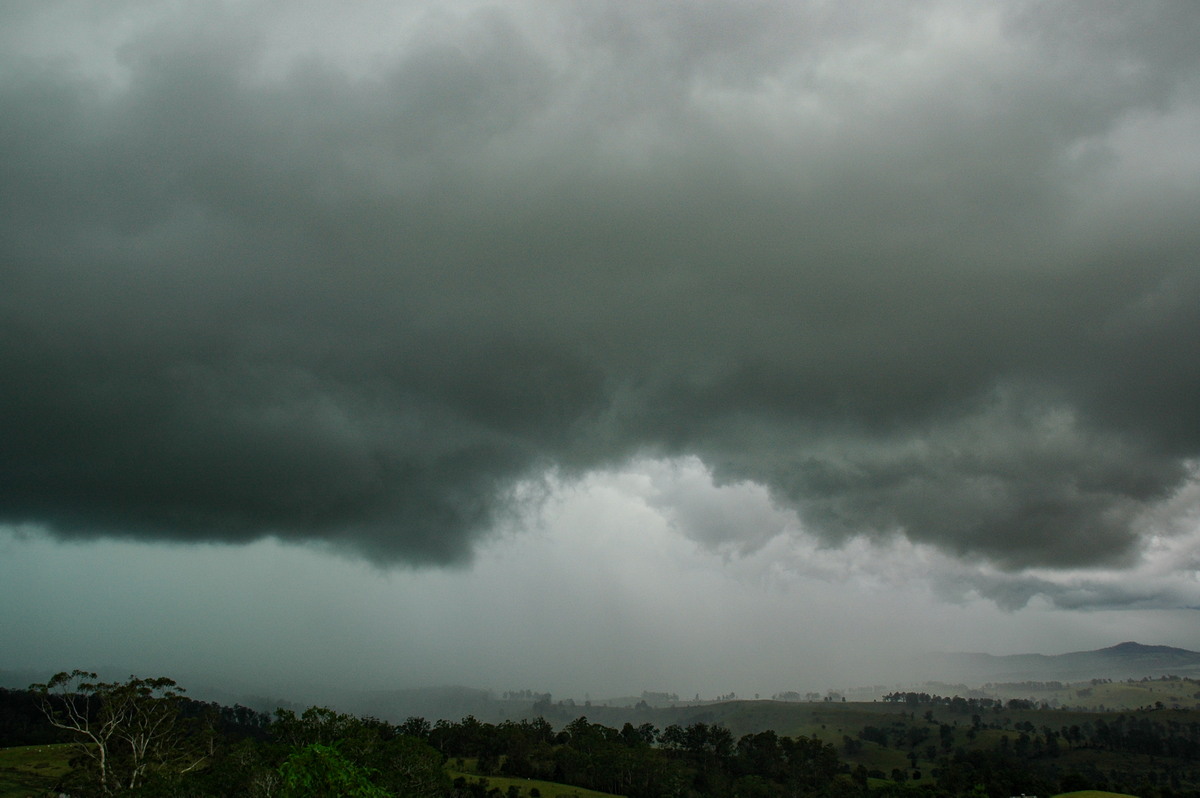
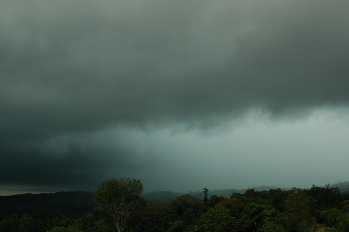
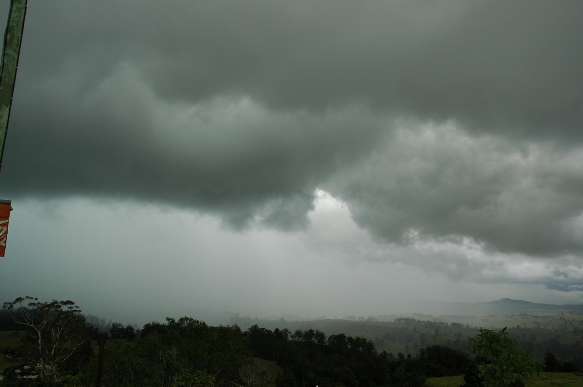
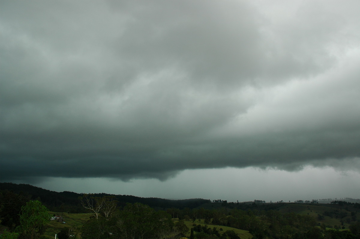
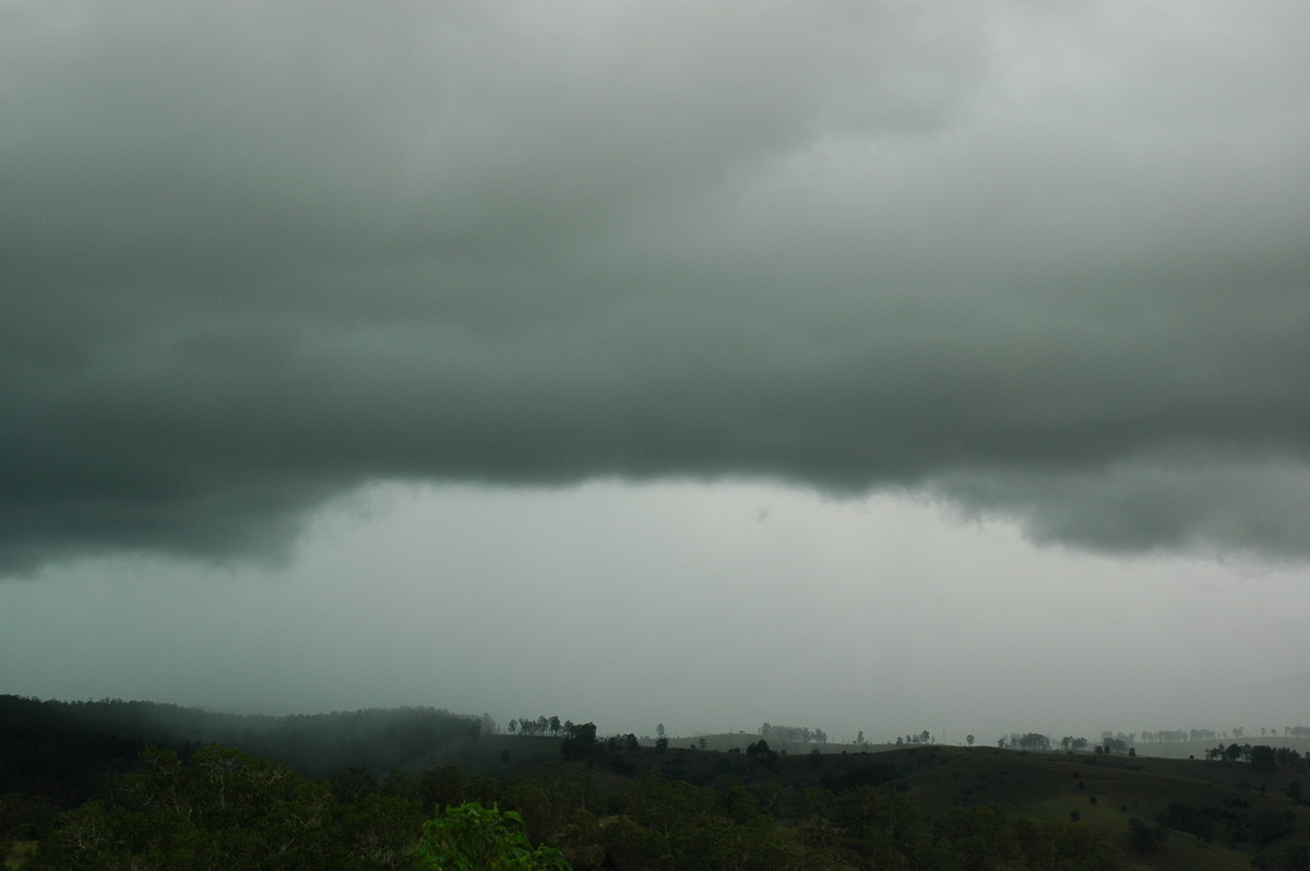
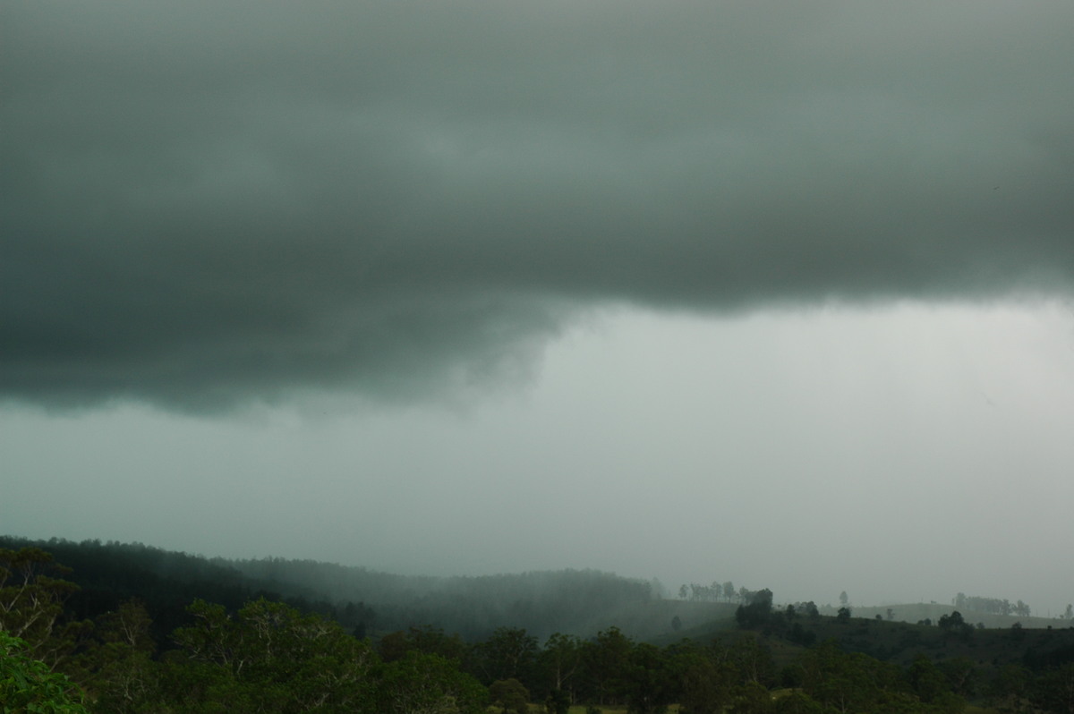
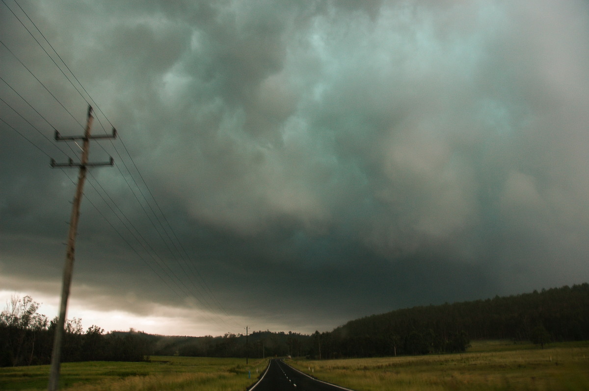
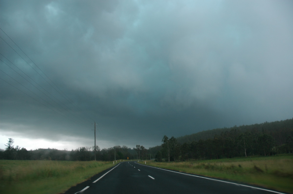
We passed in and out of intense showers and gusty winds. However the lightning was going crazy - intense pulsing CGs coming out of low clouds all around us. The timing of our move allowed us to parallel the storm's intense core without being hit by the worst weather.
The green tinge in the boiling clouds gave an indication of what was going on, but we only found out later that hail the size of cricket balls (8cm) were falling, smashing roofs and cars at Hogarth Range, just beyond the hills in these photos.

These photos of the hail at Hogarth Range were taken by Steve Fortser.


These photos were taken looking west towards the Hogarth Range by Vicki Joy.


We continued east and encountered some extreme rainfall rates and brief hail falls to about 2.5cm diameter at Piora - 10ks WNW of Casino.
We waited just west of Casino as more storms had formed in a line and were moving towards the same area. Light rain persisted and hardly any storm features could be identified in any direction. However, CG lightning was still occurring, particularly to the SW. A radar update on the laptop was not very helpful as it indicated activity was weakening into large rain areas.
It was time for some food so we took a break in Casino. The decision was made to call it quits and head into the movies in Lismore and see King Kong (which had already been postponed by storms on Tuesday). However, by the time we got to the eastern side of Casino, intense CGs were flashing off behind us ! The local rain had really obscured what was going on.
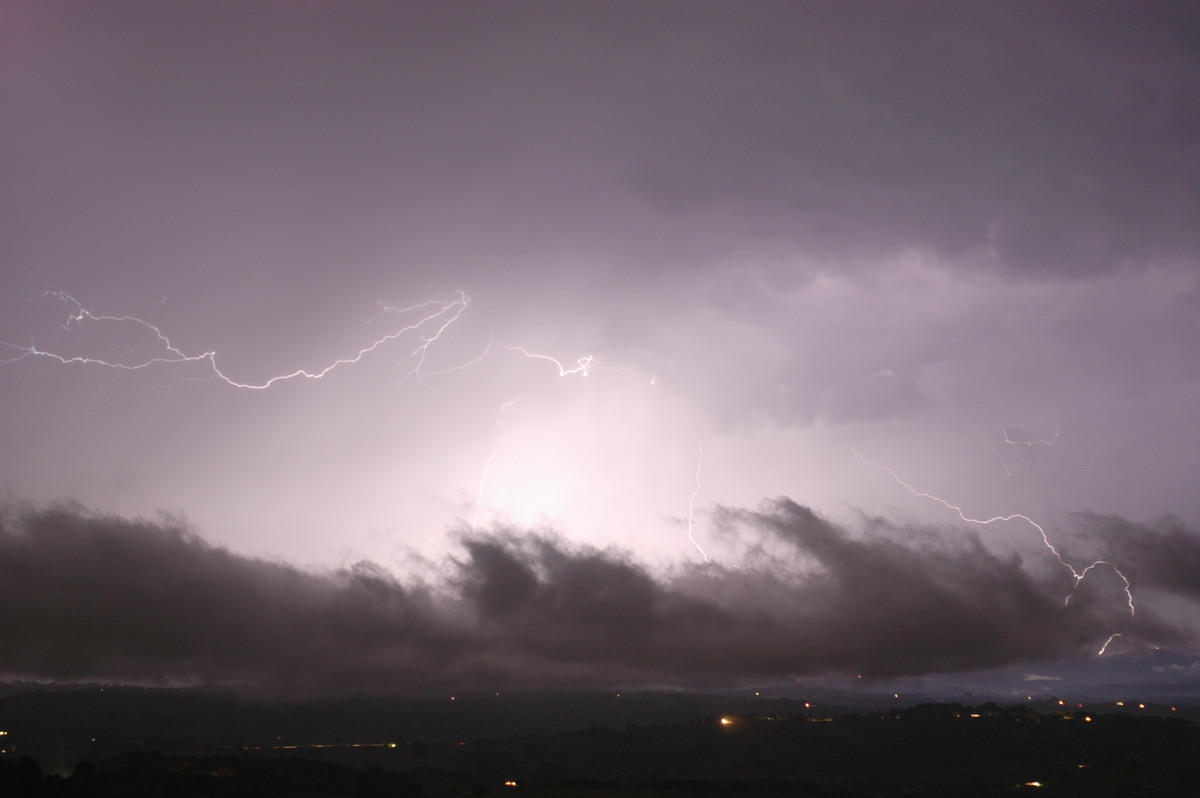
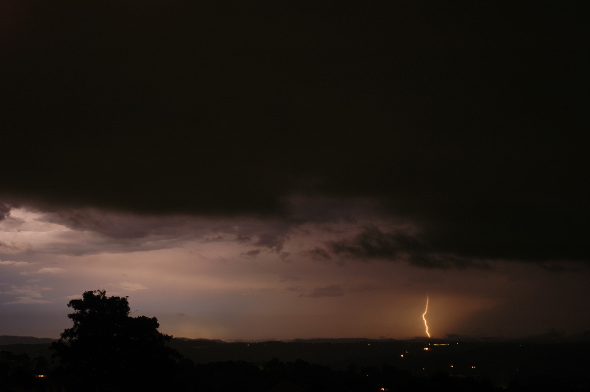
We turned around and we treated to continuous CG lightning. Extremely heavy rain hit. There was no time to find a good spot so just pulled in at the industrial estate away from trees. Flang after flang hit and then the winds became really intense! It was pretty obvious this storm was going to be causing damage. It eventually eased so we moved to under a service station awning to try and get some lightning photos. A large tree was smashed across the Bruxner Highway at this location. Most of Casino had been blacked out except the eastern fringe where we were.


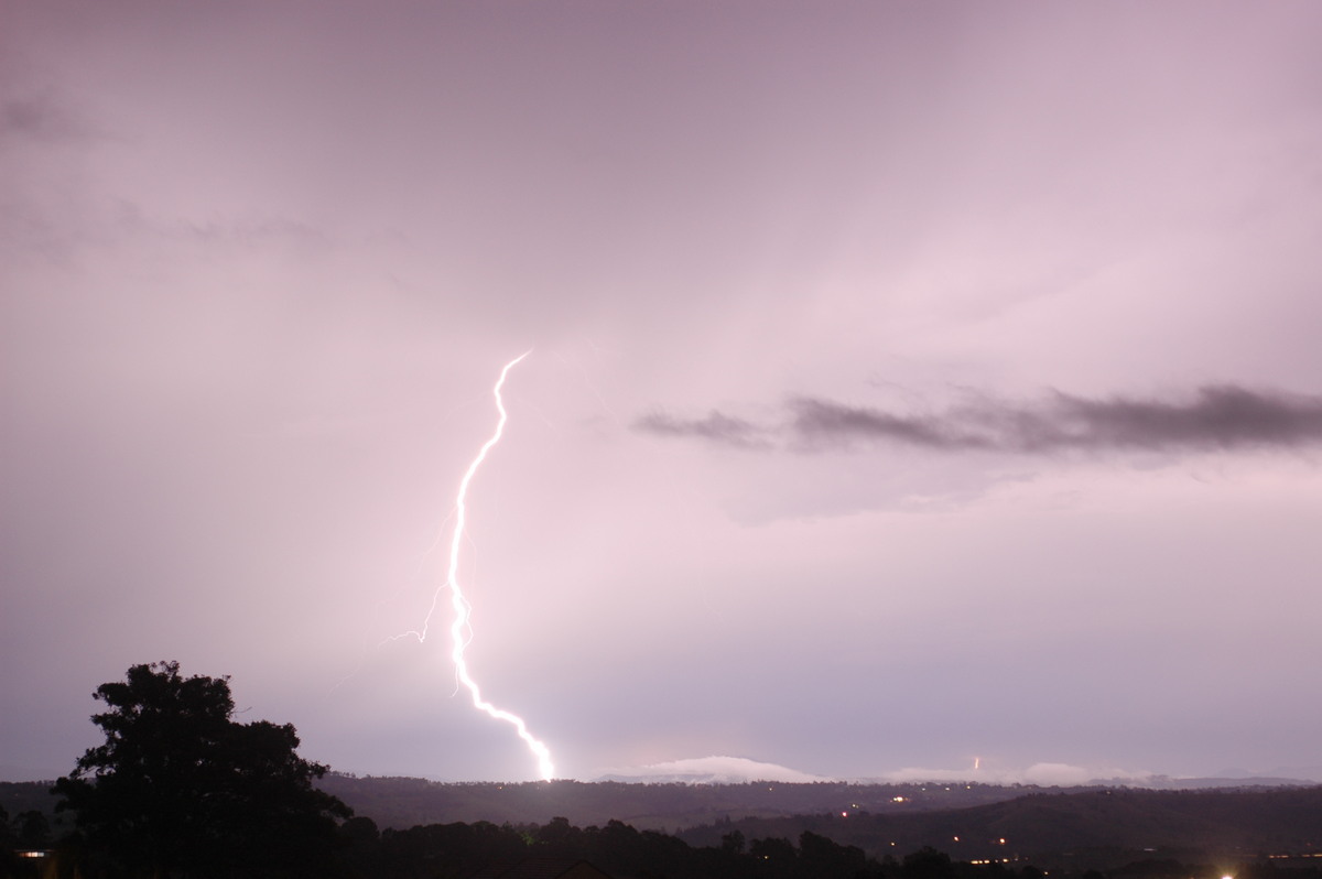
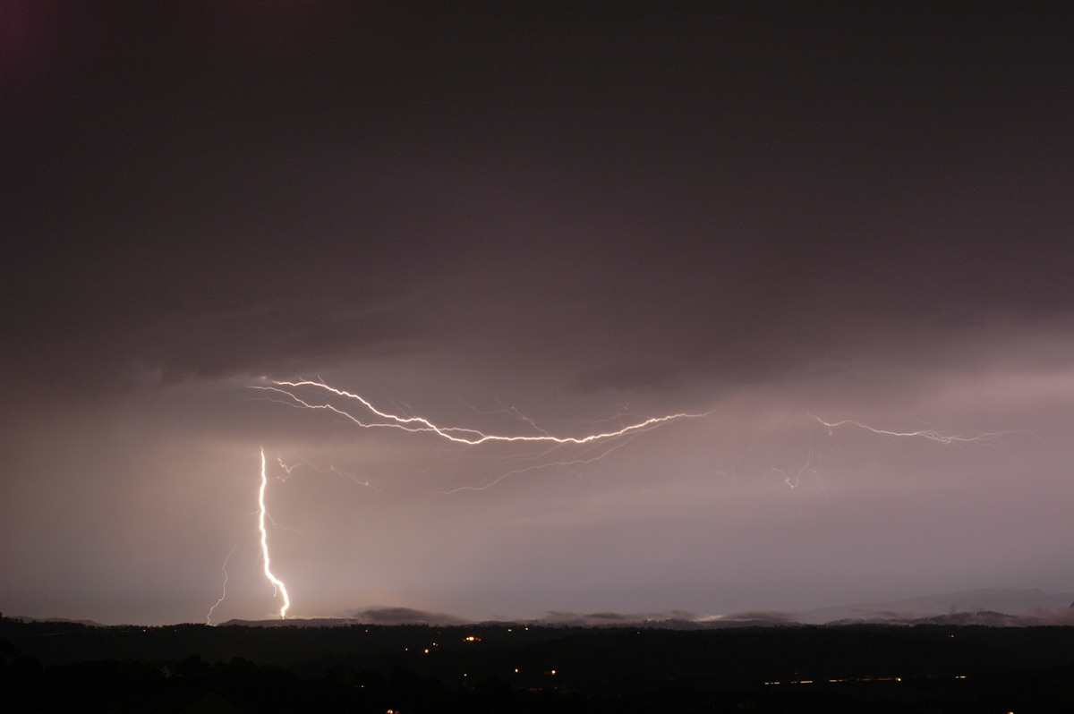
Rain persisted with windy conditions so photography was difficult, but still got a couple of shots.
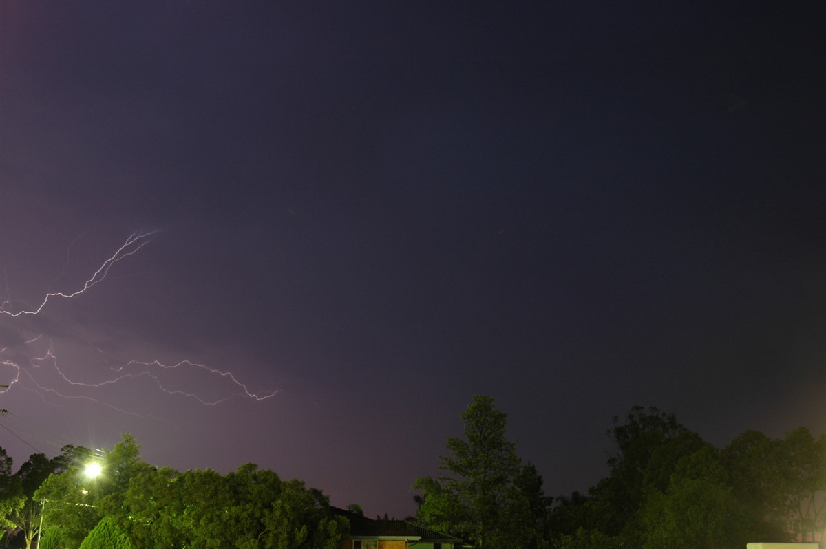
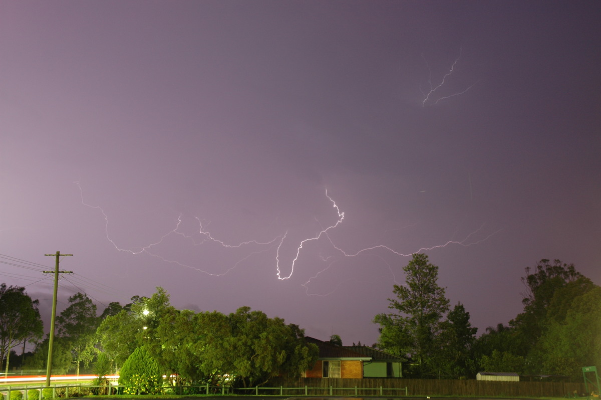
I dropped Rodney off at his home, then set the camera up at my place at McLeans Ridges as some lightning persisted to the north.
Harald Richter from the Melbourne BoM reported:
5.30pm
At 06z a likely supercell near Pretty Gully 115 km NNW of Grafton sports 50 dBZ to 16 km, outbidding its southern neighbour who produced 50 dBZ to 14 km earlier (a form of one-upmanship among storms, I suppose). The Pretty Gully storm has a mildly displaced echo on the N flank. WDSS (an experimental radar-based algorithm) prints a hail size of 46 mm onto my screen.
Apart from me being storm-starved, I think the sheer height of the 50 dBZ echoes is impressive with this event. Very tall CAPE fed by deep rich BL moisture seems to be the main driver of this event, but some moderate deep layer shear has presumably created some updraught rotation (judged by storm structure, longevity and anomalous motion).
and at 6.11pm
Impressive supercell over Mallanganee bound for Casino (~40 min) at 7z. 50 dB echo tops remain very high ( > 14 km) and are generously displaced to the N of the cell core. A clear pendant echo has developed on the NW flank at low levels. Hail sizes should be such that clubs can now be exchanged for bats.
From Weatherzone
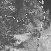
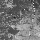
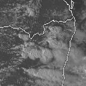
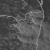 1pm to 6pm local
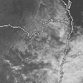
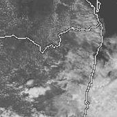
From Bureau of Meteorology
 Brisbane sounding at 11am 06/01 local
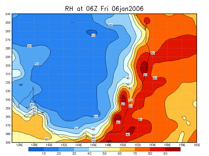
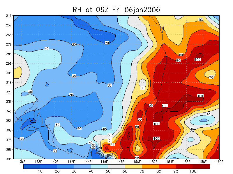
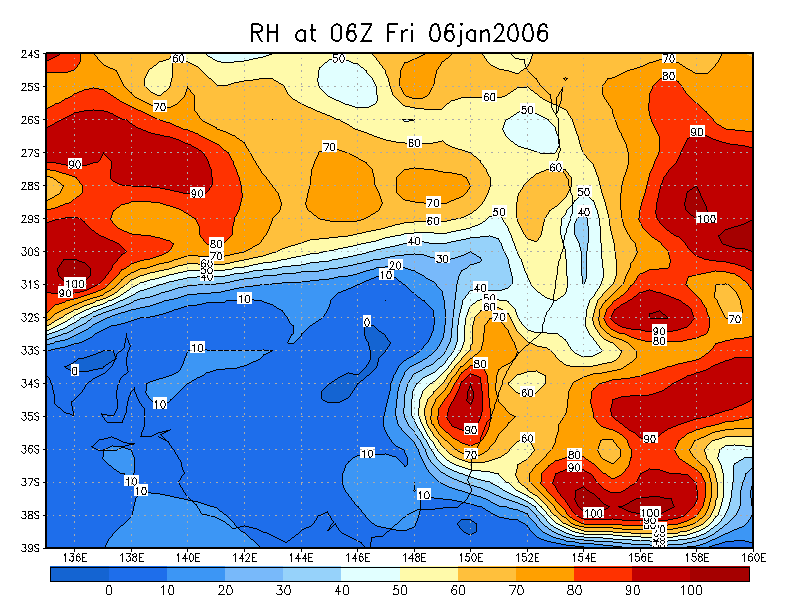
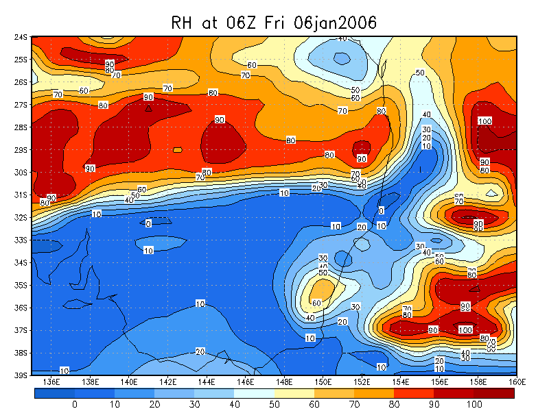
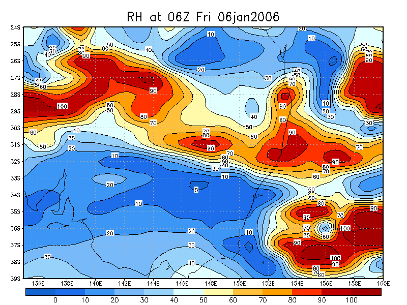
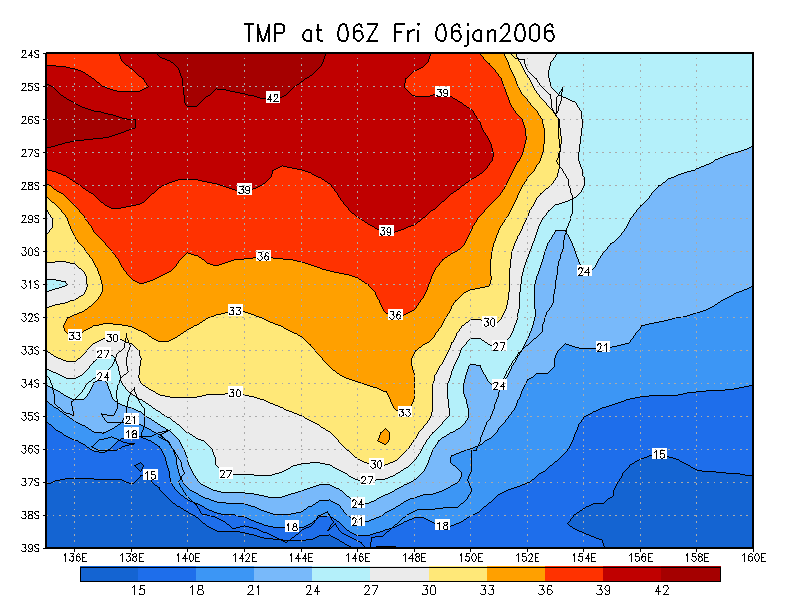
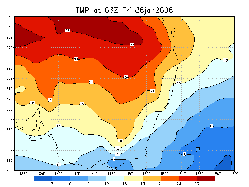
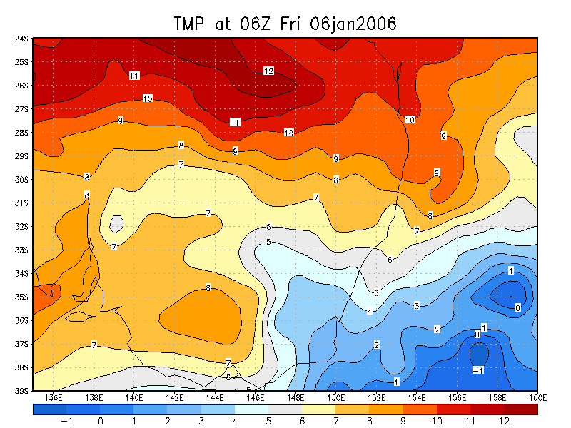
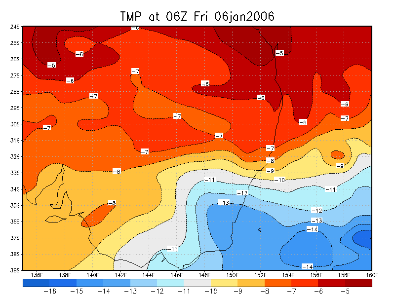
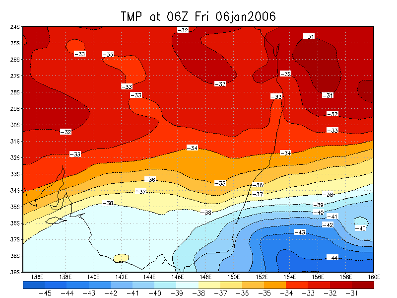
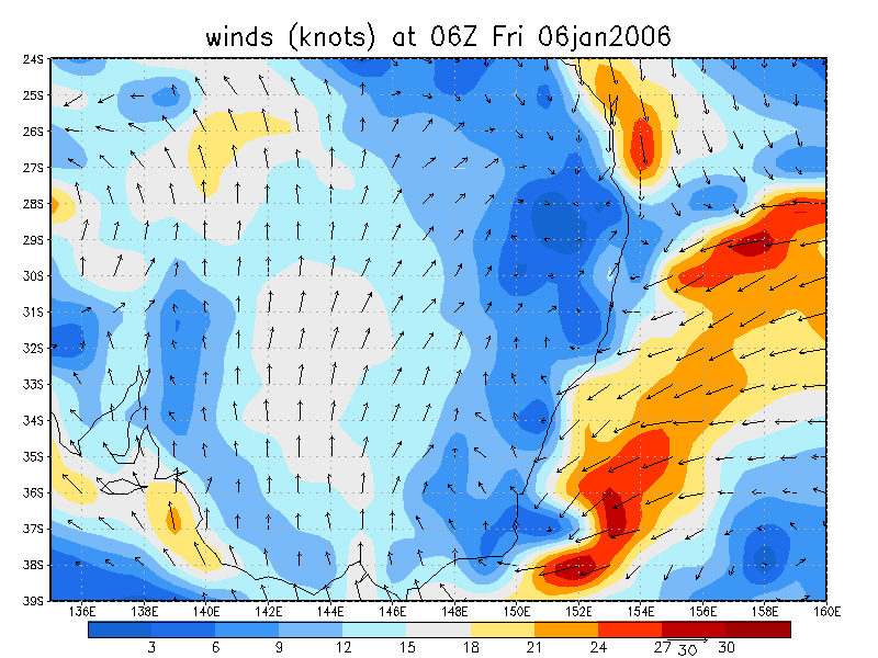
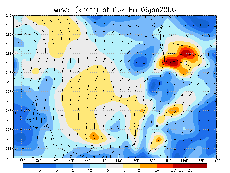
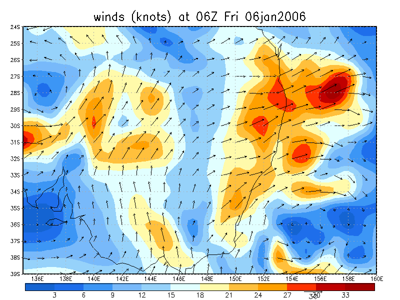
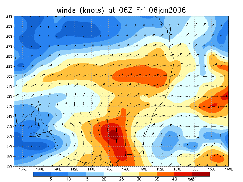
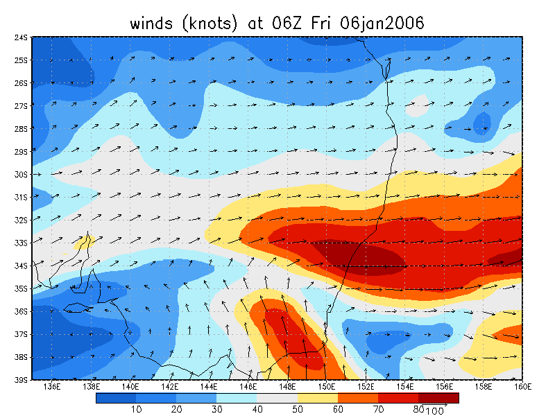
From NOAA 06/01/2006 06z analysis
|
Document: 200601-02.htm Updated: 23rd January 2006 |
[Australian Severe Weather index] [Copyright Notice] [Email Contacts] [Search This Site] |