and Chasing
[Index][Archives]
Snow Weather Data: Wednesday 27th to Thursday 28th June 2007
[NSW Northern Ranges Snow Chase Forecasting Guide] [Australian Severe Weather forum thread]
| Storm News and Chasing [Index][Archives] |
Snow Weather Data: Wednesday 27th to Thursday 28th June 2007 [NSW Northern Ranges Snow Chase Forecasting Guide] [Australian Severe Weather forum thread] |
27/06/2008 12z GFS model run
27/06/2008 12z TWC model run
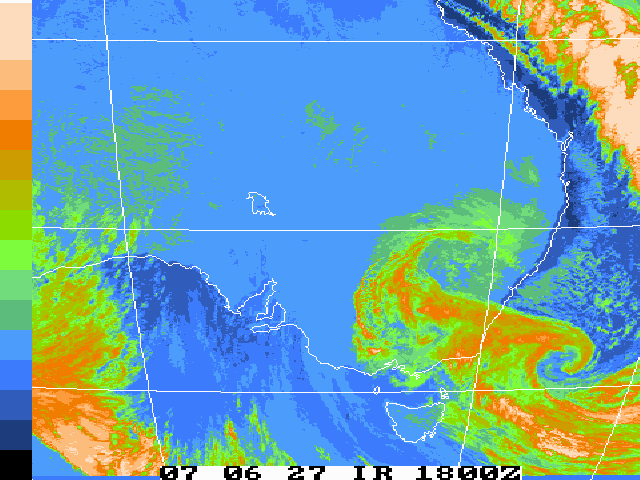 Infrared satellite loop: 24/06/2007 12z to 29/06/2007 12z [5.8mb]
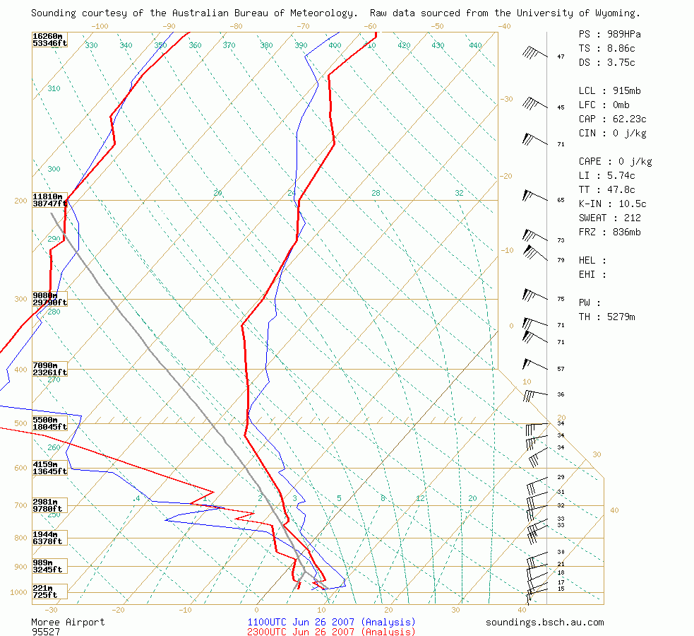
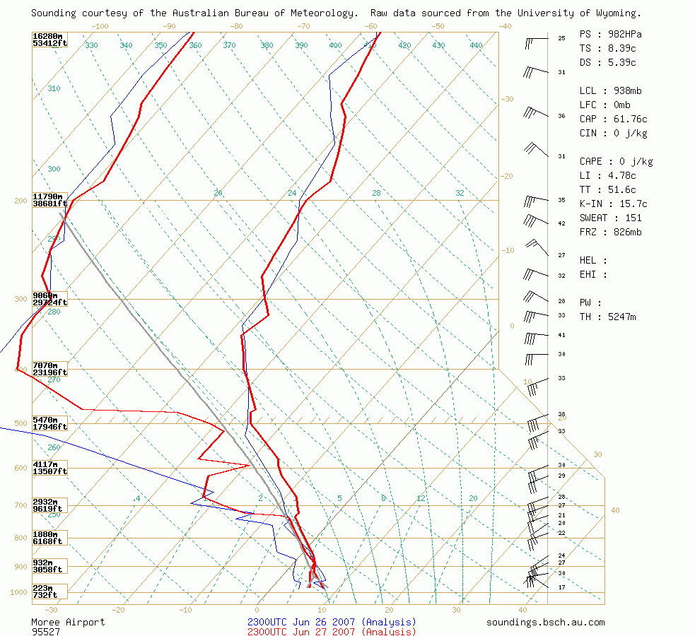 Moree Soundings 9am 27th and 28th June
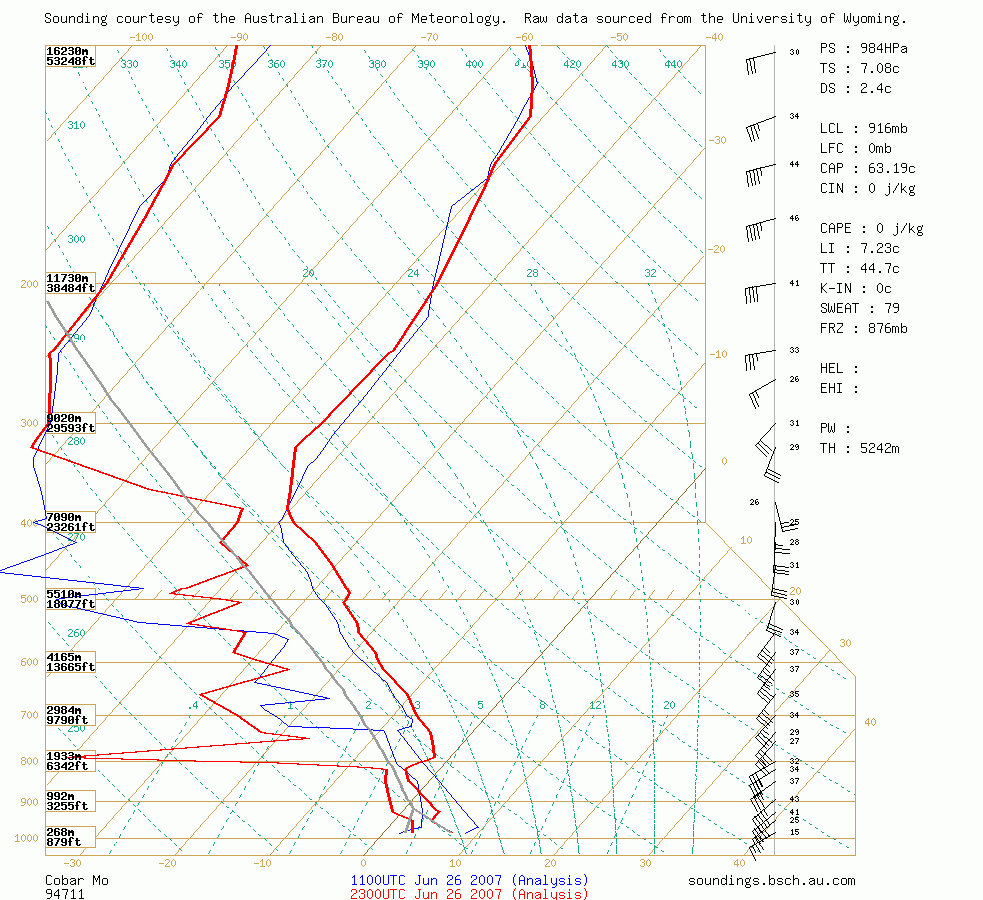
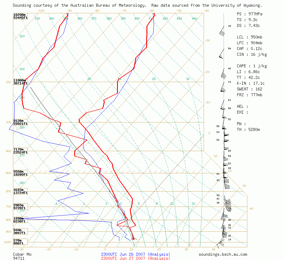 Cobar Soundings 9am 27th and 28th June
Loop of the 27/06/2007 18z GFS model run: +00 to +18 in 3 hour increments
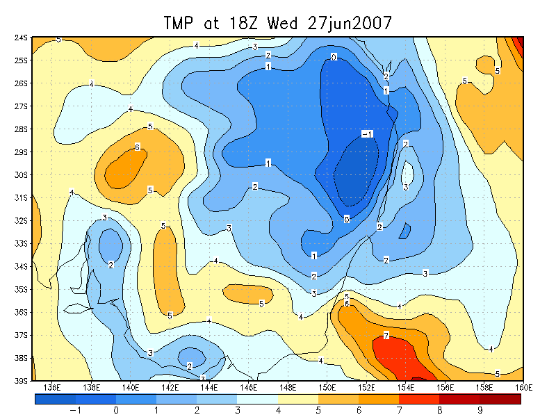
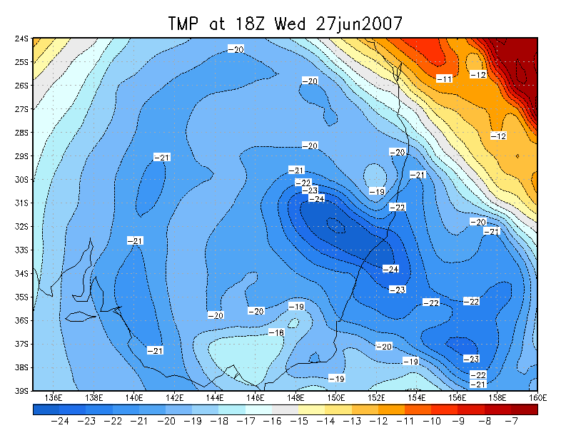
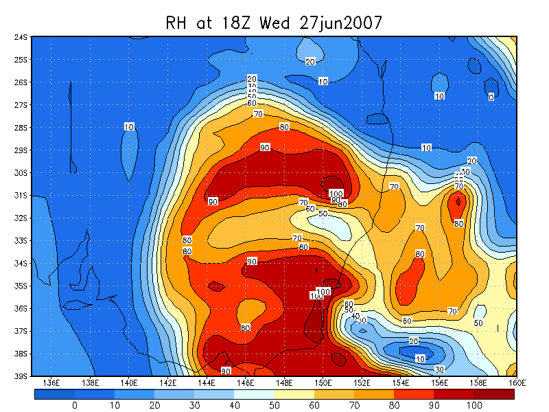
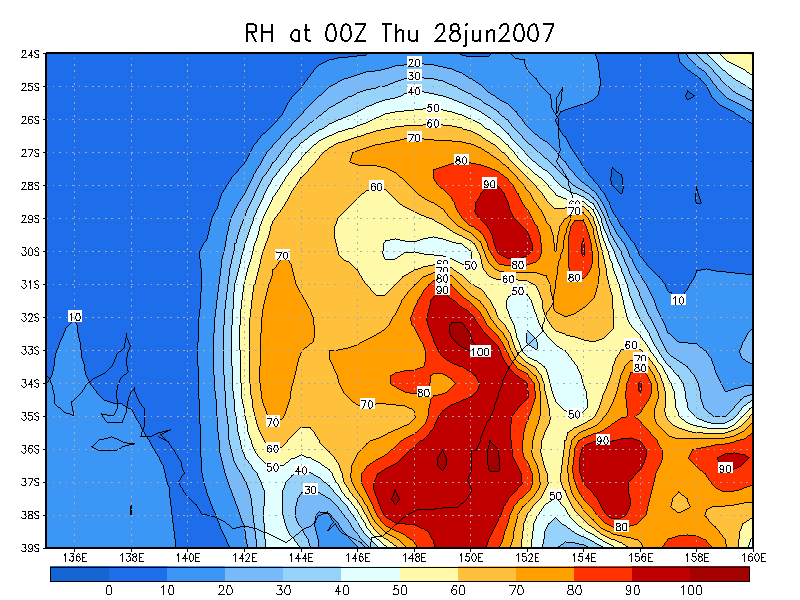
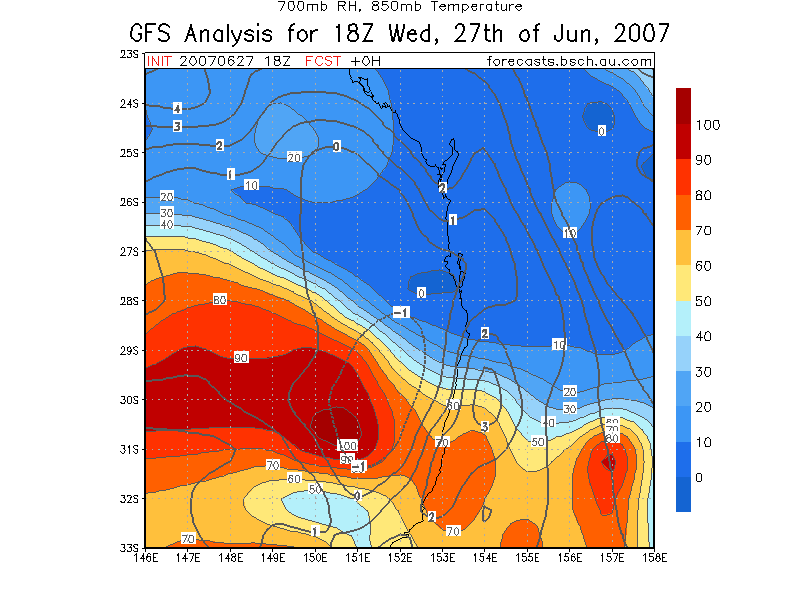
700 hPa Relative Humidity / 850 hPa Temperature
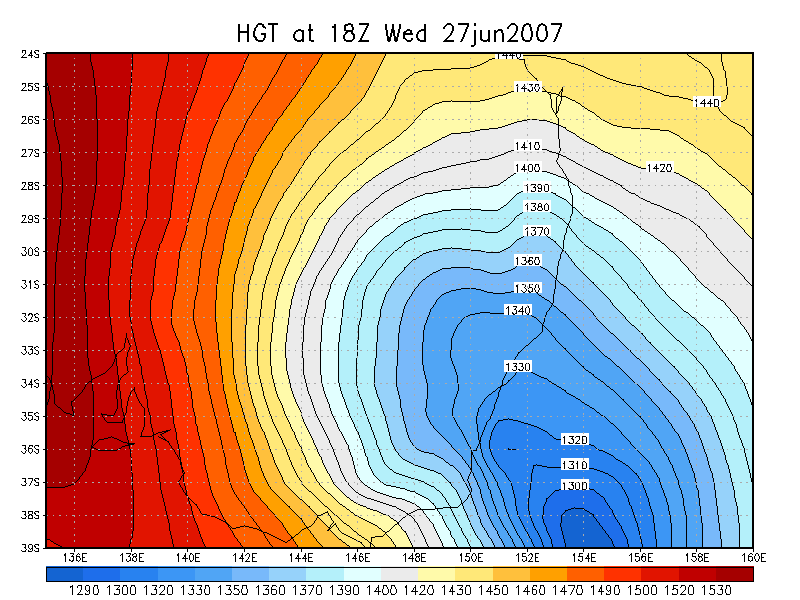
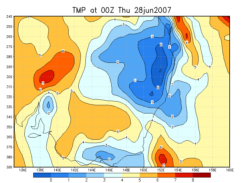
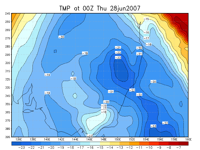
GFS Model Analysis 27/06/2007 18z and 28/06/2007 00z runs
| 850 hPa Temp | 500 hPa Temp | 700 hPa RH | 850 hPa Thickness | |
| 18z 27th |
|
|
|
|
| 00z 28th |
|
|
|
|
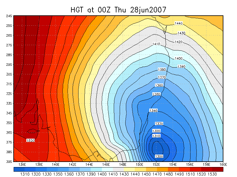
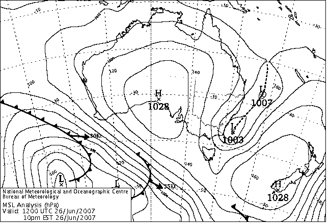
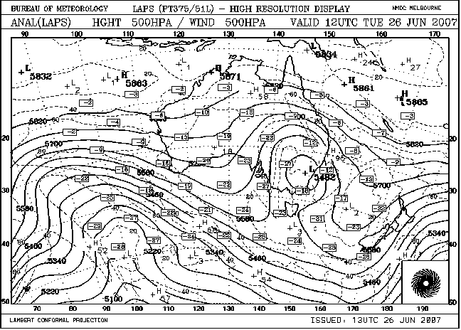
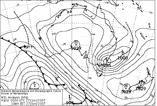
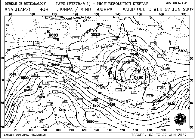
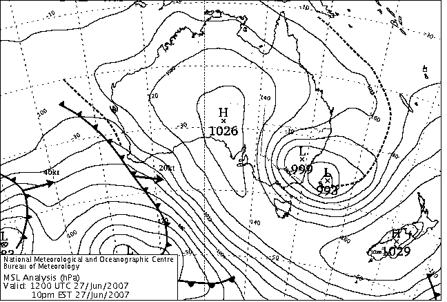
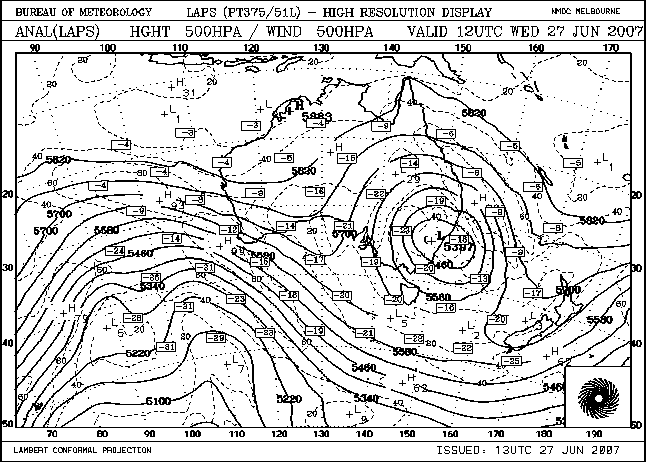
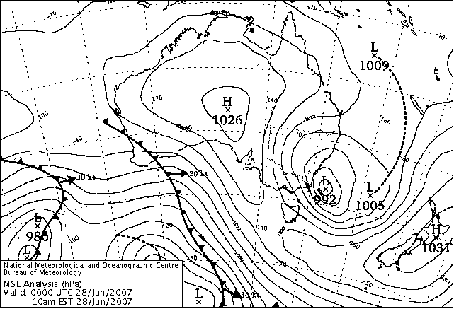
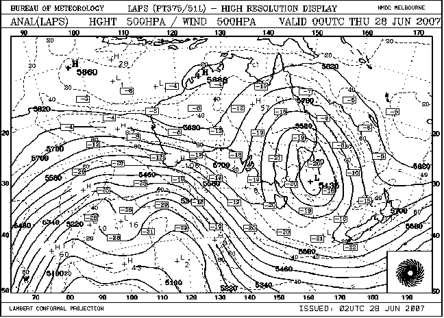
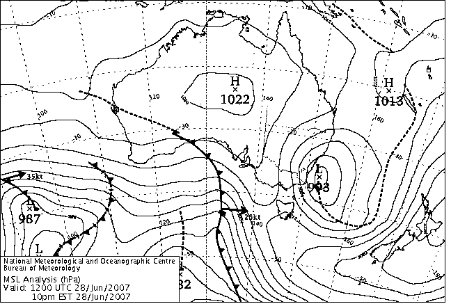
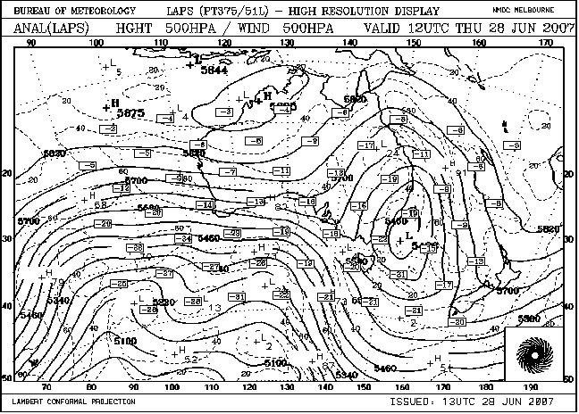
MSL and 500hPa LAPS analysis
|
|
|
|
|
|
|
|
|
|
|
Document: 20070628_snow_data.htm Updated: 2nd June 2008 |
[Australian Severe Weather index] [Copyright Notice] [Email Contacts] [Search This Site] |